Showing posts with label sandwich. Show all posts

Wednesday, October 12, 2016

Cape Cod Canal-Only Fog

This was Saturday's fog, but there was a slight release delay as I pondered the "terrible pics of a cool phenomena" question.


I lacked the testicular fortitude to dash across the four lanes and shoot through the bars. This is what I would imagine that prison looks like in Heaven. 


The fog was the result of some temperature contrast between "cold morning" and "warm water." I was shooting from the side where the sun had been shining on the Canal longer.... or the people on the Cape side be smokin' up a few bales of that sticky-icky-icky. 


I kind of one-two'd these shots quickly, mostly to show how the fog was creeping over Buzzards Bay.

I'll get a better camera some day, honest.


Sunday, October 2, 2016

South Shore Saturday Storm Surf Shots

We had a steady East wind yesterday, so we took to the road to see how local beaches were looking. This decision was greatly influenced by me having nothing to do.

We started off in Scituate, because.. well, why not Scituate? I know people who say that you shouldn't start anywhere but Scituate. I wanted to be in Scituate before high tide, be in Marshfield for high tide, and then just move back towards Cape Cod until the wave pics started to get weak.


My girl has taken a few waves to the face, I'm sure. Having your house look like the front bow of a ship is pure New England Coastal, player. I lack the skills as a writer to tell you how cool this guy's house is.


The wind wasn't too bad, and the surf is nothing worthy of a George Clooney movie. Like I said, I had some free time.


Anyone who grew up on a beach knows that this is an incoming wave that got smacked up by a wave ahead of it that was rebounding off of the seawall. I was in Marshfield by this point, and it was high tide. I was very pleased to see that I still have the instinct where I know when a wave will throw water over the wall, and managed to get behind the car door before this wave soaked everyone who was watching it with me.


Marshfield was fun, as there was some splashover happening. It was a change, being soaked by the waves instead of the rain. I had to change clothes not once but twice getting the pics for this article, but that's how I roll, people. If you're the family who came around the corner of the Pavilion while I was changing at Duxbury Beach.... the giant nude guy says "Sorry." I also apologize to the commenter on a previous article who noted that I tend to tilt the horizon on my shots. I've been working on that, but sometimes the wind wins.


There were no lifeguards on duty at Duxbury Beach yesterday. I did hook the seagull up with some of my turkey sandwich, just in case you think that I don't compensate my models. I don't think that Green harbor was that foggy, I was having a lot of trouble getting even one shot off without the camera lens getting spotted up by the rain. I have a rotten camera, and the lifeguard chair shouldn't be looking that good when the housing behind it looks that bad.


Duxbury has to do this to the seawall boat-ramp opening because the ocean smashed through 6 inch thick hardwood planks when they used to use those. If they don't put that iron plate there, this opening births an ocean river flowing into a residential neighborhood.

I usually shoot the residential part of Duxbury Beach, but I really didn't feel like getting out of the car if I could avoid it. I was soaked. I went to the Bath House, but I ended up having to get out of the car anyhow. As you have probably guessed, I got soaked.

What happens if you assume a bad Cuban accent and yell "Hey, Pelican!!" at a heron over and over.... at least that's what happens on Duxbury 's marshes. 


Plymouth, Cedarville to be precise, was our next stop. I poached my way into the White Hills Country Club for some above-the-fray shooting. This is from around where their 18th hole is,  That rock structure is called a Groyne.


Even small waves erode the heck out of those sand cliffs. That's why they are willing to risk the goofing that comes with installing a Groyne. 


Cape Cod Canal... this is a jetty, not a groyne.


Sagamore gets maximum barrier beach protection from Cape Cod.


Sandwich looked pretty calm from where I was standing. Time to wrap it up.


Sunday, September 4, 2016

Tropical Storm Warning For Cape Cod, South Coast; MEMA Situational Awareness Statement


(Editor's Note... we'll be on the road all week to get you some storm pictures. For now, we'll turn it over to MEMA)

MASSACHUSETTS EMERGENCY MANAGEMENT AGENCY
SITUATIONAL AWARENESS STATEMENT
DATE: September 4, 2016
TIME: 9:00 AM
SUBJECT: Tropical Storm Hermine
Situation:
No significant changes were made to the forecast overnight and Hermine remains a post-tropical storm with little change in strength expected today. At 5 AM the post-tropical storm was located about 305 miles south-southeast of the eastern tip of Long Island with maximum sustained winds of 65 mph moving to the east-northeast at 12 mph and a minimum central pressure of 998 mb. The National Weather Service continues to expect a glancing blow to the south coast, Cape Cod and the Islands mainly tonight into Monday morning. The primary concern continues to be 40-50 mph wind gusts on the south coast, Cape Cod and Islands resulting in some downed trees and scattered power outages tonight into Monday afternoon. Hermine is expected to slow down and turn northward later today. Southeastern Massachusetts, to include the south coast, Cape Cod, and Islands remains in the Cone of Error for this storm.
Forecast and Impacts:
The post-tropical cyclone is expected to turn toward the northeast and north with a decrease in forward speed expected later today, followed by a slow northward to northwestward motion through Monday. On the forecast track, the center of Hermine will meander slowly offshore of the mid-Atlantic coast for the next couple of days. While little change in strength is expected today, Hermine is forecast to intensify to Hurricane Force tonight and on Monday.
Hermine continues to have a large wind field with Tropical Storm force winds extending outward up to 205 miles from the center. The wind threat from Hermine is expected to come in two pulses, with the strongest tonight into Monday afternoon. The other (less certainty at this time) will be on Tuesday as the storm pulls away. Isolated downed tree limbs are possible across eastern Massachusetts with 25-35 mph wind gusts tonight into Monday with scattered tree and powerline damage possible along the south coast area. Despite the winds not being too extreme, drought exhausted trees could fall more easily. Expect a long duration of high surf, dangerous rip currents, beach erosion and wind gusts to Tropical Storm force on the southern waters and south coast and Islands. Mariners should expect a period of strong winds and rain beginning on Sunday afternoon and lasting through Monday with wind gusts to 45 knots and seas of 15-20 feet across southern waters. There is a low risk for minor coastal flooding, and riverine flooding is not expected to pose a significant threat due to ongoing drought conditions across much of the Commonwealth.

National Weather Service has provided the following most likely scenario at this time:
· 30-50 mph wind gusts with the strongest winds focused along the immediate South Coast and the Cape and Islands.
· Up to 1 to 2 inches of rain, focused mainly across Cape Cod and the Islands
· Rough surf and dangerous rip currents
· Minor beach erosion
· Marine impacts with wind gusts to 45 knots, and seas 15 – 20 feet over southern waters
National Weather Service has provided the following reasonable worst case scenario at this time (if Hermine takes a more northerly track than forecast by Monday into Tuesday):
· 40-50 mph wind gusts farther inland to the RI/CT border, with more gusts to 50 mph.
· 2 to 3 inches of rain on Cape Cod and the Islands
· Minor coastal flooding
· Moderate beach erosion
· Marine impacts, with wind gusts to 55 knots, and seas 20-25 feet over southern waters
Watches and Warnings:
· Tropical Storm Warning is in effect for the outer waters from Provincetown, MA to Montauk, NY. Strongest winds will be tonight with gusts of 50 knots possible. Seas will build rapidly today and may reach at least 20 feet south of the Islands by tonight.
· A Tropical Storm Watch remains in effect from Watch Hill, RI to Sagamore Beach, MA to include Narragansett and Buzzards Bay and Nantucket and Vineyard Sounds. Tropical storm force winds associated with Hermine will likely develop this evening and tonight and persist into Monday morning. The strongest winds will occur tonight with gusts 40-45 knots, especially over open waters. Seas will rapidly build today and may reach 10-15 feet tonight.
· A Gale Warning is in effect from 11 PM tonight to 8 AM Monday for Cape Cod Bay, coastal waters east of Ipswich Bay and the Stellwagen Bank National Marine Sanctuary with northeast winds 20-30 knots gusting to 35 knots and seas 7-12 feet.

What we do not know at this time:
· Exactly how far north the edge of the Tropical Storm force winds will reach before Hermine loops back to the Southwest
· How strong Hermine will be when it passes Southeast of New England and what exactly that means for the second pulse on Tuesday.
· What accumulated erosion effects may occur from what looks to be a long duration period of storm surge and high waves.
Rainfall Forecast through Thursday AM
Current NWS Headlines – Watches, Warnings and Advisories
Marine:
Based on National Weather Service and National Hurricane Center forecasts regarding Tropical Storm Hermine, the Captain of the Port, Southeastern New England, has set Port Condition WHISKEY. While ports in Southeastern New England remain open to all commercial traffic, the following preparatory measure is effective immediately:
Owners, operators or agents of all self-propelled oceangoing vessels over 500 gross tonnage and all barges and their supporting tugs must report their intention to depart or remain in port to Sector Southeastern New England within 24 hours.
The Coast Guard will continue to monitor Tropical Storm Hermine and, if necessary, may implement preventative measures to ensure the safety of mariners, vessels, and waterfront facilities. Possible preventative measures include, but are not limited to, terminating lightering or transfer operations, rescinding permits for marine events, and directing vessel arrivals/departures to/from port.
The NWS has issues a Small Craft Advisory for 6 AM Sunday to 8 PM Monday for Massachusetts and Ipswich Bay.
Ferry Services Update (as of 0800):
Steamship Authority – Anticipates the cancellation of Nantucket ferry runs sometime this afternoon, as the wind picks up. They anticipate that the Vineyard Route may also be impacted before the end of scheduled trips. All ferries are operating as scheduled at this time.
Hy-Line Cruises – Service to Martha’s Vineyard has been suspended for today and Tomorrow, as well as inter-island service from Martha’s Vineyard to Nantucket. Hyannis to Nantucket is still operating, however it is weather dependent.
Island Queen Falmouth - Canceled all trips Sunday and Monday, Trip by Trip Basis Tuesday, and Wednesday.
Seastreak New Bedford- Martha’s Vineyard and Nantucket trips, Canceled Sunday through Tuesday, or when the Hurricane barrier in New Bedford reopens. Could be later than Tuesday depending in the impact of the storm.
Seastreak NY – New York To Martha’s Vineyard and Nantucket, Canceled for Monday (anticipates running Sunday) Operates Friday’s and Sunday’s and Labor Day.
Rhode Island Fast Ferry- Quonset Point to Martha’s Vineyard canceled all Ferries Sunday through Tuesday
New Bedford Hurricane Barrier is anticipating closing Sunday and anticipates reopening on Tuesday, Possible sooner or later depending on the track of the storm.


Monday, July 25, 2016

Tracking Bridge Traffic Over A Summer Weekend


Just for laughs, we summoned up Google Traffic every hour or so during peak commuting periods.

We struck during mid-summer, which is a peak period around here. We did it before the end of the month, so we spared ourselves the cottage monthly-rental crowd.

We chose a weekend without some major event like a Scallop Festival or the Pan Mass Challenge. We did, however, choose a scorcher of a weekend.

Overall, I'd say we got as easy of a weekend as we could ask for in the summer. We may do another version of this when the PMC is in town (early August), just to see how it compares.

Here's the volume:

Bourne Bridge
Year round daily average (2011) = 42,505 vehicles
Summer daily average = 58,467

Sagamore Bridge
Year round daily average = 51,489
Summer daily average = 70,674

Here's what we found this week. We had no way of counting cars, even though we did do a few drive-bys just to make sure that Google Maps wasn't fibbing.


Friday, 5 PM.... 1 mile backup heading on-Cape at the Bourne Bridge, 1.5 mile backup at the Sagamore.

Friday, 6 PM.... traffic flowing freely over Bourne, minor delays approaching and crossing Sagamore.

Friday, 7 PM-Midnight.....hardly any traffic at all


Saturday, 8 AM.... 1 mile backup at Bourne Bridge, 2 mile backup at the Sagamore Bridge. Accident reported on Route 3 South just before the Sagamore Bridge

Saturday, 9 AM,... Accident at Sagamore still there, traffic back 4 miles, well past Exit 2. Bourne Bridge has 2 mile backup.

Saturday, 9:30 AM... Sagamore delays still back 4 miles, Route 6 East jammed to Chase Road.

Saturday, 10 AM.... Sagamore accident cleared, traffic still back 4 miles, pushing 5. Route 6 East jammed almost to Meetinghouse Road. 2 mile backup at Bourne Bridge, Scenic Highway jammed. Cranberry Highway filling up in Buzzards Bay.

Saturday, 11 AM... Route 3 South jam approaching Exit 3, Route 6 still jammed to Meetinghouse Road, entire Scenic Highway is bumper-to-bumper heading towards Buzzards Bay. Bourne Bridge jam 3-4 miles back onto the mainland. Bounedale Road, which may have 10 houses on it, has several ominous red sections on Google Traffic.

Saturday, 1 PM.... 3 mile backup heading on Cape towards the Bourne Bridge, accident just reported, this delay may grow substantially. One of our scouts tells us that Rte 25 heading to the Bourne Bridge sems to be moving 25 feet a minute. Both the Scenic Highway and the Cranberry Highway have multiple accidents, and are bumper to bumper. Traffic already on the Cape has eased up, just a brief jam after the Quaker Meetinghouse Road area. Traffic easin g up slightly approaching the Sagamore from Plymouth, maybe 3.5 mile backup now instead of 4.

Saturday, 2-4 PM.... 3 mile backups at both bridges, multiple accidents. Both rotaries are jammed. t 4 PM, there had been at least a 3 mile backup at Sagamore for over 8 hours.

Saturday, 6 PM on.... accidents are cleared, traffic flowing smoothly over both bridges.


Sunday, 9 AM... minor delays crossing Sagamore, a mile of bumper-to-bumper on traffic on Route 6 leaving the Cape. The Belmont Circle rotary in Buzzards Bay s getting full, might be church-related.

Sunday, 10 AM.... All clear, other than Route 6 leaving the Cape. The traffic jam is back two miles now.

Sunday, 11 AM... Mile long backup at the Boune Bridge, heading on-Cape. Six mile backup leaving Cape Cod on Route 6. Scenic Highway jammed.

Sunday, noon... Scenic Highway cleared, but Sandwich Road bumper-to-bumper. Mile long backup at the Bourne Bridge, Route 6 leaving the Cape is backed up to Chase Road.

Sunday, 1 PM... Route 6 jammed to Quaker Meetinghouse Road, accident in effect, 6A now jammed back to the Stop & Shop, perhaps people trying to get around the accident. Mile length backup at Bourne. Sandwich Road heading towards Bourne Bridge jammed a mile back.

Sunday, 6 PM.... very little traffic, minor delays leaving the Cape at both bridges. Ungodly good beach day, could be heavy volume later.

Sunday, 7:30 PM... The Exodus.... Rte 6 jammed back to Exit 6. One mile backup at Bourne Bridge. Sandwich Road and 6A have pockets of heavier traffic. Bumper to bumper on 495 around the Middleboro rotary.

Sunday, 9 PM.... One mile backup approaching Bourne Bridge rotary, pockets of traffic on 28 in Falmouth, Yarmouth, Harwich and Chatham. Route 6 approaching Sagamore back to Route 149.

Sunday, 11 PM..... except for a small stretch of 28 in Harwich, all traffic on the Cape is moving unimpeded.


Monday AM.... no Monday traffic, a sure sign of a slow summer weekend


Wednesday, July 20, 2016

Cape Cod And The Islands Gas Prices


Life doesn't play fair, and the Man is always trying to get one over on you. There's not much that you can do about it, as the Man is the Man for a reason, and that reason is not gender-exclusive. Sometimes, the best thing that can be done is to lessen the intensity of the beating.

As a man who has both studied military history and who has gone toe-to-toe with a few run-stoppers in my lifetime, I can tell you that many battles are won and lost by Logistics. That's one of those Army words that can mean whatever they need it to, and it has wide-ranging civilian implications. The short definition is getting to the right place at the right time with (or, in today's case, for) the proper supplies.

Logistics broke several of history's fiercest warlords, men such as Napoleon, Hitler, the Crusaders.... America would be British today were it not for the inherent Logistical Flaws involved with running America from England. Russia would be Nazi or French. Japan would be Mongol. All of Korea would be North Korea, even South Korea.

That's what we're here today to help you with. No matter how hard I work today, you're going to pay about double what you were paying for gas at the turn of the century. Sorry about that. However, if you can shave a few shekels off the Damages, it adds up over a year.

We're going town-by-town, giving you the lowest and highest gas prices you can find there. It's pushing noon on Wednesday, July 20th. The prices are whatever has been reported since Monday.

We publish this on Wednesday so that you can stumble across this article and fill your tank before they jack the price up to eff over the tourists on Friday.

You don't want to get treated like a tourist in your own home town, babe... that gets old fast. The best way to avoid that is to know your town. C’est ma raison d’etre......

MARTHA'S VINEYARD
Best: $2.99, Mobil, State Road, West Tisbury
Worst: $3.15, Shell, Main Street, Edgartown

NANTUCKET
$3.57, Shell, Sparks Avenue

PROVINCETOWN
Best: $2.40, Cumerland Farms, Shank Painter Road
Worst: $2.45, Gulf, Bradford Street

EASTHAM/ORLEANS
Best: $2.33, Tedeschi's, Vandale Circle
Worst: $2.39, Mobil, Route 6A

CHATHAM
Best: $2.35, Roundabout Gas, Main Street
Worst: $2.45, SAV-ON, Orleans Road

BREWSTER
Best: $2.34, Cumberland Farms, Seaway Road
Worst: $2.43, Mobil, Main Street

DENNIS
Best: $2.23, East-West Dennis Road
Worst: $2.49, Shell, East-West Denis Road

YARMOUTH
Best: $2.33, Mobil, Main Street
Worst: $2.45, Mobil, Station Ave

BARNSTABLE
Best: $2.27, BJ's, Route 132
Worst: $2.49, Mobil, Iyannough Road

MASHPEE
Best: $2.27, Shell, Nathan Ellis Highway
Worst: $2.29, Mobil, Great Neck Road

FALMOUTH
Best: $2.21, Johnny's Tune and Lube, East Falmouth Hwy and Cumby's, Teaticket Highway
Worst: $2.33, Mobil, Palmer Ave

SANDWICH
Best: $2.24, CITGO, Route 6A
Worst: $2.34, Shell, 6A

BOURNE
Best: $2.03 (reported at 10:45 AM Wednesaday), Bay Village Full Serve, Main Street
Worst: $2.17, Mobil, MacArthur Blvd/Clay Pond Road

CAPE COD AS A WHOLE, NOT INCLUDING BUZZARDS BAY OR NANTUCKET
Best: $2.15, Gulf, Bourne Bridge Rotary
Worst: $2.49, Dennis Shell, Barnstable Mobil

MASSACHUSETTS AVERAGE: $2.217

NATIONAL AVERAGE: $2.190

PRICE PER BARREL, CRUDE: $44.96

BEST PRICE IN MASSACHUSETTS: $1.93 US Gas and Stoughton Car Wash, Stoughton

WORST PRICE IN MASSCHUSETTS: $3.57, Shell, Sparks Avenue

WORST MASSACHUSETTS MAINLAND PRICE: $3.49, Mobil, Newburyport

WORST GAS PRICE IN AMERICA, $5.99, Orlando FL

SOUTH COAST GAS PRICES

If we missed something, let us know in the comments section...


Saturday, June 18, 2016

The Bournedale Wall

Cape Cod is all about Welcome! We rely on our tourists, and go to great lengths to draw them in to us. Without visitors, we'd be in a mess of trouble. We white people were once visitors ourselves, and we may have perished without the hospitality of the incumbent residents.
There have been times, however, where we sought to limit that access. Granted, the visitors in question had a habit of killing both livestock and perhaps the occasional Pilgrim-era child. They also were rather noisy at night, especially when the moon shone brightly. You couldn't go out safely without a gun. Things got bad enough that we once considered building a fence, right here in Bourne.
That seems sort of Donald Trumpish, but we're not talking about Muslims, Mexicans or even a Mohegan. We're speaking about wolves. Pilgrims and Sachems may have viewed the wolf differently, but both would agree that life is generally much happier when a hungry one isn't walking around the neighborhood.
Man has only been on Cape Cod for a hot minute when compared with the overall natural history of the region, but our time here has seen us be Impact Players to the point where you can divide the whole of Cape Cod's natural history into two parts. One part would be Since Man Arrived, and the other would be Everything Else.
Wolves were chased off Cape Cod by the time of the Industrial Revolution. The chief culprit was Habitat Destruction, and they were also heavily hunted once the Europeans arrived. The native Americans lived in harmony with nature, but their English cousins cleared out the forests. The wolves were gone soon after. However, during the process, there was a period- almost two centuries- where it was not unusual to lose livestock to the Big Bad Wolf.
Massachusetts was not even remotely urban outside of some bustling villages for a while, and they were almost 100% dependent on localized farming and livestock raising. Wolves love themselves a good steak dinner if they can get it, and they don't really care if it hurts the people who are stealing their land. This set the stage for conflict.
A coyote, but a coyote that may be 25% wolf (Scituate, taken by Matthew Loveitt)

In 1713, the town of Eastham decreed that they would pay out 3 pounds for a wolf, payable when you show up at the constable's place with an adult wolf head. Since our little Cape wasn't the millionaire haven it is now, you know that anything worth a bounty was at least somewhat of a serious problem.

A person could make a fairly nice 1713 living by helping to rid the Cape of this toothy difficulty, if your definition of "nice" includes "hunting multiple apex predators in a dark, uncharted Algonquin forest with a single-shot-per-minute musket."

There were even bounties issued on individual wolves, with payment going to "any individual who shall kill the wolf who has of late been prowling through the township."
In 1717, the town of Sandwich came upon a unique idea. Why not build a fence to block Cape Cod off from wolves?
There are several famous walls, all built to keep something Bad out of (or in) a town. Hadrian's Wall was built to stop barbarians. The Great Wall of China was built to repel Mongols. The Berlin Wall was built to keep the Communists from leaving. Pink Floyd's "The Wall" made for a fine movie, but is completely unrelated to the topic.
The wall would have run roughly along the same path of the present Cape Cod Canal. I presume it would have been made of wood, and maybe stone. I don't know if they planned to extend it out into the ocean a bit, as a wolf who is determined to get to Hyannis Port can always swim out past the fence.
Whether this fence would hold up if the wolf huffed and puffed, we'll never know.
As near as I can tell, it would have started at Peaked Cliff (extreme north Sagamore Beach), worked along the line of the Herring River into and though Bournedale, before finishing up at Buttermilk Bay. Remember that the western/southern end of what is now the Canal was back then a swampy area where several small rivers emptied.
The Bournedale wolf wall was met with something less than enthusiasm by the townspeople, and the idea was shelved permanently. Aside from the obvious cost and effort, there was a sentiment about town that the wall, while keeping wolves out, would also keep wolves we already had in.
It was instead decided to wage an environmental holocaust, deforest an entire region, and chase the fauna into New Hampshire. Ironically, about 200 years later, they decided to instead dig a moat and float oil tankers and container vessels through the same area. The Cape Cod Canal had pretty much the exact effect that Sammich voters were asked to consider in 1717. The Canal became a stopping point for most animal migration, and it is fairly amazing that we somehow got a bear to Truro recently.
We may never get wolves again, although they are advancing south and east from Canada. Once they get to New Hampshire, it becomes only a matter of time before one of them ponders a swim across the Canal. Lesser predators such as fishers and coyote have already made the Hop.
In fact, the wolves may already be here. They got here via the ol' "gradually mate and hybridize (not real science kids, I just made the word up) and then come back disguised as coyote" trick. The local Eastern Coyote has a lot of Grey Wolf in his DNA. A study in Maine showed 22/100 coyotes studied had wolf DNA, with one "coyote" having 89% wolf DNA. 
The basic idea here is that, as wolves were chased from a region, they mated with coyote in the regions they fled to. Through kicking it as wolves and coyotes do, the hybridized DNA would spread through the coyote population. The resulting hybrid (a "coywolf") which is migrating back into Massachusetts is the basic current design of that coyote you see in your back yard. If you want to guess at how much Wolf DNA they have, look for pack behavior. Coyotes generally hunt in pairs, while wolf/coyotes work in larger groups.
Mother Nature, who is inexorable, tends to get the last laugh. She no doubt had a solid session watching us ponder and build fences and canals which in the end failed to keep the wild dogs away. 
Either way, it may make normally boring Bournedale a little more exciting if you know that it was almost a Checkpoint Charlie for Cape Cod wildlife.
"Ah-rooooooooooooooo!!"

Friday, June 3, 2016

Naming Post-Secession Mainland Cape Cod


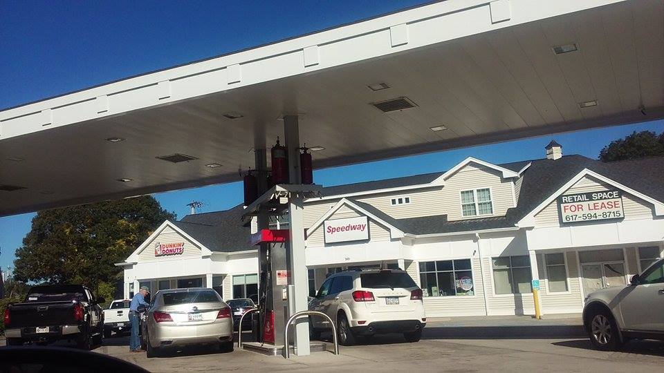
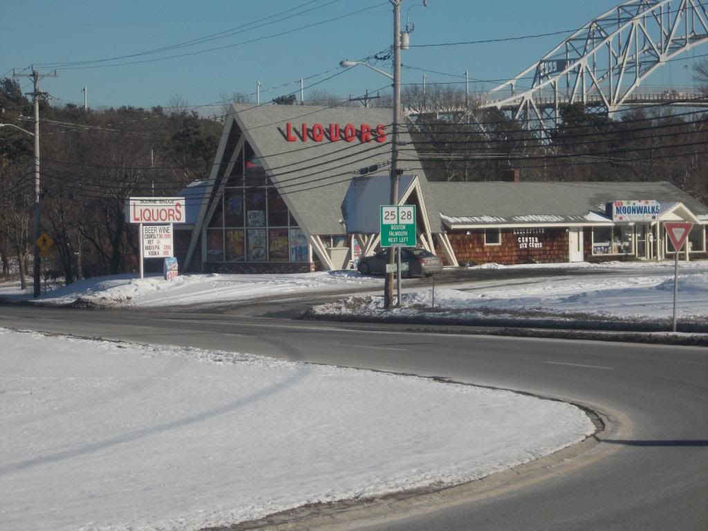
When the traffic gets bad enough and pols start talking about making residents pay tolls to cross a theoretical third bridge, people who live in the mainland areas of Bourne and Sandwich start getting angry. When that anger boils up enough, you even hear talk of secession.

"We lost any financial benefits from Cape traffic in 1985. Start our own town, demand financial concessions from Cape Cod for the traffic, and dump both bridges into the Canal if the Cape says no" is the general tone of secession talk.

I'm not going to support the "dump the bridges" talk, as it is terrorism and might kill someone. I'm also not here to push Secession. It's a fun conversation piece, and it might get me some site visits, but I'm simply not the man with the answers you'd need if you wanted to get the movement going. I'm not sure how it would be done, nor am I sure if it is even a good idea.

I'll leave those questions for a future article, most likely one written in August when I just took 90 minutes to get through the Belmont Circle rotary. Instead, I will take on something that I am completely capable of doing... naming the post-secession town.

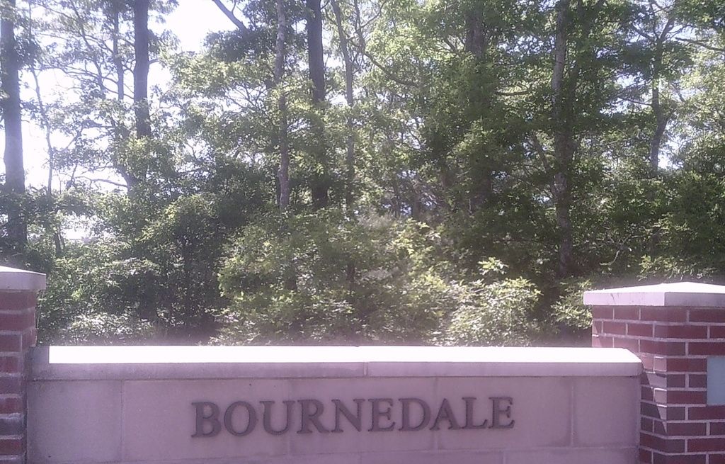
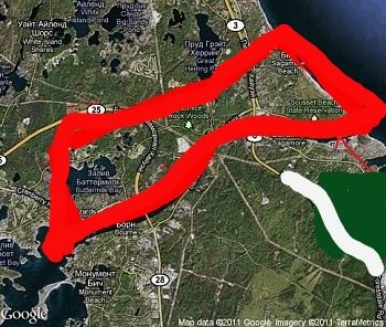
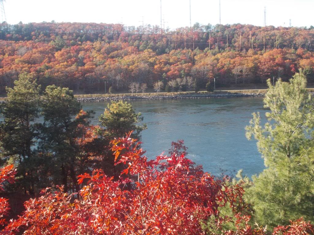
We're going to work from a fictional scenario where Buzzards Bay, Bournedale, Sagamore Beach and Scusset Beach have all broken away from Bourne, Sandwich and perhaps even whatever parts of Wareham and Plymouth (why not go for everything east of Red Brook and all of the Great Herring Pond area?) we could get our hands on.

The resultant bow-tie shaped town would need many things, but the main thing it would need is a name. We've kicked around a few, and we'll share some of them with you now. There's no ranking, even if the staff have their own personal favorites.


- Gridlock

"Gridlock" would be a form of protest. It would speak of the new town's plight, while concurrently scaring away tourists who would otherwise clutter up our roads. It would be easy to remember, it would gain us amazing name-recognition value, and might invite investment.

"Gridock" was chosen from among several staff suggestions for traffic-related town names, edging out equally awesome but less serious contenders such as "Jam City, Massachusetts, " "Road Rage, Massachusetts," "Slow Lane, Massachusetts" and "Bumper-to-Bumper, Massachusetts."

"Bumper-to-Bumper" would have a sort of Stratford-upon-Avon sound to it, and would pair us with "Manchester-by-the-Sea" as the only town names in the state with hyphens in them. We'd also join them as the only town names with Prepositions in them.


- Ripton

"Ripton" was the name of a fictional Berkshires town that an awesome western Massachusetts pol (Editor's note: it was a UMass-Amherst professor) invented. He was able to apply for grants, and even got Ripton included in the state budget. He did Ripton's work so well, he was able to obtain state funds for the fictional community. He gave the money back, as he was less interested in Fraud and more interested in pointing out that the state government lacks Western Massachusetts awareness.

Anyhow, my financial adviser- who I will admit up front is in jail at the moment- tells me that he's "pretty sure" that state funds were collected and set aside for Ripton, and that if a Ripton should suddenly appear, they would be owed both the original sum of money and any interest accrued since Ripton's 1980s inclusion in the state budget.


- Capeside

Not a lot of TV shows were set on Cape Cod and the Islands (I can only think of one other one, Wings), but one of the best was Dawson's Creek. I don't think that I saw enough DC to tell you what it was actually about, but it launched the careers of Katie Holmes, James Van Der Beek, Michelle Williams and that other kid.

If you were a child of the 1990s and didn't arc a few to Katie Holmes... nice restraint, brother.

The "Capeside" town scenes in Dawson's Creek were actually filmed in Wilmington, North Carolina, and any Massachusetts scenery used in the show was filmed in Oak Bluffs. However, why not steal the name? As you can see from the entries above and below this one in the article, it's not like we have any better ideas.

"Capeside" edges out several other fictional town names that we wished to steal from TV, movies or literature, including "Amity," "Crabapple Cove," "Dunwich, "Wallencamp," "Peyton Place," "Gotham City," "Atlantis," "Jerusalem's Lot," "Dudleyville" and "Quahog."


- Wutham

Pronounced what-ham, it would be a goof on neighboring Wareham. We'd spell it "Whatham," but we wish to avoid GPS errors with Waltham.

We'd need Marion to change their name to Whoham in order to complete the trinity.


- Sagamore

"Sagamore" is probably the logical choice, although it would be complicated in that the actual village of Sagamore is on the Cape side of the Canal.

We might have to name the town "Scusset Beach," which would force us to  negotiate something with what would most likely be a very hostile Sandwich town government.

The "Scusset Beach" thing would be unfair to the Buzzards Bay part of the new town, while a "Buzzards Bay" naming would be unfair to Sagamore Beach.


Shark City

Assuming that we are unable to cut a concession for traffic from Cape Cod, and assuming that we lack the testicular fortitude to destroy the Canal bridges.... well, not all fights are physical.

If we can't take the physical means of going to Cape Cod away, why not attack them through tourism?

There would be no way of driving a car to Cape Cod without going past the NOW ENTERING SHARK CITY signs which we would dot the highway with. I'd even post the population on town signs, and cross it out every time someone died... you know, like they do in bad towns from cowboy movies.

Sure, most of those deaths would be Old Age, Cancer and so forth....  but you won't be thinking that when you drive past the Shark City sign.
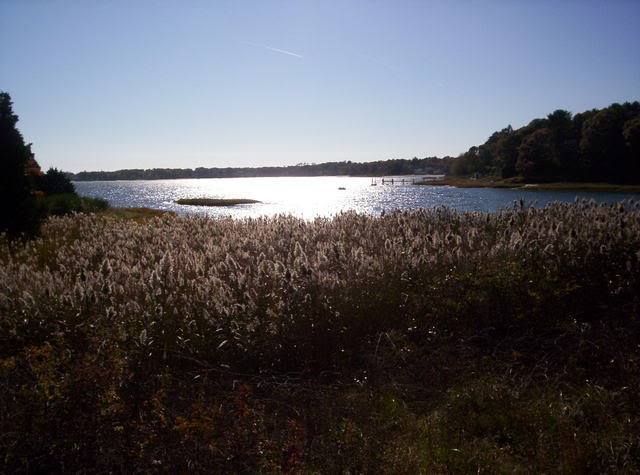

Double Bay

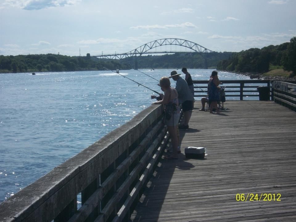
One thing that this fictional town would have on every other town in the state would be the fact that we would be the only town to touch two (Buzzards Bay and Cape Cod Bay) bays.

If you count Buttermilk Bay, we could even be Triple Bay.

This one is here mostly because it would make a great Casino name. If we stole enough of Wareham's eastern and Plymouth's southern forests, we could build a mega-casino right off the highway.

Shoot, I'd leave the bridges up at that point. Who wants to go to Taunton or friggin' Everett when you can instead gamble all night in Double Bay, and then dip over to Cape Cod for some daylight beach time?

Bowtie

"Bowtie" would be a play on the shape of the new town. Yes, it sucks.

Keeping the theme, but changing the shape.... this (and the Casino) would be a big motivator for the Wareham and Pymouth land grabs. If we seize the Ponds sections of Wareham and Plymouth, we'd be shaped like a mini-Connecticut.

Squanto

"Squanto" beats out "Samoset," "Metacomet," and "Massasoit" for Algonquin tribute purposes.

Squanto has the best Q Rating, and would be the best tourist-drawing name.

I don't know how we could do it, but maybe Johnny Depp or the Farrelly Brothers could be convinced to re-invent Squanto as an action hero. Maybe he goes all Seagal on invading Mi'kmaq, or perhaps he even kills a Sasquatch that was menacing Priscilla Alden. Squanto's story is an amazing one, but it needs more kung-fu and dinosaurs if he's getting his own town

Have Any Better Ideas? Let us know in the Comments...

Monday, May 30, 2016

Rainy Memorial Day Traffic Notes And Gas Prices For Cape Cod


It is said that, much like how the Eskimo has 200 words for snow, residents of Bourne have hundreds of different classifications for traffic. They distinguish between weekend and weekday traffic, summer and winter traffic, rain/snow/sun traffic and holiday traffic.

Today is one of those subsets... Rainy Memorial Day.

Memorial Day is when summer starts on Cape Cod. Summer people opening their cottages, winter cottage rentals departing, hotels getting summer volume, places with SEE YOU NEXT SUMMER signs un-shuttering, old people smart enough to come off-season arriving... all of the little omens that the locals know of are in effect.

Traffic heading on-Cape was heavy on Friday, Saturday and Sunday. Many of those people have to be on the mainland by Tuesday, and most of them will be making the Drang nach Westen at some point today.

Again, traffic is always going to be bad on Memorial Day Monday. I know it sucks right now, and I haven't opened Google Traffic since I got home from lunch. However, as the list of services offered by the Mustang Ranch in North Las Vegas tells you, there are different kinds of sucking. Allow me to explain.

A nice, sunny Memorial Day means that everyone bails out in the evening, after a day at the beach, a nice dinner and some time spent packing. This has a tendency to put them on the road at the same time. This is where you get those 15 mile traffic jams that Cape Cod is famous for.

A rainy Memorial Day breaks the people up a bit, leading to a heavy-but-lesser flow of the day-long variety. I was writing this article at 8 AM, and there was substantial traffic heading off-Cape even then. Those were the people who saw a rainy Memorial Day coming and opted to bail ahead of the traffic, the Cape Cod version of a guy sneaking out of a Pats game when we're up 42-10 after 50 minutes. Beat the traffic, before it beats you.

Other people, especially those who rented the place they were staying at all weekend, are determined to make a day of it. Cape Cod has shops, museums, galleries, restaurants and all sorts of stuff with a roof over it to pass the time. This tendency to stick it out is not restricted to those who have or don't have children.

Cape Cod will get day-trippers, even with this rotten weather. Some and perhaps many grandfathers who were alive when Hurricane Donna came ashore don't consider this to be real rain, and will insist on hosting a barbecue in it. This effect is limited. We've been keeping an eye on traffic heading both on and off-Cape for most of the day, and there has been no problem at all getting on to Cape Cod.

Even with the people bailing out early, there should be some heavy traffic tonight. The smart people leave early Tuesday morning, but you'll see plenty of the Other Type as you crawl up Route 6 tonight.

We've already had some traffic difficulty, as heavy rains flooded the Cranberry Highway up by the old 99. The road, which was having traffic diverted through the Stop & Shop plaza, is now open.

Note that there comes a time, usually in the Church hours of the morning, where you are under a lesser risk of encountering an impaired driver. Not too long after that, the risk goes up, and it gets to roll-them-dice levels on days where disappointed tourists have been drinking all day.

If you must go, don't forget to fuel up! You don't want to run out of gas in a ten mile bumper-y-bumper traffic jam while a tropical storm is pouring water up from Carolina at you. Here are the best (reported) prices for each Cape Cod town.

Eastham: $2.39 a gallon, Tedeschi's, Vandale Circle

Orleans, $2.34/gallon, Cumberland Farms, Route 6A

Chatham, $2.31, Cumberland Farms, Main Street and Roundabout Gas, Main Street

Brewster, $2.36, Cumberland Farms, Main Street

Harwich, $2.32, Harwich Gas And Propane

Dennis, $2.23, Mobil, East-West Dennis Road

Yarmouth, $2.29, Speedway, Main Street and Cape Cod Farms, Main Street

Barnstable, $2.29, Sunoco, Falmouth Road and Gulf, Falmouth Road

Hyannis, $2.26, Airport Gas, Mary Dunn Road

Mashpee, $2.26, Stop & Shop, Falmouth Road

Sandwich, $2.34, Shell, Route 6A

Bourne (Capeside), $2.35, Mobil, Clay Pond Road

Bourne (Mainland), $2.26, Bay Village Full Serve, Main Street

Wareham, $2.23, Speedway, Main Street and Joe's Gas, Main Street

Plymouth, $1.89, Mobil, South Street


3 PM UPDATE: Traffic on Route 6 heading off-Cape is stretched back to Exit 6, while traffic on 28 is jammed back to the Otis Rotary.


Wednesday, April 27, 2016

Right Whales In Cape Cod Bay, Warning Issued

Cape Cod Bay has a group of Right Whales operating by her western shores this week.

It's sort of a rite of spring. The ocean waters get to the right temperature and the zooplankton prospers or gathers or whatever zooplankton does to attract feeding whales. The presence of this plankton draws in the whales, who feed to their content and eventually follow the plankton to the next hot spot.

The whales being drawn in are Right Whales, which are among the most endangered creatures on the planet.

Because of this, the Massachusetts Division Of Marine Fisheries is issuing a cautionary notice to boaters in western Cape Cod Bay.

There are five mother/calf pairs within two miles of shore between Duxbury and Sandwich.

Did we mention that Right Whales are very rare? Right Whales get categorized into three, uhm, categories: North Atlantic, Pacific and Southern. All are very rare, with the eastern version of the NARW numbering in the functionally-extinct teens. Our own population of Right Whales number about 400.

Cape Cod Bay (and the nearby-in-whale-terms Bay Of Fundy) are major feeding grounds for Right Whales, and they usually put in work here right around this time of year. You stand a good chance of seeing one if you prowl along any beach between Duxbury and Sandwich. If you can get some elevation, at like, say, the White Cliffs Country Club, your odds of seeing one increase substantially.

They tend to hug the coast, staying within 2 miles of shoreline. They are surface feeders, although they will dive for meals if need be. Look for their distinctive V-shaped spout, which produces corresponding V-shaped spout spray.

If one is nearby, they shouldn't be hard to see. They go about 60 feet long, about the size of a New York City subway train. The whale is considerably fatter, weighing about 100 tons.

INTERACTIVE WHALE TRACKING MAP FOR CAPE COD BAY

Win a bar bet or ten by knowing that, at about 9 feet, they win the Largest Testicles On The Planet contest. Said testicles weigh 1100 pounds, about what the entire Wyatt Family (including Brau Strowman) in the WWE weighs. This is probably why the female Right Whales only mate about every 3-5 years or so.

A contributing factor with the once-every-Presidential-Election-year lovemaking desire cycle on the part of the female may also be due to the fact that Right Whale calves are 20 feet long and weigh as much as the New England Patriots' front seven does... at birth.

She has plenty of time. While no one knows how long Right Whales live, a human-sized life span seems to be about the norm. A baby Right Whale photographed in 1935 was still kicking in the 1995, before being killed by a ship strike.

Speaking of which, you want to keep your boat far, far away from any Right Whales you see. You could injure the whale, and you could get your boat sunk.   For the safety of both mariners and whales, vessel operators in this area are strongly urged to proceed with caution, reduce speed (less than 10 knots), and post lookouts to avoid colliding with these highly endangered whales.

Right Whales get their name because they were the "right" whale to harvest during the Whaler days. Surface-skimming, lots of oil, weak fighters =  "Right."

On a sad note, a whale washed up dead on Duxbury Beach yesterday. I don't believe it was a Right Whale, it was about 15-20 feet long. I believe that the town is going to bury it.


Best Whale Songs

1) Moby Dick,Led Zeppelin

2) Nantucket Sleighride, Mountain

3) The Whale, ELO

4) To The Last Whale, Crosby/Nash

5) The Mariner's Revenge Song, The Decemberists

6) Home Of The Whale, Massive Attack

7) Shanty Of The Whale, K.T. Tunstall

8) Save The Whales, Country Joe McDonald

9) Moving, Kate Bush

10) Don't Kill The Whale, Yes

11) The Last Great American Whale, Lou Reed

12) Stove By A Whale, Scissorfight


Wednesday, April 13, 2016

Death Row? Dividing The Scenic Highway...


The Scenic Highway in Bourne may be undergoing some major changes, according to Wicked Local Sandwich.

The Scenic Highway, as you know, is the 4.5 mile section of Route 6 that runs along the Cape Cod Canal between the Bourne Bridge and the Sagamore Bridge in mainland Bourne. It eventually becomes the Cranberry Highway, but that's Wareham's problem.

The Scenic Highway's problem is that it is undivided. The only things stopping you from using all four lanes to weave through summer traffic are Law and Imagination. The potential for head-on collisions is staggering. The downhill/northbound part just before the Herring Run rest area traffic lights might be the worst section of road on Cape Cod in a snowstorm.

Why, just yesterday, I saw a northbound fuel truck with 55000 gallons of gasoline pass within one nanometre of a southbound 18 wheeler truck entirely devoted to delivering Bic lighters to various liquor and convenience stores in the area. The potential explosion would have flattened Buzzards Bay and took down the Bourne Bridge. A nanometre is a unit of measurement equivalent to one billionth of a metre.

It's only a matter of time before we have some terrible accident like that, or one like the rejected-by-staff example where an unfortunate collision causes a truck full of liquid nitrogen to disgorge into a bus full of of church-picnic nuns and orphans. When the accident does happen, people are going to look back and ask "What could have been done to prevent this?"

One thing that we could do involves Jersey Barriers. Now, you should already know that a Jersey Barrier is not when a corpulent Governor puts a bunch of DPW trucks on the one bridge leading in to your town. No, these are modular concrete or plastic barriers used to divide traffic lanes.

Laying a line of these things down the Scenic Highway would vastly lower the chance of head-on crashes, the big killer of the Oops industry. The police, who have to clean these messes up, agree. When asked about the environmental impact of the Jersey Barriers, one Bourne cop told WLS to "paint it green."

Speaking of green, those barriers don't just sprout up on their own. Funding would be needed, not an easy thing to get these days. They're already talking about a permatax (in the form of a toll) on any third bridge project.

Patrick Ellis, a Sandwich selectman who has run a business in the area for years, also sits as the Upper Cape representative on the Metropolitan Planning Organization. He thinks that getting the project on the Transportation Improvement Program will open up the possibility of federal funding.

Granted, we still have to pay for federal funding stuff via taxes, but it's a much larger pool of "we" when we go national instead of local.

I'm not sure if we could get the fancy, HOV lane style of movable Jersey barriers. I'm not sure if they'd help at all, to be honest. Our worst traffic jams seem to be when the traffic is coming fro all directions, anyhow.

There would be a learning curve. People may also get a bit gun-shy when driving near barriers. Many people think that the prominent sidewalk is what slows down traffic on the bridges.

 Either way, you'll be hearing about the Jersey barrier idea again, and it may become a fact of life in the upcoming years.


Saturday, April 9, 2016

April Storm Tide, Final Snow Of Season?


Fans of the stormy weather will enjoy this weekend's entertainment, if they are situated well enough and don't mind staying up all night.

A storm will slide south of New England tonight, and her northern fringe may give the South Coast and Cape Cod a bit of snow. An inch would be the high end figure, and the snow would be more notable for being a strong candidate for the last snow of the year.

April snow isn't that crazy. We've had a blizzard on April Fool's Day, I saw nearly two feet in Worcester on April 28th once, and the Boston record is May 10th.

However, April snow falls at a time when we are tired of winter and looking forward to spring. The last thing a New Englander who doesn't write about weather for a living wants in April is snow.

Again, this storm will mostly precipitate on the fishes, with only the Cape and the extreme South Coast getting any Siberian Marching Powder. Nantucket and the Outer Cape look like the best bet to get enough to make a snowball with.


The South Shore may get left out of the snowfall, but they'll have a shot at some coastal flooding overnight. The storm will produce heavy winds (gusts well over tropical storm force), and they will be coming N/NE at the time of high tide.

Those tides will be very high. Seriously, look:

Duxbury Beach, 1:43 AM, 12.2 feet

Scituate Harbor, 1:52 AM, 11.5 feet

Brant Rock, 1:56 AM, 11.7 feet

Hull Bay, 1:55 AM, 12.2 feet

Manomet Point, 1:40 AM, 12.2 feet

Scusset Beach, 1:44 M, 12.2 feet

Sandwich Town Beach, 1:43 AM, 12.2 feet

Cold Storage Beach (Dennis), 1:46 AM, 12.2 feet

Provincetown, 1:56 AM, 11.8 feet

The storm won't be on us long enough or hard enough (some winds will be more N than the more feared NE) to really tear up the coastline, but splashover tides are bad news in low-lying coastal neighborhoods. When I lived on Duxbury Beach, we used to run the sump pumps 24 hours in a row for a few days during the April high tides, and that was without a storm piling up water onto the shore.

 A 12.2 foot high tide means that, if you stood stock still with your toes at the edge of the water exactly at low tide, you'd be under 12.2 feet of water in the same spot at high tide. The average tide is about 8 or 9 feet, and this waning new moon tide of 12.2 is trouble.

The winds will make a 1-2 foot storm surge on top of all that moon tide stuff, and the worst of it will be along a Hull-to-Bourne-to Orleans run. Let's guess at a Scituate-to-Duxbury epicenter.

Again, never clean up coastal yards until late April at the earliest, Landlubber.

If you live on the coast and are up at that hour, feel free to send us a pic at our Facebook page, we'll maybe do an article Sunday morning if I get out at that wicked time of the night.


We'll also be getting what is presently believed to be the last freezing weather in SE Massachusetts.

This little cold snap has been the result of a polar vortex sending Canada air down to us. As that vortex breaks down, we start getting Oregon air... which doesn't sound that great until you recall the Santa stuff we've been getting every time it snows in April.

From what I see on the Accuweather month-long forecast for Buzzards Bay, there will be no more days where the temperature falls below freezing. When that skim coating of snow on your lawn melts, winter will be over by every conceivable measure.

Look a this way... Opening Day at Fenway is Monday. The Boston Marathon is a week after that. Memorial Day is six weeks after that. Summer is about 3 weeks after that.

You can handle this.