Showing posts with label bourne bridge. Show all posts

Sunday, February 12, 2017

Blizzard Watch For Coastal Massachusetts, Winter Storm Warning Inland


Cranberry County Magazine is actually part of a secret government experiment where we see if you can bankrupt a website by running the same headline every 5 days. OK, maybe the government isn't involved, but here we go again with another Blizzard!

Let's just hand this to the pros, shall we?

BLIZZARD WATCH REMAINS IN EFFECT FROM LATE TONIGHT THROUGH
MONDAY EVENING...

* LOCATIONS...Cape Cod and Nantucket.

* ACCUMULATIONS...4 to 6 inches of snow.

* HAZARD TYPES...include moderate to heavy snow, as well as
blowing snow.

* TIMING...spotty light rain this morning becomes steadier and
heavier this afternoon, then transitioning to snow overnight
along with increasing winds by early Monday morning. It is
during these peak winds, that blizzard conditions are possible.

* WINDS...Northwest 35 to 45 mph with gusts up to 65 mph.

* VISIBILITIES...One quarter mile or less at times.

* IMPACTS...The combination of brief heavy snow and strong winds
may lead to dangerous driving conditions as well as scattered
power outages.

PRECAUTIONARY/PREPAREDNESS ACTIONS...

A Blizzard Watch means there is a potential for considerable
falling and/or blowing snow with sustained winds or frequent
gusts over 35 mph...with visibilities below one quarter mile...
for at least 3 hours. Whiteout conditions will be possible...
making travel very dangerous. Be prepared to alter any travel
plans.
**************************************************

Remember, folks.... a Blizzard doesn't necessarily mean that you re getting the Blizzard of '78 with 25 inches of snow. All you need is three hours of heavy snow and some high winds. Buffalo once had a blizzard where it didn't snow at all... the high winds just picked up all the fluffy snow sitting on frozen Lake Erie and blew it into Buffalo.

The coast has more NWS stuff to deal with... and you know they're serious, because they're going CAPS LOCK:

COASTAL FLOOD WATCH REMAINS IN EFFECT FROM MONDAY MORNING THROUGH MONDAY
AFTERNOON...

* LOCATION...SALISBURY TO ROCKPORT, NORTH SIDE OF CAPE COD FROM SANDWICH TO
EASTHAM, AND NANTUCKET.

* TIDAL DEPARTURE...1 TO 2 FEET ABOVE NORMAL TIDE IS POSSIBLE SALISBURY TO
ROCKPORT, AND 2 TO 3 FEET ABOVE NORMAL TIDE IS POSSIBLE ALONG THE NORTH SIDE
OF CAPE COD AND THE NANTUCKET HARBOR AREA.

* TIMING...WITHIN A COUPLE OF HOURS OF THE MONDAY EARLY AFTERNOON HIGH TIDE.

* COASTAL FLOOD IMPACTS...MINOR TO MODERATE COASTAL FLOODING IS POSSIBLE
SALISBURY TO ROCKPORT INCLUDING THE PLUM ISLAND AREA AS WELL AS NANTUCKET
HARBOR. MODERATE WITH POCKETS OF MODERATE TO MAJOR COASTAL FLOODING IS
POSSIBLE FROM SANDWICH TO EASTHAM WHERE DAMAGE TO THE MOST VULNERABLE
STRUCTURES ALONG THE IMMEDIATE SHORE AS WELL AS SHORELINE ROAD WASHOUTS ARE
POSSIBLE DUE TO THE COMBINATION OF STORM SURGE AND LARGE BREAKING WAVES.
INUNDATION OF 1 TO 3 FEET IN LOW SPOTS IS POSSIBLE.

* SHORELINE IMPACTS...LARGE WAVES OF 15 TO 20 FEET JUST OFFSHORE WILL LIKELY
CAUSE SIGNIFICANT EROSION OF OCEAN EXPOSED SHORELINES ALONG EASTERN
MASSACHUSETTS. THE EROSION ALONG THE NORTH SIDE OF CAPE COD FROM SANDWICH TO
EASTHAM, THE OCEAN SIDE OF CAPE COD FROM TRURO TO CHATHAM, AND THE EAST SIDE
OF NANTUCKET MAY BE SEVERE IN PLACES.

PRECAUTIONARY/PREPAREDNESS ACTIONS...

A COASTAL FLOOD WATCH MEANS THAT POTENTIAL EXISTS FOR MODERATE OR MAJOR COASTAL
FLOODING. MODERATE COASTAL FLOODING PRODUCES WIDESPREAD FLOODING OF VULNERABLE
SHORE ROADS AND/OR BASEMENTS DUE TO THE HEIGHT OF THE STORM TIDE AND/OR WAVE
ACTION. NUMEROUS ROAD CLOSURES ARE NEEDED. LIVES MAY BE AT RISK FOR PEOPLE WHO
PUT THEMSELVES IN HARMS WAY. ISOLATED STRUCTURAL DAMAGE MAY BE POSSIBLE.

MAJOR COASTAL FLOODING IS CONSIDERED SEVERE ENOUGH TO CAUSE AT LEAST SCATTERED
STRUCTURAL DAMAGE ALONG WITH WIDESPREAD FLOODING OF VULNERABLE SHORE ROADS
AND/OR BASEMENTS. SOME VULNERABLE HOMES WILL BE SEVERELY DAMAGED OR DESTROYED.
NUMEROUS ROADS ARE IMPASSABLE...SOME WITH WASHOUTS SEVERE ENOUGH TO BE LIFE-
THREATENING IF ONE ATTEMPTED TO CROSS ON FOOT OR BY VEHICLE. SOME NEIGHBORHOODS
WILL BE ISOLATED. EVACUATION OF SOME NEIGHBORHOODS MAY BE NECESSARY.
********************************************************
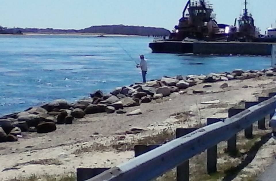
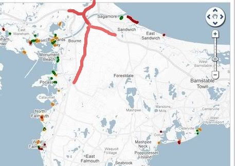
Please note and know that the greatest danger here is for people on north-facing coastlines. This means you:

Hull

Scituate Neck

Fourth Cilff

Brant Rock

Gurnet Point

Manomet

Sandwich

Barnstable Harbor

Dennis

Brewster

Provincetown

Here is a list of Tide Charts that you probably want to have a look at before tomorrow's entertainment.
***************************************************

The rest of you (meaning the inland and South Coast parts of our reading area, you get:

WINTER STORM WARNING REMAINS IN EFFECT UNTIL 7 PM EST MONDAY...

* LOCATIONS...include Northern Connecticut, Northern Rhode
Island, and Southeast Massachusetts.

* ACCUMULATIONS...4 to 8 inches of snow.

* HAZARD TYPES...include moderate to heavy snow, as well as
blowing snow.

* TIMING...spotty light snow early this morning will give way to
steady snow later this morning and then heavy at times this
afternoon. Snow may mix with sleet at times later this afternoon
and possibly mixed with freezing drizzle tonight before turning
back to snow Monday morning.

* WINDS...North 15 to 25 mph with gusts up to 40 mph.

* VISIBILITIES...One quarter mile or less at times.

* IMPACTS...The combination of sleet and snow will lead to
hazardous driving conditions at times. There is also the low
risk for isolated power outages.

PRECAUTIONARY/PREPAREDNESS ACTIONS...

A Winter Storm Warning is issued when an average snowfall of
6 inches or more is expected within a 12 hour period...or for
8 inches or more in a 24 hour period. Travel will be slow at best
on well treated surfaces...and quite difficult on untreated
surfaces. Only travel in an emergency. If you must travel...keep
an extra flashlight...food...and water in your vehicle in case of
an emergency.
********************************

There's even a HIGH WIND WATCH for the next few days, and a SPECIAL WEATHER STATEMENT about this morning's snow.

*****************************************************
This NWS chart shows a lot of stuff,but the first three numbers after the town name equal 1) Best Case Scenario, 2) Most Likely Scenario, and 3) Worst Case Scenario

Location At least Likely Potential for >=0.1" >=1" >=2" >=4" >=6" >=8" >=12" >=18"
Boston, MA 6 14 16 100% 100% 100% 100% 93% 79% 35% 0%
Edgartown, MA <1 3 4 92% 77% 43% 10% 0% 0% 0% 0%
Greenfield, MA 10 12 15 100% 100% 100% 100% 100% 100% 46% 0%
Hartford, CT 3 4 10 100% 100% 99% 83% 48% 27% 0% 0%
Hyannis, MA <1 4 6 93% 83% 67% 34% 12% 0% 0% 0%
Nantucket, MA 2 4 5 100% 100% 88% 23% 0% 0% 0% 0%
Newport, RI 0 1 5 77% 56% 42% 21% 0% 0% 0% 0%
Plympton, MA 1 6 11 95% 89% 83% 60% 41% 27% 1% 0%
Providence, RI 2 6 11 100% 98% 93% 78% 48% 33% 4% 0%
Springfield, MA 5 8 12 100% 100% 100% 99% 83% 49% 10% 0%
Taunton, MA 2 7 11 99% 96% 89% 75% 46% 31% 3% 0%
Westerly, RI 0 2 5 81% 63% 43% 18% 0% 0% 0% 0%
Worcester, MA 8 12 16 100% 100% 100% 100% 99% 88% 42% 0%

*******************************************************************

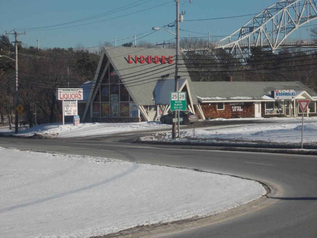
This is a dangerous storm, and it looks like fun for both commutes Monday.
It may start of as rain, but don't fall for that. It'll switch over soon enough, and the roads will be treacherous.

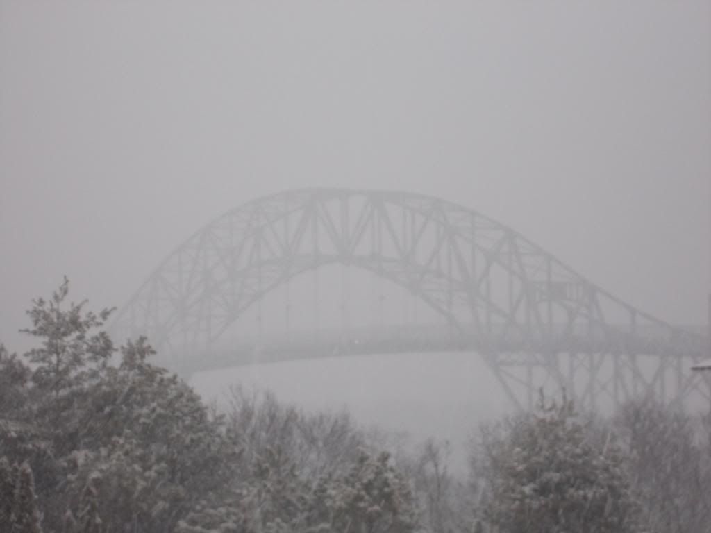
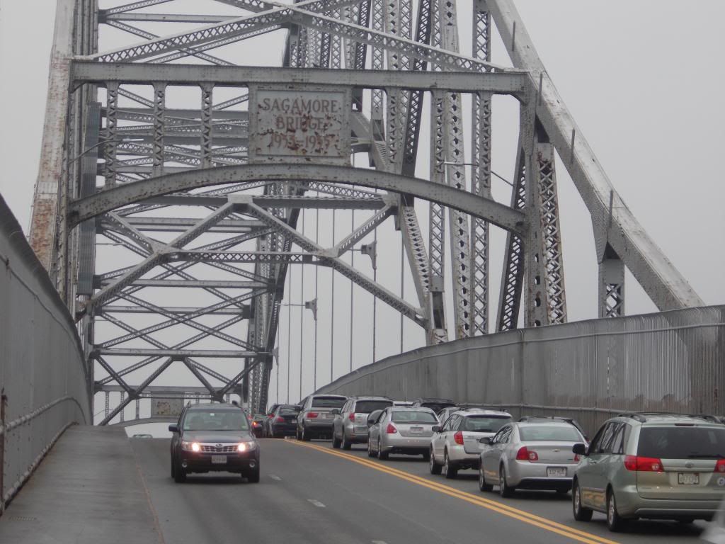
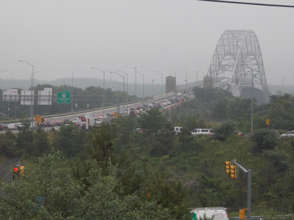
I'm considering going in to work 24 hours early and just hanging around. I barely made it over the Bourne Bridge in my junker Dodge during the blizzard last week. I had to resort to Tacking, a sailing method that involves repeatedly aiming your bow in different directions to do the seemingly-impossible move of sailing into the wind. I don't know Why it worked, only That it worked.

This feat was more impressive because:

1) I wasn't in a sailboat.

2) Tacking isn't designed to move Uphill.

3) Even if it was, I wasn't on water. Well, technically I was, but you know what I mean.

4) Cars, which aren't designed to cut through the surface of an ocean, don't have bows.

5) I don't know how to sail.

6) "I was on a 25 yard wide suspended plank looking at a 200 foot fall into a coastal river in February" was my worst case scenario.

7) My second worst case scenario was to just roll back down the bridge, in the wrong lane, then try to do an Elwood Blues-style sudden spin where I ended up in the heading-onto-the-mainland lane instead of my original heading-on-Cape lane. The fact that my rear window was completely snowed over was very far down on the list of things I was worried about with this move.

8) I was going to instantly shift my focus onto move #7 once I started sliding backwards down the bridge, without a second thought.

It didn't come to that, as Tacking worked. It still took me 5 minutes at 6000 RPMs to get to the top of the Bourne Bridge.

We'll be in the Bourne and Plymouth for this storm. I'm very tempted to hide myself in my sister's house on Duxbury Beach for the high tides, but I have a graveyard shift back in Bourne on Monday night. I'm not trying to repeat 1-8.

In about two days, look for some variation of "You know you're from Massachusetts when someone says 'I wrecked my car in the blizzard,' you say 'Yesterday?" and they say "No, last Thursday" meme to start showing up.


Thursday, October 13, 2016

Cruise Ship Hits Railroad Bridge On Cape Cod Canal


Oops!

The Viking Star, a 900 passenger cruise ship, struck the railroad bridge on the Cape Cod Canal yesterday.

No one was injured, and the bridge seems to have just lost some paint. US Army Corps Of Engineers workers heard scraping sounds as the tall cruise ship worked through the Cape's favorite man-made river.

The railroad bridge is 135 feet over the water. I have no idea how tall the Viking Star is, and I looked, too. I'm guessing 135 feet and 6 inches. it either has 9 decks or 14 decks, depending on if you believe the Cape Cod Times or Wikipedia.

I actually watched the Viking Star as she approached the Bourne Bridge, but I was too far away and behind too many trees to see much of it. There were reports on Facebook that she also hit the Bourne Bridge, but nothing is turning up on those there Internets.

We'll keep you updated. You never know if the diagnosis will be worse once they look at it with the daylight.

It was just like that, just with a larger boat and contact.


Wednesday, October 12, 2016

Cape Cod Canal-Only Fog

This was Saturday's fog, but there was a slight release delay as I pondered the "terrible pics of a cool phenomena" question.


I lacked the testicular fortitude to dash across the four lanes and shoot through the bars. This is what I would imagine that prison looks like in Heaven. 


The fog was the result of some temperature contrast between "cold morning" and "warm water." I was shooting from the side where the sun had been shining on the Canal longer.... or the people on the Cape side be smokin' up a few bales of that sticky-icky-icky. 


I kind of one-two'd these shots quickly, mostly to show how the fog was creeping over Buzzards Bay.

I'll get a better camera some day, honest.


Monday, July 25, 2016

Tracking Bridge Traffic Over A Summer Weekend


Just for laughs, we summoned up Google Traffic every hour or so during peak commuting periods.

We struck during mid-summer, which is a peak period around here. We did it before the end of the month, so we spared ourselves the cottage monthly-rental crowd.

We chose a weekend without some major event like a Scallop Festival or the Pan Mass Challenge. We did, however, choose a scorcher of a weekend.

Overall, I'd say we got as easy of a weekend as we could ask for in the summer. We may do another version of this when the PMC is in town (early August), just to see how it compares.

Here's the volume:

Bourne Bridge
Year round daily average (2011) = 42,505 vehicles
Summer daily average = 58,467

Sagamore Bridge
Year round daily average = 51,489
Summer daily average = 70,674

Here's what we found this week. We had no way of counting cars, even though we did do a few drive-bys just to make sure that Google Maps wasn't fibbing.


Friday, 5 PM.... 1 mile backup heading on-Cape at the Bourne Bridge, 1.5 mile backup at the Sagamore.

Friday, 6 PM.... traffic flowing freely over Bourne, minor delays approaching and crossing Sagamore.

Friday, 7 PM-Midnight.....hardly any traffic at all


Saturday, 8 AM.... 1 mile backup at Bourne Bridge, 2 mile backup at the Sagamore Bridge. Accident reported on Route 3 South just before the Sagamore Bridge

Saturday, 9 AM,... Accident at Sagamore still there, traffic back 4 miles, well past Exit 2. Bourne Bridge has 2 mile backup.

Saturday, 9:30 AM... Sagamore delays still back 4 miles, Route 6 East jammed to Chase Road.

Saturday, 10 AM.... Sagamore accident cleared, traffic still back 4 miles, pushing 5. Route 6 East jammed almost to Meetinghouse Road. 2 mile backup at Bourne Bridge, Scenic Highway jammed. Cranberry Highway filling up in Buzzards Bay.

Saturday, 11 AM... Route 3 South jam approaching Exit 3, Route 6 still jammed to Meetinghouse Road, entire Scenic Highway is bumper-to-bumper heading towards Buzzards Bay. Bourne Bridge jam 3-4 miles back onto the mainland. Bounedale Road, which may have 10 houses on it, has several ominous red sections on Google Traffic.

Saturday, 1 PM.... 3 mile backup heading on Cape towards the Bourne Bridge, accident just reported, this delay may grow substantially. One of our scouts tells us that Rte 25 heading to the Bourne Bridge sems to be moving 25 feet a minute. Both the Scenic Highway and the Cranberry Highway have multiple accidents, and are bumper to bumper. Traffic already on the Cape has eased up, just a brief jam after the Quaker Meetinghouse Road area. Traffic easin g up slightly approaching the Sagamore from Plymouth, maybe 3.5 mile backup now instead of 4.

Saturday, 2-4 PM.... 3 mile backups at both bridges, multiple accidents. Both rotaries are jammed. t 4 PM, there had been at least a 3 mile backup at Sagamore for over 8 hours.

Saturday, 6 PM on.... accidents are cleared, traffic flowing smoothly over both bridges.


Sunday, 9 AM... minor delays crossing Sagamore, a mile of bumper-to-bumper on traffic on Route 6 leaving the Cape. The Belmont Circle rotary in Buzzards Bay s getting full, might be church-related.

Sunday, 10 AM.... All clear, other than Route 6 leaving the Cape. The traffic jam is back two miles now.

Sunday, 11 AM... Mile long backup at the Boune Bridge, heading on-Cape. Six mile backup leaving Cape Cod on Route 6. Scenic Highway jammed.

Sunday, noon... Scenic Highway cleared, but Sandwich Road bumper-to-bumper. Mile long backup at the Bourne Bridge, Route 6 leaving the Cape is backed up to Chase Road.

Sunday, 1 PM... Route 6 jammed to Quaker Meetinghouse Road, accident in effect, 6A now jammed back to the Stop & Shop, perhaps people trying to get around the accident. Mile length backup at Bourne. Sandwich Road heading towards Bourne Bridge jammed a mile back.

Sunday, 6 PM.... very little traffic, minor delays leaving the Cape at both bridges. Ungodly good beach day, could be heavy volume later.

Sunday, 7:30 PM... The Exodus.... Rte 6 jammed back to Exit 6. One mile backup at Bourne Bridge. Sandwich Road and 6A have pockets of heavier traffic. Bumper to bumper on 495 around the Middleboro rotary.

Sunday, 9 PM.... One mile backup approaching Bourne Bridge rotary, pockets of traffic on 28 in Falmouth, Yarmouth, Harwich and Chatham. Route 6 approaching Sagamore back to Route 149.

Sunday, 11 PM..... except for a small stretch of 28 in Harwich, all traffic on the Cape is moving unimpeded.


Monday AM.... no Monday traffic, a sure sign of a slow summer weekend


Saturday, April 30, 2016

Bourne, Fishing And Stan Gibbs

Bourne is a nautical town. We are where the state decided to put her Maritime Academy. We're the first clam shacks and fish huts you see when entering Cape Cod. We're named after a guy who was named after a harbor... in fact, the harbor may actually be named for him, I've got to Google that some time.
Not only are we surrounded by water, we're divided by water. You can't go from Sagamore to Pocasset without dealing with that Canal. However, Bourne residents love their little man-made ocean river, even if it sort of curses us with gridlock every weekend.
One of the reasons we love our Canal is that it has some superb fishing. It is essentially a river between Buzzards Bay and Cape Cod Bay, and all sorts of beasts (fish, whales, squids, sharks, tunas, dolphins, seals, and even, as far as we can tell, at least one bear) swim through it. You can make a case that, once accessibility is factored in, the Cape Cod Canal is the best surfcasting spot in Massachusetts.
If you had the right tools and the necessary will, you could fish a LNG tanker out of that Canal. It would require Herculean strength and Napoleonesque game-planning... but if it could be done, the Cape Cod Canal is where you could be doing it it. It is also the only place that a particularly deft surfcaster could snatch the cap off of a millionaire from 100 yards away as he piloted his Sea Limo through the Canal. You actually get a bench along the Canal named after you if you do that, it's in the small print of the Town Charter.
And if anybody could have pulled that off, it would have been Stan Gibbs, but we'll get to him in a second.
Those fish have filled many a tummy over the years, as the locals soon figured out that the Canal was essentially a Fish Funnel that could be tapped again and again and again. Her reputation grew, and it is now a Grade A surfcasting spot. 
A celebration of that Canal would be very problematic without Fishing placed up in the front row. After that, Natural Beauty and Ease Of Transporting Goods, the Canal sort of becomes a Catastrophic Traffic Issue... and, in an emergency of the right sort, a veritable Line Of Death.
But enough of that talk. We're talking about fishing today, and we're celebrating the Sea Dog, the surfcaster, the angler, the old salt... The Fisherman. 
A state stands in Buzzards Bay.. It honors the fisherman, and it has a very clever Rembrandt/Hemingway sort of title... The Fisherman.
The statue was funded via donations from private citizens (mainly the Stan Gibbs Fisherman’s Classic Fishing Tournament people), and it stands 10 feet tall. It was made by Hyannis sculptor David Lewis, and was bronzed in Arizona. It is placed near Buzzards Bay Park, by the railroad bridge. It will be surrounded by roses, fountain grass, and will even have a compass rose. As near as I can tell, the statue will be "aimed" at Sagamore.
The text reads:“The Fisherman. A tribute to past, present and future striped bass fishermen of the great Cape Cod Canal, inspired by local fishing legend Stan Gibbs." It cost $80K.
The statue depicts Stan Gibbs, and a famous photograph of Gibbs served as the model for it. I'm not the one to make the call on whether Gibbs was the best fisherman ever on Cape Cod and the Islands (I'm pretty sure we are where Quint and Captain Ahab are from, at least Movie Quint), but he certainly owned the Canal.

Gibbs was born in Easton, but the sea drew him to Sagamore. He was a giant man, but also a creative man. He became world-famous for the fishing lures he created, many of which (Polaris Popper, Casting Swimmer, Pencil Popper, Needlefish, and Darter) are still being copied and mass-produced by whatever companies make fishing stuff. His family (I think) still runs the business he created out of his love of fishing, Gibbs' Lures.

Check the Salt Water Fishing Lures Collection Club convention, at the Canal Room of the Trowbridge Tavern in Bourne.... just off the Bourne Rotary. It's going on today.
He also pioneered the use of numbered poles to mark his fishing spot. To this day, Canal anglers will say "254 was on last night" and so forth. I was completely unaware of this before I went out the other day and started bothering local fisherman.
Bothering the local anglers also provided the meat of this Story Sandwich... his legendary accomplishments. All legends need mythology, and Stan Gibbs has some amazing stories floating around about his skills. The possibility that locals were teasing a girl with ridiculous fishing stories can't be disregarded. I welcomed that, to be honest. Stan's dead, by the way, so he wasn't feeding me this stuff himself to sell lures. Primary sources are excellent and essential for real history, but they only get in the way of Legend Building. 
Here is what I've heard about Stan Gibbs, and mind you that I wasn't out collecting stories that long:
- The state catch limit on stripers is known as the Stan Gibbs Rule.
- Stan's record for Speediest Catch was 17 seconds, and that included beaching it.
- At least 20 people told me that Stan could cast completely across the Canal if someone put a C Note down on him not being able to do so.
- Stan knew the Canal's bottom well enough that he had names for certain troublesome spots.
- Stan not only fished during Hurricane Bob, he executed a 120 yard cast into the teeth of the wind. When he was casting with the wind at his back, he was somehow catching deep-sea fish.
- On a dare, Stan could snap-cast and hook a fish like an arrow shot if he had a clear visual and it wasn't windy. It required a special spear-lure that Stan refused to produce commercially.
- Stan could fish holding poles in each hand, and often did so just before Good Fridays during the Depression if the Salvation Army was planning a big supper. See "catch limits," above.
- Not only did Stan never tangle his line when fishing near others, but he could disentangle crossed lines with what I will describe as the same hand motion you use when winding up to shoot some dice.
- Stan didn't catch and release every fish in the Canal once just to intimidate them, but he liked to propagate that rumor once he started selling lures. He did it skillfully, of course. "Customers are just another fish, dear...."
- Stan was fishing for bait, caught some, and started reeling it in. A schooly striper than struck the hooked herring, in the process impaling itself on the hook. Most fisherman would have reeled that score in, but Stan- who had done it 20 or 30 times before- waited and waited... and a bluefish attacked the striper. Stan then reeled them all in, and had them for supper.
- The hat-off-a-millionaire story was actually told to me about Gibbs, but more in a "he casted so well that he could have..." manner than as something he actually did. They do say that he had a collection of Mister Howell-style hats in his shed that was completely out of context in comparison to his other trophies, but that he never ever ever answered questions about them.
- The shark you see in the New England Aquarium was caught by Stan, on shore, with a holiday ham as bait. He had a friendly boat haul his bait out a half mile, and Stan handled the rest.
- When Stan tired of eating fish, he would sneak up near The Seafood Shanty or wherever and surfcast a cheeseburger off of the plate of a tourist. He did it enough that the various clam shacks would comp meals if this was claimed by a customer, no questions asked.
- A guy accidentally dropped his keys into the Canal while swimming in from a boat. He had only a rough estimate of where they fell into the water, and the current was strong. Local kids immediately fetched Stan Gibbs. He weighted down a treble hook, asked the unfortunate soul about 3 where/what/how far questions, and then fished his keys out of the Canal on anywhere (I heard this story a few times) between 1 and 20 casts.
- Stan once hooked a Mako Shark in the Canal, fought it for 9 hours, brought it to the rocks, slapped it in the face, and let it go."Tell the others my name..." he was rumored to have whispered to it. This act- done the summer after a fatal shark attack in Buzzards Bay- is credited by some with the lack of shark attacks on humans in this area since. I think the shark who bit the guy off of Truro a few years ago was European, and he fled town the instant he heard that this was Gibbs Country.
- "Stan" is translatable to "Satan" in Striperese.
- The first thing you actually learn as a fish when you join one of those schools is to Not F*** With Stan Gibbs. The second thing you learn is "Swimming."
- I won't say with any certainty that touching the Fisherman statue before you go fishing brings you good luck when you're fishing, but I will say that it certainly can't hurt your chances. I was raised by Catholics, and thus have a very keen understanding of superstition and so forth. I want dibs on that if people start doing it.

Wednesday, April 13, 2016

Death Row? Dividing The Scenic Highway...


The Scenic Highway in Bourne may be undergoing some major changes, according to Wicked Local Sandwich.

The Scenic Highway, as you know, is the 4.5 mile section of Route 6 that runs along the Cape Cod Canal between the Bourne Bridge and the Sagamore Bridge in mainland Bourne. It eventually becomes the Cranberry Highway, but that's Wareham's problem.

The Scenic Highway's problem is that it is undivided. The only things stopping you from using all four lanes to weave through summer traffic are Law and Imagination. The potential for head-on collisions is staggering. The downhill/northbound part just before the Herring Run rest area traffic lights might be the worst section of road on Cape Cod in a snowstorm.

Why, just yesterday, I saw a northbound fuel truck with 55000 gallons of gasoline pass within one nanometre of a southbound 18 wheeler truck entirely devoted to delivering Bic lighters to various liquor and convenience stores in the area. The potential explosion would have flattened Buzzards Bay and took down the Bourne Bridge. A nanometre is a unit of measurement equivalent to one billionth of a metre.

It's only a matter of time before we have some terrible accident like that, or one like the rejected-by-staff example where an unfortunate collision causes a truck full of liquid nitrogen to disgorge into a bus full of of church-picnic nuns and orphans. When the accident does happen, people are going to look back and ask "What could have been done to prevent this?"

One thing that we could do involves Jersey Barriers. Now, you should already know that a Jersey Barrier is not when a corpulent Governor puts a bunch of DPW trucks on the one bridge leading in to your town. No, these are modular concrete or plastic barriers used to divide traffic lanes.

Laying a line of these things down the Scenic Highway would vastly lower the chance of head-on crashes, the big killer of the Oops industry. The police, who have to clean these messes up, agree. When asked about the environmental impact of the Jersey Barriers, one Bourne cop told WLS to "paint it green."

Speaking of green, those barriers don't just sprout up on their own. Funding would be needed, not an easy thing to get these days. They're already talking about a permatax (in the form of a toll) on any third bridge project.

Patrick Ellis, a Sandwich selectman who has run a business in the area for years, also sits as the Upper Cape representative on the Metropolitan Planning Organization. He thinks that getting the project on the Transportation Improvement Program will open up the possibility of federal funding.

Granted, we still have to pay for federal funding stuff via taxes, but it's a much larger pool of "we" when we go national instead of local.

I'm not sure if we could get the fancy, HOV lane style of movable Jersey barriers. I'm not sure if they'd help at all, to be honest. Our worst traffic jams seem to be when the traffic is coming fro all directions, anyhow.

There would be a learning curve. People may also get a bit gun-shy when driving near barriers. Many people think that the prominent sidewalk is what slows down traffic on the bridges.

 Either way, you'll be hearing about the Jersey barrier idea again, and it may become a fact of life in the upcoming years.


Wednesday, October 14, 2015

For Whom The Bridge Tolls: Thoughts On A New Cape Cod Canal Bridge


Let's start with some numbers:

Bourne Bridge
Year round daily average (2011) = 42,505 vehicles
Summer daily average = 58,467

Sagamore Bridge
Year round daily average = 51,489
Summer daily average = 70,674

Those numbers lead to impassable traffic jams, jams where ten mile drives take 3 hours.

You've all heard the war stories. "25 mile backups during Hurricane Bob," or "90 minutes from the the 6A/130 intersection to the Sagamore Bridge during the Mother's Day Massacre of 2012."

Bourne residents literally can't go anywhere and hope to come back on Friday afternoons, Saturday/Sunday mornings, Sunday nights, during the Monday commute, and/or during any holiday/event.

Emergency evacuation is impossible, property values suffer, the quality of life is lowered, and the last sentence of the previous paragraph is literally saying "as a Bourne resident, you sacrifice a sizable % of your waking life to traffic."

This would be tolerable in Boston, where there are a million people zipping about. It shouldn't be the case in Buzzards Bay, where 3000 souls can be found on any given day. It makes me want to scream at someone more than I care to admit.


Here's how I see it....

* We need a third bridge.

* We need a third road leading up to and away from that bridge.

* If we want it, we'll have to pay for it.

* We'll pay for it with a toll bridge.

* The tolls will be there forever, even after the bridge is paid off.

* Prices will increase as businesses pass the toll costs onto the consumers.

* We shall eventually pay billions for a $300 million bridge.

* Splitting traffic up at the Christmas Tree Shop and then merging it back together 400 yards across the Canal will not resolve our traffic problems. It may in fact make it worse.

* The bridge will not meet the stated goal of easing traffic volume at all, and it serves no other purpose.

* We'll pay for this useless bridge for the rest of our lives and the lives of our descendants.

* If we don't do something, this nightmare is imminent.

* It seems to have fallen to me to brainstorm something.


I'm not picking on MA State Rep. Randy Hunt or Cape Cod Commission CEO Wendy Northcross there. Randy is obviously putting thought and effort into the problem, and Wendy answered almost everything I asked her about the topic. They just don't seem to see the basic problems inherent in this situation, or they feel that the problems are tenable and/or unavoidable.

Pols are sort of bound by what they think they can sell in Washington or the State House. They know they will have to claw through miles of red tape to even get the idea mentioned. They know that there will be many hands reaching into our pockets once the project gets green-lighted, especially with a Massachusetts highway project.

All of that real world stuff gets them used to operating in a way that somehow prohibits Thinking Big.

The intricate solution is beyond my capabilities. If I showed any Urban Planning skill in high school, a series of guidance counselors failed to mention it to me. However, the basic philosophy on what we need to do is well within my skill set. You'll see it, too.

The toll will generate billions in revenue, without reducing traffic at all. It is almost punitive. Only someone with a financial stake in a road-construction industry or highway management can like the idea. Any politician who supports it should be chased through the streets by a mob of angry constituents, and perhaps be kicked in the ribs a bunch of times.

If we and our tourists are going to spend billions over the life of a toll bridge, we should at least get what we pay for.


50,000 cars a day times $5 a pop = $250,000 a day in toll revenue.

Let's lower the toll rate so that I can just say "a million a week" and "maybe $5 a car is a doomsday estimate" without stretching the truth too far.

300 weeks pays off the project. 300 weeks is like, uhm, 6 years or something.

But the toll will last forever.

Heck, we'll even throw in a decade or two to cover any/all maintenance costs, and a third decade to cover the eventual replace-the-old-Sagamore-Bridge costs. Over an assumed 100 year lifespan of the bridge, this still has the Man needlessly in your pocket for 65 years.

The only way for us to get any value out of this is if our project is so massive, it takes a century of tolls to pay for it.


Off the top of my head, I'd drop a third bridge right in the middle of the other two. I would gut Bournedale with roads connecting to Route 25 and Route 3, seizing Bournedale Road and Herring Pond Road by Eminent Domain if need be. I'd make the road into a big Y, with the bottom part of the Y being the third bridge.

I'd do an upside down version on the other side of the bridge, after taking some land from the gub'mint. The forks of the letter can sort of ^ towards Route 28 and Route 6 through the military base.

Shoot, why not build it in such a way that we can line it with Burger Kings, Cumberland Farms and Exxons? I have never met a local economy that couldn't use a rush of jobs. Perhaps even a Bournedale Mall would not be out of the question.

It would actually solve the problem that Main Street in Buzzards Bay has had since the freeway went in. Route 25 cut off our Tourist Flow, so we get back at Route 25 by cutting into it to run those same tourists by our businesses again. Main Street could slowly re-design itself to suit more immediate local needs, which it is sort of doing now anyhow.

There would be some ugliness to They Tore Down The Carter Beal Nature Preserve And Put Up A Gas Station With A Dunkin' Donuts In It, no doubt. We could mute the environmental damage by building an elaborate Arc de Triomphe bridge over the herring run in Bournedale.

I'd also go with a wrap-around fishing pier along the bottom of the bridges, and light all of the bridges up like they do with the Zakim Bridge. I'd celebrate the opening with a party so huge and chaotic, it would make V-J Day look like someone just won a Scrabble game.

It's being paid for... why not?


Hold on, someone did the map better than I did.


In my world of the future, we now have a third bridge. It is fed by roads which break off from highways which are already in place. The roads break off at the exact points (the Ingersoll Bend and Herring Pond Road) where we currently begin our present bumper-to-bumper congestion. We strike at the areas with the lowest population densities, mostly swamp and wasteland. Anyone we displace is compensated handsomely.

Locals can still use Main Street, Sandwich Road, the Cranberry Highway, the Scenic Highway and 6A for local-type stuff, which leads us to the best part. Before I get to that best part, I'd like to add that this plan would probably allow us to get rid of the two Bourne Bridge rotaries, and just have intersections like normal towns do.

The best part? The third bridge would be almost 100% Tourist. The current bridges feed the Bourne villages, while this hypothetical third bridge would empty into a discontinued military base and some Bournedale swampland. It would be of little use to locals, and it would only be used by tourists.

And it is this bridge that would bear the dreaded Toll. Holler if you hear me.


Now we have the burden where it should be. Tourists can pay for their own bridge. Smarter hotels and tourist destinations can comp guests for the toll. Bourne residents have suffered for years to fill Harwich restaurants with tourists, so cry me a river, Mooncussers.

Bourne and perhaps Sandwich residents will be exempt from any tolls, of course. We've been tolled in Traffic Patience for the last 100 years. F*** you.

The toll bridge can also be used by the rich man to skip heavier traffic at the free bridges via a small shedding of excess wealth, as the new bridge would sport a very low traffic volume for most of the week.  A five dollar toll for an empty bridge may also be an acceptable and necessary luxury to a working stiff who is running late for work on an important day.

We may have to somehow divert traffic to the toll bridge on certain Touristy days while preserving the free bridges for local traffic, and perhaps even invest in some of that Urban Warfare stuff that the cops get in larger cities where the people riot a lot. Maybe we can borrow some tanks from the military base.

We'll cross that bridge when we come to it, if you'll pardon the pun.


Sunday, September 27, 2015

Cape Cod Canal Fog


Good Morning, Cape Cod!

Early morning folk know that the Cape Cod Canal, on spring and autumn mornings, often develops her own little Fog River.

There isn't a puff of fog anywhere else in town right now.


I wasn't the only shutterbug around, but I'm savvy enough to not bother the fishermen.

This fog will be gone soon enough, but it's a beautiful show this morning, at least while it lasts.

If you read this right as I post it, come on down and walk in a cloud.


Only on the Canal this morning can you shoot directly at the sun.

At least one person asked me if there was a wildfire burning somewhere. Indiana plates.... shakes head.

I can't imagine how you'd pilot a boat in that. Dead reckoning sounds too ominous.


I love fog, I'd like part of the town to be like this all day.

There is a striper tournament on the Cape this weekend, and you know that a few of them wandered down to the Canal for some morning casts.

They most likely parked their cars on Sandwich Road in unlimited visibility, cut through the woods, and ended up in a film noir scene.


I had to hop around on the Sagamore Bridge for some of these, so be appreciative.

Yes, should have hopped off, I get it, very funny.


I shot this over Route 6 on the Sagamore siply by holding the camera over my head and hoping I got lucky with the clicking.

It may do this tomorrow as well, with the added bonus of a Supermoon descent.


Have a good day, folks! Go Pats!

Scallop Festival Blues

Fiendishly Foisted Food Fest!  


Last weekend brought us the annual Scallop Festival, with all of the prestige and revenue that accompanies it. It really is nice to see our old friend return to... What do you mean, not Bourne???

The people who run the Scallop Festival- the Cape Cod Chamber of Commerce- decided that the event needed a larger venue, and shifted it to the Barnstable County Fairgrounds. The move gives the festival more parking, better facilities, and dare I say a more prestigious locale. The event has swollen in popularity, to the point where it draws in 50,000 people every time they throw it. A larger facility means the chance of more money. It makes perfect sense to move the event off the mainland.

Bourne's claim to the Festival had a fingertip grip at best, buffeted by hopes of a new hotel complex, the arrival of the Commuter Rail, and the revival of the Main Street business district. There was also a nostalgia/historic basis, but that isn't worth a few thousand parking spots these days.

The move also gave a stomach punch to a struggling village, a village that has stood by the Festival for her whole existence. The Scallop Festival has been going on for 45 years. Sometimes it was in the Armory, sometimes in the big tent by the old Playland location, sometimes on the military base, and- until now- in Buzzards Bay Park.

It is was a Bourne tradition. Now, the town is losing their Main Event, the annual gift horse that would fill the hotels, buy out the goods from our stores, and put our gas stations on a paying basis.

Who knows? Some of the people who visited Buzzards Bay during the Festival may have liked it enough to maybe return again and spend more money. We'll never know now, will we?

All summer long, people heading to spend money in other Cape Cod towns clutter up Bourne during any time period you can hang "commute" off of. We're asked to deal with it, so that Eastham and Martha's Vineyard can prosper. We get very little in return for it, other than some people who tire of the traffic enough to pull off of the highway in search of food or gasoline.

The Festival has always been a sort of the last hurrah for Cape Cod's summer, especially when the event coincided with the October scallop harvest. It was fitting that Bourne got the final bow with her Scallop Festival. We took the brunt of the hassle all summer long, so it was only right that we got the last bite out of the tourists before the desolation of winter set in.

The festival was kind of like a Thank You from all the people who had been leaning on Bourne during the peak traffic season, and the town was dependent upon it. Now, they take even THAT away from us. Oh, well, there will be another Canaliversary in 98.75 years, I guess we'll be OK.

Others are not so forgiving. Homeland Security has been tracking a group called Al-Mollusk, who were planning to disrupt the Faux Falmouth Festival. They had an elaborate plan to buy junker cars and use them to block the Bourne Bridge during the festival, depriving Falmouth of anyone Inland while seeing how many Cape Codders will travel through a mob to get scallops and fries.

The town considered her own measures. The big idea was to host an Oyster Festival on the same night. Advertising was to focus heavily on the aphrodisiacal properties of the Oyster, while disparaging the scallop scarfer. "You can go to the Scallop Festival, but if you still love your spouse, you'll be in Bourne instead."

Yeah, we were gonna go right for the friggin' jugular, you really have to these days.

Bourne took it on the chin with this Scalloping of our tradition, and we should already be planning our revenge. If this were the old days, we'd be sending guys across the bridge to burn down their salt mill and deflower their virgins. Those people are lucky that I don't run Bourne, I'd drop those two bridges into the water faster than you can say "Jackie Robinson." I'd try to steal their stupid Road Race.

I can tell you this.... you won't be seeing many people from Bourne down at the Fairgrounds this weekend. It's never nice to see your ex with someone else, especially if they are being fed shellfish.


Tuesday, August 18, 2015

Between Two Bridges: Wendy Northcross

Talking Bridges With The CCC CEO
Wendy Northcross is the CEO of the Cape Cod Chamber Of Commerce. She's been down with COC since 1997, and has been running the ship for some time now. She is on the board of so many things that I don't even feel like listing them all, but some of the better ones include the JFK Museum and the Cooperative Bank Of Cape Cod.
She is one of the state and maybe the country's better tourism experts, and she wields a lot of power. If you're a little girl and still think women can only be nurses and Mashpee Ballet dancers, check out the swagger that Ms. Northcross carries around Cape Cod. When she speaks, heads turn.
Speaking of which....
She is also one of the weightier voices calling for a third bridge. That bridge may be a toll bridge. The good news is that it may ease traffic a bit. The bad news is that you'll be paying for it every time you drive across the bridge for the rest of eternity.
I sent Wendy a list of questions in the email, and she was cool enough to get them back to me in the same day. If you are upset about me not challenging her on certain points, hate the game and not the player.
Her answers are exactly as she mailed them to me, and were not altered. I switched the question order around on publishing to line up certain pictures I have.
Here we go:
Jessica Allen: Tell us about the plans being discussed about building a third bridge over the Cape Cod Canal.....
Wendy Northcross: Because of the condition of the 80 year old canal bridges, and the now chronic maintenance cycle we find ourselves facing almost annually, community and state officials began to ask about the true safety of the bridges and what was the future plan?
The responses to our questions were “there is no long range plan” – and “there are no government resources to do anything like a new bridge for at least 20 to 30 years or more.”
So the discussion turned to the questions “how long can we continue to depend upon the bridges to carry freight, and for us to safely traverse the canal - how long can Cape Codders continue to suffer significant travel delays during shoulder-season maintenance on the bridges?”
To that end, community leaders and state officials have had meaningful conversations with a broad base of businesses and residents about their tolerance level for the current state of the bridges vs. a plan for the future. Fortunately, we now have a plan that everyone can look at and decide if it holds merit. 

If we built a third bridge that was independent of the current bridges, what would it be named? 
I don’t know…. maybe “new bridge?”

Is there no other way to get this bridge built without a permatax on commuters? 
Government officials have indicated that there are no federal or state resources available to build any new crossing infrastructure for at least 20 to 30 years. The question is, how long do Cape Codders want to wait and what does waiting cost? 

- Why should Cape Codders who don't have yachts or LNG interests pay tolls for a bridge over a Canal that they don't want, need, or benefit from?
The current concept is that only users of the new bridge would pay – the Bourne Bridge would be available at no charge. I believe that most Cape Codders well understand the need for stable infrastructure over which their goods and services and customers can pass.

Should someone making $9 an hour who has to cross the bridge twice to get to and from his six hour shift be forced to give almost 20% of his day's pay to tolls? Will there be hardship exemptions to tolling?
The beauty of transponder technology is that high frequency users can be identified and calculated to pay at a different rate (or potentially no rate if they are an immediate neighbor). Remember, in this current concept, the Bourne Bridge – 2 miles up the road, remains free. 

- If we feel that many New Yorkers will balk at the prospect of paying a toll request from their Barnstable vacation the previous summer, and since we all know the tolls will never go away, at what point in history would the bridge be paid for solely by taxing tourists?
If a guest does not have the money to pay a toll, they are very unlikely to be visiting in the first place.

- In the event that the state says there are going to be temporary tolls and they instead make them permanent, can you get Randy Hunt or Bill Keating to insert some date or language into the bill now that allows us to sue the state to stop the tolls once the bridge is paid for?

The financial analysis will reveal the return on investment levels recommended to put this project out to a public/private partnership model of ownership.

Would a new bridge substantially decrease the time we'd need to evacuate Cape Cod in an emergency?
It should give us more options. 

Former clerk at the Market Basket playing urban planner here.... why not break off an off-ramp off of Route 25 at the Ingersoll Bend, while also breaking off an offramp from Route 3 through Bournedale.... both off-ramps form a "Y" and meet a new road, which feeds the third bridge, around Barlow's Clam Shack...... the third bridge enters the military reservation, where another Y breaks traffic onto Route 6 and Route 28 somewhere? Short of widening Routes 3, 6, 25, and 28, it seems like the only way to actually reduce traffic.

MA DOT traffic engineers, using the traffic counts on the key roads, and looking at land ownership vs. the cost of land takings, and using existing roadways versus building extensive new roadways laid out a variety of scenarios – and then estimated costs on all of them. And yes, some were very expensive without yielding larger increases in efficiency and safety. 

- If the short answer to the above question is "one billion dollars," the rebuttal is "We're going to have a permanent toll in place long after the bridge is paid for, why not build a hyper-expensive bridge that actually does lessen gridlock?" If it's going to cost me $10 a day in tolls to commute 2 miles to work for the rest of my life, I want to only know about gridlock in an abstract sense.
One of the questions you should have asked first is “what is the capacity of the roadway vs. the bridges?” The answer is that the bridges have much less capacity of cars per hour than the current road system, and if we give ourselves some shoulder room and separate the travel lanes – we’ll have a safer and more streamlined flow – reducing gridlock.
Fortunately for us, our state traffic engineers have found a scenario that bears further vetting based on creating safer and more efficient travel at a cost that bears consideration.

- I almost feel badly asking you this, but has anyone actually ever really seriously honestly looked into maybe building a tunnel? If so, roughly where were they thinking of putting it? Will permit decals be sold?
Yes – and we have been told and it is far more expensive. Although I do think most Cape Codders already have the decal!

If the villages of Bournedale, Sagamore Beach, and Buzzards Bay were to secede from both Bourne and Barnstable County, could we sue for a share of the loot from the toll bridge? We are the ones who do nearly 100% of the suffering with traffic, and we benefit the least from bridges.
I liken the bridge flow to a clot in a blood vessel. One small clot affects the entire human body. Our narrow bridges affect the entire Cape’s flow and thus its well being. 

- All of those bridges should be lit at night, like the Zakim Bridge. I'd do each one in a different color. What other vacation destination has THAT?
Nice idea.

How long can we expect the current bridges to hold up? Won't the twin bridge idea be a bit heavy for all that Great Depression concrete?
A new bridge would be (as currently proposed) about 15’ from the existing bridge on all new footings and made of materials that do not require painting. A new bridge could handle diverted traffic when we needed to fix the Sagamore – allowing the old bridge to be taken off-line for faster and deeper repairs.


Are there any plans to erase that ridiculous on-ramp merge at the Christmas Tree Shop?
With the proposed plan – this lane would get its own travel lane outbound over the old bridge. Between now and new bridge completion – there are some things we could try – but Bourne residents would need to be up for the experiment of restricting use of the onramp during a peak travel day. 

- Imagine that you can wipe away Main Street in Buzzards Bay... what would you lay down in place of it?
Main Street in Buzzards Bay has a great deal of character and potential opportunity as well as a bright future. I see a mix of uses with residential places within walking distance of shopping, work, recreation and access to rail.
***************************************************************************************************************