Showing posts with label route 6a. Show all posts

Monday, May 30, 2016

Rainy Memorial Day Traffic Notes And Gas Prices For Cape Cod


It is said that, much like how the Eskimo has 200 words for snow, residents of Bourne have hundreds of different classifications for traffic. They distinguish between weekend and weekday traffic, summer and winter traffic, rain/snow/sun traffic and holiday traffic.

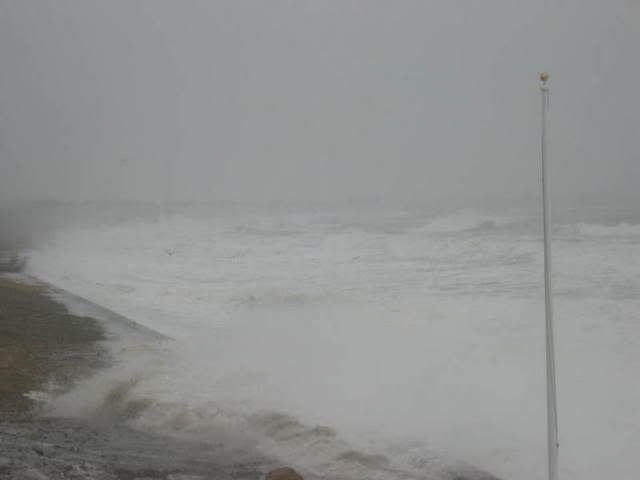
Today is one of those subsets... Rainy Memorial Day.

Memorial Day is when summer starts on Cape Cod. Summer people opening their cottages, winter cottage rentals departing, hotels getting summer volume, places with SEE YOU NEXT SUMMER signs un-shuttering, old people smart enough to come off-season arriving... all of the little omens that the locals know of are in effect.

Traffic heading on-Cape was heavy on Friday, Saturday and Sunday. Many of those people have to be on the mainland by Tuesday, and most of them will be making the Drang nach Westen at some point today.

Again, traffic is always going to be bad on Memorial Day Monday. I know it sucks right now, and I haven't opened Google Traffic since I got home from lunch. However, as the list of services offered by the Mustang Ranch in North Las Vegas tells you, there are different kinds of sucking. Allow me to explain.

A nice, sunny Memorial Day means that everyone bails out in the evening, after a day at the beach, a nice dinner and some time spent packing. This has a tendency to put them on the road at the same time. This is where you get those 15 mile traffic jams that Cape Cod is famous for.

A rainy Memorial Day breaks the people up a bit, leading to a heavy-but-lesser flow of the day-long variety. I was writing this article at 8 AM, and there was substantial traffic heading off-Cape even then. Those were the people who saw a rainy Memorial Day coming and opted to bail ahead of the traffic, the Cape Cod version of a guy sneaking out of a Pats game when we're up 42-10 after 50 minutes. Beat the traffic, before it beats you.

Other people, especially those who rented the place they were staying at all weekend, are determined to make a day of it. Cape Cod has shops, museums, galleries, restaurants and all sorts of stuff with a roof over it to pass the time. This tendency to stick it out is not restricted to those who have or don't have children.

Cape Cod will get day-trippers, even with this rotten weather. Some and perhaps many grandfathers who were alive when Hurricane Donna came ashore don't consider this to be real rain, and will insist on hosting a barbecue in it. This effect is limited. We've been keeping an eye on traffic heading both on and off-Cape for most of the day, and there has been no problem at all getting on to Cape Cod.

Even with the people bailing out early, there should be some heavy traffic tonight. The smart people leave early Tuesday morning, but you'll see plenty of the Other Type as you crawl up Route 6 tonight.

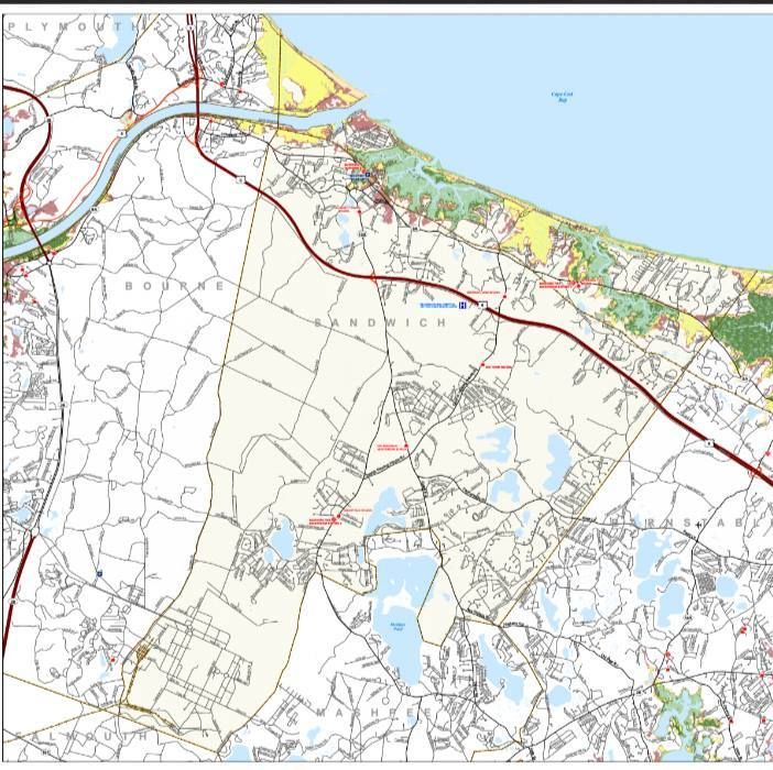
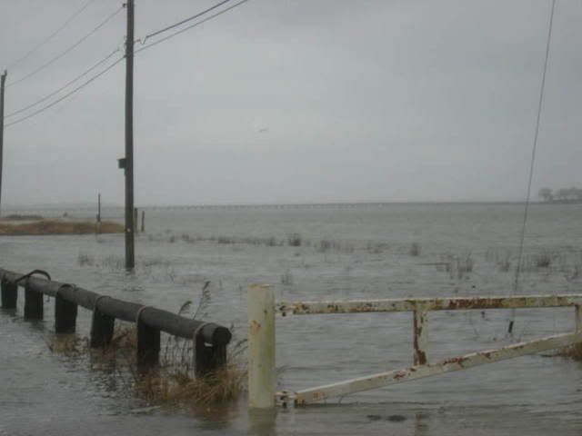
We've already had some traffic difficulty, as heavy rains flooded the Cranberry Highway up by the old 99. The road, which was having traffic diverted through the Stop & Shop plaza, is now open.

Note that there comes a time, usually in the Church hours of the morning, where you are under a lesser risk of encountering an impaired driver. Not too long after that, the risk goes up, and it gets to roll-them-dice levels on days where disappointed tourists have been drinking all day.

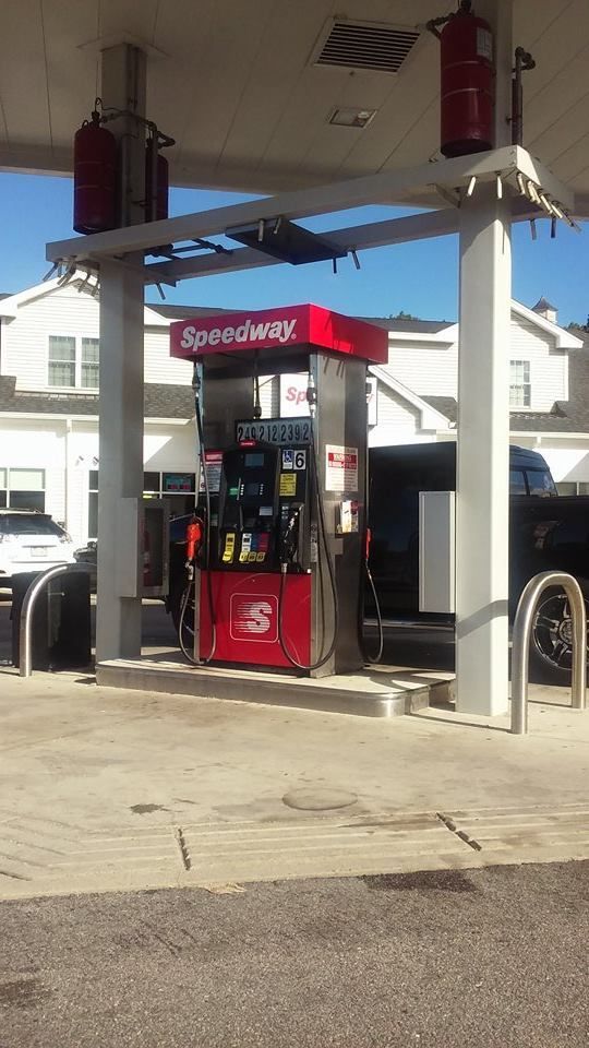
If you must go, don't forget to fuel up! You don't want to run out of gas in a ten mile bumper-y-bumper traffic jam while a tropical storm is pouring water up from Carolina at you. Here are the best (reported) prices for each Cape Cod town.

Eastham: $2.39 a gallon, Tedeschi's, Vandale Circle

Orleans, $2.34/gallon, Cumberland Farms, Route 6A

Chatham, $2.31, Cumberland Farms, Main Street and Roundabout Gas, Main Street

Brewster, $2.36, Cumberland Farms, Main Street

Harwich, $2.32, Harwich Gas And Propane

Dennis, $2.23, Mobil, East-West Dennis Road

Yarmouth, $2.29, Speedway, Main Street and Cape Cod Farms, Main Street

Barnstable, $2.29, Sunoco, Falmouth Road and Gulf, Falmouth Road

Hyannis, $2.26, Airport Gas, Mary Dunn Road

Mashpee, $2.26, Stop & Shop, Falmouth Road

Sandwich, $2.34, Shell, Route 6A

Bourne (Capeside), $2.35, Mobil, Clay Pond Road

Bourne (Mainland), $2.26, Bay Village Full Serve, Main Street

Wareham, $2.23, Speedway, Main Street and Joe's Gas, Main Street

Plymouth, $1.89, Mobil, South Street


3 PM UPDATE: Traffic on Route 6 heading off-Cape is stretched back to Exit 6, while traffic on 28 is jammed back to the Otis Rotary.


Monday, September 21, 2015

Sandwich Hurricane Information

Sandwich is a town with a funny name, even in a state that has a Marblehead and an Athol in it. Sandwich is also a town with gorgeous beaches and marshes, which are awesome for 364 days a year. Those beaches and marshes become a problem when a hurricane comes to town.

We come to you today to talk about hurricane maps. These maps come from FEMA, MEMA, NOAA and NHC. The map at the top of the page is a Hurricane Inundation Map.

Here's how it works:

Light Green = Category 1 hurricane. Hurricane Gloria was one of these, and the offshore Halloween Gale was, too. Although not a tropical system, the Blizzard of '78 did Cat. 1-style damage.

Dark Green = Category 2 hurricane. Hurricane Bob was one of these.

Yellow = Category 3 hurricane. We've only had five of these hit New England since the Other Man arrived in 1620, the most recent being Hurricane Carol in 1954.

Pink = Category 4 hurricane. We've had one in recorded New England history, and it struck in 1635.

Flesh = One Hundred Year FEMA Food Zone. This is the "100 year storm" you hear people speak of, but you have to go pre-Colombian to find them ("going pre-Colombian" means using salt marsh soil samples to look for sand layering associated with large hurricanes). New England has had storms in the Category 4+ level in the 1100s, the 1300s, and the 1400s.

Sorry about Flesh, but my knowledge of color names was and continues to be heavily influenced by whoever was in charge at Crayola in the 1970s.

Yes, that's Duxbury, and yes, that's from a nor'easter and not a hurricane, but it is Inundation.
"Inundation" is a big word for "storm surge," which are two small words for "saltwater pushed ashore ahead of an incoming cyclone." Feel free to develop more colorful terms like Deathwash or Liquid Doom if that gets your people serious. Flooding is the big killer in hurricanes, sort of what artillery is to warfare.

This map is based on the zany-weatherman-titled SLOSH model for storm surge inundation. It depicts the inundation that FEMA thinks will occur with a direct-hit hurricane arriving at mean high tide. It does not account for freshwater flooding. It also shows what intensity (on the Saffir-Simpson hurricane intensity scale) of storm would be needed to soak certain parts of Sammich.

I have written this very same article for every town in SE Massachusetts with a coastline, and many towns are tricky with flooding. Pembroke, which isn't even near the ocean, will get some salt water in a bad enough hurricane. Mattapoisett floods several miles inland, while New Bedford should- in theory- hardly flood at all.

Sandwich isn't even a little bit tricky. Most of her flooding will occur very close to shore, and you can pretty much guess where it will happen if you take a Sunday drive through town. Granted, someone with my job has looked at a lot of hurricane inundation maps and gets sort of jaded with coastal destruction, but nothing on the Sandwich map makes me say "Damn... who woulda thunk?"

That's not snow, it's, uhm, stubborn hurricane wave foam...
Now, don't look at that map, see that your neighborhood isn't colored (FEMA is very egalitarian, and "colored" neighborhoods on FEMA maps are generally populated by less swarthy, waterfront-property-having folks... towns with significant minority populations usually have them in the White neighborhoods), and think that you are off the hook from hurricane damage if one comes up on us. No.

You can get Ended in an innumerable amount of ways if a hurricane hits Sammich, only a few of which involve saltwater inundation. You could step on a downed power line, get the Charles I treatment from flying debris, drown in pond flooding, have a tree fall on your car, get crucified by purging looters, get swallowed (either up into a cyclone or down into a whirlpool), drown in your attic, suffer summary execution by the National Guard, stumble into a sharknado... trust me, I'm just scratching the surface here, player.

We want you alive. Beyond base reasoning like "If you actually looked at this article, we cherish you and cannot fiscally afford to lose your potential site visits," we also have a sort of "If they utilized the article properly, they live" professional pride thing going on. We also want you alive for regular, nice-person reasons. You're our kind of people.

This leads into our next map, the Evacuation Zone map. This one is much less nuanced than the Inundation map, in that there are only two colors.

They basically break down to:

Pink = These people should leave.

Yellow = You should leave, too.


Here are a few things that my highly trained eye sees with these here maps of ours:

- Storms will be very, very capable of washing out Route 6A in some spots. This makes Scorton Neck into an island.

- Add that to "the bridges close when the winds top 70 mph or so," and you have a Trapped Sandwich.

- Marylou's of Sandwich is vulnerable to Category 4 storms, a problem I expect them to have solved before the next Category 4 storm hits. I need Marylou's, as I don't like Red Bull and this site doesn't make enough for me to afford cocaine.

- The Sandwich fire and police stations are vulnerable to even a minimal hurricane.

- You're safe off Route 130, and I'd encourage coastal people to befriend someone off 130 well enough to be granted asylum from the storm.

- Even a minor hurricane will at least temporarily end Sandwich's above-water presence on the mainland.

- The Canal would only spill over in Category 3 and above.

- The power plant is safe from flooding in all but the worst storms, according to FEMA.

- Ridiculous shoreline change is likely, with much sand loss into the marshes. Thanks to the Canal jetty and certain legislative failures, no replenishing sand will be forthcoming.

- We'll leave the street-by-street analysis to the reader. You can use the maps on the site to zoom in to your very home. We'll link you up at the end of the article, no worries.

- Seek out and question whichever old-timer has lived in your neighborhood the longest. Ask him or her what happened in Hurricane Carol. Find out how bad the road flooded, what happened to your house, how impossible escape was, and all that. You should never fail to utilize the Old School when planning your personal emergency response.


Bone up on the Hurricane Information with these handy links:

Hurricane Inundation Maps

Evacuation Maps

Worst Hurricanes To Hit New England

List of all hurricanes to hit New England


Sandwich Flood Mitigation Plan

(pictures by FEMA, Stacey Moreau and Carter Malpass)