Sunday, August 9, 2015

Death From Above: Seagull Attacks On Humans


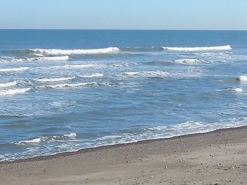
The beach is getting to be a dangerous place these days. You could always drown, or get washed out to your doom by a riptide, or smashed into a rock by storm waves, or even get eaten by a shark. Most of your trouble is going to come from the sea part of the seashore.

You're not expecting Death From Above.

Now, fear you not, I'll be speaking of English things today. However, it's just a hop across the puddle from England to here. England's problems can become our problems very easily, even without the actual suspects themselves coming over the pond.

What you and I think of as Cranberry County could very easily be overrun with Attack Gulls. These attack gulls are all the rage in England right now, and there is no reason to think that we aren't in for some of the same medicine.

In England, seagulls are attacking people to the extent that the Prime Minister had to address it. They have tallied up a few corpses, including a human.

Gulls are big birds, and remarkably adaptive. They'll eat anything people eat, and then some. This makes them frequent visitors to McDonald's, dumps, sporting arenas, wharfs, and anywhere else people might leave food lying around.

While I personally think they're cute, many view them as a pest species. Nicknames for gulls include "flying rat," "featherpest," "wharf rat" and "air dog." They beg for food harder than any non-dog species, and are not above taking food if it is not proffered.

English residents are complaining about gulls being involved in various forms of malfeasance. The principal offenses include:

- Two seagulls in Cornwall killing a Yorkshire Terrier named "Roo." They had previously been stealing Roo's food. Roo weighed 2 pounds. Cause of death = head trauma, and he was covered in peck marks. He was killed in front of a 3 year old.

- There's another gull vs. dog killing story in England somewhere, I couldn't find the link. (Editor: A chihuahua in Devon was killed by gulls)

- A pet tortoise, also from Cornwall, was turned over and pecked to death by a flock of seagulls (not the band). Tortoise name = "Stig."

- Numerous other near-fatal or unreported fatalities involving cats, dogs, pet rodents and other gull prey.

Then, the gulls started messing with People Food

- A pensioner (English for "old person") got her wig split by a dive-bombing gull who may have mistaken her hair for a rabbit or something. A different white-head was attacked by the town wharf earlier in the week.

- English people call such attacks either "being swooped upon" or a "scalping."

- Gulls attacked an elderly man in Yorkshire. It looked Hitchcockian, according to witnesses. Another pensioner (that's a catchy phrase, I'm starting to go to it instinctively) and her husband came to his aid, and she got her pelvis broken for her troubles.

- Postal service was disrupted in wherever you live to be Cornish by gulls, who may have been protecting nests. This is even more fun because I found out that mail carriers are called "posties" in the UK, and the offender was called a "stroppy seagull."

Then, sh*t got real.

An elderly mail-carrier died after suffering a heart attack during an attack by gulls. He had been working in his garden at the time, something that gull-attack researchers like myself come to realize is a bad move for old people in Gull Country.

This was the only gull-related fatality I came across, but I'm sure there were dozens in pre-history.

Two other gull attacks jumped out of the news, and note the locations, which prove that gull attacks are not distinctive to England.

- Pope Francis may have invented a ghastly new sport when he had two children release Peace Doves. As you've probably already guessed by the previous content of this article, the Peace Doves were set upon by a gull and a crow. Gulls and crows, who usually compete for food and are not above eating each other, become allies in some food-gathering situations. Fun aside... the attacking gull was nicknamed the "Holy See-gull." This was in the very non-English locale of Vatican City.

- In Ocean City, Maryland, a man made the news for snapping a gull's neck on a crowded beach. Police responded, and left with a story. The man had been defending his two year old daughter. Gulls had honed in on her because she had a sandwich, and they weren't taking No for an answer. Dad did what Dads sometimes have to do with overbearing suitors, and snapped his neck like Rick Rude. The child suffered pecking injuries. Dad claimed he dispatched the beast with a towel snap, and broke the gull's neck as a mercy killing. "Love is the shadow that ripens the wine."

- A girl in England, who lives in a link I saw when I was thinking about writing this story but can not find now that I actually AM writing the story) had a finger nearly severed when a gull tried to steal a snack out of her hand.

Anyhow, enough links. I have proven that gulls are dangerous, and that you should live in fear of them.

Gulls attack humans for two reasons, generally. Not enough research has been done to determine if sociopathology exists among gulls, who would then just attack for the f*ck of it.

One, the gull is protecting her nest. Bird eggs are a source of food for countless animals, birds, and what have you. Gulls know the eggs are yummy, and go to great lengths to protect them. This is generally what happened if you read about a human without food being attacked.

Two, gulls are going after food. Gulls get fed by humans, both directly and indirectly. They come to associate humans with food. When they see people, they start thinking about food.

Food theft is a gull behavior known as, and I'm not making this up, kleptoparasitism. Even the spell check doesn't believe that I didn't make that term up.

Kleptoparasitism is when animals steal food from more adept predators. A bear may chase wolves off a kill. A shark may appropriate a meal from a spearfisher. Stuff like that. Throw some french fries out of your window the next time you're at a coastal McDonald's. Watch a big gull show up and chase off the smaller gulls. That's kleptoparasitism.

Applied in a gull/human interaction, it involves either a dive bombing attack on a sandwich, a hopping gull trying to swipe a sandwich from a vulnerable human, or a mass attack by a pile o' gulls.

A dive bombing is the only real threat to an adult human, although getting pecked is no fun. A big gull, such as an around-here Great Black Backed Gull, can be a yard across and weigh 5 pounds. While not in the 200 mph range of a diving falcon, a diving gull can hit 30-50 mph from a short height and still make a precision attack.

For a basis of comparison, Logan Thomas threw the fastest ball at the NFL combine in the most recent test (2014) I've read about. He hit 65 mph, with an object roughly the same size, shape and weight as a seagull. Imagine having him throw at the back of your head, and the ball having talons. That's a gull attack, player!

Gulls are more built for combat than we give them credit for. Gulls can kill hawks and eagles if they get the drop on them, and there are reports from Europe of gulls killing sheep and even a deer. They can do damage with their beak, with their powerful talons, or their sheer f=ma dive-bombng striking power. A Mister Webster from 1980s Duxbury High School would be pleased to see that I somehow retained Newton's second law of motion from Physics class.

Gulls generally, but not always, launch stealth attacks. It's easier to attack someone who doesn't see you coming, and gulls- an apex predator anywhere where large eagles and hawks are not present- are fully aware of this. Be it for food or to drive you from the nest, they'll swoop down from above or behind, maybe both. They'll strike with their talons, and leave you in stitches.

Cape Cod, the South Coast and the South Shore have seagulls all over the friggin' place. They look innocent, but they could be massing, plotting, or both. One day, people, there may be a reckoning. Don't you dare say that Cranberry County Magazine didn't try to warn you.

Remember.... Plymouth was the home of Genghis Swan.

Here's some English stuff about How To Survive A Gull Attack. Be careful, they speak English-English, and you have to look up terms like "Stroppy."

Just so you know that I listen to both sides, here is a link to Seagulls Are Not Evil.


Friday, August 7, 2015

Great White Shark Spotted Off Duxbury Beach


Do nothing at all seal-like this weekend, as an apex predator put in an appearance off of Duxbury Beach this morning.

Not only was he spotted, he was pinged. This was one of the sharks that Dr. Gregory Skomal tagged, and he was the first test of Duxbury's detect-a-tagged-shark beach protection plan. It passed, with flying colors, a test where a dead Duxburian may have been a failing grade.

The same pinger (there's probably a better term for that, I don't know, sorry) which told us that the shark was in the area is also telling us that he hasn't left the area yet. Yes, we have a new Duxbury celebrity, he's as large as a Grand Cherokee, and he eats human-shaped meals.

(Editor's notes: 1) A tagged GWS set off the Duxbury alarm on 7/11 and 7/17 of this year... 2) I spoke with the Atlantic White Shark Conservancy, and they said that the shark was spotted by a fisherman... 3) They didn't mention which tagged shark it was.)

Since he's sporting a pingy-thingy, we know that he is one of Dr. Skomal's sharks. That means that he migrated to Duxbury from Monomoy, almost certainly by hooking around Provincetown. That means that the Outer Cape's nightmare may be diffusing over to Duxbury.

Duxbury is usually spared the Cape traffic, too. Odd...

Again, his favorite food is seal. Do nothing at all seal like. Don't even listen to Seal.

We're sort of far back on the list of places that shark experts study (for now), so we don't really know why the shark is here, if he plans to summer here, if he leaves in the winter, if he's the one who tried that kayak out last summer... to be honest, we don't know all sorts of stuff about this shark. We know that he likes People Food.

Swimming was restricted today, at least on Duxbury's town beach. I doubt that people were lining up to dive in off Gurnet Road, either. A shark can rip you up smooth, and not many people win fights with sharks (note the Mick Fanning reference on Duxbury's town beach bulletin board). Be careful out there.


(Cheryl Manning on the pic, merci....)


Wednesday, August 5, 2015

Mattapoisett Hurricane Primer: Inundation And Evacuation

Note the "Mattepoisett" spelling...

Hurricane season is upon us, and we are nearing the peak of it.

Now, we're in Massachusetts, and we haven't been hit dead-on by a hurricane since the 1990s. That means that we don't get them often, and it means that we are long overdue.

They aren't a frequent enough event that you should walk around wringing your hands or anything. However, there are certain things that a wise person might do which can actually eliminate a lot of the hand-wringing.

Ironically, the first step to a peaceful mind is to view some Disaster Porn!

We have two maps for you to look at, and they are specific to your town. One is for Inundation, and the other is for Evacuation. They pertain to a direct-hit hurricane hitting your town at mean high tide.

"Inundation" means "covered in water," although you can call it a Deathflood or a Sea Plague if that gets your people motivated. It refers to which areas in town will be covered with seawater (important distinction, these maps do NOT project freshwater flooding) if you play host to a hurricane.

The map for Inundation (the top one) is color-coded, with light green, dark green, yellow and red. Those colors equate to which areas will get wet in what kind of storm, i.e. Category 1, 2, 3 and 4. Where you see colors changing on the map, that's where the experts think it will require a greater storm to flood that area in seawater.

The map for Evacuation (right) is less complicated. If you look at the Inundation map for a moment and then look at the Evacuation map, the logic will eventually make sense. The red areas of the map essentially say "Those People Have To Leave," and the yellow areas say "You Have To Leave, Too."

See how you compare to your neighboring towns with the complete list of Inundation maps and Evacuation maps.

Remember, storm surge is not the only threat from a hurricane. Things like falling branches, freshwater flooding, lightning, flying debris, slick roads, tornadoes, downed power lines, looters and a thousand other variables can mess you up plenty when the barometer drops heavy.

Mattapoisett's status as a hurricane target depends on a battle between the barrier effect provided by Falmouth and The Islands and the funnel effect that Buzzards Bay has on storm surge being pushed ahead of a big hurricane.

As we say in all of these storm articles we write, Buzzards Bay provides a similar effect on cyclones to what you see happen in Bangladesh. Water goes into the big end and the narrowing of the bay leaves the water with nowhere to go but Forward and Higher.

There is a saying that civilization stops at the waterline, and that we all enter the food chain after that... but not always at the top. Mattapoisett has taken shots from the sea on several occasions, be it shark attack (1930s) or monster storms in 1938, 1944, 1954 and 1991. You can see the post-Bob ruins of Master P in one of these fine videos collected by my main man at West Island Weather.

Aside from the torn-apart-coastline shots you see with every storm, Matty P also offers a unique chance for the ocean to shut down not one but two major highways. Estimates vary, but even a Category 3 storm (granted, which would be among the worst in the state's White Guy history) would run a strong chance of making both Route 6 and Route 195 impassable in the Mattapoisett River area. Aucoot Cove flooding of a high order could also send ocean water across Route 6.

Aside from coves and river mouths, Matta P also gets flooding along her immediate coastline. It's not the place you want to be if a storm hits. As you might imagine, Matty has an extensive area which would merit evacuation in even a moderate hurricane. Places along the Mattapoisett River would be evacuated up to 195 in a minimal hurricane, and a slobberknocker of a storm woud push evacuations due to ocean water flooding miles past 195.

A hurricane in Mattapoisett ain't to be played with. Anyone who lives there, or even anyone who plans to visit, should be aware of which areas are prone to flooding and which areas will need to be evacuated.

We want you alive for monetary reasons, as we live off your site visits. We want you alive for professional pride reasons, i.e. "If they listened to me, they lived." We also want you alive for regular, nice-people reasons. Like the Boy Scouts say, "Be prepared."


Eastwick Meets The East Wind: A Cohasset Hurricane Primer


Hurricane season is upon us, and we are nearing the peak of it.

Now, we're in Massachusetts, and we haven't been hit dead-on by a hurricane since the 1990s. That means that we don't get them often, and it means that we are long overdue.

They aren't a frequent enough event that you should walk around wringing your hands or anything. However, there are certain things that a wise person might do which can eliminate a lot of the hand-wringing.

Ironically, the first step to a peaceful mind is to view some Disaster Porn!


We have two maps for you to look at, and they are specific to your town. One is for Inundation, and the other is for Evacuation. They pertain to a direct-hit hurricane hitting your town at mean high tide.

"Inundation" means "covered in water," although you can call it a Deathflood or a Sea Plague if that gets your people motivated. It refers to which areas in town will be covered with seawater (important distinction, these maps do NOT project freshwater flooding) if you play host to a hurricane. 

The map for Inundation (the top one) is color-coded, with light green, dark green, yellow and red. Those colors equate to which areas will get wet in what kind of storm, i.e. Category 1, 2, 3 and 4. Where you see colors changing on the map, that's where the experts think it will require a greater storm to flood that area in seawater.

The maps for Evacuation (right and below) are less complicated. If you look at the Inundation map for a moment and then look at the Evacuation map, the logic will eventually make sense. The red areas of the map essentially say "Those People Have To Leave," and the yellow areas say "You Have To Leave, Too."

See how you compare to your neighboring towns with the complete list of Inundation maps and Evacuation maps!

Remember, storm surge is not the only threat from a hurricane. Things like falling branches, freshwater flooding, lightning, flying debris, slick roads, tornadoes, downed power lines, looters and a thousand other variables can mess you up plenty when the barometer drops heavy.

Cohasset doesn't get the storm-love that Scituate gets. Part of this is from the more northern tilt to her beaches. Part of it is the armor of a rocky coastline, as those offshore rocks and ledges can knock the oomph out of a storm wave. A great part of it is Scituate sticking her Scituate Neck out to block Cohasset from the full effects of the east wind. 

In the end, Cohasset slides a bit. If you see a rich person's beach house getting washed away, it's more likely to be from Duxbury than Cohasset.

We sort of butchered the part where we cleanly upload the Cohasset evacuation map, but enough of the Scituate and Hull maps will bleed into C City that you can get the general idea. With evacuation, the general rule is When In Doubt, Get Out.

Most of Cohasset's housing is in the east side of town, and rightfully so. This will put many people in the Inundation area, and, shortly before or after, in the Evacuation area. Beach Street and Atlantic Avenue will live up to their names. Joy Place almost certainly will not.

No elitist, Mother Nature will also have herself a few swings at Jerusalem Road. One of the great differences between hurricanes and tornadoes is that the rich suffer disproportionately in coastal storms due to their habit of buying up shoreline property, while tornadoes- using logic which only they understand- prefer trailer parks.

The worst omission from my evacuation maps was the area of Cohasset along the Scituate border, which has a coastal river as the dominant feature. Ocean water loves to surge up coastal rivers during hurricanes, and Cohasset will see this first hand if a major storm arrives. Anything west of Scituate Neck, and anyone along a river, should be evacuated.

You can view Cohasset's evacuation map right here.

As always, know that hurricanes are rare in these parts. They have to plow through either the South Coast or Cape Cod (and then fight through the South Shore) before they even think about Cohassle. By the time they arrive, they will be considerably weakened.

Still, you want to be careful if the weather gets nasty. There are plenty of ways to die in Cohasset during a hurricane, and most people only need one.

Remember, as we say on Duxbury Beach, the other 364 days of the year look sort of like this!


Tuesday, August 4, 2015

Truro Hurricane Primer: Inundation And Evacuation


Hurricane season is upon us, and we are nearing the peak of it.

Now, we're in Massachusetts, and we haven't been hit dead-on by a hurricane since the 1990s. That means that we don't get them often, and it means that we are long overdue.

They aren't a frequent enough event that you should walk around wringing your hands or anything. However, there are certain things that a wise person might do which can actually eliminate a lot of the hand-wringing.

Ironically, the first step to a peaceful mind is to view some Disaster Porn!

We have two maps for you to look at, and they are specific to your town. One is for Inundation, and the other is for Evacuation. They pertain to a direct-hit hurricane hitting your town at mean high tide.

"Inundation" means "covered in water," although you can call it a Deathflood or a Sea Plague if that gets your people motivated. It refers to which areas in town will be covered with seawater (important distinction, these maps do NOT project freshwater flooding) if you play host to a hurricane. 

The map for Inundation (the top one) is color-coded, with light green, dark green, yellow and red. Those colors equate to which areas will get wet in what kind of storm, i.e. Category 1, 2, 3 and 4. Where you see colors changing on the map, that's where the experts think it will require a greater storm to flood that area in seawater.

The map for Evacuation (right) is less complicated. If you look at the Inundation map for a moment and then look at the Evacuation map, the logic will eventually make sense. The red areas of the map essentially say "Those People Have To Leave," and the yellow areas say "You Have To Leave, Too."

See how you compare to your neighboring towns with the complete list of Inundation maps and Evacuation maps.

Remember, storm surge is not the only threat from a hurricane. Things like falling branches, freshwater flooding, lightning, flying debris, slick roads, tornadoes, downed power lines, looters and a thousand other variables can mess you up plenty when the barometer drops heavy.

Truro is very exposed to the sea, but also has a few advantages that limit the damage of hurricanes somewhat. Most people in Truro live on the bay side of town, rather than the open ocean part. Truro's east-facing beaches have an impressive wall of dunes that swat down ocean waves like they were goaltending.

Truro is also well-positioned in that hurricanes that hit them will be somewhat blunted by contact with the South Coast or the more western/southern parts of Cape Cod. Cape Cod Bay is colder than the Gulf Stream Atlantic or even Buzzards Bay, and cold water is the deathblow for a hurricane.

This doesn't mean that you should schedule 18 holes or anything. Truro will be a very dangerous place to be in a hurricane. Pamet Harbor becomes the Pamet Marsh and then becomes the Pamet River and flows into Pamet Hollow. All of them will be a fine way for ocean water to move ashore.

Pamet Harbor is going to be the first place that the water starts coming ashore, and some other parts of town (including the beaches east of East Harbor) will also flood during minimal hurricanes. The land east of East Harbor around Pilgrim Lake would also be a threat to flood, although it require a next level-type of storm. Corn Hill Beach and Fisher Beach could go submarine if the storm is bad enough.

Truro is in the mix as far as worrying about hurricanes goes, and any resident (or even visitor) should have an idea of where they score on these maps. 

Hey, we'll throw in the Provincetown map, because we're good like that!
"Truro" is one of the very few words that people with Boston accents pronounce both Rs in...


Kingston Hurricane Primer: Inundation And Evacuation


Hurricane season is upon us, and we are nearing the peak of it.

Now, we're in Massachusetts, and we haven't been hit dead-on by a hurricane since the 1990s. That means that we don't get them often, and it means that we are long overdue.

They aren't a frequent enough event that you should walk around wringing your hands or anything. However, there are certain things that a wise person might do which can eliminate a lot of the hand-wringing.

Ironically, the first step to a peaceful mind is to view some Disaster Porn!

We have two maps for you to look at, and they are specific to your town. One is for Inundation, and the other is for Evacuation. They pertain to a direct-hit hurricane hitting your town at mean high tide.

"Inundation" means "covered in water," although you can call it a Deathflood or a Sea Plague if that gets your people motivated. It refers to which areas in town will be covered with seawater (important distinction, these maps do NOT project freshwater flooding) if you play host to a hurricane. 

The map for Inundation (the top one) is color-coded, with light green, dark green, yellow and red. Those colors equate to which areas will get wet in what kind of storm, i.e. Category 1, 2, 3 and 4. Where you see colors changing on the map, that's where the experts think it will require a greater storm to flood that area in seawater.

The map for Evacuation (right) is less complicated. If you look at the Inundation map for a moment and then look at the Evacuation map, the logic will eventually make sense. The red areas of the map essentially say "Those People Have To Leave," and the yellow areas say "You Have To Leave, Too."

See how you compare to your neighboring towns with the complete list of Inundation maps and Evacuation maps.

Remember, storm surge is not the only threat from a hurricane. Things like falling branches, freshwater flooding, lightning, flying debris, slick roads, tornadoes, downed power lines, looters and a thousand other variables can mess you up plenty when the barometer drops heavy.

Kingston is somewhat shielded from the worst effects of a hurricane by several factors.

1) Any hurricane that hits Kingston is going to have made landfall somewhat south of Kingston, either on the South Coast or on Cape Cod. That will weaken it, and The Town Of Kings wont get any of that Hurricane Bob damage unless the storm is a true behemoth.

2) Another benefit that Kingston enjoys is the double wall of barrier beaches provided by Duxbury Beach and Long Beach in Plymouth. Throw in the even larger barrier beaches for Kingston that are the South Coast, the Upper Cape and the Outer Cape, and Kingston is (relatively) catching softballs.

3) Kingston Bay is shallow, which is sort of offset by the fact that some coastal areas of Kingston are low-lying.

4) Other than the head of the bay (which is also where a river empties, no small consideration in a storm where 6-12 inches of rain could be falling), a lot of the Kingston coast is in no great danger other than directly at the coast.

5) A lot of the area in Kingston that will flood is undeveloped.

6) Water is only predicted to make it deeper ashore (Jones River flooded with ocean water out to Route 106) in a Category 4 hurricane, which hasn't hit New England since the Paleface Man arrived.

This doesn't get K off the hook, though. Kingston has suffered storm damage in the past, and the future promises even more.

The jackpot areas seem to be Jones River Beach, the direct shores of Rocky Nook, Gray's Beach and especially Bay Farm. Bay Farm will take the most flooding, but it also has the least development. 

In short, Kingston probably won't be Ground Zero for some Katrina-style event. You might be in the news story, but you'll be in the small print unless a school gets leveled. Still, you want to memorize this information and base a plan around it. We need you alive to provide site visits for us.

Cover Your Assonet: A Freetown Hurricane Primer


Hurricane season is upon us, and we are nearing the peak of it.

Now, we're in Massachusetts, and we haven't been hit dead-on by a hurricane since the 1990s. That means both that we don't get them often, and it means that we are long overdue.

They aren't a frequent enough event that you should walk around wringing your hands or anything. However, there are certain things that a wise person might do which can eliminate a lot of the hand-wringing.

Ironically, the first step to a peaceful mind is to view some Disaster Porn!

We have two maps for you to look at, and they are specific to your town. One is for Inundation, and the other is for Evacuation. They pertain to a direct-hit hurricane hitting your town at mean high tide.

"Inundation" means "covered in water," although you can call it a Deathflood or a Sea Plague if that gets your people motivated. It refers to which areas in town will be covered with seawater (important distinction, these maps do NOT project freshwater flooding) if you play host to  hurricane. 

The map for Inundation (the top one) is color-coded, with light green, dark green, yellow and red. Those colors equate to which areas will get wet in what kind of storm, i.e. Category 1, 2, 3 and 4. Where you see colors changing on the map, that's where the experts think it will require a greater storm to flood that area in seawater.

The map for Evacuation (right) is less complicated. If you look at the Inundation map for a moment and then look at the Evacuation map, the logic will eventually make sense. The red areas of the map essentially say "Those People Have To Leave," and the yellow areas say "You Have To Leave, Too."

You'd think that saltwater flooding would be something Freetown people wouldn't have to worry about, but No.

Freetown has the ominously-named Three Mile River (never name a river or an island "Three Mile" or even "Eight Mile," for that matter) flowing up in her guts from Mount Hope Bay. The Taunton River also gets in on the saltwater redistribution action.

Those rivers are fine conductors of ocean water, should a large surge push ashore. This makes the village of Assonet very vulnerable. Assonet Bay Shores, which is already out in the water some, could become Atlantean in a bad enough storm.

It could also be tough to get to the Stop 'n' Shop Redistribution Center, so get that bread and milk early.

I kind of hung the + and - zoom thingy over Assonet in the shot at the bottom, my bad, folks.

The Commonwealth was good enough to supply us with a pile of maps for coastal communities. Here are the Inundation Maps for each town, and here are the Evacuation Maps. See how good you have it compared to your neighbors.

Freetown is a small town, although it covers a good sized area. Most of that area, and I mean like 98% of it, won't have to worry about ocean water. However, like the Mexican politician said when an American told him that the US "didn't take that much of Mexico,' a hurricane will take "the part with the roads."

Ocean water is only one small part of the danger associated with hurricanes. You don't ever have to see salt water to get high winds, flying debris, downed wires, freshwater flooding, lightning strikes, sewer overflow, tornadoes, looters, falling tree limbs... you know, the whole nine.

However small a town Freetown may be, you can be sure that it will cost more than 20 coats, some cookware, some cloth, some iron tools (supporters of a Wampanoag casino will be pleased to know that the purchase price of Freetown included "a dozen hoes") and a hatchet to rebuild Freetown.

Knowledge is power, so get a good look at these maps, see what the score looks like for your house, and have the bones of a plan in place by the time hurricane season gets on... which, unfortunately, is Now.