Hurricane season is upon us, and we are nearing the peak of it.
Now, we're in Massachusetts, and we haven't been hit dead-on by a hurricane since the 1990s. That means that we don't get them often, and it means that we are long overdue.
They aren't a frequent enough event that you should walk around wringing your hands or anything. However, there are certain things that a wise person might do which can actually eliminate a lot of the hand-wringing.
Ironically, the first step to a peaceful mind is to view some Disaster Porn!
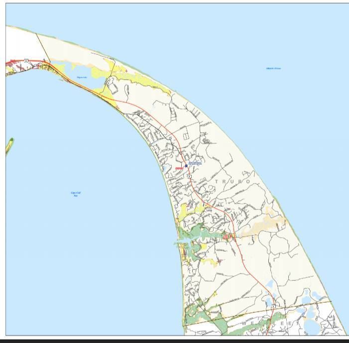
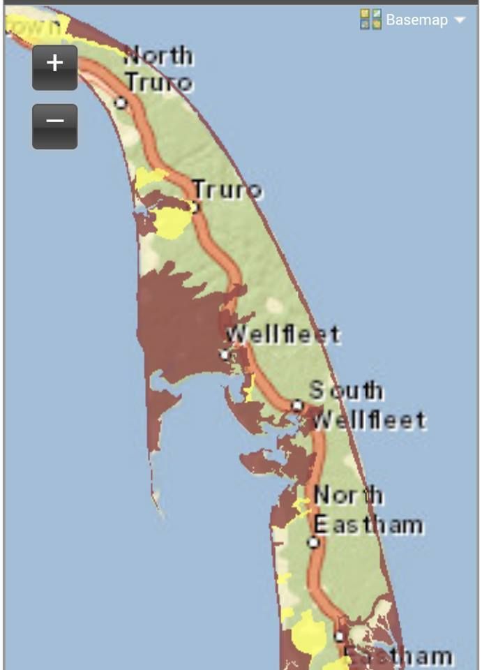
We have two maps for you to look at, and they are specific to your town. One is for Inundation, and the other is for Evacuation. They pertain to a direct-hit hurricane hitting your town at mean high tide.
"Inundation" means "covered in water," although you can call it a Deathflood or a Sea Plague if that gets your people motivated. It refers to which areas in town will be covered with seawater (important distinction, these maps do NOT project freshwater flooding) if you play host to a hurricane.
The map for Inundation (the top one) is color-coded, with light green, dark green, yellow and red. Those colors equate to which areas will get wet in what kind of storm, i.e. Category 1, 2, 3 and 4. Where you see colors changing on the map, that's where the experts think it will require a greater storm to flood that area in seawater.
The map for Evacuation (right) is less complicated. If you look at the Inundation map for a moment and then look at the Evacuation map, the logic will eventually make sense. The red areas of the map essentially say "Those People Have To Leave," and the yellow areas say "You Have To Leave, Too."
See how you compare to your neighboring towns with the complete list of Inundation maps and Evacuation maps.
Remember, storm surge is not the only threat from a hurricane. Things like falling branches, freshwater flooding, lightning, flying debris, slick roads, tornadoes, downed power lines, looters and a thousand other variables can mess you up plenty when the barometer drops heavy.
Truro is very exposed to the sea, but also has a few advantages that limit the damage of hurricanes somewhat. Most people in Truro live on the bay side of town, rather than the open ocean part. Truro's east-facing beaches have an impressive wall of dunes that swat down ocean waves like they were goaltending.
Truro is also well-positioned in that hurricanes that hit them will be somewhat blunted by contact with the South Coast or the more western/southern parts of Cape Cod. Cape Cod Bay is colder than the Gulf Stream Atlantic or even Buzzards Bay, and cold water is the deathblow for a hurricane.
This doesn't mean that you should schedule 18 holes or anything. Truro will be a very dangerous place to be in a hurricane. Pamet Harbor becomes the Pamet Marsh and then becomes the Pamet River and flows into Pamet Hollow. All of them will be a fine way for ocean water to move ashore.
Pamet Harbor is going to be the first place that the water starts coming ashore, and some other parts of town (including the beaches east of East Harbor) will also flood during minimal hurricanes. The land east of East Harbor around Pilgrim Lake would also be a threat to flood, although it require a next level-type of storm. Corn Hill Beach and Fisher Beach could go submarine if the storm is bad enough.
Truro is in the mix as far as worrying about hurricanes goes, and any resident (or even visitor) should have an idea of where they score on these maps.
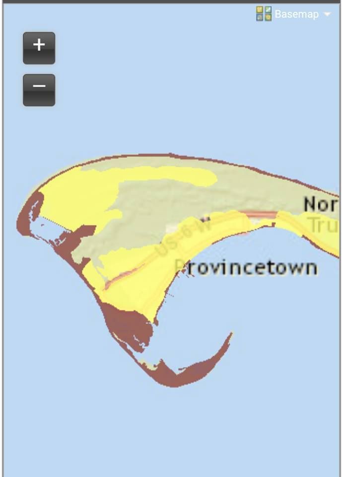
Hey, we'll throw in the Provincetown map, because we're good like that!
 |
| "Truro" is one of the very few words that people with Boston accents pronounce both Rs in... |