Hurricane season is upon us, and we are nearing the peak of it.
Now, we're in Massachusetts, and we haven't been hit dead-on by a hurricane since the 1990s. That means both that we don't get them often, and it means that we are long overdue.
They aren't a frequent enough event that you should walk around wringing your hands or anything. However, there are certain things that a wise person might do which can eliminate a lot of the hand-wringing.
Ironically, the first step to a peaceful mind is to view some Disaster Porn!
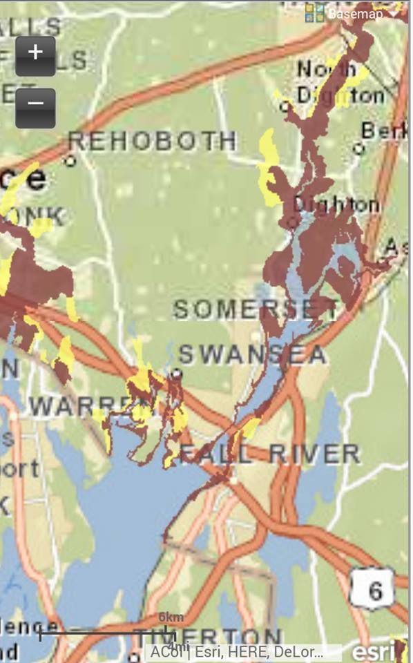
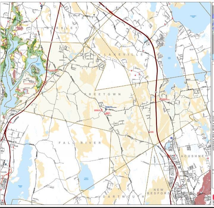
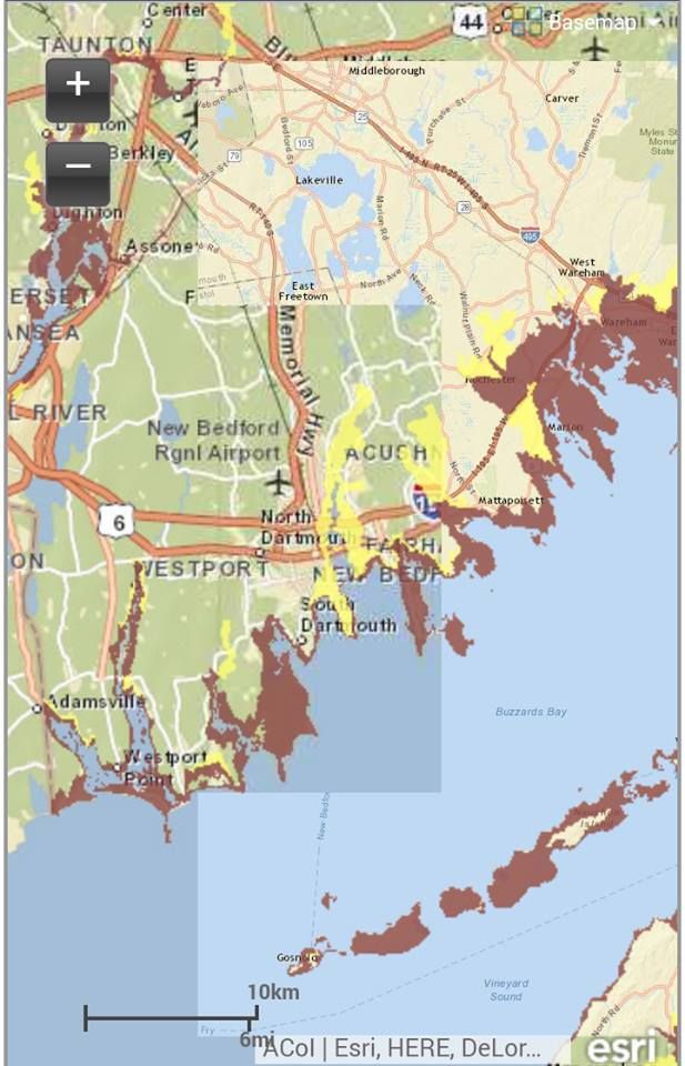
We have two maps for you to look at, and they are specific to your town. One is for Inundation, and the other is for Evacuation. They pertain to a direct-hit hurricane hitting your town at mean high tide.
"Inundation" means "covered in water," although you can call it a Deathflood or a Sea Plague if that gets your people motivated. It refers to which areas in town will be covered with seawater (important distinction, these maps do NOT project freshwater flooding) if you play host to hurricane.
The map for Inundation (the top one) is color-coded, with light green, dark green, yellow and red. Those colors equate to which areas will get wet in what kind of storm, i.e. Category 1, 2, 3 and 4. Where you see colors changing on the map, that's where the experts think it will require a greater storm to flood that area in seawater.
The map for Evacuation (right) is less complicated. If you look at the Inundation map for a moment and then look at the Evacuation map, the logic will eventually make sense. The red areas of the map essentially say "Those People Have To Leave," and the yellow areas say "You Have To Leave, Too."
You'd think that saltwater flooding would be something Freetown people wouldn't have to worry about, but No.
Freetown has the ominously-named Three Mile River (never name a river or an island "Three Mile" or even "Eight Mile," for that matter) flowing up in her guts from Mount Hope Bay. The Taunton River also gets in on the saltwater redistribution action.
Those rivers are fine conductors of ocean water, should a large surge push ashore. This makes the village of Assonet very vulnerable. Assonet Bay Shores, which is already out in the water some, could become Atlantean in a bad enough storm.
It could also be tough to get to the Stop 'n' Shop Redistribution Center, so get that bread and milk early.
I kind of hung the + and - zoom thingy over Assonet in the shot at the bottom, my bad, folks.
The Commonwealth was good enough to supply us with a pile of maps for coastal communities. Here are the Inundation Maps for each town, and here are the Evacuation Maps. See how good you have it compared to your neighbors.
Freetown is a small town, although it covers a good sized area. Most of that area, and I mean like 98% of it, won't have to worry about ocean water. However, like the Mexican politician said when an American told him that the US "didn't take that much of Mexico,' a hurricane will take "the part with the roads."
Ocean water is only one small part of the danger associated with hurricanes. You don't ever have to see salt water to get high winds, flying debris, downed wires, freshwater flooding, lightning strikes, sewer overflow, tornadoes, looters, falling tree limbs... you know, the whole nine.
However small a town Freetown may be, you can be sure that it will cost more than 20 coats, some cookware, some cloth, some iron tools (supporters of a Wampanoag casino will be pleased to know that the purchase price of Freetown included "a dozen hoes") and a hatchet to rebuild Freetown.
Knowledge is power, so get a good look at these maps, see what the score looks like for your house, and have the bones of a plan in place by the time hurricane season gets on... which, unfortunately, is Now.
No comments:
Post a Comment