 |
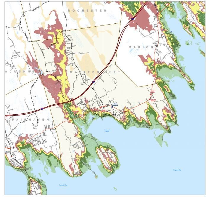
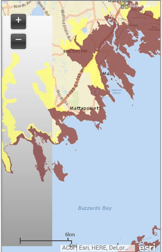
| Note the "Mattepoisett" spelling... |
Hurricane season is upon us, and we are nearing the peak of it.
Now, we're in Massachusetts, and we haven't been hit dead-on by a hurricane since the 1990s. That means that we don't get them often, and it means that we are long overdue.
They aren't a frequent enough event that you should walk around wringing your hands or anything. However, there are certain things that a wise person might do which can actually eliminate a lot of the hand-wringing.
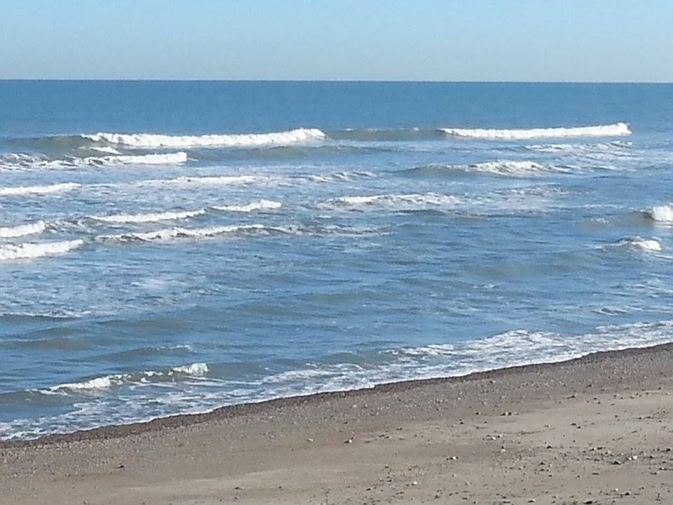
Ironically, the first step to a peaceful mind is to view some Disaster Porn!
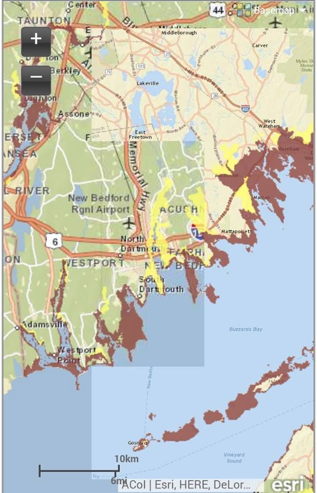
We have two maps for you to look at, and they are specific to your town. One is for Inundation, and the other is for Evacuation. They pertain to a direct-hit hurricane hitting your town at mean high tide.
"Inundation" means "covered in water," although you can call it a Deathflood or a Sea Plague if that gets your people motivated. It refers to which areas in town will be covered with seawater (important distinction, these maps do NOT project freshwater flooding) if you play host to a hurricane.
The map for Inundation (the top one) is color-coded, with light green, dark green, yellow and red. Those colors equate to which areas will get wet in what kind of storm, i.e. Category 1, 2, 3 and 4. Where you see colors changing on the map, that's where the experts think it will require a greater storm to flood that area in seawater.
The map for Evacuation (right) is less complicated. If you look at the Inundation map for a moment and then look at the Evacuation map, the logic will eventually make sense. The red areas of the map essentially say "Those People Have To Leave," and the yellow areas say "You Have To Leave, Too."
See how you compare to your neighboring towns with the complete list of Inundation maps and Evacuation maps.
Remember, storm surge is not the only threat from a hurricane. Things like falling branches, freshwater flooding, lightning, flying debris, slick roads, tornadoes, downed power lines, looters and a thousand other variables can mess you up plenty when the barometer drops heavy.
Mattapoisett's status as a hurricane target depends on a battle between the barrier effect provided by Falmouth and The Islands and the funnel effect that Buzzards Bay has on storm surge being pushed ahead of a big hurricane.
As we say in all of these storm articles we write, Buzzards Bay provides a similar effect on cyclones to what you see happen in Bangladesh. Water goes into the big end and the narrowing of the bay leaves the water with nowhere to go but Forward and Higher.
There is a saying that civilization stops at the waterline, and that we all enter the food chain after that... but not always at the top. Mattapoisett has taken shots from the sea on several occasions, be it shark attack (1930s) or monster storms in 1938, 1944, 1954 and 1991. You can see the post-Bob ruins of Master P in one of these fine videos collected by my main man at West Island Weather.
Aside from the torn-apart-coastline shots you see with every storm, Matty P also offers a unique chance for the ocean to shut down not one but two major highways. Estimates vary, but even a Category 3 storm (granted, which would be among the worst in the state's White Guy history) would run a strong chance of making both Route 6 and Route 195 impassable in the Mattapoisett River area. Aucoot Cove flooding of a high order could also send ocean water across Route 6.
Aside from coves and river mouths, Matta P also gets flooding along her immediate coastline. It's not the place you want to be if a storm hits. As you might imagine, Matty has an extensive area which would merit evacuation in even a moderate hurricane. Places along the Mattapoisett River would be evacuated up to 195 in a minimal hurricane, and a slobberknocker of a storm woud push evacuations due to ocean water flooding miles past 195.
A hurricane in Mattapoisett ain't to be played with. Anyone who lives there, or even anyone who plans to visit, should be aware of which areas are prone to flooding and which areas will need to be evacuated.
We want you alive for monetary reasons, as we live off your site visits. We want you alive for professional pride reasons, i.e. "If they listened to me, they lived." We also want you alive for regular, nice-people reasons. Like the Boy Scouts say, "Be prepared."