Showing posts with label cohasset. Show all posts

Sunday, March 19, 2017

Should Route 3A Have A Nickname?


Granted, there are more important issues on the table. Syria and Iraq look messy. The Trumpcare rollout has been slightly less than smooth. North Korea is advancing their nuclear technology. There are many problems in the world more important than naming Route 3A something cool.

However, those problems require complex solutions, ones that will most likely not be figured out by a wandering stoner journalist lining up his next road trip. However, I'm just the man to bring this issue to your attention and maybe float a few names out there to sort of jump-start the process. I'm not smart enough for a brainstorm, but I do generate an impressive squall line now and then. That's good enough to name a highway.

One thing that Bourne, Wareham and Sandwich do well is name highways. Sandwich has the Old King's Highway (Route 6A), Bourne has the Scenic Highway (mainland Route 6, between the bridges) and ?ham has the Cranberry Highway. You could also throw in the Mid-Cape Highway and the Grand Old Army of The Republic Highway, but we're getting ahead of ourselves.

Running a road along the Canal and giving it a catchy name didn't get the Muslims and the Jews to stop bickering or anything, but it adds some character to the area, makes it easier for traffic reports and helps the tourists along.

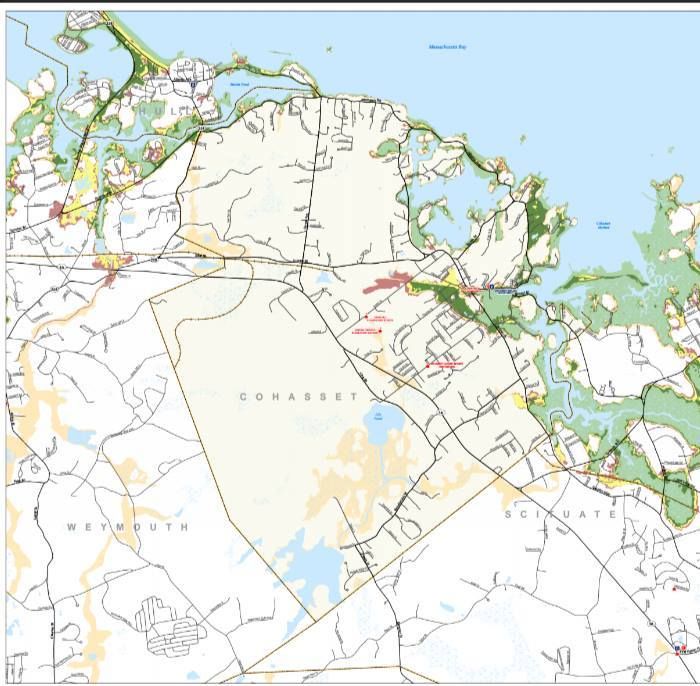
Meanwhile, the 50 mile stretch of road between Bourne and Quincy- Route 3A- has no nickname at all. Wikipedia says it is known as the "Cape Way" highway, but that sort of doesn't really work either functionally (these days), as no one goes to the Cape that way anymore, and stylistically (ever). "Cape Way" blows like the mighty north wind.

Every year at around St. Patrick's Day time, we run whatever Irish-themed articles we have kicking in the archives. "Check Your Irish" is a good one, as is "The Irish Riviera."

One thing you'll learn if you read either article (or read both, I need the money) is that the area between Quincy and Bourne is stuffed with Irish-Americans. That, and the seasonal/coastal nature of the area, garnered the "Irish Riviera" nickname for the area.

Many inland towns have high Irish populations, but the big unbroken run of 33+% Irish goes from Weymouth to Plymouth.

If you stare at a map long enough, you'll also notice that Route 3A runs right through the same area. While 3A itself is inland some and doesn't host the actual Riviera, it connects to every piece of it through a sort of river/tributary system.

If you weigh the factors of 1) no effective Route 3A nickname and 2) the green wave of Irish-Americans in that Plymouth-Weymouth stretch, a solution comes to mind. Give it an Irish-themed nickname.

There are many sorts of nicknames, some official, some not. At least one pol who I asked said I'd have to go to MassDOT. That's if we want to go official. If we just want to introduce a nickname or three into the public domain and see if one of them catches on, all we have to do is write an article and post it a bit.


Let's kick a few around, shall we?

- "St. Patrick's Highway" has a nice ring to it, but it may violate the concept of keeping the church and state apart. That's probably my only official-sounding one.

- "Paddy Road" sounds like an Irish Mob movie, but it is also very catchy.

- "Mick Street" and the Happy Meal-sounding "McStreet" might offend someone, but it won't be someone Irish. The Irish, who were compared with dogs for a lot of US history, are incapable of taking offense. Don't believe me? Approach any college and say "You should be more like the Notre Dame Fighting Irish. How about the Bridgewater State University Crafty Jews?" You're not going to get a callback, player. Meanwhile, Irish-Americans who have never been near Indiana root for Notre Dame. If you think Christianity has anything to do with that, suggest that the bartender at your local sports bar stop what he is doing and hunt through the channels for the Oral Roberts University game.

- I am reluctant to put quote marks around O'Boulevard, because it already has a half of one in it.

- "The Green Mile" has ominous connotations from the movie that will be gone in a generation or two. It will also fit perfectly into those "Massachusetts Roads Make No Sense" memes, along the lines of "The Green Mile is 50 miles long." This nickname also lets us experiment with painting those yellow lines in the road green, which is just the thing to do in resort areas with a hard-drinking population base.

- "Shamrock Lane" sounds like a stripper, but it is also very catchy and relatively inoffensive to people who aren't a bit too familiar with Stripper Naming. The movie with the giant monster (Cloverfield or John Goodman, take your pick) sort of ruined any "Clover Road" possibilities.

- "The Guinness Bypass" would be ugly the first time someone de-barked a Route 3A tree.

- "The Capital Highway" would be a simple power grab. Ireland stopped being the place with the most Irish one potato famine ago. America now has the most people of Irish descent, by a large margin. In America, Massachusetts is known as the most Irish state.  In Massachusetts, the South Shore is recognized as the most Irish part of the most Irish state. Why shouldn't the South Shore thus have Capital status? Ireland can put the Capitol wherever they wish, but we can make a great claim to the Capital status. We should make a reality of that claim by naming Route 3A in such a mindset.

- "The Leprebahn" is a mishmash spelling of the little Irish pixie and the Autobahn in Germany where you can drive 200 mph if your car (and skills) will support it. We could paint the stripes between the lanes Gold, like the pot o' gold that the leprechaun guards. To save money, we can just declare that we painted them gold, leave them as the present yellow that they are, and hope that it either A) fools the tourists or B) amuses the locals. Stacey, an editor here, is arguing strenuously for a spelling of "Leprechahn."

- "The Edge" is not only a cool name for a road, but it is U2 related. U2 is an Irish rock band that the kids are listening to these days, or 1986 or whatever. That in itself doesn't merit a road, but could the actual real Edge guy be persuaded to record a quick ditty in exchange for having a highway named after him? I float this possibility only because Route 3A doesn't have her own song, like Route 128 does with that Roadrunner song by the Modern Lovers... although someone once told me that Roadrunner somehow references Cohasset (Editor's Note: Christine Frka, a former Frank Zappa groupie, lived and died at the Cohasset house of Modern Lovers founder Johnathan Richman,,, h/t to Nathaniel Palmer) . The Edge could hand us that title with ten minutes work.

- "Beating A Dead Horse Street" comes to mind when it's time to end this article.


Saturday, March 4, 2017

The Rise, Fall and Rebirth Of The Hanover Mall


A local icon is about to get a major face lift in an attempt to Get Modern.

The Hanover Mall was sold recently (to PECO Real Estate Partners, for $39.5 million), and the new owners came out this week and debuted their plans for the Route 3 landmark.

The plans are radical. it involves the Hanover Mall becoming a sort of outdoor mall, along the lines of Shops At The 5 in Plymouth or even- keeping it Plymouth- the Colony Place mall with the Wal-Mart. Rather than enter one big building with all the shop entrances inside the mall, you can pull up to whatever store you want to go to.

Malls, aka large scale public shopping centers, have been around at least as long as Rome, and actually predate Rome if you're willing to break out the dictionary and argue Semantics for a while. Trajan's Market in Rome is the first one with a name I can find, but Istanbul, Damascus, Tehran, Oxford, Paris and St. Petersburg have malls that are older than America. Timbuktu, technically a city, was essentially a mall that was fortunate enough to have culture spring up around it.

America mastered the mall, and we were/are the catalyst behind the advent of the modern mall. America is big, and we spread ourselves further out than European or Middle Eastern people do. This led to us getting into cars and highways and- most importantly- Suburbia.

Notice that all of the old malls that I named are based in cities. For much of history, people would take their goods into the cities, where the large numbers of people gave them the largest market possible for those goods. Cars, trains and highways allowed Americans to flee the teeming industrial cities, and they didn't want to have to trek back into the Metropolis every time they needed a vacuum cleaner or a manicure.

In the same vein, the low population density of a suburb means that you can't set up a vacuum store in town and sell enough of them to earn a living. Americans also need a great variety of stuff, and there is only so much room on Main Street. You can't fit every sort of store that someone needs in one town.

Keep in mind, this is pre-Internet. If you need a part for your wood stove and it's 1972, you can't just order it online. You can't even Google up a location for the Wood Stove Parts store a few towns over from you. That's just how it was back then. "The Internet must have sucked in the 1920s," as one of my students once said.

The solution? Build an airport-sized building, and fill it with every sort of shop that a person could want. Space these buildings out, maybe one or three per county. Soon enough, rather than trekking town to town in search of an obscure product that you need, you can walk through a mall full of more stuff than you could possibly even take a crack at buying in an average life span. Walk through your local mall today, and you'll probably see several dozen stores that you will never set foot in. "This place has got everything," as Joliet Jake once said.

Laws opening up land for development and tax dodges where real estate investment trusts could avoid corporate income taxes spurred mall growth. Retail Stores dominated America. The enclosed suburban mall style (like Hanover) came about in the 1950s. By 2015, there was 48 square feet of retail space for every American.

Malls are deeply ingrained in American culture. While I lack the fashion knowledge, several girls in Duxbury that I knew in high school could tell where someone was from by a formula of A (what they're wearing) = B (which mall had an Old Navy or whatever), which = C (the kid must be from the region which had that mall), so A = C.

Every kid in every 1980s movie who wasn't babysitting or selling drugs  worked in a mall. I think that all of the non-Spicoli kids from Fast Times At Ridgemont High worked in a mall. The best car chase in The Blues Brothers went through a mall.


The Hanover Mall has stood in place since 1971, and was the only mall in the region until they put the Independence Mall (now known by the newly redesigned and ridiculous Kingston Collection moniker). If you commute to Boston up Route 3 from anywhere south of Exit 13, you look at the Hanover Mall twice a day.

Any kid from the 1980s Irish Riviera who was too far from the South Shore Plaza didn't have many mall choices. Hanover was your mall. It's where you did your school shopping, where the cinema was, where to try to get girls before you figured out Beer... it was where you could buy jeans and have a pretzel while someone was fixing your brakes. If you couldn't knock off your Christmas shopping in one trip there, you weren't trying hard.

Still, as the child of the 80s grew up, he saw the Decline setting in. I can recall being very angry when the York Steak House left (one YSH remains in America, and it's in Ohio), I still miss Friendly's and Brigham's, I disagreed with the closing of Zayre's and a big part of me thinks that the mall people deserved what they got when they uprooted the fountain.

The Hanover Mall never really died, and the tail still wags. They just became marginalized. It's funny, because it is straddled by wealthy towns like Duxbury and Cohasset, but here's what did in the Hanover Mall that you know and love. Keep in mind,the guy doing all this urban planning talk peaked in life as a Sportswriter, and has very little experience planning malls and analyzing market trends.

1) They were slow to adapt to the Food Court idea. When the Independence Mall opened and you could get Taco Bell in these parts, it was very bad for Hanover when the best non-Brigham's meal you could get in their mall was an Orange Julius. Much like a house with shag carpeting, the Hanover Mall had a very 1970s look during an era of rapid Mall Change.

2) The Independence Mall came when the Hanover Mall was getting complacent. Hanover was the only dog in town for a while, and when the Kingston mall opened, people had shopped themselves out at Hanover's long-term offerings. "Let's go to Hobbytown again!"

3) Hanover had a highway project going right off Route 3's exit that took 35 years or so to complete, and the left turn towards the mall for someone coming up from Plymouth was a death wish.

4) We're getting into Square Footage talk that I'm not really smooth enough to discuss, but Hanover was very poorly equipped to accommodate the big Box Stores that came into vogue after Hanover was constructed.

5) Wal-Mart kills everything else, why not the Hanover Mall? You can carry a dozen shopping bags full of goods through 40 stores like a homeless person at a mall, or you can get all of that stuff in shoddy, Made-in-Chine mode and run it through the register all at once in a Wally.

6) The Hanover Mall eventually went into business with the devil and gave Wal-Mart a corner office, but it's one of those weak Wallys without the supermarket. More modern malls are built to accommodate free-standing Super Wal-Marts.

7) Hanover finally went for a food court, but they did so when Kingston was kicking their ass. The food court was never profitable, and they ended up putting an Old Navy there instead.

8) We had a backbreaking recession kick in by 2008, and there was trouble with gas inflation long before that. Those things bring about the Want/Need question among belt-tightening people.

9) The Internet slit a lot of Mall throats. Why wander through gangs of teenagers when you could instead just order stuff online? While a mall has great variety, the Internet has more stuff.

10) Hanover is set in a wealthy area of the South Shore, and those towns tend to trend Elderly. Old people buy less stuff, and towns with lots of elderly are bad places to open up a Hot Topic in.

11) The growth of Southern Plymouth (and the explosion of shopping options south of the Independence Mall) both drew away customers and illustrated the new open-mall game plan that Hanover would either adopt or perish before.

12) Malls in general went into decline. Malls were still being built in the 1990s, but a marked decline was present by the turn of the century. The fight-or-flight period for many struggling malls went down during the Great Recession.

13) Store owners balked at the high cost of heating the common areas in an indoor mall.


Hanover is now rolling the dice on the outdoor mall approach. This will be a sort of retail cul-de-sac formation, based around several box stores.

They'll pour millions of dollars into it, snarl up the traffic some, and a whole new entity will emerge in the following years. It will be a major economic base in the central South Shore, and it will employ or supply many of her residents.

We'll miss the old Hanover Mall, but progress is inexorable, Several "dead" malls (Hanover, which is still somewhat vibrant, qualifies as a "dead" mall among mall-labeling people because it is seen to be underperforming) have been restored to their former glory through just this sort of bulldozing, and Hanover is in a prime commercial region.

Even the guy who paid $39 million for the Hanover mall described it as a "B+" 1970s mall that "started to diminish." I doubt that's what he has in mind as an end goal, so we should end up with a pretty cool mall sitting in a prime location just off the highway.

Only time will tell us what ends up in there. He could change his mind and fill it with low-income housing, for all that I know. For now, we're looking at a bulldozing and rebuilding project, and a brand new, redesigned Hanover Mall that will confuse elderly people for a generation.

Construction is set to kick off at the end of 2017, so prepare yourselves. We'll be back with an update as they get closer to Bulldozer Time.


Wednesday, August 5, 2015

Eastwick Meets The East Wind: A Cohasset Hurricane Primer


Hurricane season is upon us, and we are nearing the peak of it.

Now, we're in Massachusetts, and we haven't been hit dead-on by a hurricane since the 1990s. That means that we don't get them often, and it means that we are long overdue.

They aren't a frequent enough event that you should walk around wringing your hands or anything. However, there are certain things that a wise person might do which can eliminate a lot of the hand-wringing.

Ironically, the first step to a peaceful mind is to view some Disaster Porn!


We have two maps for you to look at, and they are specific to your town. One is for Inundation, and the other is for Evacuation. They pertain to a direct-hit hurricane hitting your town at mean high tide.

"Inundation" means "covered in water," although you can call it a Deathflood or a Sea Plague if that gets your people motivated. It refers to which areas in town will be covered with seawater (important distinction, these maps do NOT project freshwater flooding) if you play host to a hurricane. 

The map for Inundation (the top one) is color-coded, with light green, dark green, yellow and red. Those colors equate to which areas will get wet in what kind of storm, i.e. Category 1, 2, 3 and 4. Where you see colors changing on the map, that's where the experts think it will require a greater storm to flood that area in seawater.

The maps for Evacuation (right and below) are less complicated. If you look at the Inundation map for a moment and then look at the Evacuation map, the logic will eventually make sense. The red areas of the map essentially say "Those People Have To Leave," and the yellow areas say "You Have To Leave, Too."

See how you compare to your neighboring towns with the complete list of Inundation maps and Evacuation maps!

Remember, storm surge is not the only threat from a hurricane. Things like falling branches, freshwater flooding, lightning, flying debris, slick roads, tornadoes, downed power lines, looters and a thousand other variables can mess you up plenty when the barometer drops heavy.

Cohasset doesn't get the storm-love that Scituate gets. Part of this is from the more northern tilt to her beaches. Part of it is the armor of a rocky coastline, as those offshore rocks and ledges can knock the oomph out of a storm wave. A great part of it is Scituate sticking her Scituate Neck out to block Cohasset from the full effects of the east wind. 

In the end, Cohasset slides a bit. If you see a rich person's beach house getting washed away, it's more likely to be from Duxbury than Cohasset.

We sort of butchered the part where we cleanly upload the Cohasset evacuation map, but enough of the Scituate and Hull maps will bleed into C City that you can get the general idea. With evacuation, the general rule is When In Doubt, Get Out.

Most of Cohasset's housing is in the east side of town, and rightfully so. This will put many people in the Inundation area, and, shortly before or after, in the Evacuation area. Beach Street and Atlantic Avenue will live up to their names. Joy Place almost certainly will not.

No elitist, Mother Nature will also have herself a few swings at Jerusalem Road. One of the great differences between hurricanes and tornadoes is that the rich suffer disproportionately in coastal storms due to their habit of buying up shoreline property, while tornadoes- using logic which only they understand- prefer trailer parks.

The worst omission from my evacuation maps was the area of Cohasset along the Scituate border, which has a coastal river as the dominant feature. Ocean water loves to surge up coastal rivers during hurricanes, and Cohasset will see this first hand if a major storm arrives. Anything west of Scituate Neck, and anyone along a river, should be evacuated.

You can view Cohasset's evacuation map right here.

As always, know that hurricanes are rare in these parts. They have to plow through either the South Coast or Cape Cod (and then fight through the South Shore) before they even think about Cohassle. By the time they arrive, they will be considerably weakened.

Still, you want to be careful if the weather gets nasty. There are plenty of ways to die in Cohasset during a hurricane, and most people only need one.

Remember, as we say on Duxbury Beach, the other 364 days of the year look sort of like this!


Thursday, July 23, 2015

Enter The Hoodsie....


So, what is this Hoodsie that the author speaks of?

No, it's not the little ice cream cup with the wooden spoon in the picture above, although those are good and I want one right now.

Basically, a Hoodsie is a female teenager from the South Shore. It's more complicated than that, but that's the short answer.

Usually, the author finds out the answer to the question and then writes the article. That's not going to be the case here, as I am expecting the real answer to this question to turn up in the comments.

Here is what I don't know about the term, which makes for a longer article than if I told you what I know for sure:

- Why are South Shore girls known as Hoodsies?

- How far does the term range?

- When did the term come into use?


WHY?

I have no idea on the Why? The Hood company was founded in Charlestown, though they may have got the actual milk from Bridgewater. From what I have heard, the term is used by city people when speaking of South Shore girls. It seems pretty complicated for a nickname.

Boston University has The Wicked Good Guide To Boston English, and the term makes an appearance in there. It is not ascribed to the South Shore in there, nor was it listed so in the Universal Hub definition.

A thread on Yelp said that a Hoodsie was a sexually promiscuous girl below the legal age of consent, but they may be confusing that with "jailbait." The author may also have heard the term in his youth, when he was hunting South Shore snuggling from younger girls.

I have also heard, on Facebook, that the nickname stems from girls sitting on the hoods of cars.

As near as I can tell, Boston guys would go to the South Shore to get girls. Both dictionaries list "scoop" as a term for picking up girls. Hood was the dominant local ice cream, a Hoodsie is an individual serving, and here come Donna from Weymouth! The girls, equated with something you scoop like ice cream, thus became Hoodsies. I suppose that the fact that there aren't many reasons for a Boston guy to go to Abington beyond "scooping" also led to the association.

More than one source said that the Hoodsie's slogan of "small and sweet and good to eat" played a role in the name, but only one source notes the Hoodsie cup size connotation with the smaller breasts of the teenager.... which has to be true, because I read it on a site called Swing Batta Batta Swing.

I could be 1000% wrong about this, I'm speculating about something that barely merits a mention on the Internet.


EPICENTER, TIMING AND RANGE

If I'm not wrong about the South Shore ownership of the term, I'd assume that it came to us with the development of the highway system. I'd especially associate it with Route 3.

I say this because Route 3 either A) made it feasible to drive from Dorchester to Hanover to get a little somethin'-somethin', or B) led to an exodus from the city, which brought a term generally associated with Boston girls into the South Shore suburbs. SBBS listed the term as a Dorchester/Southie term, and the South Shore filled up with people from Southie, The Dot, JP, Roslindale and Hyde Park right around when busing started.

I actually like Option B the best, with Hoodsie as a White Flight import from the city. It makes the most sense, and it follows the path of least resistance. Boston schools went from 100,000 kids pre-busing to 55,000 kids in 1988, and many of the refugees ended up in the Irish Riviera.

Duxbury, for example, went from 4700 people in 1960 to 11,000 in 1980. That's a remarkable growth rate, even before you factor in the town's more elderly demographic. I, personally, was in Dorchester in 1970 and in Duxbury by 1978. I was not the only Dorchester kid in my Duxbury classes by a long shot. Plymouth went from 18,000 people in 1970 to 35,000 in 1980. Ol' Marsh Vegas went from 6000 in 1960 to 20,000 in 1980.

A lot and maybe most of that spike is the Baby Boom, but a lot of it is White Flight. It is, in my completely uneducated opinion, enough oomph to transfer slang from city to suburbs.

So, the date would either be the late 1950s (Route 3 goes through the South Shore) or the 1970s (White Flight). I'm hoping that some old-schooler enlightens me in the comments section. It may be a bit of both.

The range of the Hoodsie term becomes the issue here. I have only heard it ascribed to South Shore girls, but I also can only claim Duxbury, Halifax and Buzzards Bay as my last three hometowns. There could be Hoodsies running around in Natick or Woburn or Concord or Mansfield for all that I know.

If my White Flight theory is correct, the term would move out to the suburbs with the city kids. Enough white kids remained in the city for the term to remain there, but enough white kids had left that the term became suburban. It's sort of how the country with the most black people isn't African, it's Brazil... but, just about the opposite of that. I digress...

To determine the range of the Hoodsie by operating along this theory, you just have to go through some census numbers on Ye Olde Wikipedia. I already fed you Duxbury and Marsh Vegas data... how does the North Shore and Metro West stack up? Does the White Flight reach New Hampshire or even the South Coast?

I'll pick random towns, or we'll be here all day. We'll go 1970 population to 1980 population.

Stoneham... 17K to 21K, nine miles north of the Bean

Framingham... 64K to 65K

Middleboro... 13K to 16K

Foxboro... 14,218 to 14,178, and that's with the Patriots moving to town during the era in question.

Andover... 24 to 26K

Marion... 3400 to 3900

Manchester-by-the-Sea, 5100 to 5400

OK, what I'm seeing here and not listing in numbers is that Massachusetts suburban towns tended to have population explosions from 1950 to 1970, but the South Shore also had a Busing Boom in the 1970s that doubled the population of some towns.

To this day, people who know this stuff tell me that Geography isn't why the Cape Cod accent doesn't get across the Canal, it's that the Boston accent stormed South in the 1970s with all the White Flight kids. I can recall getting SPED-type help for my speech in 1978, my first year in Duxbury. All that I can remember of it was the lady making me say "barter" and "martyr" over and over.

SUMMARY

So, my research leads me to believe that "Hoodsie" is a Boston term, most likely distinct to the Irish parts of town like Jamaica Plain and Southie. When busing came, those cities disgorged their wealthier Irish-Catholics onto the South Shore, and those people brought the concept of the Hoodsie with them. By 1980, it had become a South Shore term, and by 2015, it had been South Shore long enough that city folk- the original Hoodsies- now referred to the South Shore girls as Hoodsies.

Yup, it's that confusing AFTER we try to summarize it. But I'm pretty sure that the theory is correct.

I thank you for your time.

Not hoodsies, just cool enough to pose for Cranberry County Magazine...