Tuesday, September 22, 2015

Rural Exploration, And Our Fall Preview

Middleboro, MA

Autumn is here, and we're shifting gears into Fall Stuff.

When I was teaching at a Charlestown charter school, we had a class called Urban Exploration. "Urb X" was a code word we'd use for "our lesson plan got fouled up for some reason, so we're going to take the bus around Boston and show the sights to the kids. Give me lunch money for 8 kids and 2 staff."

To be fair... although I was most likely the one who had the fouled-up lesson plan, credit for the terms "Urban Exploration" and "Urb X" goes to a football coach named Mr. Cawthorne or something close to that. Left to me, the title would have been the less-smooth-sounding "We're gonna take the bus and drive around town for 3 hours," which program directors of charter schools probably wouldn't sign off on.

Some of my better classes were from Urb X, and I tried to incorporate the same spirit into my career as a shabby-website content generator. We did a bit of Urb X yesterday... although, since we went up Route 105 and down Route 106, it was technically Rural X.

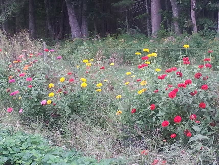
As we said, Autumn is here, so we thought we'd trot out a fisherman's platter of what we'll be up to over the next few months.

I'm thinking maybe Lakeville, MA, Fall 2014

We have several trips planned to cover Fall Foliage. Ideally, we plan to catch some late September foliage in Maine, and then move down the coast with it until we are polishing up with Cape Cod after Halloween.

Marlboros costing $4.95 a pack in small-town New Hampshire has nothing to do with the frequency of these trips. Everybody buys 180 packs at once, Officer.

We also have a bee in our bonnet about stealing acorns from New Hampshire, planting them along the Cape Cod Canal, and turning the Canal into the Fall Foliage destination of 2075 AD or so, whenever the trees grow enough to turn Yellow regularly. We'll be pumping that article out after I interview a few experts.

Cranberry County Magazine has road offices in Freeport, Maine, Bow, New Hampshire, and Jeremiah's Lot, Vermont. We're analyzing more spots than Matlock, and we've got this Leaf Game on padlock.

In theory, we'll have a 4-5 fall foliage article run that starts in Maine in late September and ends up on Cape Cod after Halloween. Droughts, wind storms, low motivation and lack of money/free time may screw up this schedule, but we're looking good as of 9/22.

We did go to Maine last week, but saw nothing foliage-ish of note. The locals told me two more weeks or so.

Plympton MA
Massachusetts, especially the part of Massachusetts we work, isn't as known for her foliage/greenery as other parts of New England are. However, you can find some good 1700s stuff if you snoop around a bit and drive down the side streets.

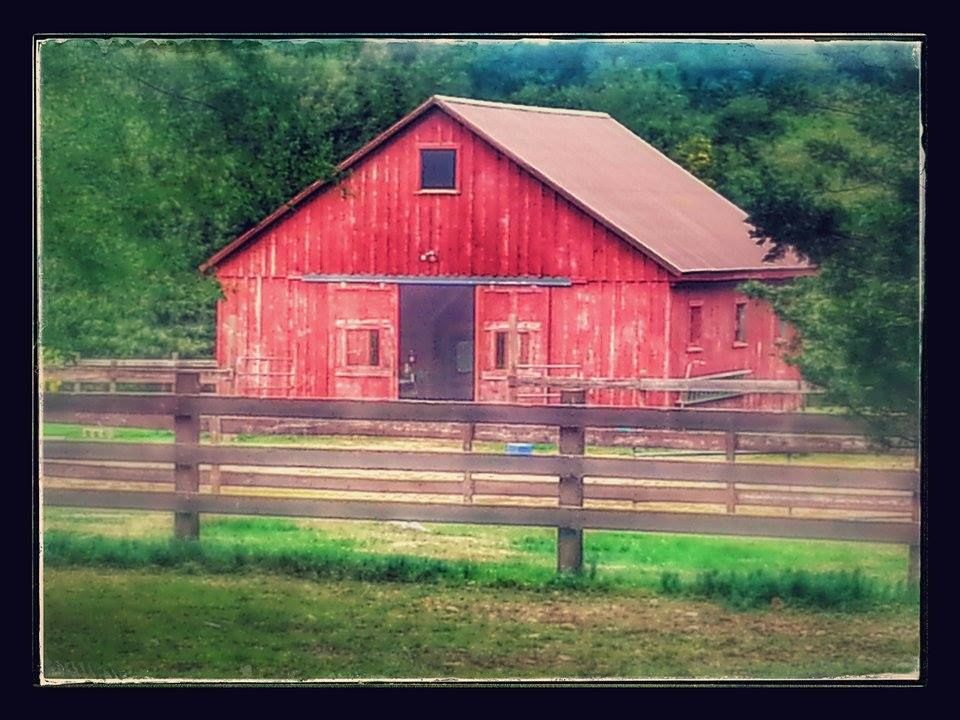
Between flowers and foliage and even us stumbling through some dude's farm, we'll try to go out among the reapers now and then.

The harvest, formerly the occupation of just about everyone, is barely important now to anyone but farmers, craft fair hosts and the media. However, there is still a primordial recognition in most humans for the harvest season. At worst, it is perhaps the most powerful omen for the change of seasons that we have.

I feel it, and I can't even grow old properly, let alone grow cranberries. We're looking at late October for the hard color pics.

Speaking of which...

Buzzards Bay, MA
Another thing that we intend to pound into the mat is the local Cranberry haul.

The mighty cranberry is in the title of this website, so you know that we're going to represent hard at the harvest.

The compound in Buzzards Bay is just across the street from a cranberry bog, so we should be able to get this one done just by walking the Shorty out to the bus stop.

The possibility of us going inland and upstate to pursue non-coastal cranberry harvests is there, although I shouldn't need to drive any further than Carver or Hanson.

I'm a hack photographer at best, but even I can get some Ansel Adams work in if I snap enough shots at a cranberry bog with the sun shining overhead.

There is also talk of scooping a few buckets of cranberries out of Mann Farm's vast pile, dumping a few bags of sugar into a big pot, cooking/chilling, and then seeing how much cranberry sauce I can eat in one sitting. The goal would be to turn my skin burgundy.

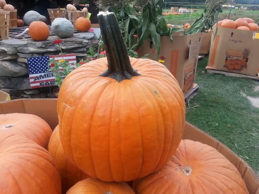
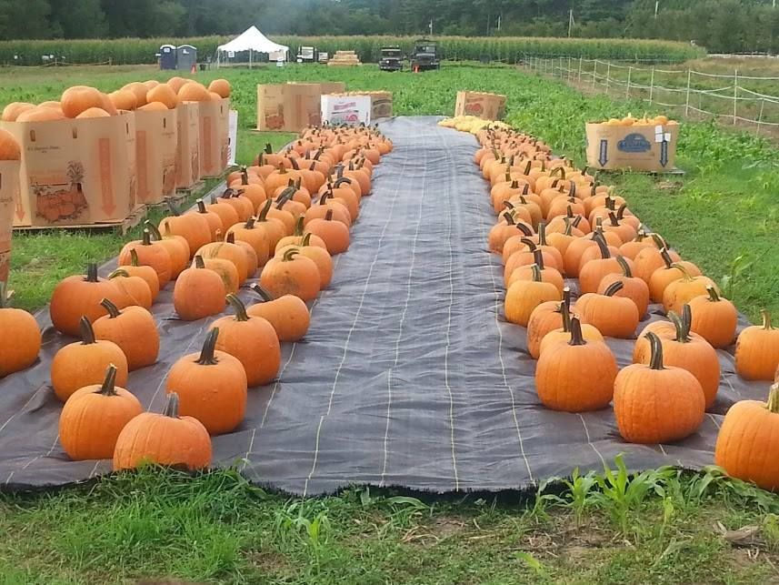
Billingsgate Farm, Plympton MA
You know we'll be talking about pumpkins, player!

Pumpkins figure heavily in our harvest season, even more than the more ubiquitous cranberry. They are the premier decorative item for both the harvest season and Halloween, to the point where a great majority of the people who buy pumpkins have no intention of eating them.

We'll use pumpkins for photos, articles about visiting pumpkin patches, articles about decoration, Thanksgiving pie recipes, Halloween vandalism talk, and even excuses for doing vintage D'Arcy Wretzky image searches.

One thing we're kicking around is the idea of gathering (via a lot of Rural X, or from Facebook friends) a collection of pictures featuring the better Halloween displays. We'll do the same for whoever we see over-lighting their house at Christmas.

Halloween is important to us, and we also plan to run our Expand The Bridgewater Triangle article during this season, and perhaps explore a few haunted locations in our coverage area.

We also want to blow up a pumpkin with whatever fireworks we can gather up on our Foliage trips. This, and my idea to do a Diet Coke/Mentos experiment that involves tossing the bottle off of the Bourne Bridge onto the bike path below, is pretty much as deep into Science as we get here. I also have a great desire to film a pumpkin being shot by a high caliber weapon.


We actually are in preliminary discussions with a gun-range owner in Texas about re-creating the JFK assassination with pumpkins.

Me: I'm thinking that you get a pumpkin, fill it with Zar-Ex, put it in a suit, drive it around in a convertible and shoot it from 6 stories up out of a moving limo.

Them: Huh?

Me: Don't worry, I'll pay for the ammo, the pumpkins, the Zar-Ex and lunch for the shootist.

Them: How do you plan to do this?

Me: Don't worry about it. I can also provide the Kennedy accent for the doomed pumpkin. My girlfriend can do the Jackie O screaming. She's French, it'll be seamless.

Them (from TX): What's Zar-Ex?
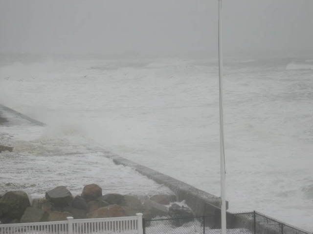
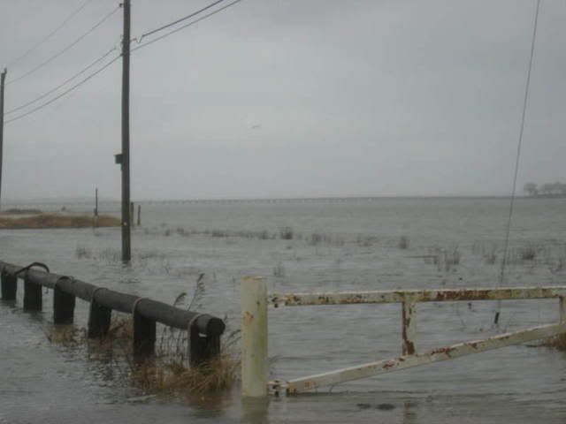
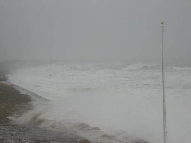
Duxbury Beach, MA
We also will have the photographers embedded for any nor'easters that may come up once October comes around.

September and October have hosted some of our worst storms, including the Halloween Gale.

If we get our ship tightened up some, we'll try to get into some other towns for our nor'easter photography. I've always wanted to do a storm in Scituate, the Outer Cape, and on the Grey Lady.

I do have a press pass that, if I presented it to the cops and they called it to verify my vocation, would ring up my own phone. That should get me on the block.

It goes without saying that, should we get the opportunity to shoot a nor'easter, it will most likely be caused by weather conditions that will effectively cancel the rest of our foliage articles.

That should carry us through Thanksgiving...


The Beast Of Truro


The particular Beast in question was newsworthy enough to make the New York Times in 1981.

One advantage Cape Codders hold when discussing Not Being Killed By A Beast with mainlanders is that we got here first, cleared the forests first, and that the most dangerous thing on Cape Cod for a lot of White Man History was a Bluefish. We had wolves and bears and other scary things at one point, but they were all chased westward into the frontier as European civilization encroached upon Cape Cod.

The other edge we hold is that we chopped Cape Cod off from the mainland in 1914 or so. Anything that wasn't on Cape Cod already wasn't getting on, short of a perilous swim across the Canal or a highly-visible trot across one of the bridges.

Even before then, most of Massachusetts had been cleared for farmland. This eliminated the routes that something like a cougar would use to get some Cape Cod eatin; in.

Cape Cod was also cut off by a stretch of urban territory that lays between Eastern Massachusetts and the more like-nature-used-to-be wilderness of New Hampshire, Vermont, Maine and Canada. Nothing that couldn't slink unnoticed through Worcester or Cambridge was going to be visiting Cape Cod.

This (and our particular climate) saves us a lot of the bears, wolves, cougars, wolverines, giant hogs, Sasquatch and other megafauna that other parts of the country have to deal with. We had it pretty easy.

When former farmland in mainland Massachusetts was abandoned as farming ceased to be America's primary occupation, wilderness crept back into eastern Massachusetts. We were protected by the urban corridor and, later, by the Cape Cod Canal.

Truro is a small town (2000 souls) right now. It was smaller (1500 or so) in 1982. Much like today, the majority (I read 80% somewhere, lost the link) is undeveloped swamp.

There are about 5 reasons to live to Truro....
1) you like beaches,
2) you inherited property there,
3) you're an artist,
4) you dislike living near other people, or
5) you're an artist who loves beaches but dislikes living near people and you inherited property there.
If it exists, Reason #6 would almost certainly be "Nothing ever happens there."

That's why it was so disturbing when a series of animals began to be slaughtered in Truro. At first, it was the local cat population. More than a dozen Meow Machines from the same part of Truro turned up un-living. Then, whatever was responsible started going for bigger prey. The time was about September, 1981.

A hog that weighed 175 pounds was mauled badly enough to warrant euthanasia. The flanks of the hog were grooved with claw marks, and it's throat was mauled. A few days later, another hog pen in Truro suffered an attack by a mystery hunter. In this incident, two hogs were clawed in their pen. People across Truro also reported hearing strange, eerie, cat-like screams.

Experts said that the attacks were the work of either a dog or a pack of dogs. Packs of dogs are not unusual in the countryside, and they roll deep enough to kill deer and livestock. Anything beyond that- even things that we know are here now, like coyote, wildcat, and bear- would have been close to science fiction in the minds of authorities back then.

Hogs don't talk (except in Charlotte's Web), so they make poor witnesses. However, you can tell a lot by the damage that was done to them. You can't tell enough to say anything definitively, however. The wounds to the throat could have been canine, feline, or even ursine. The slashes to the flanks appear to be only feline or ursine.

Big cats, wolves, and bears all will tear out the throat of prey if able to. Cats use their claws to latch on to the animal. Bears will attack by swatting with their powerful paws in an attempt to break the prey's back. Either attack would be consistent with the wounds seen on the hogs.

The problem is that the animals were still alive and not consumed. A bear or a mountain lion would destroy a hog, while smaller animals wouldn't be able to inflict the wounds that the animals suffered. You can imagine the slashed hogs were maybe attacked through fencing somehow, which you'd think a bear would knock down or a lion would leap over.

A cougar's killing bite is applied to the back of the neck, head, or throat and they inflict puncture marks with their claws, usually seen on the sides and underside of the prey, sometimes also shredding the prey as they hold on. Coyotes also typically bite the throat region, but do not inflict the claw marks.

One thing was for sure... it wasn't a pack of dogs. It was something we hadn't seen before around here, at least in our lifetimes.

The mystery got wilder soon after. A local couple, the Medeiros, saw what they described as a mountain lion on Truro's Head Of The Meadow Beach. Other sightings soon followed, including a policeman, an accountant, a noted sculptor, and a school principal. All spoke of a slender, big cat with a long, J-shaped tail. The couple described it as knee high, 60 pounds, and definitely not a fox.

The sightings led to some terror. A cougar is a very bad thing to be attacked by. Several or so Californians a year are mauled/killed/eaten by cougars, also known as Mountain Lions. One of those walking around Truro would be very bad for the locals. Pets, livestock, kids and even adults were at risk. Unless it met an armed man or jumped into the water with a shark, it displaced the Cape Codder as the apex predator on Cape Cod.

The sightings also led to some skepticism. Eastern Cougars, which once roamed all over America, were then (and are still now) the subject of debate. Many experts feel that North America has two sorts of cougars.

One school of thought is that the Eastern Cougar is a subspecies of regular Cougars, while others feel that they're all in the same gang. Many biologists (then and now) believe that the Eastern Cougar is extinct, while others feel that it is making a comeback.

Cougars show up in New England now and then (one was killed by an SUV in Connecticut in 2011), but some and maybe even most officials feel that these are either escaped captives or western cougars who wandered extensively. The cougar killed in Connecticut was actually found somehow to be from South Dakota.

Either way, a cougar in Truro would be amazing. The last confirmed cougar of any sort in Massachusetts was in 1858, before the Civil War. A cougar in the Berkshires would be amazing. One in Truro would almost defy science.

The Beast of Truro, who was also known as the Pamet Puma (the Pamet River, named after the Paomet tribe, lent the Beast his second nickname), was national news for a while in 1982.  An article by the New York Times went viral (pre-Internet), and our Beast was being spoken of in New York, Florida, Maine and probably a bunch of other newspapers that I didn't actually see. Long before she was dishing in the Herald, a then-unknown Gayle Fee was sent to obscure little Truro to seek out the Pamet Puma for the Cape Cod Times. Fee listed a "Bengal tiger" as a possible culprit.

Then, by early 1982, he was seen no more. This led to another mystery. Unlike other monsters like an alligator or an anaconda (which would freeze like a popsicle up here as soon as winter fell), a cougar can survive a Massachusetts winter, especially the milder Cape Cod variety. A cougar would be the apex predator on Cape Cod the instant he arrived, meaning that- unless he went swimming off Chatham- nothing ate him. No one reported hitting one with a car, and no carcass was found. There are more than enough deer on Cape Cod to support a big cat.

With no physical evidence (eyewitness sightings are not considered to be as reliable as tracks and scat, meaning that humans actually know less than sh*t), no definitive analysis could be made. State officials, who always try to be conservative in such cases, say that it was a dog or a pack of dogs.

With 20/20 hindsight, we can read and laugh at officials saying, "Some people even claimed it was a fisher!" Fishers, then thought to be urban legend on Cape Cod, are now accepted as legitimate residents.... just like bears and bobcats were thought to be extinct here until people started getting video.

Maybe he realized he was the only Beast for 300 miles, and the instinct to get laid drove him back to the mainland. Maybe he went for a swim, and a shark ate him. Maybe he was shot by a hunter who then realized that he had just blasted an animal that was thought to be extinct and which probably had a jail term attached to it.

Or maybe, just maybe.... on certain nights when the moon passes too closely, someone on Cape Cod- maybe even someone you know- sprouts fur and claws, and roams the night in search of his next 150 pounds of meat. It sounds funny now, but it wasn't so funny in 1981.

The moors of Truro have been quiet for 30 years now. State officials view the whole thing as the work of a dog pack. The locals who even remember the tale do so with a sense of humor- the Pawmet Puma has been immortalized with a 5K road race, for instance. The Pawmet Puma even has a Twitter account, and seems to be a Dawson's Creek fan.

The local white trash staggering out of the nearby taverns pose a greater threat to Trurorians than cougars do, and probably always have. The last megafauna attack on a human there was from the current villain, a Great White Shark. With a monster like that just offshore, hunting humans... only a fool would worry about a most-likely-mythical Beast of Truro.

Still... anyone who was sentinent and living in Truro in 1982 most likely will never feel 100% at ease on the moors of Pamet, on a dark night when the wind is up and the Hunter's Moon shines.

Wrong Way 5K Race To Benefit Marshfield Girls Lacrosse


Now, we're a website run by a Duxbury kid, and we view anyone who might play Duxbury as Enemies who need to be Smited.

That said, we're also suckers for a good cause, and the watch of the Good Cause generally rules the hour on these pages.

Allow me to cut-n-paste a bit, K?

Picture

SEPTEMBER 26, 2015
9:00 AM

Come out and join the Marshfield Girls Lacrosse Club at the Wrong Way 5K.  The race will be held beginning at 9:00 am on Saturday, September 26th beginning on the Brant Rock Esplanade.

This is a walker friendly event so if you're not a runner but would like to participate, we would love to have you join us.

For information on the Marshfield Girls Lacrosse Club (MGLC), please visit their website at:
http://marshfieldgirlslax.com/
Picture
REGISTRATION
Adult:  $25.00 online (plus fee)/ $30.00 race day
Student (11-18):  $20.00 online (plus fee)/ $25.00 race day
Child (10 & under):  $15.00 online (plus fee) / $20.00 race day
Online registration is open through the end of the day on September 24th(Registration fees above do not include the online processing fee)

Awards will be given to the top 3 male and female overall as well as to 1st place in the following age groups:  10 & under, 11-15, 16-19, 20-29, 30-39, 40-49, 50-59, 60-69, 70+

USATF Sanction #15-02-901


T-shirt deadline is the end of the day September 15th
We will estimate the number of additional shirts we will need for those that register after the shirt deadline, however, if you register after September 15th we cannot guarantee you will receive a shirt or that it will be in the size you requested when you register.

Awards will be given as follows:
Top 3 overall male and female
1st place in the following age groups:  10 & under, 11-15, 16-19, 20-29, 30-39, 40-49, 50-59, 60-69, 70+

Course Map:

Picture

Lacrosse is a tremendous sport. It is distinct to the Northeast, as it (in Native form, with 1000 player teams contesting the game for 3 days) was regularly played by Iroquois people. It dates back to about 1100 AD. It was called "the Creator's game," and those who played it were considered to be warriors.

The French co-opted the game ("la crosse" is a French term, stolen from field hockey's "la jeu de la crosse," applied to any stick with a curved end... don't ask me why, the French part of the team is out at the bus stop with the Cub Reporter), and it is still a very popular game in the Northeast. 

Jim Thorpe, Bill Belichick and Jim Motherf***ing Brown were or are lovers of lacrosse. More than one sportswriter has said that it was Brown's best sport.

Lacrosse is also good for the kids. If your kid plays lacrosse, she will 

A) be in great shape

B) take part in a positive, social, team sport

C) be on a field, supervised, playing a positive sport at an hour of the day when other kids are gang-fighting, smoking synthetic THC, killing small animals, sleeping with the local greasers, embracing Satanism, etc...

D) perhaps get really good at the sport, and merit herself a free ride to Syracuse or Johns Hopkins

E) get to hit the popular, snobby girls in the back with a huge stick.

It's win/win, but Marshfield Girls Lacrosse needs help to make all of that happen. You can provide that help by taking part in the Wrong Way 5K. All of the details are in the stuff I cut-n-pasted.

Let's be honest... you could also use a few hours of exercise. Yes, I'm looking at you, and you could stand to lose a few pounds. Get on out there and support the community!


Wellfleet Hurricane Information

If God needed to open a beer bottle, He would use Wellfleet Harbor.

There are no imminent storms, Wellfleet is just next up to bat in our ongoing series.

We have two maps from FEMA to check out today. The map above is a Hurricane Inundation map, and it depicts storm surge from a direct hit hurricane visiting Wellfleet at mean high tide. It also shows what sort of storm would be needed to soak certain regions, which we'll get to in a minute.

The map is from the combined efforts of FEMA, MEMA, NOAA and the NHC. They use the funny-weatherman-titled SLOSH model of storm surge estimation. They do not depict freshwater flooding.

The colors relate to the Saffir-Simpson scale of hurricane intensity, and break down like this:

Light Green = Category 1 hurricane. Hurricane Gloria was one of these, and the offshore Halloween Gale was, too. Although not a tropical system, the Blizzard of '78 did Cat. 1-style damage.

Dark Green = Category 2 hurricane. Hurricane Bob was one of these.

Yellow = Category 3 hurricane. We've only had five of these hit New England since the Other Man arrived in 1620, the most recent being Hurricane Carol in 1954.

Pink = Category 4 hurricane. We've had one in recorded New England history, and it struck in 1635.

Flesh = One Hundred Year FEMA Food Zone. This is the "100 year storm" you hear people speak of, but you have to go pre-Colombian to find them ("going pre-Colombian" means using salt marsh soil samples to look for sand layering associated with large hurricanes). New England has had storms in the Category 4+ level in the 1100s, the 1300s, and the 1400s.

Sorry about Flesh, but my knowledge of color names was and continues to be heavily influenced by whoever was in charge at Crayola in the 1970s.

We shall leave the street-by-street analysis to the reader, who can use the links I'll throw in at the end of the article to zoom in on their own house if it suits them.

Note that you don't need to be in a shaded area to get yourself a quick and sudden Ending. You can have a tree fall on you, have your car washed out in street flooding, step on a downed power line, get purged by looters, enjoy the Robespierre treatment from flying shingles, be summarily executed by National Guardsmen, or even stumble into a sharknado. There's no shortage of ways for you to get Left.

With that in mind, we now present to you the down-there-somewhere Evacuation Zone map.

Remember, you don't HAVE to leave when 5-0 tells you to. Also remember that the cop you read the Constitution to before the storm may be the one who has to fish you out of the drink when the ship hits the fan.

The E-map is easier to read, as it is made up of only two colors.

Red = Get Out.

Yellow = Get the f*** out.


Bone up on some cool, hurricane-related information!

Hurricane Inundation Maps

Evacuation Maps

Worst Hurricanes To Hit New England

List of all hurricanes to hit New England


Monday, September 21, 2015

Dennis-Yarmouth Hurricane Information


There are no imminent storms, Dennis-Yarmouth are just next up to bat in our ongoing series.

We have two maps from FEMA to check out today. The map above is a Hurricane Inundation map, and it depicts storm surge from a direct hit hurricane visiting D-Y at mean high tide. It also shows what sort of storm would be needed to soak certain regions, which we'll get to in a minute.

The map is from the combined efforts of FEMA, MEMA, NOAA and the NHC. They use the funny-weatherman-titled SLOSH model of storm surge estimation. They do not depict freshwater flooding.

The colors relate to the Saffir-Simpson scale of hurricane intensity, and break down like this:

Light Green = Category 1 hurricane. Hurricane Gloria was one of these, and the offshore Halloween Gale was, too. Although not a tropical system, the Blizzard of '78 did Cat. 1-style damage.

Dark Green = Category 2 hurricane. Hurricane Bob was one of these.

Yellow = Category 3 hurricane. We've only had five of these hit New England since the Other Man arrived in 1620, the most recent being Hurricane Carol in 1954.

Pink = Category 4 hurricane. We've had one in recorded New England history, and it struck in 1635.

Flesh = One Hundred Year FEMA Food Zone. This is the "100 year storm" you hear people speak of, but you have to go pre-Colombian to find them ("going pre-Colombian" means using salt marsh soil samples to look for sand layering associated with large hurricanes). New England has had storms in the Category 4+ level in the 1100s, the 1300s, and the 1400s.

Sorry about Flesh, but my knowledge of color names was and continues to be heavily influenced by whoever was in charge at Crayola in the 1970s.

We shall leave the street-by-street analysis to the reader, who can use the links I'll throw in at the end of the article to zoom in on their own house if it suits them.

Note that you don't need to be in a shaded area to get yourself a quick and sudden Ending. You can have a tree fall on you, have your car washed out in street flooding, step on a downed power line, get purged by looters, enjoy the Robespierre treatment from flying shingles, be summarily executed by National Guardsmen, or even stumble into a sharknado. There's no shortage of ways for you to get Left.

With that in mind, we now present to you the down-there-somewhere Evacuation Zone map.

Remember, you don't HAVE to leave when 5-0 tells you to. Also remember that the cop you read the Constitution to before the storm may be the one who has to fish you out of the drink when the ship hits the fan.

The E-map is easier to read, as it is made up of only two colors.

Red = Get Out.

Yellow = Get the f*** out.


Hurricane Inundation Maps

Evacuation Maps

Worst Hurricanes To Hit New England

List of all hurricanes to hit New England


Chatham Hurricane Special


Chatham is, if you view Cape Cod as a big fist being shaken towards Europe, the Elbow. Like any other elbow, it's gonna get banged off things now and then. In this case, instead of a table, its a Hurricane.

There are no imminent storms, Chatham is just next up to bat in our ongoing series.

We have two maps from FEMA to check out today. The map above is a Hurricane Inundation map, and it depicts storm surge from a direct hit hurricane visiting Chatham at mean high tide. It also shows what sort of storm would be needed to soak certain regions, which we'll get to in a minute.

The map is from the combined efforts of FEMA, MEMA, NOAA and the NHC. They use the funny-weatherman-titled SLOSH model of storm surge estimation. They do not depict freshwater flooding.

The colors relate to the Saffir-Simpson scale of hurricane intensity, and break down like this:

Light Green = Category 1 hurricane. Hurricane Gloria was one of these, and the offshore Halloween Gale was, too. Although not a tropical system, the Blizzard of '78 did Cat. 1-style damage.

Dark Green = Category 2 hurricane. Hurricane Bob was one of these.

Yellow = Category 3 hurricane. We've only had five of these hit New England since the Other Man arrived in 1620, the most recent being Hurricane Carol in 1954.

Pink = Category 4 hurricane. We've had one in recorded New England history, and it struck in 1635.

Flesh = One Hundred Year FEMA Food Zone. This is the "100 year storm" you hear people speak of, but you have to go pre-Colombian to find them ("going pre-Colombian" means using salt marsh soil samples to look for sand layering associated with large hurricanes). New England has had storms in the Category 4+ level in the 1100s, the 1300s, and the 1400s.

Sorry about Flesh, but my knowledge of color names was and continues to be heavily influenced by whoever was in charge at Crayola in the 1970s.

Zoomed out... blurry, but anything unshaded is flooded....
We shall leave the street-by-street analysis to the reader, who can use the links I'll throw in at the end of the article to zoom in on their own house if it suits them.

Note that you don't need to be in a shaded area to get yourself a quick and sudden Ending. You can have a tree fall on you, have your car washed out in street flooding, step on a downed power line, get purged by looters, enjoy the Robespierre treatment from flying shingles, be summarily executed by National Guardsmen, or even stumble into a sharknado. There's no shortage of ways for you to get Left.

With that in mind, we now present to you the down-there-somewhere Evacuation Zone map.

Remember, you don't HAVE to leave when 5-0 tells you to. Also remember that the cop you read the Constitution to before the storm may be the one who has to fish you out of the drink when the ship hits the fan.

The E-map is easier to read, as it is made up of only two colors.

Red = Get Out.

Yellow = Get the f*** out.


Hurricane Inundation Maps

Evacuation Maps

Worst Hurricanes To Hit New England

List of all hurricanes to hit New England


Sandwich Hurricane Information

Sandwich is a town with a funny name, even in a state that has a Marblehead and an Athol in it. Sandwich is also a town with gorgeous beaches and marshes, which are awesome for 364 days a year. Those beaches and marshes become a problem when a hurricane comes to town.

We come to you today to talk about hurricane maps. These maps come from FEMA, MEMA, NOAA and NHC. The map at the top of the page is a Hurricane Inundation Map.

Here's how it works:

Light Green = Category 1 hurricane. Hurricane Gloria was one of these, and the offshore Halloween Gale was, too. Although not a tropical system, the Blizzard of '78 did Cat. 1-style damage.

Dark Green = Category 2 hurricane. Hurricane Bob was one of these.

Yellow = Category 3 hurricane. We've only had five of these hit New England since the Other Man arrived in 1620, the most recent being Hurricane Carol in 1954.

Pink = Category 4 hurricane. We've had one in recorded New England history, and it struck in 1635.

Flesh = One Hundred Year FEMA Food Zone. This is the "100 year storm" you hear people speak of, but you have to go pre-Colombian to find them ("going pre-Colombian" means using salt marsh soil samples to look for sand layering associated with large hurricanes). New England has had storms in the Category 4+ level in the 1100s, the 1300s, and the 1400s.

Sorry about Flesh, but my knowledge of color names was and continues to be heavily influenced by whoever was in charge at Crayola in the 1970s.

Yes, that's Duxbury, and yes, that's from a nor'easter and not a hurricane, but it is Inundation.
"Inundation" is a big word for "storm surge," which are two small words for "saltwater pushed ashore ahead of an incoming cyclone." Feel free to develop more colorful terms like Deathwash or Liquid Doom if that gets your people serious. Flooding is the big killer in hurricanes, sort of what artillery is to warfare.

This map is based on the zany-weatherman-titled SLOSH model for storm surge inundation. It depicts the inundation that FEMA thinks will occur with a direct-hit hurricane arriving at mean high tide. It does not account for freshwater flooding. It also shows what intensity (on the Saffir-Simpson hurricane intensity scale) of storm would be needed to soak certain parts of Sammich.

I have written this very same article for every town in SE Massachusetts with a coastline, and many towns are tricky with flooding. Pembroke, which isn't even near the ocean, will get some salt water in a bad enough hurricane. Mattapoisett floods several miles inland, while New Bedford should- in theory- hardly flood at all.

Sandwich isn't even a little bit tricky. Most of her flooding will occur very close to shore, and you can pretty much guess where it will happen if you take a Sunday drive through town. Granted, someone with my job has looked at a lot of hurricane inundation maps and gets sort of jaded with coastal destruction, but nothing on the Sandwich map makes me say "Damn... who woulda thunk?"

That's not snow, it's, uhm, stubborn hurricane wave foam...
Now, don't look at that map, see that your neighborhood isn't colored (FEMA is very egalitarian, and "colored" neighborhoods on FEMA maps are generally populated by less swarthy, waterfront-property-having folks... towns with significant minority populations usually have them in the White neighborhoods), and think that you are off the hook from hurricane damage if one comes up on us. No.

You can get Ended in an innumerable amount of ways if a hurricane hits Sammich, only a few of which involve saltwater inundation. You could step on a downed power line, get the Charles I treatment from flying debris, drown in pond flooding, have a tree fall on your car, get crucified by purging looters, get swallowed (either up into a cyclone or down into a whirlpool), drown in your attic, suffer summary execution by the National Guard, stumble into a sharknado... trust me, I'm just scratching the surface here, player.

We want you alive. Beyond base reasoning like "If you actually looked at this article, we cherish you and cannot fiscally afford to lose your potential site visits," we also have a sort of "If they utilized the article properly, they live" professional pride thing going on. We also want you alive for regular, nice-person reasons. You're our kind of people.

This leads into our next map, the Evacuation Zone map. This one is much less nuanced than the Inundation map, in that there are only two colors.

They basically break down to:

Pink = These people should leave.

Yellow = You should leave, too.


Here are a few things that my highly trained eye sees with these here maps of ours:

- Storms will be very, very capable of washing out Route 6A in some spots. This makes Scorton Neck into an island.

- Add that to "the bridges close when the winds top 70 mph or so," and you have a Trapped Sandwich.

- Marylou's of Sandwich is vulnerable to Category 4 storms, a problem I expect them to have solved before the next Category 4 storm hits. I need Marylou's, as I don't like Red Bull and this site doesn't make enough for me to afford cocaine.

- The Sandwich fire and police stations are vulnerable to even a minimal hurricane.

- You're safe off Route 130, and I'd encourage coastal people to befriend someone off 130 well enough to be granted asylum from the storm.

- Even a minor hurricane will at least temporarily end Sandwich's above-water presence on the mainland.

- The Canal would only spill over in Category 3 and above.

- The power plant is safe from flooding in all but the worst storms, according to FEMA.

- Ridiculous shoreline change is likely, with much sand loss into the marshes. Thanks to the Canal jetty and certain legislative failures, no replenishing sand will be forthcoming.

- We'll leave the street-by-street analysis to the reader. You can use the maps on the site to zoom in to your very home. We'll link you up at the end of the article, no worries.

- Seek out and question whichever old-timer has lived in your neighborhood the longest. Ask him or her what happened in Hurricane Carol. Find out how bad the road flooded, what happened to your house, how impossible escape was, and all that. You should never fail to utilize the Old School when planning your personal emergency response.


Bone up on the Hurricane Information with these handy links:

Hurricane Inundation Maps

Evacuation Maps

Worst Hurricanes To Hit New England

List of all hurricanes to hit New England


Sandwich Flood Mitigation Plan

(pictures by FEMA, Stacey Moreau and Carter Malpass)