Showing posts with label ocean bluff. Show all posts

Sunday, September 24, 2017

Brant Rock Jose Surf


When people who like watching big surf see a North wind blowing, they start thinking Brant Rock. The Rock has more northerly bearing than most neighborhood beaches, and they really take their lumps on the back end of a nor'easter... or a near-miss hurricane.


Generally, Scituate gets it worse with East winds, Duxbury holds the crown with NE winds and Brant Rock gets her worst damage with North winds.

Sometimes I get out of the car, sometimes I shoot between cycles of the wiper blades 

This is about two hours before high tide on Thursday, so things got worse.

Brant Rock gets her name from Brant Geese, which used to rest on those rocks back in map-drawing time. A few local areas are named for wildlife. Gurnet Point got her name because someone influential thought that it looked like a place in England where he used to catch Gurnett Fish.

This is where all the splashover water comes from which eventually washes downhill and floods the Esplanade 

Marsh Vegas aint no joke when Poseidon has been angered by the ways of men.

Wednesday, October 7, 2015

Seawall Repair In Marshfield


Marshfield fights back against Poseidon this week, as they scramble to repair ruined seawalls before nor'easter season kicks in.

They dodged a bullet last week, as a powerful storm battered the coast for several tides. It never really got biblical however, and things appear to be sailing along well enough this week.

The town is fixing 1000 feet of seawall, mostly along Foster Avenue. It is replacing a wall that has been up since 1931. Recent storms have smacked it around, with the dark spectre of Attrition also having a loud say in matters.


There's no need to fear... FEMA (or the US Army Corps of Engineers, or the DPW) is here. Your tax dollars at work, as they say.

Left without maintenance, these walls would crumble into the sea. When that happens, it opens up the houses of that part of town to direct wave impacts. It also brings about great inundation. Relocation would involve re-settling 10000 souls or so.

That also means losing valuable property tax revenue, business money, jobs, tourist loot and any other of the zillion permutations that would come with telling the Coasties to eff themselves.

It's a lot like gun control.... ideally, there would be no development in vulnerable coastal areas. However, once you have it, it's easier to try to regulate it than it is to go door-to-door seizing property.

"Easier" in this case involves millions of dollars in seawall repairs, but that's cheap when compared to worst-case scenarios.

Joe Deady took the non-blurry, useful pictures.

This wall will be two feet higher than the present wall, and 84 years younger. They'll be using that, uhm, like, modern concrete or whatever they put in that wall. Vauban, I am not.

This maritime Maginot Line is Marshfield's magic against Mean Momma Mer.

Marsh Vegas, depending on how the storm winds blow, sort of alternates the title of First Town That Atlantic Storm Waves Hit Without Breaking On Cape Cod First between themselves, Scituate and Duxbury. This means that she takes heavy shots from the storm waves, and they kinda need the 2015 version of the seawall.

The town (through a loan from a state seawall fund) will split the costs of the project with the state, which will provide half of the necessary cheddar via a grant.

Total cost? $3.94 Million.

If this wall were built by the Donald, it would be taller, thicker, and deeper in the ground... and Mexico would be paying for it.
However, Vegas was happy to pay their half of the loot. Seawalls are like divorce... they cost so much because they're friggin' worth it.

The locals allowed the town some eminent domain mojo, so they can do future repair and maintenance work. From what I saw of this in Duxbury, it may cost you a foot of the lawn if they have to dig down for some maintenance.

That's a small price to pay for a wall that I'm pretty sure is thicker and tougher than the wall in Berlin that the Soviets used to keep the eastern Nazis penned up.

The whole wall is there to protect the Port-a-Potty, which is actually a cleverly-disguised Stargate.

Hawk-eyed readers will notice the 2015 date carved into the top of the stairs. I was gonna park and get a better picture, but the locals are sort of touchy about stuff like that.

Vegas had a tough week, with murder and nor'easters dominating the local news. The people of this particular neighborhood also have had a lot of heavy equipment erecting a Soviet-style cement project just outside their windows. These are the very last beach days, and they've had a few weeks ruined by both storm prevention maintenance and the storms themselves. I didn't want to throw "some moron journalist parked in my road" onto that list.

I never went to school for Journalism, and for most of that time where real reporters were learning Ethics from some professor, I was out learning how to break into cars and stuff like that.

However, I try to be a seamless and respectful addition to any neighborhood I may be visiting.


They still have a lot of work to do for a project that is supposed to be done by December.

Today's entertainment was on 13th St, and they have to get down to 9th for this phase of the project They eventually will go down to 3rd, but I don't have an ETA for that one.

Even if you aren't from Vegas, you should pay close attention to how things go down here. Massachusetts is lined with seawalls, and they cost a lot of money to repair.

Feel free to check our very-much-relative article on seawall repairs that we posted up on the world last summer.

Marshfield is laying the blueprint that a lot of towns may be following as their ancient seawalls fail. This could be happening in your Duxbury or Falmouth beach neighborhoods soon enough.

Otherwise, this could be happening...


Tuesday, October 6, 2015

Coastal Storm Clean-Up Notes

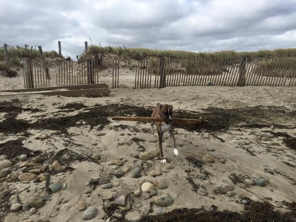
Sara Flynn on the camera, Sara Flynn's dog on the stick.

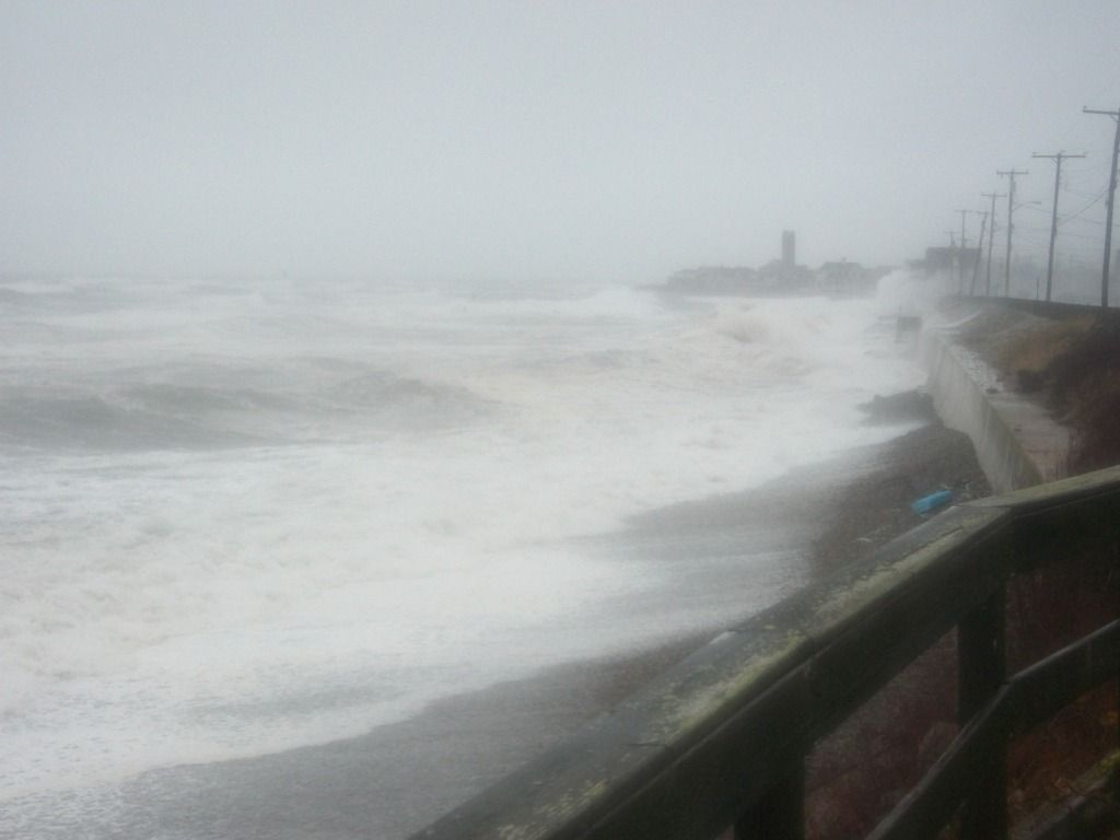
This last storm was fun to take pictures of, but it was a D+ grade storm historically, maybe a generous C if you value Staying Power. The dog enjoyed it heartily.

No one, except the guy I photographed jumping the Sandwich boardwalk on a parasail, is going to look back on this storm in 20 years with anyone who will remember what he was talking about. It doesn't merit historical consideration, other than the tragedy down in the Bahamas with the MMA kid.

However, even minor storms can mess up the neighborhood pretty nasty, and things will be a bit ugly until Toil and Tide smooths everything over.

We'll try to give you an idea of how the coastal people deal with storms.


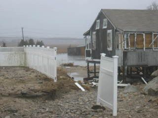
This is an old picture, from a 2006 Duxbury nor'easter, To my knowledge, there were no houses torn apart in this last storm.

If the storm is bad enough to take houses, it goes without saying that the cleanup will be lengthier and more complicated.

Some storms can even alter the look of the neighborhood forever. To keep it Duxbury, I can recall the Blizzard of '78 being the end of the road for cottages in front of the dunes. The 1991 Halloween Gale knocked over the last of the 1950s-style cottages, and future gales will put the rest of the neighborhood up on stilts.

Again, this storm wasn't a home-killer. We're just establishing one end of the spectrum for the discussion.


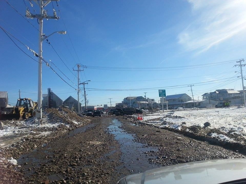
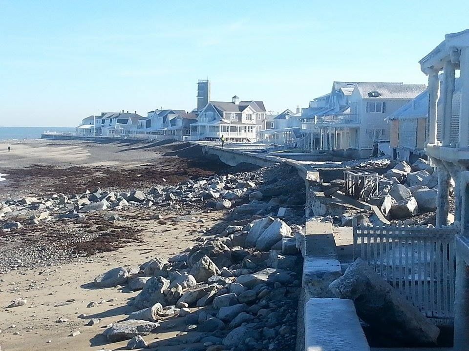
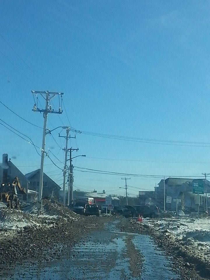
The next level of storm is where the houses are up, but the road is ruined. This is the Ocean Bluff/Brant Rock area, after one of last winter's blizzards. That's not a dirt road, that's heavily-used and trust-me-it's-paved Route 139.

The ocean, when it moves from shoreline to street, isn't just water. It is moving large piles of sand and stone with it, as well as anything that might be in the yard of whoever owns the land the ocean is washing through.

When I was trapped in my house for the Halloween Gale, you couldn't stand in front of a window, even on the second floor, when waves were breaking on the house. Each wave would slam a Shirley Jackson story worth of stones off of the house. That's why you board the windows up, player.

Those stones also wash past the house, and that usually puts them in the street.

Sand also shifts, remember...


This was the most damage I saw working the Sandwich-Barnstable-Yarmouth-Dennis run during the storm last weekend. Some DPW guy can sweep that ish back up onto the dune or whatever happens to it in this town.

Duxbury usually has the other sort of problem, with the ocean slicing through from ocean to bay. That makes parts of Duxbury Beach- as well as Saquish, where people live- into islands. Most of the town's effort after the 1991 storm involved making the beach whole again.

Otherwise, people get cut off, supplies get low, panic ensues, and the people from the Gurnet rise up and slaughter the people of Saquish for food and goodies.

Even tony Sandwich takes her lumps now and then.


Sammich is located on the wrong side of the Cape Cod Canal jetty, and it gets very little replenishment sand from more northern towns.

Prior to the construction of the jetty, this was the sole benefit that Sandwich gained from nor'easters. Once the jetty was up, Sammich was having sand washed down the beach from them without getting any sand washed down to them.

This eventually leads to large chunks of Sandwich being claimed by the sea. The sea then starts touching things that she isn't supposed to be touching, like highways.

It's probably not going to come to that on Route 6A, at least from what I saw this weekend. There were some houses taking shots, and I'd bet that they lost a lot of sand.


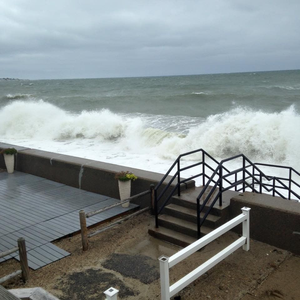
If the street an the beach got messed up, you can bet that the wall that was supposed to be protecting the street has been compromised.

Seawall repairs are ugly business, for several reasons. One, if you need them, you most likely just had a damage-doin' storm. Two, seawall repairs are costly, with coastal towns sitting on potential seawall repair bills running into the millions. Three, there will almost always be a fight between homeowners, the town, the state and the US of g*d-damned A over who will be footing the bills for the seawall repair.

I am related to at least one guy who had to run down to Town Hall and wave deeds and contracts in their face before getting off the hook for thousands of dollars worth of seawall repairs that the town was supposed to pay for.

You have to watch the towns, as they try to get off "cheap" on the repairs now and then. Duxbury, which can hardly plead poverty, had a wooden seawall until the mid-1950s.


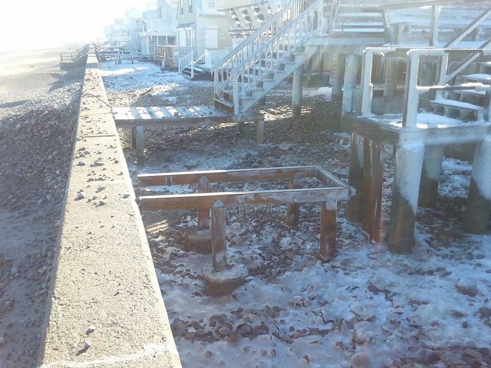
This is more of the Brant Rock/Ocean Bluff damage from last winter. If the elements and the budget won't let you build a fancy seawall, a bunch of boulders will have to do.

You just want something tall enough to slap down even huge waves, and you want it heavy enough to not be washed away when the Atlantic Ocean leans on it. If a little bit of water gets by it... well, hey, you live at a beach, right?

If you don't build a seawall, the ocean gets to tee off on you for 5-12 waves a minute for 3 hours of nor'easter tide, twice a day, any time the pressure drops. You want to try to avoid having that happen.

Seawalls are like divorces.... they cost so much because they're worth it. The town and state will complain, but it will get fixed in the end. The alternative- again, like the divorce- is too ugly to countenance.


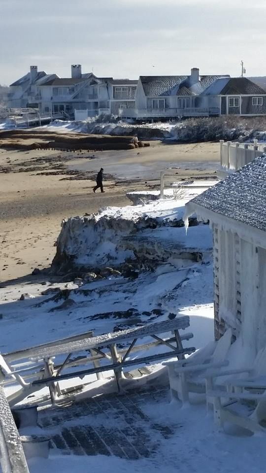
The seawall houses in Duxbury are known for their beautifully maintained lawns and just-like-God-planned-it soft sand yards. Oh, wait... this is a post-blizzard shot of Duxbury Beach.

I swear to God that one of those houses in this picture above (the foreground, with the ice) is owned by a golf course groundskeeper, and his lawn is kept at putting-green-trim levels all summer.

In order for that to happen, you have to shovel (or hire someone to shovel) the beach back on to the beach. My yard on Ocean Road North would pick up what I would conservatively estimate to be 1000000000 rocks every nor'easter.

Rocks are handy to have around if you, say, need to fill large holes in your lawn.


Once the yard is cleared, it must be repaired.

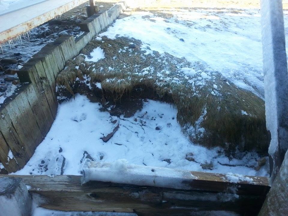
Even after you fill the large holes (snow doesn't count, lazybones!), you still have problems. All of your grass has been washed and soaked on salt water.

The Romans, after razing Carthage, covered the ground with salt and sea salt. They salted it down because, as Sam Kinison said, "Nothing grows in sand, nothing's gonna grow in sand!"

Grass is no exception, which is why beaches tend to be sandy. If you want the grass back after a storm ruins it, you have to skim the top layer of soil and replace it with unspoiled topsoil. Then you plant the grass, and then you see if you removed enough salty soil.

This is why some people say "Screw lawns," and just go with natural sand yards. It turns out that these also require tireless maintenance. I did that with the patio near the seawall, as we would lose the front 10-20 feet of lawn with every storm.


This wonderful beach scene, as we noted in a previous article, would be perfect sand-water-dunes-lifeguard chair Cape Cod if this were not the parking lot of Sandy Neck Beach.

It'll all wash away at some point. It's marshy over there, and the DPW can sweep up and re-deposit that sand where it belongs. A parking lot is less of a touchy maintenance job than that of a million-dollar Hyannis Port beach house. You can't just let the Kennedy Compound drain, and then hire some townie to sweep it up whenever.

This can be touchy with October storms, as no coastal resident with any brains makes yard repairs on the nor'easter damage until late April. June through October is hurricane season, but October through the Ides of April is noreaster season, and we get several storms a year.

The beach suffers during those storms. People like the natural aspect of a soft-sand beach, in theory. In reality, "natural" beaches look a lot more like the picture with the dog at the beginning of the article.

The tide will take care of the lower beach, but the upper beach can get a little bit ugly.


Anyone who lives on a seawall knows this scene, represented perfectly by Duxbury Beach.

Several somebodies let the storm sneak up on them, and didn't take their stairs up (in the local patois, stairs are taken "up" onto the seawall, as opposed to being taken "down" from the seawall) in time. The stairs bang around in the surf until there isn't a seawall to prevent them from being tossed up past the wave-wash.

Eventually, you sneak on the beach with a Jeep (the "Duxbury Cadillac" of legend, in case you heard the term and never knew the reference), tow the stairs back to your house and hopefully store them a little more securely.

Duxbury Beach gets lots of odd stuff washing up. Every now and then, a barge loses a cargo container over the side, whch busts open and disgorges her contents into the sea. They eventually wash up on the beach somewhere. One winter, it was oil filters. Another winter, it was Nikes. If they had EBay in 1980, I would have sold more sneakers than that Air Jordan motherf***er.


Lobstermen get caught slippin', too.

For reasons I don't know but that some salty dude (or dudette, the only lobsterman among my Facebook friends is a girl known to me as Tornado) could tell us, wire pots don't wash ashore as much as wooden pots do.

When I was a kid, we'd go out after every nor'easter and snag lobsters out of the wooden traaps that washed ashore. We'd get several dozen this way, as pots, buoys and so forth were all over the beach.

You never steal the pots, however, and even the buoys were a rough proposition. I don't know if lobstermen can shoot you for touching their gear, but I know that many think they can... and that's all that will matter if the heat comes out on you, friend.


This is the Mystic River, courtesy of Paul Walker... no, not THAT one.

While this isn't ocean damage, what you see here are leaves. Those leaves, still green, should be up in a tree, getting ready to be in my fall foliage shots.

If those are lily pads or something, just try to work with me here.

Massachusetts, and especially Eastern Massachusetts, doesn't really get around to fall-foliaging until late October. Some places on Cape Cod (I noticed this while bell-ringing at the Sagamore Christmas Tree Shoppe) don't even go over until mid-November.

That overlaps with the October-April nor'easter season, and is one of the many reasons why coastal Massachusetts isn't really top-notch foliage country. We rock pretty hard compared to, say, New Mexico, but New Hampshire people laugh at our foliage... they LAUGH at it.

Of course, they don't have ocean storms up there, so they can just shush now.


Tuesday, September 22, 2015

Wrong Way 5K Race To Benefit Marshfield Girls Lacrosse


Now, we're a website run by a Duxbury kid, and we view anyone who might play Duxbury as Enemies who need to be Smited.

That said, we're also suckers for a good cause, and the watch of the Good Cause generally rules the hour on these pages.

Allow me to cut-n-paste a bit, K?

Picture

SEPTEMBER 26, 2015
9:00 AM

Come out and join the Marshfield Girls Lacrosse Club at the Wrong Way 5K.  The race will be held beginning at 9:00 am on Saturday, September 26th beginning on the Brant Rock Esplanade.

This is a walker friendly event so if you're not a runner but would like to participate, we would love to have you join us.

For information on the Marshfield Girls Lacrosse Club (MGLC), please visit their website at:
http://marshfieldgirlslax.com/
Picture
REGISTRATION
Adult:  $25.00 online (plus fee)/ $30.00 race day
Student (11-18):  $20.00 online (plus fee)/ $25.00 race day
Child (10 & under):  $15.00 online (plus fee) / $20.00 race day
Online registration is open through the end of the day on September 24th(Registration fees above do not include the online processing fee)

Awards will be given to the top 3 male and female overall as well as to 1st place in the following age groups:  10 & under, 11-15, 16-19, 20-29, 30-39, 40-49, 50-59, 60-69, 70+

USATF Sanction #15-02-901


T-shirt deadline is the end of the day September 15th
We will estimate the number of additional shirts we will need for those that register after the shirt deadline, however, if you register after September 15th we cannot guarantee you will receive a shirt or that it will be in the size you requested when you register.

Awards will be given as follows:
Top 3 overall male and female
1st place in the following age groups:  10 & under, 11-15, 16-19, 20-29, 30-39, 40-49, 50-59, 60-69, 70+

Course Map:

Picture

Lacrosse is a tremendous sport. It is distinct to the Northeast, as it (in Native form, with 1000 player teams contesting the game for 3 days) was regularly played by Iroquois people. It dates back to about 1100 AD. It was called "the Creator's game," and those who played it were considered to be warriors.

The French co-opted the game ("la crosse" is a French term, stolen from field hockey's "la jeu de la crosse," applied to any stick with a curved end... don't ask me why, the French part of the team is out at the bus stop with the Cub Reporter), and it is still a very popular game in the Northeast. 

Jim Thorpe, Bill Belichick and Jim Motherf***ing Brown were or are lovers of lacrosse. More than one sportswriter has said that it was Brown's best sport.

Lacrosse is also good for the kids. If your kid plays lacrosse, she will 

A) be in great shape

B) take part in a positive, social, team sport

C) be on a field, supervised, playing a positive sport at an hour of the day when other kids are gang-fighting, smoking synthetic THC, killing small animals, sleeping with the local greasers, embracing Satanism, etc...

D) perhaps get really good at the sport, and merit herself a free ride to Syracuse or Johns Hopkins

E) get to hit the popular, snobby girls in the back with a huge stick.

It's win/win, but Marshfield Girls Lacrosse needs help to make all of that happen. You can provide that help by taking part in the Wrong Way 5K. All of the details are in the stuff I cut-n-pasted.

Let's be honest... you could also use a few hours of exercise. Yes, I'm looking at you, and you could stand to lose a few pounds. Get on out there and support the community!


Monday, August 17, 2015

Marshfield Hurricane Primer: Inundation And Evacuation


Where do you start with Marsh Vegas?

It's more of a nor'easter town than a hurricane town, but A does not necessarily preclude B in this case. Marshfield is cap-ee-tull-T Trouble in any coastal storm situation, just because of the lay of the land. That's not going to improve if the winds get over 100 mph.

For starters, they didn't name the town Marshfield because some guy named Marsh founded it. Marshes, moors, swamps, bogs and estuaries all define the town''s geography. You can't be the green-bleeding heart of the Irish Riviera without some bogs to trot on, no?

Marshfield's eponymous marshes and her river mouths (you expect the North River to be trouble, but the itty-bitty Green Harbor River?) ensure that a lot of water will be flowing through and collecting in Marshfield during any rain event. That's before we factor in the waves breaking over houses.

The map above is what they call a Hurricane Inundation Map. It's what floods in town, and note that these estimates are only for salt water flooding. They assume a direct hit (almost impossible in Marshfield's case) from a hurricane at mean high tide.

The map (provided by the NHC and FEMA) is a bit tough to read, as tidal flooding far inland made for a need to zoom the map out. You can still see enough to know, and local knowledge is probably as good as any map.

Of course, your local knowledge isn't top-notch until you can trace your residency back to a signature storm like Hurricane Carol, the Blizzard of '78 or the Halloween Gale. You can always talk up the longest-standing resident of the neighborhood for local flooding history, and any solid plan for a coastal resident should include such considerations.

The light green areas on the map are areas that would be underwater in a Category 1 hurricane. Darker green is Category 2, and yellow is Category 3. Keep in mind, five Category 3 hurricanes have hit New England since the white man arrived. FEMA also provides areas (the reddish shade) that would get hit in a Category 4 storm, which we have not had in modern history. That scenario almost-but-not-quite puts the Dairy Queen under seawater.

The authorities are also nice enough to give us Evacuation Maps. These are a bit more broad-stroked and are much easier to read.

Basically, red means "those people have to go," while yellow means "and you have to go, too."

Marshfield is an odd geographical thing, very close to sea level, and even the high ground drains downhill into the marshes. Areas of Marshfield that shake off a nor'easter with just some frozen spray on the houses may be in for a rude awakening if a Bob-style hurricane unloads on her. Once those marshes top off, the water has nowhere to go except into the neighborhoods.

Much of the area's coast (hello, Rexhame and Humarock) is wedged between the sea and the South River, which only aids the inundation process... which, in turn, spurs along the need to evacuate.

Most of Marshfield's coast- and any areas along rivers or marshes- would have to be evacuated in even a minimal hurricane forecast to hit at high tide. Greater storms would force people near the Fairgrounds to evacuate.

A solid run from the Duxbury border, through Green Harbor, Brant Rock, Ocean Bluff, Fieldston, and Rexhame to the tip of Humarock would be Gotta Goville. I'm guessing, but at the height of summer, that might be 10,000 people.

From what I can see of the maps, people might want to head for the (Marshfield) Hills.

It's like we say on Duxbury Beach... "The other 364 days of the year are beautiful."

If you want to play with the maps or get the links to other towns, maybe see how bad the other suckers near you are gonna get it.... FEMA Inundation Maps For Massachusetts.

You can also window-shop other town's disaster porn with the FEMA Evacuation Zone Maps For Massachusetts.

Marsh Vegas, as you can see, gets wrecked on the regular.