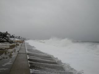
Falmouth holds a corner lot on Cape Cod, facing both Buzzards Bay and Nantucket Sound. You never want to have multiple county-sized bodies of water looking to push ashore into your town when a storm comes, which leads us to today's topic of discussion.
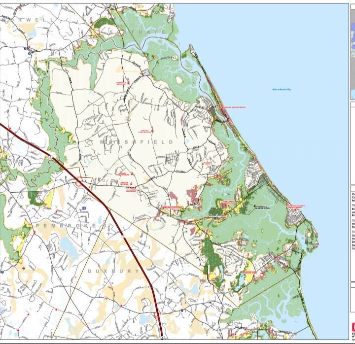
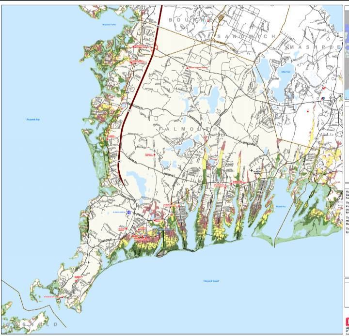
We have two maps for you to analyze with your friends and family. The map above is a Hurricane Inundation Map. It comes from FEMA, MEMA, NOAA and NHC, will be written about by ME, and read by U.
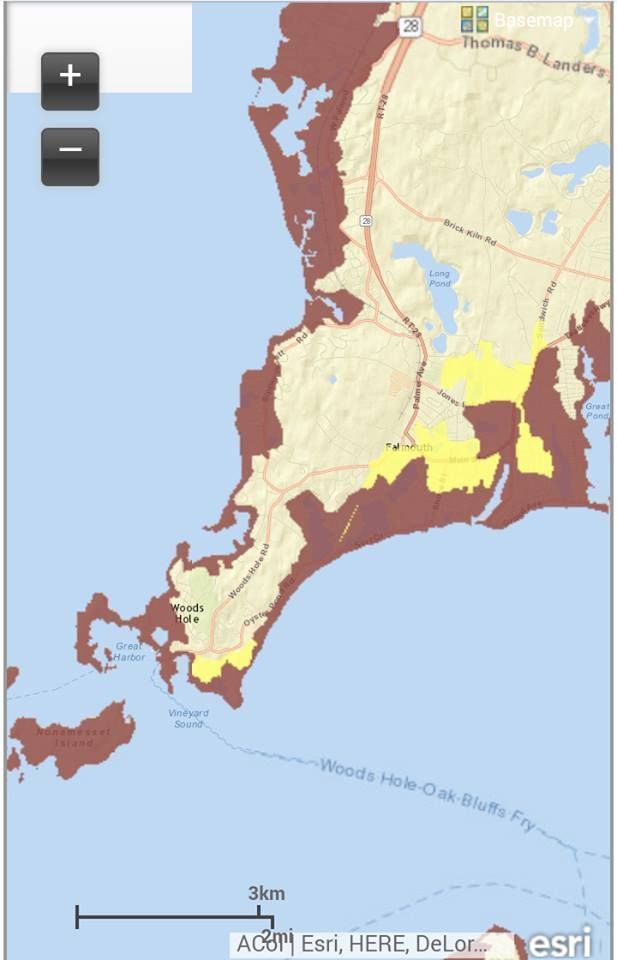
"Inundation" is a fancy word for "storm surge," which are two fancy words for "water pushed ashore by a storm." This is the killer in a storm, it's what did in New Orleans 10 years ago, and the maps give you several views of it.
You can see where water will come ashore in a direct hit hurricane arriving at high tide, and you'll see what degree of storm (via the Saffir-Simpson hurricane intensity scale) will flood different parts of town. They are based on the zany-weatherman-titled SLOSH model of storm surge inundation.
These maps do not project freshwater flooding things like rain, overflowing rivers and sewer backups, as well as people just spraying the hose into the street for the hell of it, mid-storm, because Falmouth is a hardcore sort of town.
Light Green = Category 1 hurricane. The Blizzard of '78 and the Halloween Gale are good examples of Category 1 storm damage, although neither was directly a hurricane. If those didn't hit hard down there (I'm a Duxbury kid, and was on Duxbury Beach for '78 and '91), use Hurricane Gloria as a hits-at-low-tide benchmark.
Dark Green = Category 2 hurricane. Hurricane Bob was a weak Category 2, and yes we do realize that "weak" and "Category 2 hurricane" are odd words to chain together.
Yellow = Category 3 hurricane. We've only had five storms of this strength hit New England since the Other Man arrived in 1620, the most recent being Carol in 1954.
Pink = Category 4 hurricane. We've had one in recorded history, in 1635.
Flesh = 100 Year FEMA Flood Zone. This is the "hundred year storm" you hear about, although you have to go pre-Colombian to find them. New England was hit by storms greater than Category 4 in roughly 1100 AD, 1300 AD and 1400 AD. They can tell by checking layers of sand on salt marsh muck.
Sorry about "flesh," my knowledge of colors was greatly dictated by the people at Crayola in the 1970s.
You can check these maps in far greater detail by going here and zooming a bit. It's disaster porn, styled to your very home!
Again, these maps do not depict freshwater flooding, and freshwater flooding will cause a whole slew of problems on her own if a hurricane says "Wuzzup?" to Wood's Hole.
Remember, you don't have to get flooded with seawater to die in a hurricane. You can get hit by lightning, sucked into a river, mashed in a road accident, have a tree fall on you, step on power lines, stumble into a sharknado or be killed by looters.
These maps show you what dangers face your particular house, and you can use them to decide on whether to make a run for it or not.
We'd also advise you to chat up the oldest guy with the longest residency in your neighborhood. Find out what Carol did to the house you live in now. Find out how high the water was in the street, how long the power was out for, what roads become impassable, and any other k-nuggets of knowledge the old fella might have.
Cranberry County Magazine stands strong behind our philosophy that your hurricane preparation planning is incomplete until you talk to some white heads. Your neighborhood's Old School is an asset which should not be underutilized.
FEMA and GRAMPS may hold differing opinions as to when you should flee, but FEMA most likely wasn't living on your street in 1954 when Carol came ashore. Gramps was. If he says your street floods and FEMA doesn't (my own neighborhood floods in nor'easters, but FEMA gives it Category 4 status), you may want to do some serious merit-weighing when deciding if you should Get To Steppin'.
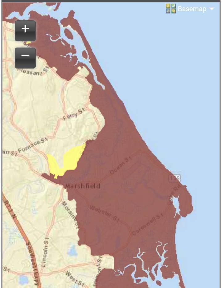
This leads to our second map style, the Evacuation Map,
This is the map the authorities use when determining which neighborhoods will be evacuated. You don't HAVE to leave when the police tell you, but you also want to remember that the cop you were reading the Constitution to before the storm might very well be the one who has to make a decision as to whether or not to dive in to the maelstrom after you and your family.
I'm not chastising you. I watched the Halloween Gale from a waterfront home, with the police on a nearby hill blasting a searchlight on us the whole time.
Of course, that was a stupid move, so we'll work the other side now, and tell you about Feets Don't Fail Me Now, Heading For The Hills, and Running Like A Scaled Dog.
This map is easier to follow. It has two colors:
Pink = They have to evacuate.
Yellow = You do, too.
Here's the Evacuation Zone map:
Hurricane Inundation Maps
Evacuation Maps
Worst Hurricanes To Hit New England
List of all hurricanes to hit New England