Where do you start with Marsh Vegas?
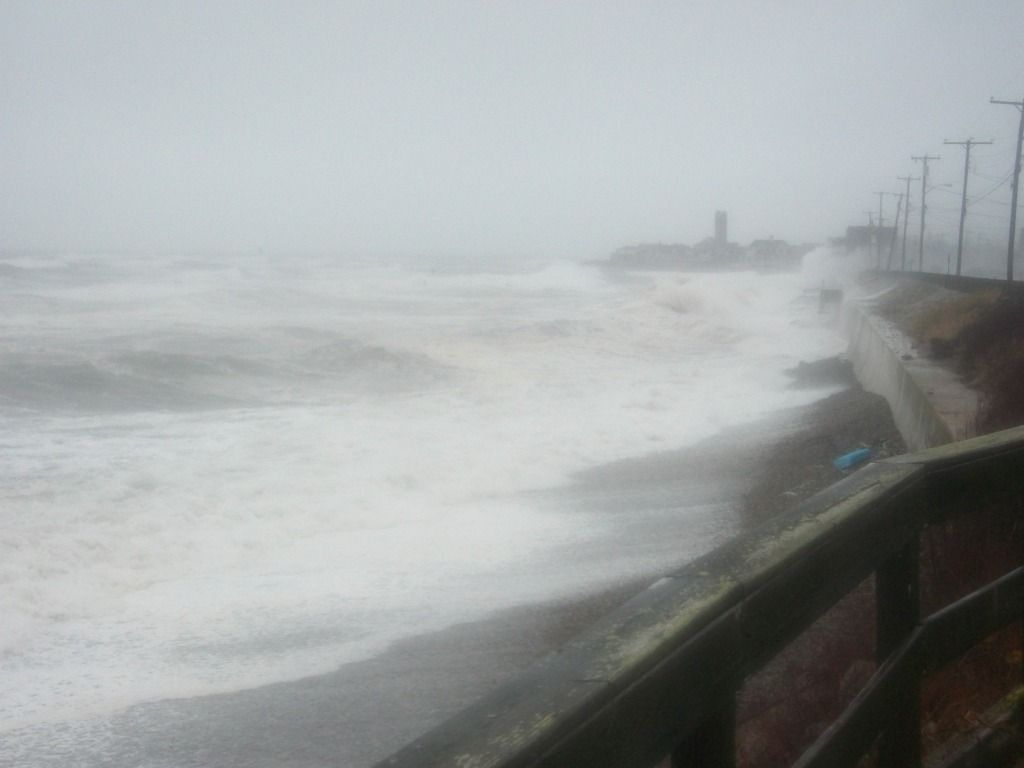
It's more of a nor'easter town than a hurricane town, but A does not necessarily preclude B in this case. Marshfield is cap-ee-tull-T Trouble in any coastal storm situation, just because of the lay of the land. That's not going to improve if the winds get over 100 mph.
For starters, they didn't name the town Marshfield because some guy named Marsh founded it. Marshes, moors, swamps, bogs and estuaries all define the town''s geography. You can't be the green-bleeding heart of the Irish Riviera without some bogs to trot on, no?
Marshfield's eponymous marshes and her river mouths (you expect the North River to be trouble, but the itty-bitty Green Harbor River?) ensure that a lot of water will be flowing through and collecting in Marshfield during any rain event. That's before we factor in the waves breaking over houses.
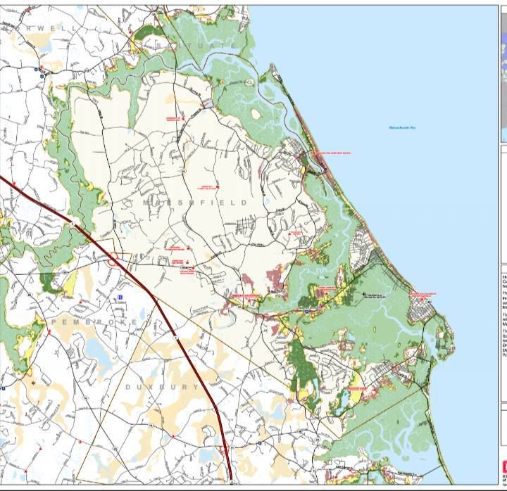
The map above is what they call a Hurricane Inundation Map. It's what floods in town, and note that these estimates are only for salt water flooding. They assume a direct hit (almost impossible in Marshfield's case) from a hurricane at mean high tide.
The map (provided by the NHC and FEMA) is a bit tough to read, as tidal flooding far inland made for a need to zoom the map out. You can still see enough to know, and local knowledge is probably as good as any map.
Of course, your local knowledge isn't top-notch until you can trace your residency back to a signature storm like Hurricane Carol, the Blizzard of '78 or the Halloween Gale. You can always talk up the longest-standing resident of the neighborhood for local flooding history, and any solid plan for a coastal resident should include such considerations.
The light green areas on the map are areas that would be underwater in a Category 1 hurricane. Darker green is Category 2, and yellow is Category 3. Keep in mind, five Category 3 hurricanes have hit New England since the white man arrived. FEMA also provides areas (the reddish shade) that would get hit in a Category 4 storm, which we have not had in modern history. That scenario almost-but-not-quite puts the Dairy Queen under seawater.
The authorities are also nice enough to give us Evacuation Maps. These are a bit more broad-stroked and are much easier to read.
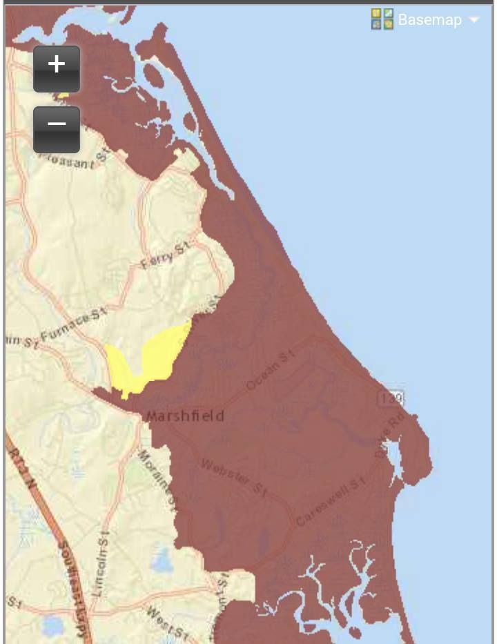
Basically, red means "those people have to go," while yellow means "and you have to go, too."
Marshfield is an odd geographical thing, very close to sea level, and even the high ground drains downhill into the marshes. Areas of Marshfield that shake off a nor'easter with just some frozen spray on the houses may be in for a rude awakening if a Bob-style hurricane unloads on her. Once those marshes top off, the water has nowhere to go except into the neighborhoods.
Much of the area's coast (hello, Rexhame and Humarock) is wedged between the sea and the South River, which only aids the inundation process... which, in turn, spurs along the need to evacuate.
Most of Marshfield's coast- and any areas along rivers or marshes- would have to be evacuated in even a minimal hurricane forecast to hit at high tide. Greater storms would force people near the Fairgrounds to evacuate.
A solid run from the Duxbury border, through Green Harbor, Brant Rock, Ocean Bluff, Fieldston, and Rexhame to the tip of Humarock would be Gotta Goville. I'm guessing, but at the height of summer, that might be 10,000 people.
From what I can see of the maps, people might want to head for the (Marshfield) Hills.
It's like we say on Duxbury Beach... "The other 364 days of the year are beautiful."
If you want to play with the maps or get the links to other towns, maybe see how bad the other suckers near you are gonna get it.... FEMA Inundation Maps For Massachusetts.
You can also window-shop other town's disaster porn with the FEMA Evacuation Zone Maps For Massachusetts.
 |
| Marsh Vegas, as you can see, gets wrecked on the regular. |
No comments:
Post a Comment