Wednesday, October 14, 2015

For Whom The Bridge Tolls: Thoughts On A New Cape Cod Canal Bridge


Let's start with some numbers:
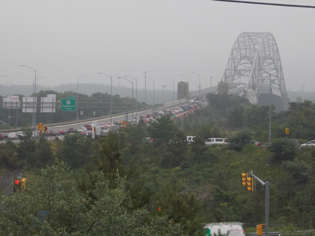
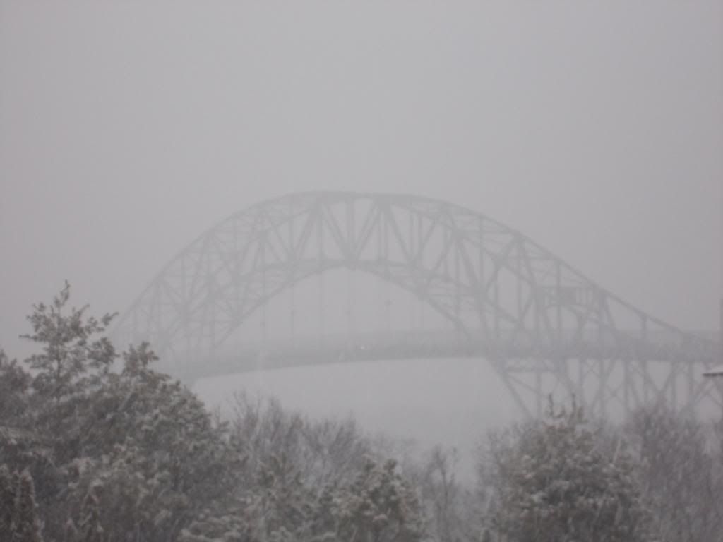
Bourne Bridge
Year round daily average (2011) = 42,505 vehicles
Summer daily average = 58,467

Sagamore Bridge
Year round daily average = 51,489
Summer daily average = 70,674

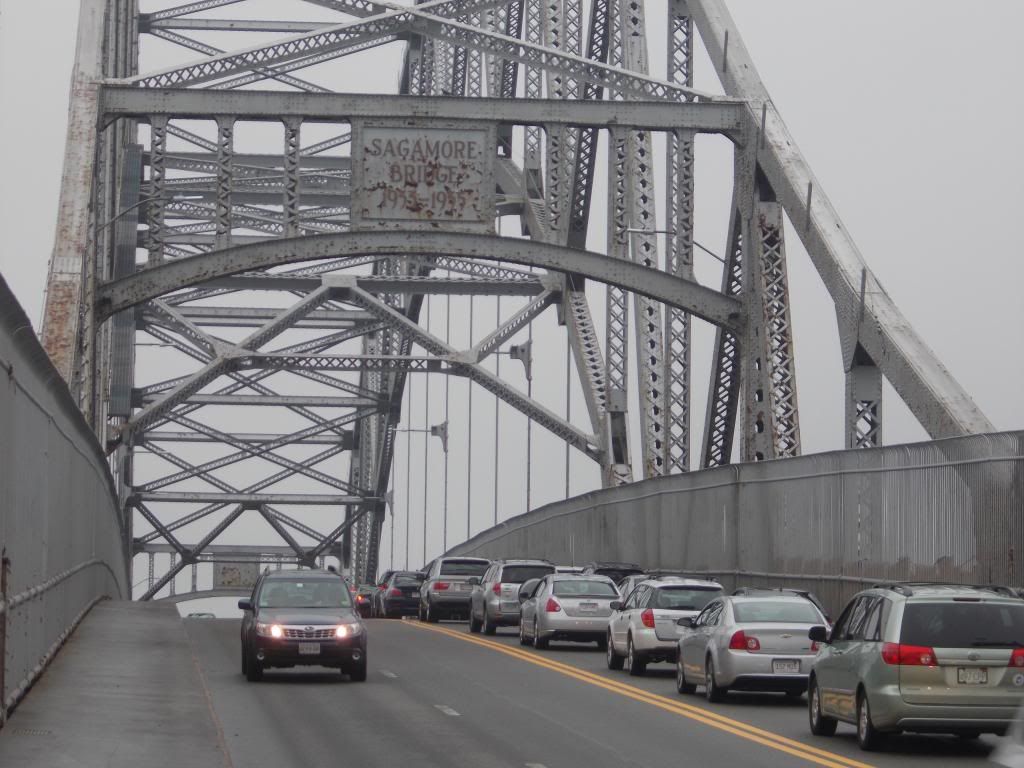
Those numbers lead to impassable traffic jams, jams where ten mile drives take 3 hours.

You've all heard the war stories. "25 mile backups during Hurricane Bob," or "90 minutes from the the 6A/130 intersection to the Sagamore Bridge during the Mother's Day Massacre of 2012."

Bourne residents literally can't go anywhere and hope to come back on Friday afternoons, Saturday/Sunday mornings, Sunday nights, during the Monday commute, and/or during any holiday/event.

Emergency evacuation is impossible, property values suffer, the quality of life is lowered, and the last sentence of the previous paragraph is literally saying "as a Bourne resident, you sacrifice a sizable % of your waking life to traffic."

This would be tolerable in Boston, where there are a million people zipping about. It shouldn't be the case in Buzzards Bay, where 3000 souls can be found on any given day. It makes me want to scream at someone more than I care to admit.


Here's how I see it....

* We need a third bridge.

* We need a third road leading up to and away from that bridge.

* If we want it, we'll have to pay for it.

* We'll pay for it with a toll bridge.

* The tolls will be there forever, even after the bridge is paid off.

* Prices will increase as businesses pass the toll costs onto the consumers.

* We shall eventually pay billions for a $300 million bridge.

* Splitting traffic up at the Christmas Tree Shop and then merging it back together 400 yards across the Canal will not resolve our traffic problems. It may in fact make it worse.

* The bridge will not meet the stated goal of easing traffic volume at all, and it serves no other purpose.

* We'll pay for this useless bridge for the rest of our lives and the lives of our descendants.

* If we don't do something, this nightmare is imminent.

* It seems to have fallen to me to brainstorm something.


I'm not picking on MA State Rep. Randy Hunt or Cape Cod Commission CEO Wendy Northcross there. Randy is obviously putting thought and effort into the problem, and Wendy answered almost everything I asked her about the topic. They just don't seem to see the basic problems inherent in this situation, or they feel that the problems are tenable and/or unavoidable.

Pols are sort of bound by what they think they can sell in Washington or the State House. They know they will have to claw through miles of red tape to even get the idea mentioned. They know that there will be many hands reaching into our pockets once the project gets green-lighted, especially with a Massachusetts highway project.

All of that real world stuff gets them used to operating in a way that somehow prohibits Thinking Big.

The intricate solution is beyond my capabilities. If I showed any Urban Planning skill in high school, a series of guidance counselors failed to mention it to me. However, the basic philosophy on what we need to do is well within my skill set. You'll see it, too.

The toll will generate billions in revenue, without reducing traffic at all. It is almost punitive. Only someone with a financial stake in a road-construction industry or highway management can like the idea. Any politician who supports it should be chased through the streets by a mob of angry constituents, and perhaps be kicked in the ribs a bunch of times.

If we and our tourists are going to spend billions over the life of a toll bridge, we should at least get what we pay for.


50,000 cars a day times $5 a pop = $250,000 a day in toll revenue.

Let's lower the toll rate so that I can just say "a million a week" and "maybe $5 a car is a doomsday estimate" without stretching the truth too far.

300 weeks pays off the project. 300 weeks is like, uhm, 6 years or something.

But the toll will last forever.

Heck, we'll even throw in a decade or two to cover any/all maintenance costs, and a third decade to cover the eventual replace-the-old-Sagamore-Bridge costs. Over an assumed 100 year lifespan of the bridge, this still has the Man needlessly in your pocket for 65 years.

The only way for us to get any value out of this is if our project is so massive, it takes a century of tolls to pay for it.


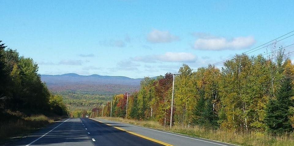
Off the top of my head, I'd drop a third bridge right in the middle of the other two. I would gut Bournedale with roads connecting to Route 25 and Route 3, seizing Bournedale Road and Herring Pond Road by Eminent Domain if need be. I'd make the road into a big Y, with the bottom part of the Y being the third bridge.

I'd do an upside down version on the other side of the bridge, after taking some land from the gub'mint. The forks of the letter can sort of ^ towards Route 28 and Route 6 through the military base.

Shoot, why not build it in such a way that we can line it with Burger Kings, Cumberland Farms and Exxons? I have never met a local economy that couldn't use a rush of jobs. Perhaps even a Bournedale Mall would not be out of the question.

It would actually solve the problem that Main Street in Buzzards Bay has had since the freeway went in. Route 25 cut off our Tourist Flow, so we get back at Route 25 by cutting into it to run those same tourists by our businesses again. Main Street could slowly re-design itself to suit more immediate local needs, which it is sort of doing now anyhow.

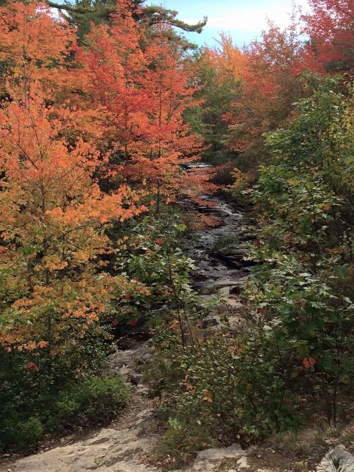
There would be some ugliness to They Tore Down The Carter Beal Nature Preserve And Put Up A Gas Station With A Dunkin' Donuts In It, no doubt. We could mute the environmental damage by building an elaborate Arc de Triomphe bridge over the herring run in Bournedale.

I'd also go with a wrap-around fishing pier along the bottom of the bridges, and light all of the bridges up like they do with the Zakim Bridge. I'd celebrate the opening with a party so huge and chaotic, it would make V-J Day look like someone just won a Scrabble game.

It's being paid for... why not?


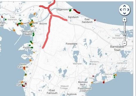
Hold on, someone did the map better than I did.


In my world of the future, we now have a third bridge. It is fed by roads which break off from highways which are already in place. The roads break off at the exact points (the Ingersoll Bend and Herring Pond Road) where we currently begin our present bumper-to-bumper congestion. We strike at the areas with the lowest population densities, mostly swamp and wasteland. Anyone we displace is compensated handsomely.

Locals can still use Main Street, Sandwich Road, the Cranberry Highway, the Scenic Highway and 6A for local-type stuff, which leads us to the best part. Before I get to that best part, I'd like to add that this plan would probably allow us to get rid of the two Bourne Bridge rotaries, and just have intersections like normal towns do.

The best part? The third bridge would be almost 100% Tourist. The current bridges feed the Bourne villages, while this hypothetical third bridge would empty into a discontinued military base and some Bournedale swampland. It would be of little use to locals, and it would only be used by tourists.

And it is this bridge that would bear the dreaded Toll. Holler if you hear me.


Now we have the burden where it should be. Tourists can pay for their own bridge. Smarter hotels and tourist destinations can comp guests for the toll. Bourne residents have suffered for years to fill Harwich restaurants with tourists, so cry me a river, Mooncussers.

Bourne and perhaps Sandwich residents will be exempt from any tolls, of course. We've been tolled in Traffic Patience for the last 100 years. F*** you.

The toll bridge can also be used by the rich man to skip heavier traffic at the free bridges via a small shedding of excess wealth, as the new bridge would sport a very low traffic volume for most of the week.  A five dollar toll for an empty bridge may also be an acceptable and necessary luxury to a working stiff who is running late for work on an important day.

We may have to somehow divert traffic to the toll bridge on certain Touristy days while preserving the free bridges for local traffic, and perhaps even invest in some of that Urban Warfare stuff that the cops get in larger cities where the people riot a lot. Maybe we can borrow some tanks from the military base.

We'll cross that bridge when we come to it, if you'll pardon the pun.


Tummy Porn: Popeyes Louisiana Kitchen


Normally, we'll aim a little higher with Tummy Porn than a B level fast food franchise. We take the sacred responsibilities of being your Tummy Pornographers very seriously, and it makes the whole region look bad if the food critics get all worked up over a chicken shack.

However, since the region is covered with fast food franchise outlets, it starts to creep into our territory when we get a chance to show a reader something that they may have not ever seen before.

We were in Fall River on some other business, so we decided to Tummy Porn our way into the Popeyes (Al Copeland, the original owner, claimed during his Chapter 11 proceedings that he was too poor to afford an apostrophe) Louisiana Kitchen on Pleasant Street in the great US city and port of Fall River.


Popeyes (named not for the famous Sailor Man, but instead for Detective Popeye Doyle from the film The French Connection, and, no, I'm not making that up) was founded in Louisiana in 1972. The original founder was a rags to riches street kid who, when Popeyes made him a millionaire, refused to join the local gentry... kind of a sin down there.

This earned him numerous battles with the local elite. Vampire Diaries author Anne Rice couldn't stand the mention of the man after he bought an iconic locale from the Lestat canon (the "Let me pass now from fiction into legend" building) and put up a garish eatery on the grounds. Other gentry hated Copeland's hyper-extravagant Christmas displays, which the TODAY show listed as #3 in America.

Popeyes expanded in the 1970s and 1980s to the point where there were 1500 franchises in the US by 2010. They slugged though bankruptcy in 1991 and went public in 2001.


Popeyes doesn't stray too far from the KFC motif practiced by rival Col. Harland Sanders.

The same limits that keep us from properly describing fine restaurants will also keep this section of the article from spooling out too far. Their chicken isn't too far from KFC's, although they have a spicy option that is favored by many customers. Jambalya is offered, not something you see at the Burger King. They also serve a sub that Southerners call a Po' Boy, in shrimp, chicken and catfish genres.

Yes, catfish. It's good, trust me.

OK, don't trust me, I got chicken. I've had a profound distaste for Catfish since I saw a monster show featuring catfish in the Mekong River that would eat a Khmer Rouge now and then. They may very well be why Charlie don't surf.


We went simple, which is always wise to do with fast food. It's a simple menu, which helped us in that regard.

I never actually expect to go to a Popeyes, so I never really pay attention to Annie The Chicken Queen, a sort of matriarch spokeswoman who stars in their commercials. This left me a bit unprepared going in, a mistake I won't let happen again.

Depending on where you clock in on spice preference, Popeyes lives on about the same level of Culinary Hell that Colonel Sanders rules. I could flip a coin between the two, personally.

I was going to go for the Wild Pepper Tenderloins, but the kid was with me, and I didn't want him bursting lava on the way home to Buzzards Bay.


Popeyes has cajun fries, potatoes with cajun gravy, macaroni and cheese and about what you'd expect from such a place.

The kids running the place were very nice, always a plus, especially in Fall River.

I should add that Popeyes is no worse cold than it is hot, I wolfed down my leftovers in a minute!

I should add that, at least from what I see on those Internets, you can get beaten up for no reason in Popeyes. We like when the chicken is battered... not us.

They also run out of chicken during special promotions now and then, which is often a point of contention with regular customers.


I go to chicken shack fights only when I have to cover up for my poor chicken pics.

Familiarity with Popeyes Lousiana Kitchen may not be an issue for you. I have no idea whether or even if they would be able to expand into the South Shore and Cape Cod. I'd like to see Duxbury or Sandwich get a franchise.

Tuesday, October 13, 2015

Thoughts On The Post-Pilgrim Nuclear Power Plant Future


The Pilgrim Nuclear Power Station in Plymouth will close in 2019, according to multiple sources.

They are citing low energy costs, market pressures and millions of dollars in necessary upgrades as the reasons for the closure.

The power plant was a source of both energy and concern for area residents ever since it was placed in the Manomet scrub coast. It helped keep the houses warm and the drinks cold for a few decades, and- Good Lord willing- we got it opened and closed without a Chernobyl-style disaster.

I took a tour of Pilgrm in 2008 or so, for an old article that I cant find in the archives. It looked very 1970s, with multiple dial labeled controls that made me think of the Batcave from the 1960s version of the Batman show. That's really what it looked like, sans Bat-mobile of course.

A few other things jumped out at me. The plant, while listed at 27 feet or so, seemed to be very, very close to sea level. They had two jetties and a jersey barrier between the Atlantic Ocean and a boiling water nuclear reactor.

The water flowing out of the plant, towards the ocean, was exactly the same color as Mountain Dew. I'm sure this has to do with sunlight and ionized water or something, and that nuclear power doesn't turn you green like the Incredible Hulk, but still...

The plant was also storing spent fuel on the site, hoping to send it to the Yucca Mountains in Nevada or somewhere like that. Amazingly, there aren't many takers when you're shopping Spent Nuclear Fuel storage.

The plant was also heavily, heavily guarded. I won't spill their details or anything, but you'd want to have a very good plan if you wanted to do some Bond Villain stuff. You'd be getting lit up before you even got exposed to the uranium or whatever they were using there.

The security force, which is 101% paramilitary, even wear their assault rifles while eating Chinese food. I kid you not. The guy I saw doing that immediately became my permanent visual definition of Badass Casual. You know he's gonna shoot you more than necessary if your terrorist attack makes him have to dump his General Tso's chicken on the ground and sling up Ol' Painless.

You can read about the shutdown here, or about the plant itself here... I'm not the expert. I'm more of the write-a-thought-provoking-article guy.

Here are some tangents we can explore together, if you like....

- Unless something bad happens quickly, we will never know if Pilgrim would have been able to stand up to a direct-hit monster hurricane. It had a nice bit of elevation, built on top of a sizable sand cliff. It also had Cape Cod blocking anything but a direct-hit storm.

Someone should put a marker about where the Fukushima line of reactor inundation would be, and maybe someday we'll see if the planners made a few crucial planning errors.

- If you wonder what the sudden loss of 14% of Massachusetts' power generation will do to your power bill, you'll find out in July of 2019. Remember, Cape Wind also got the Bozack from just about everyone, so we won't even have nascent wind technology to help things along.

- The plant's closure will cost the town 600 nice-paying jobs and $9.75 million a year in taxes. It also means we will need to import an additional 10 million barrels of oil and run our coal-fired power plant in Sagamore much harder.

- I'm already seeing a lot of "News Flash: Plymouth Economy To Collapse In 2019" things on Facebook. I'm seeing sympathy for the plant workers, too.

- I wonder what the NO ESCAPE FROM THE CAPE people who we used to see on the Sagamore Bridge will do for fun now.

- The closure of the plant means that Monster Hurricane becomes the only way we'll see a massive evacuation of Cape Cod, short of an Atlantic tsunami or the sudden arrival of Godzilla. We were looking at a Road To Basra type scenario of people cooking in their cars with a nuclear accident causing Cape Cod to empty.

- I planned to evacuate by boat, with the fact that I don't own a boat just being a minor obstacle in my world view.

- I'll have to go into the archives, find my Cape Cod Disaster Scenarios article, and revise the list from the top down. Pilgrim had the top spot there, I forget what #2 was, it may have been "series of shark attacks destroys tourist economy" or "asteroid strike" or "Sea AIDS."

- No, I don't know how long it will take to dismantle it, or how long before the area is safe for farming or anything like that. The line starts on the right for the Grown On The Site Of The Former Nuclear Power Plant produce.

- Will the towns keep the nuclear air-raid sirens up, on the off-chance we get a tornado or an air raid or something? We could have town-wide versions of the Morning Announcements we all remember from high school. I'd like Duxbury to use theirs to constantly broadcast reggae instrumental beats.

- Much of the area around Pilgrim, and I mean like Manomet to Bournehurst, is wildly underdeveloped scrub forest. If they start filling that in, we may need to carve a piece off of southern Plymouth and make a new town, maybe merging it with mainland Bourne. We'll do a whole article on that once some of the more serious people straighten me out on it in the comments or on Facebook.

- Will there be reluctance to develop that land around the plant? Will we have a Forbidden Zone?

- Would developing the Forbidden Zone around Pilgrim generate enough property taxes and carpenter jobs to offset the tax hit and plant job loss?

- It'd be funny if the land where Pilgrim presently stands is developed, someone puts a corny seafood restaurant there, Al Qaeda fails to get a series of memos, and a sorely-mistaken terrorist crashes a SEMTEX-loaded Cessna into a Seafood Shanty-type clam shack. Hopefully, it happens off-season.

- Fearless fishermen knew that the fishing was always good off Pilgrim. The water temperature differential plays a role or something, I don't know. It's always an Act Of Luck whenever I catch a fish.

- This pretty much kills the Cape Cod setting for my Nuclear Mutant Shark  movie script. I'm never gonna get that Oscar now...


Monday, October 12, 2015

Finding Foliage: Maine


"Cranberry County" is a purposefully ambiguous term. While it is technically Southeastern Massachusetts, we can (and will) expand when we need to.

Much like Hunter Thompson said about the code of the west, "Cranberry County" can mean "whatever we need it to mean, in a pinch."

Today, it means Maine.


This was very much aimless rambling, so I apologize in advance for not being like "That's Mount So-and-So." I don't go to Maine much, and the names of places tend to escape me.

I'm very good at SE Massachusetts town names, but Ive been banging around this part of the state professionally for a while. Even then, I just got my first visits in to places like Rehoboth and Somerset during last year's foliage articles.

I don't feel bad about that. A lot of Southeastern Masschusetts is on the If You Ain't From Here, You Don't Come here tip. That's not aggressive, just utilitarian.


Ideally, we'd have waited a few weeks and got into that Currier & Ives stuff, but I'm a busy man.

Maine, as you know, turns their foliage over before Massachusetts does. It gets colder up there sooner or something, I'm not that into tree science for a guy who writes about them as often as I do. I just like to look.

I'm assuming that we'll hit New Hamster about when the foliage is right, we sort of made it Maine when circumstances put us there.

To ensure that we get every last drop out of Rolling Stone writers, I've heard P.J. O'Rourke describe Norway as "God got carried away with the winter recipe for Northern Maine."


We will be moving South from Maine with the deepening of Autumn. We'll be in New Hampshire pretty soon, Northern Massachusetts a bit after that, and we're even trying to work Vermont. I'm not above sub-contracting it if need be.

We may even throw Rhode Island in the mix, I'm not sure if they turn over before or after Cape Cod does.

We won't make it to Connecticut, but if we do, you can almost bet that the pictures will be very Foxwoodsian.


Sunday, October 11, 2015

Tummy Porn: Mezza Luna

Jessica hooked the kid up for his birthday (it's Tuesday, but I don't mind punctuality) with lunch at Mezza Luna. We brought along my man Hard Core Logo, too.

Mezz Luna dates back to the 1930s, and made their bones serving pasta to servicemen from the military base. If there's a better restaurant in Bourne, I'd like to try it out.

Check out their website, which- don't be alarmed- might play some Sinatra for you.

The place went up in flames (firefighters tell me that even the restaurant fire smelled good) a few years ago, but they rebuilt. The Cubellis family is a good enough employer that they got a nice % of the staff back when they re-opened. Jake, who served us, was superb.
Hardcore Logo is a man of simple tastes, and tends to order off the Kid Menu. I actually have about the same diet, so this restaurant review probably won't move down the evolutionary scale much more than "The salad was yummy."

It never hurts to fortify yourselves with enough Autumn Punch that the pictures start coming out blurry.

Jessica is at work, and I'm a bit of a moron when it comes to all things classy. We dd a food review for Cape Cod TODAY once, and it wasn't pretty. Some quotes from the article..."Fudge Bomb"... "donnez-moi le bag de chienne, monsieur."... "God help me, I'll stab this fork into your stupid forehead.".. "Momma cooked the breakfast with no squid."... "I don't care if it's what I get at Olive Garden, it's what I want."

We don't call it Tummy Porn because someone violates a navel. Heck no, we go Tummy Deep into various restaurants in the area. This is my manicotti, with a diet-busting side of two meatballs. They don't skimp on the sauce, I'm a messy eater, and the table around me looked like a crime scene when I finished.

The food melts in your mouth to the extent that, other than when I stole some of Hard Core Logo's fries, I didn't have to chew anything.


Could be worse....


Friday, October 9, 2015

A Visit To The Fort Phoenix State Reservation


We took the troops to Fort Phoenix recently.

The Fort Phoenix State Reservation is a small park in Fairhaven. It is on the site of a Revolutionary War fort, and it is armed well enough to chase off Captain Jack Sparrow.

Military purposes aside, it's a lovely spot to spend a day. We did just that a few weeks ago, and it was cool enough that we're writing now to recommend it to you.

For starters, there aren't that many (there are some, especially around here) parks where the expressed purpose of said park is to Kill Englishmen.

You gotta like that!


That's a cannon-eye view of the mouth of the Acushnet River, the wet way into New Bedford. You may have been some big bad Brit admiral, but you weren't getting into New Beffuh without dealing with the hastily-mobilized toothless farmer enjoying this same view two centuries ago.

New Bedford and Fairhaven were very, very important to the colonial era economy, as well as to the colonial era military efforts. They were active ports, bringing and sending out goods that drove the local economy. They could host American warships. They were also excellent privateer bases.

Of course, stuff like that is going to attract the attention of the people you are at war with or in rebellion against. That's why little Fairhaven has a Marne-like history, with multiple military activities.


Now, in an era where you can whip out the ol' nuclear football, push a button and obliterate 500000 people on the other side of the world, a fort with a few cannons aiming out at the ocean isn't really a big deal. Strategically, Fort Phoenix is a zero.

However, it is (and was) of great Tactical value, especially back in the Day. If you have to sail what is essentially a big wooden kid's fort into the Acushnet River, a bunch of cannons aimed at you from a hill overlooking the harbor is what stereotypical Native Americans in old cartoons call Heapum Big Trouble.

Yes, you could pretty much dictate what would and wouldn't be coming in and out of New Betty by boat if you could put a few cannons on a hill over the harbor. "A cannon on a hill" is pretty much why the English fled Boston not that long after winning The Battle Of Bunker Hill.

The only way to neutralize those cannon was to hack down a forest grove, build a big floating platform for 45 cannons, sail it halfway around the world and send it headlong into direct kill-or-be-killed conflict with a bunch of whiskey-crazed English hinterland rebels. The English felt strongly enough about the Acushnet River that they took more than one crack at just that course of action.


Fort Phoenix is 2-1 in fights with the British, but the L was a big one.

The fort, nameless to me at least, was put up in some form before the start of the American Revolution... perhaps even to fight the French, I'm not sure. True to the hardcore nature of the South Coast, the fort was involved in several fights almost immediately.

Not a lot of people know this, or at least not a lot when compared to those who can tell you about Bunker Hill, but the first naval engagements of the American Revolution went down off of the South Coast.

The British sloop Falcon appeared off of the New England coastline shortly after the entertainment at Lexington/Concord. Both sides were scrambling to get men and supplies up to Boston for the imminent Big Squabble. The Falcon was able to bag two 'Murican ships in one day. One (the Champion) was full of supplies from Maryland intended for the rebels, and they kept that.

The other, a now-nameless sloop from Nantucket, was given a skeleton crew and some scant firearms. It was then sent to Dartmouth (Fairhaven was still Dartmouth at the time), where the Falcon had heard that a smuggler's vessel was docked. They seized that vessel, and went off to find the Falcon. They anchored off Martha's Vineyard for some reason, about 3 miles apart.

The South Coast was having none of that, and assembled a militia of 30 men carrying every gun they could get their hands on. They jammed this militia onto the whaling sloop Success, armed it with two swivel guns, and set off to kick Brit Butt.

Finding the English off of Martha's Vineyard, they immediately seized the Dartmouth ship without firing a shot. They then aimed both vessels at the British sailors on board the Nantucket ship, and closed before the Brits could flee. Shots were fired, and three Limey Poofters dropped.

The Americans then boarded the English ship. English military dudes were among the toughest on the planet. You could dunk them in Boston Harbor in April, march them on soaking foot to Lexington and Concord, and still go 1-1 against every Patriot in Massachusetts. Perhaps the only tougher people on the seas that day were South Coast whalers... especially if they had 30:11 odds.

They took the ships back to the yet-to-be-named Fort Phoenix, and the South Coast had a W in the books against the Empire On Which The Sun Never Sets.


The English had a measure of revenge in 1778. A series of operations known as Grey's Raid resulted in 4000 Brits burning New Bedford in a blaze that could be seen in Newport, Rhode Island. They then destroyed the cannon in Fairhaven before being run off by militia. The fort was rebuilt, hence the rising-from-the-ashes "Phoenix" moniker

The British took another crack at the Acushnet River during the War of 1812. The troublesome British raider HMS Nimrod made a run at New Bedford during action where they also attacked Wareham.

This story has a couple of different endings, one of which looks suspiciously like that of the Army of Two story where a pair of Scituate lighthouse keeper daughters used a fife and drum behind a dune to fool the British into thinking militia were gathering. In this one, it's a bugle or something.

Others say it was a gathering militia and fire from Fort Phoenix which made the British take a pass on tangling with New Betty. There is even a case to be made for the British feinting at Fairhaven to put the militia there, too far away to race the ships to Wareham that were the goal of the English visit. If that was the plan, it worked like a charm, because the British beat ?ham down like she stole something.

The burning of New Bedford's docks in 1778 was done under the orders of Sir Charles Grey. His kid, the 2nd Earl Charles Grey, is who Earl Grey's Tea is named for... something New Bedford and Fairhaven people should keep in mind when making tea purchases. Some people forget, but not Cranberry County Mother***ing Magazine.


Things were pretty peaceful since then, although the cannons are still pointing to sea.

Now, it's a nice little park on a beautiful bay, perfect for grabbing a bench and reading a book. There is a "Charlie Don't Surf" aspect to this park, as the Brits were misusing the park before we got it and put pretty girls with books under the trees there on a nice late-summer morning.

A day spent watching the boats come in is a lot more enjoyable if you don't have to worry about those ships disgorging 4000 British marines to burn New Bedford. A distinctly American primordial urge did jump into me once or twice when I pondered using the cannon against barges and rich people boats that were sailing by, but it passed.

In fact, I had a wonderfully peaceful morning at Fort Phoenix.


Fort Phoenix also has some of the best views that any baller or tennis player could hope for. I'm capable of putting both a full-court fast break pass or an overenthusiastic tennis serve into Buzzards Bay if I'm not careful.

And One should have their games here, the setting would make for some great camera shots. A bunch of 7 foot basketball players running on the shore around may also deter any British invasions that don't have Led Zeppelin in them.

You get a sense that whichever player runs this court can shoot really well in the wind. I can also sense some "losing team has to dive into Buzzards Bay" bets getting made here now and then. That's what I'd bet.

In case you think I was making up that part about using the cannon on yachts....


"Nearer my God to thee," especially up in that tower.


It's just like Washington Street in Duxbury, except that if you take a left at the end of Washington Street, you don't end up in New Bedford.


What the Brits were after... OK, a 1778 version of that, but still....

Wednesday, October 7, 2015

Seawall Repair In Marshfield


Marshfield fights back against Poseidon this week, as they scramble to repair ruined seawalls before nor'easter season kicks in.

They dodged a bullet last week, as a powerful storm battered the coast for several tides. It never really got biblical however, and things appear to be sailing along well enough this week.

The town is fixing 1000 feet of seawall, mostly along Foster Avenue. It is replacing a wall that has been up since 1931. Recent storms have smacked it around, with the dark spectre of Attrition also having a loud say in matters.


There's no need to fear... FEMA (or the US Army Corps of Engineers, or the DPW) is here. Your tax dollars at work, as they say.

Left without maintenance, these walls would crumble into the sea. When that happens, it opens up the houses of that part of town to direct wave impacts. It also brings about great inundation. Relocation would involve re-settling 10000 souls or so.

That also means losing valuable property tax revenue, business money, jobs, tourist loot and any other of the zillion permutations that would come with telling the Coasties to eff themselves.

It's a lot like gun control.... ideally, there would be no development in vulnerable coastal areas. However, once you have it, it's easier to try to regulate it than it is to go door-to-door seizing property.

"Easier" in this case involves millions of dollars in seawall repairs, but that's cheap when compared to worst-case scenarios.

Joe Deady took the non-blurry, useful pictures.

This wall will be two feet higher than the present wall, and 84 years younger. They'll be using that, uhm, like, modern concrete or whatever they put in that wall. Vauban, I am not.

This maritime Maginot Line is Marshfield's magic against Mean Momma Mer.

Marsh Vegas, depending on how the storm winds blow, sort of alternates the title of First Town That Atlantic Storm Waves Hit Without Breaking On Cape Cod First between themselves, Scituate and Duxbury. This means that she takes heavy shots from the storm waves, and they kinda need the 2015 version of the seawall.

The town (through a loan from a state seawall fund) will split the costs of the project with the state, which will provide half of the necessary cheddar via a grant.

Total cost? $3.94 Million.

If this wall were built by the Donald, it would be taller, thicker, and deeper in the ground... and Mexico would be paying for it.
However, Vegas was happy to pay their half of the loot. Seawalls are like divorce... they cost so much because they're friggin' worth it.

The locals allowed the town some eminent domain mojo, so they can do future repair and maintenance work. From what I saw of this in Duxbury, it may cost you a foot of the lawn if they have to dig down for some maintenance.

That's a small price to pay for a wall that I'm pretty sure is thicker and tougher than the wall in Berlin that the Soviets used to keep the eastern Nazis penned up.

The whole wall is there to protect the Port-a-Potty, which is actually a cleverly-disguised Stargate.

Hawk-eyed readers will notice the 2015 date carved into the top of the stairs. I was gonna park and get a better picture, but the locals are sort of touchy about stuff like that.

Vegas had a tough week, with murder and nor'easters dominating the local news. The people of this particular neighborhood also have had a lot of heavy equipment erecting a Soviet-style cement project just outside their windows. These are the very last beach days, and they've had a few weeks ruined by both storm prevention maintenance and the storms themselves. I didn't want to throw "some moron journalist parked in my road" onto that list.

I never went to school for Journalism, and for most of that time where real reporters were learning Ethics from some professor, I was out learning how to break into cars and stuff like that.

However, I try to be a seamless and respectful addition to any neighborhood I may be visiting.


They still have a lot of work to do for a project that is supposed to be done by December.

Today's entertainment was on 13th St, and they have to get down to 9th for this phase of the project They eventually will go down to 3rd, but I don't have an ETA for that one.

Even if you aren't from Vegas, you should pay close attention to how things go down here. Massachusetts is lined with seawalls, and they cost a lot of money to repair.

Feel free to check our very-much-relative article on seawall repairs that we posted up on the world last summer.

Marshfield is laying the blueprint that a lot of towns may be following as their ancient seawalls fail. This could be happening in your Duxbury or Falmouth beach neighborhoods soon enough.

Otherwise, this could be happening...