Showing posts with label acushnet river. Show all posts

Friday, October 9, 2015

A Visit To The Fort Phoenix State Reservation


We took the troops to Fort Phoenix recently.

The Fort Phoenix State Reservation is a small park in Fairhaven. It is on the site of a Revolutionary War fort, and it is armed well enough to chase off Captain Jack Sparrow.

Military purposes aside, it's a lovely spot to spend a day. We did just that a few weeks ago, and it was cool enough that we're writing now to recommend it to you.

For starters, there aren't that many (there are some, especially around here) parks where the expressed purpose of said park is to Kill Englishmen.

You gotta like that!


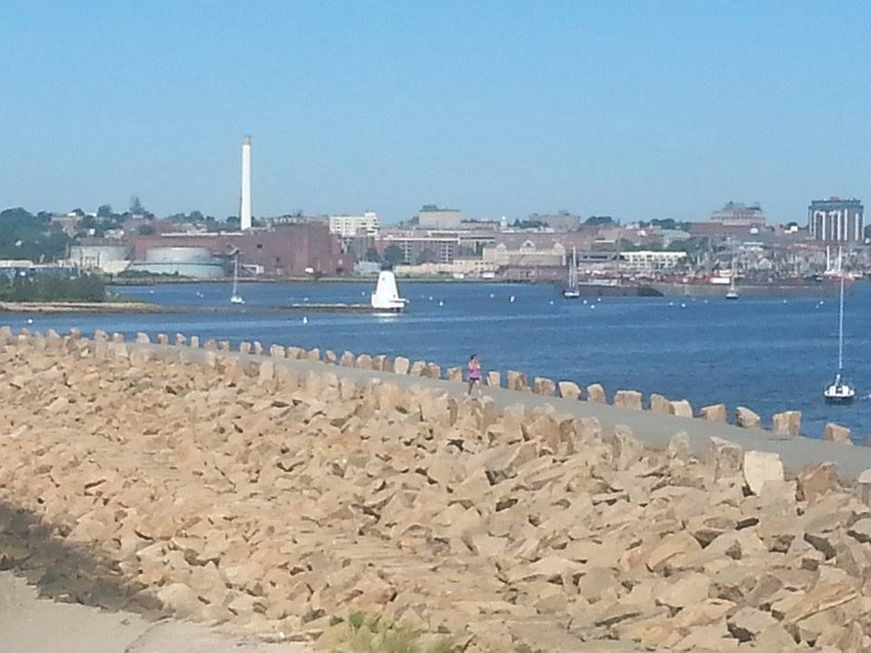
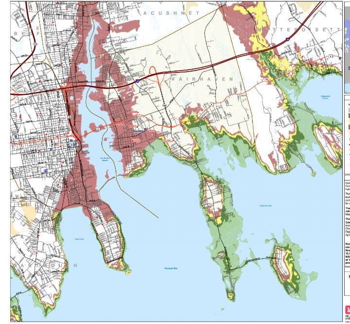
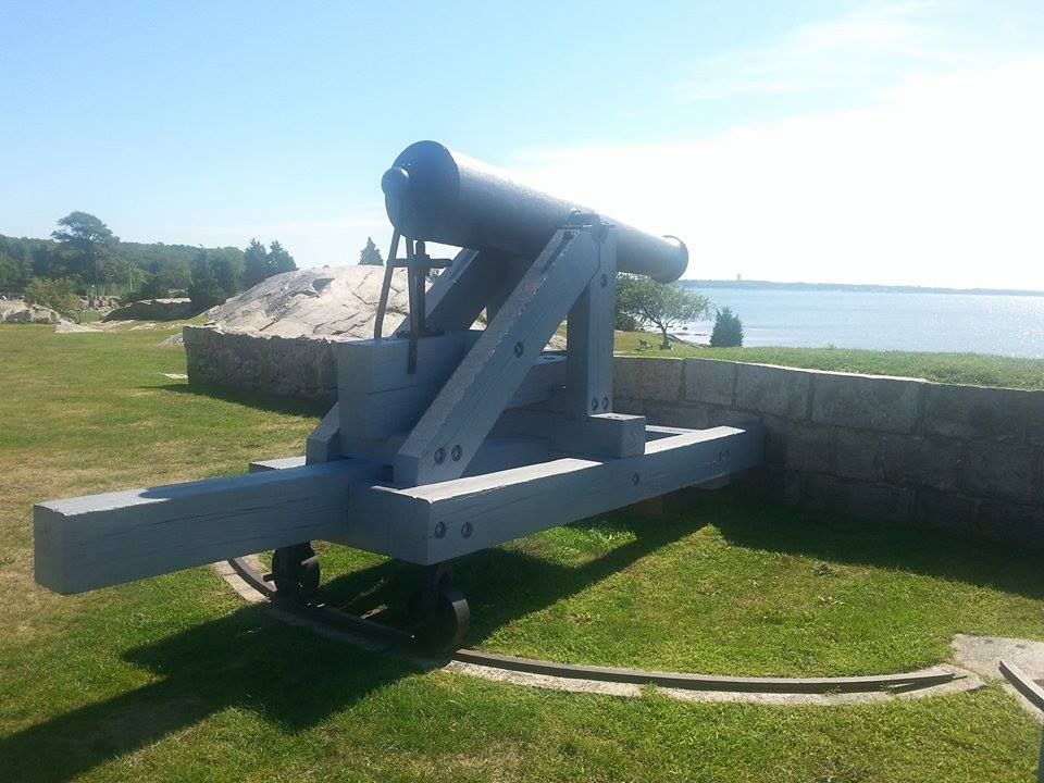
That's a cannon-eye view of the mouth of the Acushnet River, the wet way into New Bedford. You may have been some big bad Brit admiral, but you weren't getting into New Beffuh without dealing with the hastily-mobilized toothless farmer enjoying this same view two centuries ago.

New Bedford and Fairhaven were very, very important to the colonial era economy, as well as to the colonial era military efforts. They were active ports, bringing and sending out goods that drove the local economy. They could host American warships. They were also excellent privateer bases.

Of course, stuff like that is going to attract the attention of the people you are at war with or in rebellion against. That's why little Fairhaven has a Marne-like history, with multiple military activities.


Now, in an era where you can whip out the ol' nuclear football, push a button and obliterate 500000 people on the other side of the world, a fort with a few cannons aiming out at the ocean isn't really a big deal. Strategically, Fort Phoenix is a zero.

However, it is (and was) of great Tactical value, especially back in the Day. If you have to sail what is essentially a big wooden kid's fort into the Acushnet River, a bunch of cannons aimed at you from a hill overlooking the harbor is what stereotypical Native Americans in old cartoons call Heapum Big Trouble.

Yes, you could pretty much dictate what would and wouldn't be coming in and out of New Betty by boat if you could put a few cannons on a hill over the harbor. "A cannon on a hill" is pretty much why the English fled Boston not that long after winning The Battle Of Bunker Hill.

The only way to neutralize those cannon was to hack down a forest grove, build a big floating platform for 45 cannons, sail it halfway around the world and send it headlong into direct kill-or-be-killed conflict with a bunch of whiskey-crazed English hinterland rebels. The English felt strongly enough about the Acushnet River that they took more than one crack at just that course of action.


Fort Phoenix is 2-1 in fights with the British, but the L was a big one.

The fort, nameless to me at least, was put up in some form before the start of the American Revolution... perhaps even to fight the French, I'm not sure. True to the hardcore nature of the South Coast, the fort was involved in several fights almost immediately.

Not a lot of people know this, or at least not a lot when compared to those who can tell you about Bunker Hill, but the first naval engagements of the American Revolution went down off of the South Coast.

The British sloop Falcon appeared off of the New England coastline shortly after the entertainment at Lexington/Concord. Both sides were scrambling to get men and supplies up to Boston for the imminent Big Squabble. The Falcon was able to bag two 'Murican ships in one day. One (the Champion) was full of supplies from Maryland intended for the rebels, and they kept that.

The other, a now-nameless sloop from Nantucket, was given a skeleton crew and some scant firearms. It was then sent to Dartmouth (Fairhaven was still Dartmouth at the time), where the Falcon had heard that a smuggler's vessel was docked. They seized that vessel, and went off to find the Falcon. They anchored off Martha's Vineyard for some reason, about 3 miles apart.

The South Coast was having none of that, and assembled a militia of 30 men carrying every gun they could get their hands on. They jammed this militia onto the whaling sloop Success, armed it with two swivel guns, and set off to kick Brit Butt.

Finding the English off of Martha's Vineyard, they immediately seized the Dartmouth ship without firing a shot. They then aimed both vessels at the British sailors on board the Nantucket ship, and closed before the Brits could flee. Shots were fired, and three Limey Poofters dropped.

The Americans then boarded the English ship. English military dudes were among the toughest on the planet. You could dunk them in Boston Harbor in April, march them on soaking foot to Lexington and Concord, and still go 1-1 against every Patriot in Massachusetts. Perhaps the only tougher people on the seas that day were South Coast whalers... especially if they had 30:11 odds.

They took the ships back to the yet-to-be-named Fort Phoenix, and the South Coast had a W in the books against the Empire On Which The Sun Never Sets.


The English had a measure of revenge in 1778. A series of operations known as Grey's Raid resulted in 4000 Brits burning New Bedford in a blaze that could be seen in Newport, Rhode Island. They then destroyed the cannon in Fairhaven before being run off by militia. The fort was rebuilt, hence the rising-from-the-ashes "Phoenix" moniker

The British took another crack at the Acushnet River during the War of 1812. The troublesome British raider HMS Nimrod made a run at New Bedford during action where they also attacked Wareham.

This story has a couple of different endings, one of which looks suspiciously like that of the Army of Two story where a pair of Scituate lighthouse keeper daughters used a fife and drum behind a dune to fool the British into thinking militia were gathering. In this one, it's a bugle or something.

Others say it was a gathering militia and fire from Fort Phoenix which made the British take a pass on tangling with New Betty. There is even a case to be made for the British feinting at Fairhaven to put the militia there, too far away to race the ships to Wareham that were the goal of the English visit. If that was the plan, it worked like a charm, because the British beat ?ham down like she stole something.

The burning of New Bedford's docks in 1778 was done under the orders of Sir Charles Grey. His kid, the 2nd Earl Charles Grey, is who Earl Grey's Tea is named for... something New Bedford and Fairhaven people should keep in mind when making tea purchases. Some people forget, but not Cranberry County Mother***ing Magazine.


Things were pretty peaceful since then, although the cannons are still pointing to sea.

Now, it's a nice little park on a beautiful bay, perfect for grabbing a bench and reading a book. There is a "Charlie Don't Surf" aspect to this park, as the Brits were misusing the park before we got it and put pretty girls with books under the trees there on a nice late-summer morning.

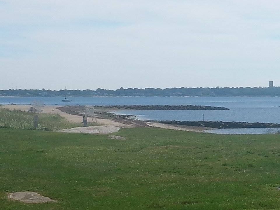
A day spent watching the boats come in is a lot more enjoyable if you don't have to worry about those ships disgorging 4000 British marines to burn New Bedford. A distinctly American primordial urge did jump into me once or twice when I pondered using the cannon against barges and rich people boats that were sailing by, but it passed.

In fact, I had a wonderfully peaceful morning at Fort Phoenix.


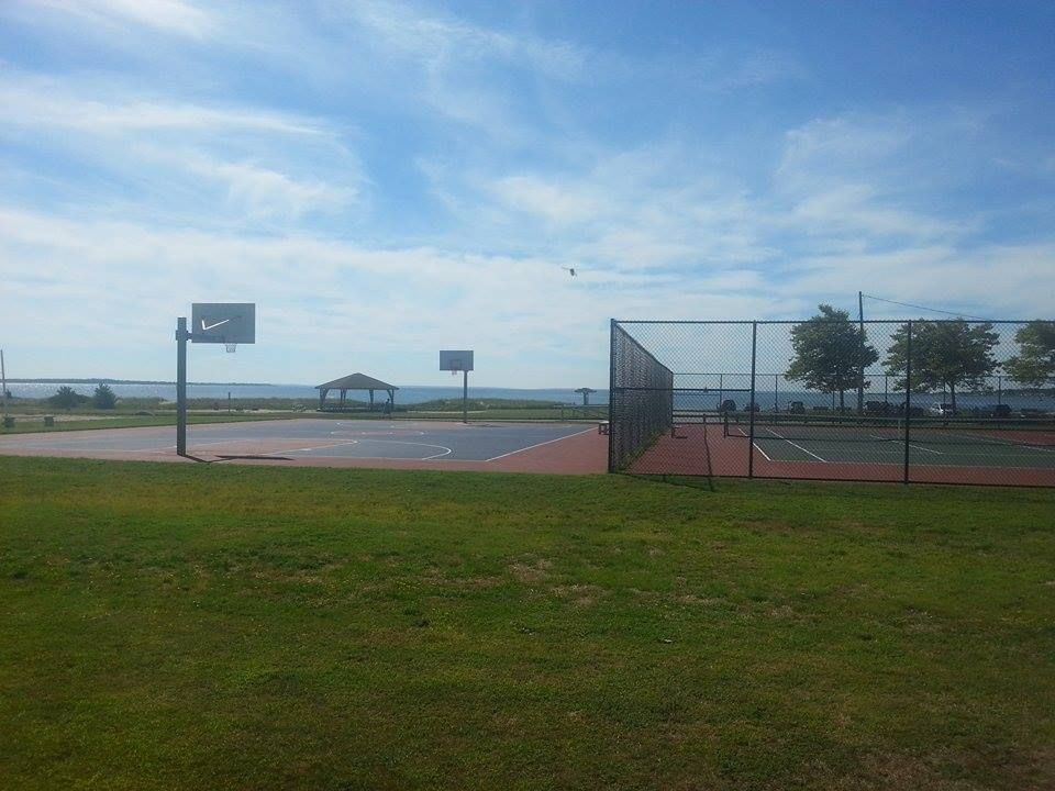
Fort Phoenix also has some of the best views that any baller or tennis player could hope for. I'm capable of putting both a full-court fast break pass or an overenthusiastic tennis serve into Buzzards Bay if I'm not careful.

And One should have their games here, the setting would make for some great camera shots. A bunch of 7 foot basketball players running on the shore around may also deter any British invasions that don't have Led Zeppelin in them.

You get a sense that whichever player runs this court can shoot really well in the wind. I can also sense some "losing team has to dive into Buzzards Bay" bets getting made here now and then. That's what I'd bet.

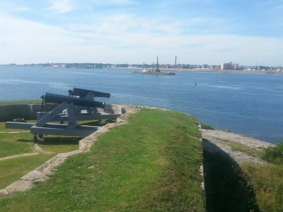
In case you think I was making up that part about using the cannon on yachts....


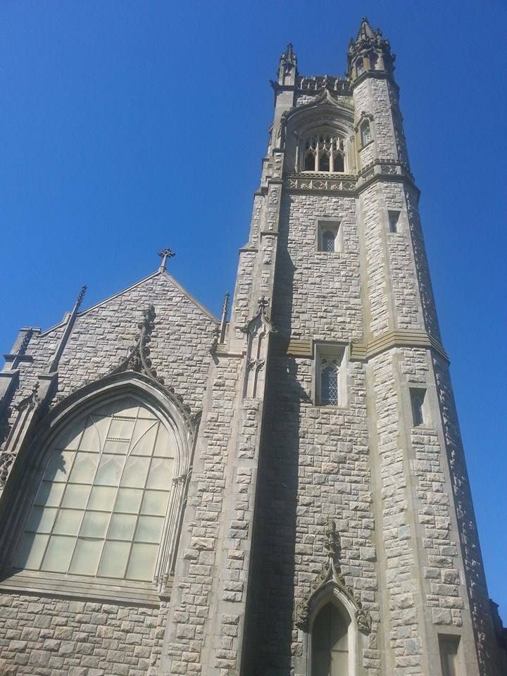
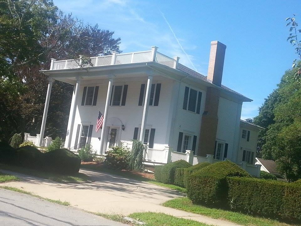
"Nearer my God to thee," especially up in that tower.


It's just like Washington Street in Duxbury, except that if you take a left at the end of Washington Street, you don't end up in New Bedford.


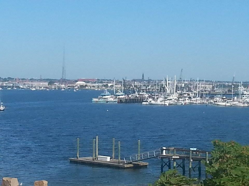
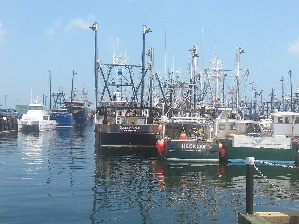
What the Brits were after... OK, a 1778 version of that, but still....

Wednesday, September 9, 2015

New Bedford Hurricane Special


New Bedford is about as salty as it gets, and they get that salting by being exposed to the ocean, both as a profession and as residents.

This puts them in the path of some potentially serious storms.

New Betty had a 5.8 foot storm surge during Hurricane Bob, and one of her fishing boats off of Cuttyhunk reported a peak gust of 182 mph. NB had wind gusts over 90 mph during Hurricane Gloria, 110 mph during Hurricane Donna, and a 20 foot storm surge from Hurricane Carol.

Yup, you can get messed up pretty smooth in New Bedford, really get your hat handed to you. They also have bad hurricanes.

You have to be ready to deal with the sea if you're even thinking of living in New Bedford. The town does their best, throwing up a hurricane barrier to protect most of the city from anything but the worst hurricanes. You can see it up in the lead photo. It protects the Acushnet River, and, therefore most of New Bedford.

What you see below is a Hurricane Inundation Map for New Bedford. It shows what areas of New Bedford would be flooded in a direct-hit hurricane. The map comes from FEMA, MEMA, NOAA and NHC.

It also shows what strength of hurricane (strength measured by the Safford-Simpson hurricane intensity scale) would be needed to inundate certain areas. It does not depict freshwater flooding.


Light Green = Category 1 hurricane... Hurricane Gloria was a weak Category 1 hurricane. Yes, "weak" and "hurricane." are tough words to use in the same sentence, but this is how we Do.

Dark Green = Category 2 hurricane... Hurricane Bob was a Category 2, and he beat up New Beddy like she stole something while concurrently saying something awful about Bob's mother.

Yellow = Category 3 hurricane... only 5 of these have hit New England since the Other White Meat arrived in 1620, the most recent being Hurricane Carol in 1954.

Pink = Category 4 hurricane... we've only had one in our recorded history, in 1635.

Flesh = 100 Year FEMA Flood Zone. This is the hundred year storm you hear people speaking of, although you have to go pre-Colombian to find some in New England history. They (people who study this stuff) use salt marsh soil analysis techniques to study prehistoric hurricane histories, and New England was hit by storms above Category 3 in the 1100s, 1300s, and 1400s. Only the Native Americans saw them.

I don't have a better Art term for the 100 year storm color than Flesh. Blame whoever was running Crayola in 1973.

Here are a few things of note:

- FEMA and company developed these estimates based on the zany weatherman titled SLOSH model of storm surge inundation.

- I'll leave neighborhood-by-neighborhood analysis to you. I'm from friggin' Duxbury, what do I know?

- Once that hurricane wall goes, things get ugly fast in New Bedford. It's funny when the seawall gets topped over on Duxbury Beach, and 50 rich people have to drive the Land Rover up the hill. It's not so funny when 20 feet of water is rushing at 100,000 poor people.

- Just about anything south of the hurricane barrier faces a serious threat from even minor storms.

- Parts of Route 195 will be under Buzzards Bay in a bad enough storm.

- Clark's Cove didn't get a 20 foot boulder wall to protect her people.... so, uhm, have fun out there, folks.

- Cranberry County Magazine strongly advocates seeking out a local old-timer who was in your neighborhood for a major storm like Hurricane Carol. Find out whatever he/she can tell you about what happened to your neighborhood. The folks from the Old School watched hurricanes hit your neighborhood, and most of the FEMA kids haven't.

- New Bedford lost 2/3 of her fishing fleet in the 1938 hurricane.


With all of this stuff we're kicking around, it might make sense to flee New Beige if a hurricane is coming. Which parts of town will the authorities be evacuating?

The map below is an Evacuation map, and it is what The Man will be using as a template when issuing evacuation orders.

The differing colors are for differing intensities of storms, with Pink meaning "Get Out," and Yellow meaning "Get the **** out, now!"

The hurricane barrier pays off here, as only the areas to either side of it would be evacuating in a milder hurricane. Once the barrier is topped, however, it's every man for himself.

Notice that Route 195 and Route 6 get cut off by seawater in several spots, so plan to be Audi early.

New Bedford doesn't evacuate for just any storm, but when they do evacuate, they evacuate several miles inland.


That's pretty much what we have for you today. You should learn it/know it/live it.

If you disagree with something in here, let me know in the comments section. I had some disagreement with FEMA on my own beach.

Check the maps for yourself:

Hurricane Inundation Maps

Evacuation Maps


Monday, August 31, 2015

Fairhaven Hurricane Primer: Inundation And Evacuation


Ladies and gentleman, friends, Romans, countrymen, and children of all ages.... we proudly present to you the Fairhaven Hurricane Primer!

We're here today to tell you what parts of town will flood, how bad of a storm would be required to flood them out, and where the authorities will be evacuating people. This article will make you expert in all that stuff.

To be 100% cool, you want to either A) draw upon your knowledge, gained from you being in Fairhaven for a signature storm like Hurricane Bob, Hurricane Donna or even- if you're 0ld/old- the Great New England Hurricane of 1938, or B) talk to an old-timer who lives near you and has all that Bob/Carol knowledge down in his memory.

Local knowledge is immeasurably important. I study weather, I grew up on a Massachusetts beach, I live on a beach off Buzzards Bay now, I date a Fairhaven girl and visit her home beach once a season or so... and I still don't know Fairhaven in my bones. I have just this morning found out that I can't say the word "Fairhaven" properly. I say "Fair-haven," which audibly makes two words of it. My girlfriend, who grew up on West Island, says "Fa'haven," which is somehow less than one word.

I have a lot of scientific knowledge, and I have some informative maps to share... but in the end, you don't want to finalize your plans before you talk to a wise old local.


This map is what they (FEMA, MEMA, NOAA and NHC) call a Hurricane Inundation Map. It projects where the storm surge will go, and what intensity of storm would be needed to reach certain areas. They are based on the aptly-titled SLOSH model of inundation forecasting.

Storm surge, as you know, is the water pushed ashore as a big storm hits. It is the big killer in hurricanes, and even in history. The worst disaster related to lives lost in US history wasn't terrorists with planes or an earthquake, it was the storm surge associated with the 1900 Galveston hurricane.

OK, I think Antietam has it beat, but I digress...

Storm surge can also be called a Deathflood or Liquid Misery if that gets your people moving quicker. Either way, it's what those colors on the map above are showing. The differences in color depict where a more powerful storm (power = Saffir-Simpson hurricane intensity scale) would be required to inundate an area.

The maps depict a direct hit from a hurricane at mean high tide. They do not and I repeat NOT account for freshwater flooding, river swelling, sewers overflowing, and 7 inches of rain.

Your colors:

Light green = Category 1 storm. Hurricane Gloria would be a good example of a Cat 1. If you worked your way over to Fairhaven from the South Shore, the Halloween Gale would be a good example of a strong Category 1.

Darker green = Category 2. Hurricane Bob was a moderate Category 2 hurricane ("moderate" and "Category 2 hurricane" are tough words to string together, but that's how they roll at the NWS) upon landfall in Rhode Island.

Yellow = Category 3. Only 5 storms of this intensity have struck New England since the Other Man arrived in the 1600s. The most recent was Hurricane Carol in 1954.

Red = Category 4. We've had one storm of that intensity, the Great Colonial Hurricane of 1635.

Flesh = 100 year FEMA estimates. I presume this is the "100 year storm" that you hear about, and we haven't had one in modern (read: "white guy") history. "Flesh" is my non-artist word for that color, and is drawn from my Crayola days, before Crayola realized that black kids liked to color, too. It may be "apricot" or "off-whitey" these days, I'm not 100% sure.

Inundation-wise, Fairhaven is indeed A Tale Of Two Cities (and a few island/peninsula things). You have the area by the Acushnet River. This would normally be a death zone, but they built a hurricane barrier (seen, from what I hope you notice is the Fairhaven side, in the picture at the beginning of the article) at the river's mouth. That protects everything behind it from anything other than a biblical, build-an-ark style flood. We may be wrong, but SLOSH says that only a Cat. 4 storm can get past it.

A storm in the Cat. 4 range wouldn't flood a large % of Fairhaven, but it would flood the area where most everyone in Fairhaven lives. That means we're evacuating about 15,000 souls. We'll get to that in a minute.

The other part of Fairhaven, which is a nice way of saying "the part without the 20 foot stone wall built in front of it," doesn't have it so good. They'll be hurtin' for certain in smaller storms. You can check your own neighborhood (or laugh at the suckers in other neighborhoods) by viewing the links I'll plop down somewhere in this article.

A pretty bad place to be in a storm would be West Island and/or anything off Sconticut Neck Road. The swampy parts go under right away, and an intense storm would start taking houses. A storm of Bob size floods almost 75-90% of these land masses.

If you live on West Island, you want to do this:

- Go find a topographical map, or zoom in really close on the FEMA map.

- Figure out who lives on the highest ground.

- Befriend that person, and butter them up like a biscuit. You want him saying "Come on in" when you show up at his house in a tempest.

- Have an evacuation plan that not only includes "get to the town-designated shelter," but also "get to High Ground Guy's house." If the only road out gets cut off, he may be your best bet.

A few other things stand out when you look at this map.

For starters, a storm of Bob's strength would cross over Route 6 right about where the Stop 'n' Shop is. A storm of Katrina strength would put most of Route 195 by the Acushnet River underwater. Weaker storms would flood Route 6 and Route 195 in Mattapoisett, in case if you decided to think outside of the box and flee East.

West Island is actually East of everything. I'd ask Jessica about this, but she's at work. Keep in mind, I thought that Fairhaven was where Popeye lived until I opened the Wikipedia. Either way, be off of West Island if a storm comes... even a small one.

If you live in the White section of town (hurricane maps are egalitarian, and I have discovered that "white" sections of town are often poorer, while "colored" sections of the map are usually inhabited by wealthier, less swarthy waterfront home-having people), you might think you're off the hook. Remember that these maps only show storm surge, not freshwater or river flooding... and also remember that trees tend to blow over during storms.

In an Andrew-style storm, every single road leading out of Fairhaven would be compromised to some extent. Even the side streets will be under. That means you can't get out, and it means that help can't get in.

You want to be Ghost before then, which leads to our next map:


This is an Evacuation Map. It is what the authorities will use to decide who has to stay and who has to go. You don't HAVE to go, but you also don't want to rely on the cop you were just reading the Constitution to risking his neck to pull you out of the maelstrom.

The map is easier to read than the Inundation map. On this map, Red means "they have to leave," and yellow means "you have to leave, too."

This is the cell phone version of the map, you can zoom in for much better detail using the map on MEMA's page.

Route 240 looks like a good evacuation route, even though you'd eventually get pinned in a bad enough storm.

If you live in Fairhaven or if you plan to vacation there, you should have at least the bones of an evacuation plan in place. Fairhaven, unlike other towns we cover, stands in line for a possible direct hit from a hurricane that approaches New England.

We want you alive. We want you alive for selfish reasons, as- if you are reading this and may return- you are our source of revenue. We want you alive for professional reasons, i.e. "If they listened to us, they'd be alive." We also want you alive for homeboy reasons, as one of the founders of this website is a Fairhaven girl, and we consider Fairhaven to be our spiritual South Coast road office. We also want you alive for regular, kind person reasons.


Hurricane Inundation Maps

Evacuation Maps