Monday, August 3, 2015

Bourne Hurricane Primer II: Evacuation

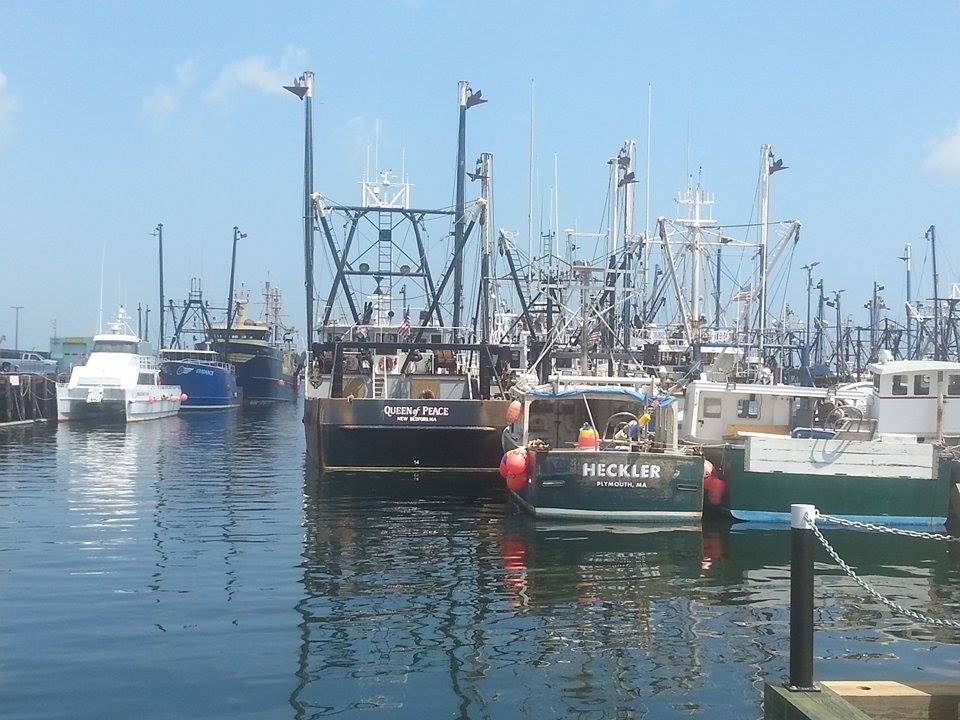
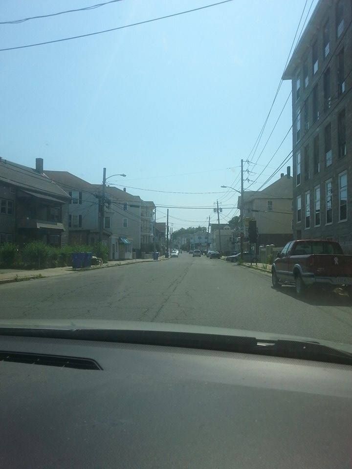
In yesterday's article, we talked about how Bourne would suffer from inundation in a hurricane. As you may have learned, it will flood heavily. If a bit of water gets in the basement, it is only a minor irritant, no big deal in the great scheme of things. If ocean water is getting into the chimney, that's a whole other animal. A big hurricane could render large sections of Bourne uninhabitable.
Unless you have a boat and even if you do, you probably want to make plans that involve fleeing before you can surf into someone's second story window. Chance favors the prepared mind.
I'm not here to say that I know better than you and that you should move when I say you should. I grew up in a coastal neighborhood, and always resented authorities who get all bossy and peremptory about beach conditions to people who live there. Ideally, the police would be asking the residents for their advice. Someone living in Monument Beach knows more about when and how Monument Beach floods than some rookie cop or some Bourne town reporter who might live in Bournedale. He even knows more than people from areas that flood worse, like Scituate or Florida.
What I plan to do is read the Cape Cod Emergency Traffic Plan and look over the FEMA Evacuation Zone Maps for Bourne, Massachusetts. I can then turn 15 pages of text into one lengthy blog entry, and leave you with the resources to find out additional information.
I could waste a lot of time defining the mission statement of the CCETP, but someone has already done that:
The Cape Cod Emergency Traffic Plan (CCETP) has been developed to facilitate the
egress of a high volume of traffic from Cape Cod in the event of a hurricane, particularly
during peak tourist season. Although developed for a hurricane scenario, this ‘All
Hazards’ Plan has been designed to be utilized in a number of emergency situations.
The plan’s main goals are to ensure the safety of the community in the event of
destructive weather or other hazards requiring the orderly but rapid movement of
motorists off Cape Cod and the Islands of Nantucket and Martha’s Vineyard; and
prepare for the temporary sheltering of displaced persons resulting from the evacuation
of potential flood areas and motorists unable to exit the Cape due to the closure of the
Bourne and Sagamore Bridges.
That's a tall order. Let's see how they are going to handle that, shall we? 
The CCETP was born after Hurricane Edouard's approach in 1996. It was five years after Hurricane Bob, and people fled the Cape in droves. Traffic on Route 6 was backed up 18-40 miles (Wikipedia said 18, FEMA said 40), to the Orleans rotary. Eddie stayed offshore, but the spectre of him slamming into a 30 mile convoy of trapped, car-bound refugees was too scary to ignore.
FEMA then gathered up all of the serious people to craft this plan, which I now have the 2013 version of.
It is not an evacuation plan. FEMA feels it is unlikely that an event would occur that would require the evacuation of the whole Cape. It is more of a plan to manage traffic in the event that low-lying areas of Cape Cod had to be evacuated. They anticipate that many coastal residents may just move inland a bit, utilize the emergency shelters offered, or just get off of Cape Cod before traffic emergency conditions go into effect.
I didn't see anything in the CCETP related to an accident at the Plymouth nuclear power plant. Unless the rumors of them closing the bridges to keep Cape Codders out of the way of Plymouth residents as they flee are true, a nuclear event would be a full-Cape evacuation, even if they didn't order it. I'm not sure if they have a plan in place for that, I'll try to find out.
It is also important to remember that the Governor of Massachusetts can order a traffic ban in blizzards. He's probably not above doing it in a hurricane, either. This adds a get-out-while-you-can aspect to any evacuation consideration.
FEMA and MEMA set this CCETP up in easy-to-follow blocs, and I'll work along their outline.
The concept of the CCETP is based upon the need to eliminate the causes of
congestion and keep traffic flowing in the area of the Bourne and Sagamore Bridges
and the main arteries leading up to them, Routes 6 & 28. This will be accomplished
primarily by the application of four traffic pattern alterations that:
1) Prohibit off-Cape access to Routes 6 & 28 at the base of both bridges;
2) Control access to certain exits for the Scenic Highway, Sandwich Road
and along Route 6 to limit traffic attempting to merge into the main stream
of off-Cape traffic;
3) Create flexibility in the opening and closing of exits by the MSP in order
to expedite off-Cape traffic flow across the Sagamore and Bourne
Bridges; and 
4) Detour traffic to alternate roadways in order to reduce congestion.  
Whuh-whuh-what?? That's a pretty heavy opening salvo. 
That going-on-Cape ban will break up families if Mom or Dad can't get home from work quickly enough. I'm not a cop- I'm kind of the opposite of one, actually- but I think I can speak for them when I say that the I-gotta-get-home-and-rescue-the-schnauzer argument for being allowed to cross the bridges during these sort of bans would be poorly met. Even if the cops were allowing it on a case-by-case basis, you would be going to the back of a very long line, and would eventually be telling your story to a man who has probably heard 1000 better ones in the last hour.
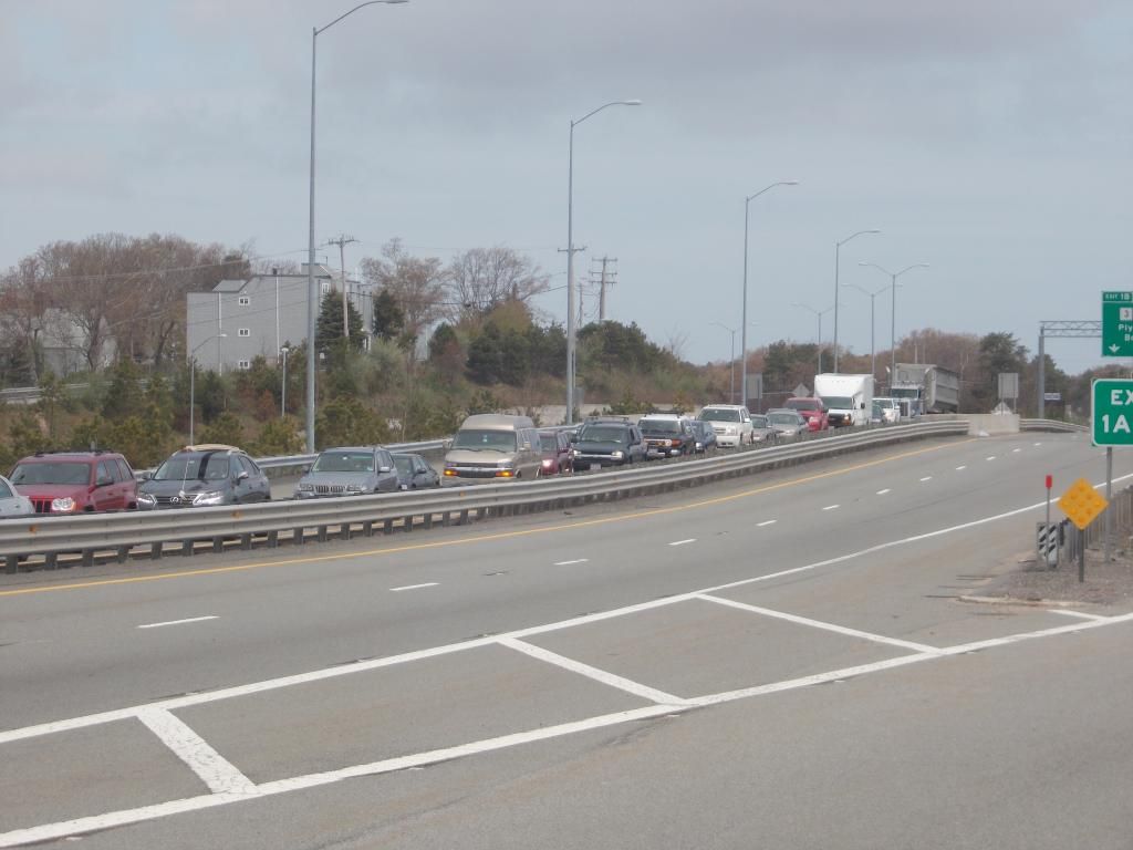
#2 looks like a ban on entering Route 6 at the Christmas Tree Shop on-ramp, which is actually a reasonable idea being proposed for peak-period non-emergency closings by no less than state rep Randy Hunt. That also looks like a ban on dipping out of the Bourne Capeside rotary and using Sandwich Road to get to the Sagamore Bridge.
Sagamore residents may find themselves in a situation where they get 50 yards from the bridge as they flee the storm, only to have to turn around at the blocked on-ramp, crawl through the masses on 6A and 130 back to Exit 2, and try again.
#3 seems to me to be a legal justification for the MSP (Massachusetts State Police, they have an appendix for acronyms in the FEMA report) to close Exits 2-6 westbound on Route 6 to keep people off of low-lying Route 6A. There is also some Route 28 stuff, but we'll get to that with the map talk.
The decisions to do this are made in several stages. The stage of Preparedness is ongoing, months and even years before a storm. The approach of the storm sets in motion the Stand-By Stage, where the wheels of the emergency response are set in motion. If all goes poorly enough, we get the Decision Stage, where the authorities activate the CCETP. This becomes the Execution Stage, where the roadblocks and detours start going up.
It is here that the authorities:
1) Prohibit access to Routes 6 & 28 at the southern, Cape side, base of both bridges;
2) Control access to the Scenic Highway, Sandwich Road and Route 6 to limit 
traffic attempting to merge into the main stream of off-Cape traffic;
3) Allow MSP flexibility in the opening and closing of exits in order to expedite off-Cape traffic flow across the bridges
4) Detour traffic to alternate roadways in order to reduce congestion.
 
The Execution Stage has two components, Traffic Operations (Phase I) and Sheltering Operations (Phase II).
I'm going to cut-n-paste a lot, so bear with me. You want to be hearing this from Them rather than from Me anyhow. It works better for everyone.

Execution Stage: Traffic Operations (Phase I)

PHASE I

Off-Cape Traffic heading west on Route 6W to Route 3 can proceed over the
Sagamore Bridge flyover and continue on Route 3N at exit 1B.

Off-Cape Traffic heading west on Route 6W traveling to the Bourne Bridge to access
routes 25/195/495 will have multiple options:
a. Traffic can detour off Route 6W at Exit 2 in Sandwich, travel South on Route 130, enter the Joint Base Cape Cod (JBCC) (formerly Massachusetts Military Reservation) at the Convoy Gate and follow the detour through Otis AFB and Camp Edwards to Route 28N at the Otis Rotary. Traffic then travels north to the Bourne Bridge and Routes 25/195/495;
or,
b. Traffic can choose to disregard the detour on Rte 6W
at Exit 2 above, and follow Route 6W to Route 3N
where they can detour at Exit 7 in Plymouth and take
Route 44W to the Route 44 rotary in Middleboro and
access Route 495. Traffic can travel Route 495 North
to access Routes 24, 95 and other points north; or
Route 495 South to access Routes 25, 195 or other
points south.
or,
c. As an option, the Massachusetts State Police will
monitor traffic flow and may open or close detours as
necessary. This includes the option of opening the
Route 6 exit ramp (Scenic Highway) between exits 1A
and 1B after the Sagamore Bridge. That exit will
open or close as directed by the MSP in order to
minimize congestion.
Local traffic traveling on Route 6W can utilize Exit 1A after the Sagamore Bridge for
local traffic only. No access to Rte 28/25 via Scenic Highway.

Off-Cape Traffic heading north on Route 28 to Routes 25/195/495 can travel over the
Bourne Bridge and continue to those routes.

The Cape-side Bourne Bridge Rotary will be blocked to prevent cross-rotary
traffic. Plan allows only north-south access to and from the Bridge via Route 28, and
local traffic only via Trowbridge and Sandwich Roads. 
The big Take from this is that you will be detoured through the military base, but not and I repeat NOT via a forced detour. This would be the ideal way for someone in Sandwich who had to get to 495 to go. The first (1A) mainland exit off of Sagamore would be limited to people who could flash Bourne/Sandwich/Plymouth IDs. Drivers hoping to use the Scenic Highway to cut from Sagamore to 28/25 will get denied at the goal line.
Again, we point out that the Cape-side Bourne Bridge rotary will cease to be circular in the CCETP. If you approach it from Route 28, your only option is straight over. Traffic will be allowed to use Sandwich and Trowbridge Roads only if it is local.
But wait... there's more!
Off-Cape traffic heading north on Route 28 which needs to get to the Sagamore Bridge to go North of Route 3 should either:
a) Access Route 151 in Falmouth to Rte. 28 to Rte. 130
to Route 6;
or,
b) Traffic can cross the Bourne Bridge, follow Route
25N, to Route 495N and take detour at Exit 5 (Route
18/44) and follow Route 44E to Route 3 north or
south. 
Local traffic traveling on Route 28N can use Waterhouse Rd. to access shelters at
Bourne Middle School and Upper Cape Cod Regional Technical High School.
Local traffic traveling on Route 28N can cross the Bourne Bridge and use Exit 2 on
Rte. 25W, to access local shelters and local destinations in Buzzards Bay and
Wareham.
Exit 3 (rte. 6) on Rte. 25W will be closed and the Scenic Highway will not be
accessible from the Mainland-side Bourne Rotary in Buzzards Bay, in order to eliminate
cross rotary traffic. 
This is a worst case scenario plan, meaning that it implies a direct hit from a strong storm at peak high tides is necessary to gain the inundation potential and evacuation necessity we're kicking around here.
Phase II involves an even worse-than-worst case scenario where the Bourne and Sagamore Bridges have been closed, most likely due to winds getting past 70 mph. You don't want to be up on a bridge and have this happen.
1. Both bridges must now be closed to all traffic.
2. Rte 6W will be closed at Exit 2 in Sandwich, and Rte 28N will be closed at the Otis Rotary.
3. All traffic between those points and the bridges will be allowed to cross.
The bridges will be closed when this residual traffic has passed.
4. Any motorists still on the road will then have the option of going to designated emergency parking areas in the JBCC and being shuttled to shelter on the JBCC, or seeking their own shelter elsewhere, until the storm passes. 
If you see a block-the-road sized DPW or Army vehicle being moved into place at the Otis Rotary, stomp the gas and get into that last mix of escape-the-Cape cars. Otherwise, you'll be sleeping at the same base they were going to stick those El Salvador kids in.
It will make great differences in the quality of your immediate future if you drive inland until you find a Motel 6 with electricity and vacancies than if you crowd in with 20000 people on a military base. You'll be happy, the family who got your cot at the shelter will be happy, and I- having helped the process along with my work here- will be happy.
If you're skipping through the article and just taking a quick look to plot your getaway, we remind you that this is Phase II of the plan, and Phase I involves blocking off Sandwich Road and the Scenic Highway.
Tow trucks will be in place to move disabled vehicles, and shuttles/parking will be provided for those still on the road when the bridges close. The tow trucks are already contracted for this potential event. They will just tow you off the road, not to your house in Quincy or anything. I can't say if or what they would be charging.
This is the nightmare, as neither you nor me nor the government knows how many people will be trapped behind enemy lines when the storm shuts down the bridges. They don't know how much water they'll need, how much food they'll need, how many beds they'll be short by, how many buses they'll need to move refugees, how long people will have to stay at the base, and a zillion other variables.
Maybe you won't have to worry about that. How do you know which areas of town authorities will be evacuating? For that matter, how do they know?
See below:
Doesn't that look like fun?
Here's how to read this map up above. The maroon areas represent places that would have evacuations (I'm not sure if these are mandatory or voluntary) in a Category 1 storm. The yellow areas are ones that would require evacuation in Category 2 storms. There are also other colors for stronger storms, but our maps seem to just cover up to Category 2. The other colors may just be for Southern states.
You'll notice that Sagamore Beach has it fairly nice, as does Sagamore itself. Just evacuate those beaches, and clear out along the Canal. Bournedale is like a hockey team, with barely any color at all. Just stay off the Canal in Bournedale, although I'll add right here that those colors on the map do NOT represent freshwater flooding potential. I looked it up and everything.
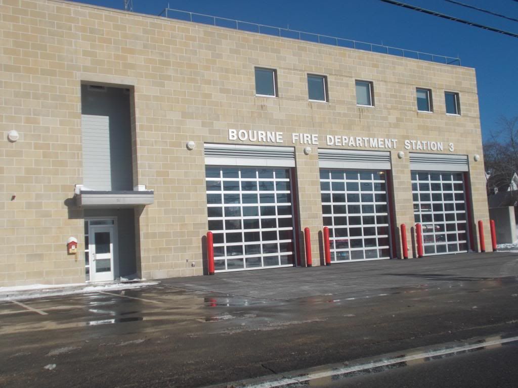
Bourne and Wareham are the very head of the body of water that we call Buzzards Bay, and the village that we call Buzzards Bay is smack dab in the path of the heaviest storm surge. Drive by the Buzzards Bay fire station if you wish to see a sign showing the water level in the 1938 storm, but I can save you the trouble by saying that it is about 4-5 feet high.
All of Buzzards Bay and most of East Wareham/Onset will have to be evacuated in the event of even a minor storm. This guaran-damn-tees that the roads will be jammed before the real Cape Codders get to the bridges.
Crossing the bridges is a bad move. Bourne Village, Pocasset, Gray Gables, Mashnee, Monument Beach and Cataumet all have areas that would have to be evacuated, many of them densely populated. Evacuation will be life-or-death for people in places like Mashnee.
As you can see from the snippets of Falmouth, Sandwich, Mashpee and Barnstable on the map, other towns will also be clearing people out in large numbers. One of the benefits of living in Bourne is that you get a little bit of a head start on the rest of the Cape Codders when it comes time for the quittin' and splittin'. The towns beyond Bourne and Wareham heading inland aren't evacuating. You also get first crack at hotels inland.
There isn't a map for getting back onto Cap[e Cod after a major storm, but we'll try to dig up some information on that for our next Hurricane Primer. We're thinking that Primer III may be History, and IV will be Preparations.
In closing, we'd like to remind you that informed people are likely to make better decisions, and those who make better decisions have a better chance of surviving in an emergency.
If you're reading this article, we definitely want you alive, so that you perform more site visits for us. We also want you alive for reasons of professional pride, i.e. "Well, at least the people who listened to me were OK." We also want you safe and sound in a not-overtaxing-emergency-services sense, and we want you alive in a friendly, neighborly way.

Sunday, August 2, 2015

Bourne Hurricane Season Primer I: Inundation

                                Run To The Hills...

We got ourselves a look at the current evacuation zone and hurricane inundation maps for Bourne, and the results are quite frightening. The Cape Cod Emergency Traffic Plan isn't exactly comforting, either.
Cape Codders often consider Bourne to be almost inland when compared to a Nantucket or even an Orleans. Heck, we're technically on two bays, we're not even open ocean. Cape Cod itself is our barrier beach, and maybe not that much will happen to us if the barometer drops hard. That is the sort of attitude that gets a man and his family killed in Bourne.
I have personally heard an 80-something year old guy talk about houses washing down the Cape Cod Canal in the 1938 storm, about people drowning in their attics as they tried to claw through the ceiling with their bare hands, about 5 feet of water rushing down Main Street, about old-school fisherman tough guys from the Great Depression getting blown off their feet and hurled down the road, and about power being off for months afterwards.

Bourne has an Achilles Heel, and it is the body of water known as Buzzards Bay. Buzzards Bay is sort of shaped like this ^ symbol, and water funnels up into it. It is a distinct geographical feature that we share with Bangladesh, and it leads to extensive flooding.
Hurricanes have storm surges, which are a wall of water that is pushed ashore ahead of/with the storm. If you were standing with your toes at the edge of the water at high tide and a ten foot storm surge suddenly appeared, you'd be under ten feet of water. Imagine how far that water would reach inland in such a situation, and mix it with 6-12" of rain, river/stream overflow and sewer backups to get an idea of what an Inundation Map represents.
We are just as vulnerable to a big storm now as we were in 1938. We are actually more vulnerable, if you think modern medicine, more accurate forecasting (Boston forecasters have blown mega-storm forecasts in 1978 and as recently as 1991's Halloween Gale and 2010's Hurricane Earl, but they didn't know the 1938 storm was happening until it hit them), and greater transportation capabilities are offset by the fact that 170,000 more people live here now and still only have two roads off of the Cape.
We'll get to all of that in a moment, but first, let me hit you up with some links. They'll help you out with the discussion.
CYA, people. We live in dangerous times, and Bourne has been God's punching bag more than once.
We intend to cover Inundation Zones and Evacuation Zones. About halfway throuh the former, we decided that this would be a two-part special. Today is Inundation, tomorrow is Evacuation. If you are a Bourne resident or visitor, this is Disaster Porn right down to your very neighborhood.
I can play with this map all day, and I already have. It tells you what sort of hurricane would flood your neighborhood. They work by Saffir-Simpson scale, a la Category 1, Category 5 and what have you.
While I get the sense that some people would disagree with their findings, few would contend with the level of detail. You can check things not only to your town, and not only to your street, but also to your side of the street.
I had some rookie trouble getting the pics from their site to the Photobucket to here, and I apologize for the blurriness. I also apologize if I cut off the map right before it got to your house, I hate when people do that to me.
You can go to this link yourself and zoom right in on your own home, and I'd recommend doing so. It's always a wise move, getting a feel for the lay of the land around you.
To assess risk in Bourne, we'll go village-by-village.
**Yes, I'm aware that the map has my boyfriend and three Hooters waitresses on it. You get used to it after a while. Sorry girls... he's taken.
Buzzards Bay has 4 borders, and only one of them isn't liquid. Buzzards Bay (water) owns their South, the Canal bisects it, and Buttermilk Bay sits on the North and West. The trouble starts at Cohasset Narrows, out where the Massachusetts Maritime Academy is. They become inundated by a Cat-1, and you might be able to sink a boat by gouging out the bottom of it on the tallest building on Taylor's Point in a bigger storm.
It wouldn't take much of a storm (note: "much of a strorm" = "Category 2 hurricane") to inundate the Belmont Circle rotary at the mainland side of the Bourne Bridge. The rotary Capeside looks a bit better suited for Hell and high water, or at least the latter.
That trouble runs pretty much all from Taylor's Point through Buzzards Bay's Main Street area down to a bit past the Bourne Bridge. A Cat-2 storm would push the flooding over Main Street into the residential neighborhoods, and would inundate the police station, the fire station, and the Veteran's Community Center, which I presume is what they would use as a shelter. A Category 3 would be all-she-wrote for the Armory, which is the last place we could put refugees.
Bournedale, which is all wooded hills, would be untouched, save for the river flooding where the Herring Run meets the Canal. They would most likely lead the Cape in fallen trees and in boulders washing into roads, however. I live along the Bournedale/Sagamore border, on a hill, and that explains the relatively light-hearted tone of the article.
Sagamore and Sagamore Beach are basically Sagamore and North Sagamore. Route 3/6 is generally considered to be the western border. Sagamore Beach benefits mightily from Cape Cod's barrier beach effect, and only the direct shoreline is in danger. That danger would be immense in a bad storm, as there is nothing but sand between Cape Cod Bay and the first houses.

Sagamore would be at the mercy of a storm large enough to overflow the Canal. A storm of Cat-3 would flood into residential neighborhoods, although 6A would be spared up until the 130 intersection. The railroad and the power station would be fish toys in this hypothetical storm. The 3A part of Sagamore would be untouched by the sea.
Scusset Beach is Sandwich, so a Category 3 storm would end Sandwich's presence on the mainland, at least in an above-water sense. A much smaller storm would swallow up all of the revenue-generating parts.
While we're on the topic, I just want it on the Internet somewhere that we should trade south-of-the-Canal Sagamore to Sandwich for Scusset Beach, and I'd throw them a chunk of Bourne Village if they insisted upon it. It makes sense with the maps, with the cops, and with me. It would tie up a lot of loose ends.
Now, this destruction I've served up is bad. However, we have only gone through the mainland, landlubbing part of Bourne. Once you cross the bridges, it gets really dangerous.
Bourne Village is easy to describe. Once the Canal overflows, they are going to lose some houses. Houses on the Cape side of the Canal by the RR bridge would suffer heavily even in a smaller storm. As 1938 showed, the Canal isn't afraid to dine upon a few waterfront homes when the barometer gets low.
Where it gets sketchy is the if/when/where part of water creeping across and blocking Sandwich Road. Sandwich Road would be the Rubicon where a storm might start trapping refugees trying to get between bridges... assuming the bridges are open, as they presently are shut down when winds hit 70 mph.
Monument Beach, Gray Gables, and Mashnee all look to be completely under water in even a Cat-1 storm, with the inundation reaching County Road. These people would have to leave if the storm was coming, and they would, to their benefit, get to the bridges first if they were ready to move quickly when the deal went down
Shore Road looks to be where a regular-bad storm would reach, while worse ones would push past it.
Mashnee shares a problem with other parts of Bourne that we'll discuss in a moment, the problem of already being out in the water before the Inundation calculations start getting calculated.
Cataumet and Pocasset also have large sections of village that are sticking out into Buzzards Bay.
Wing's Neck, Mashnee Neck and Scraggy Neck all become a series of high-ground islands in hurricanes, and those islands are divided by hills in larger storms. Anyone riding out a major storm there is beyond foolish, although I'm sure that some of the hardcore have done it.
If an area like Sagamore Beach gets catastrophic storm damage, someone will eventually get a truck full of water or an ambulance out there soon enough. If the only road to land from where you live is, say, Scraggy Neck Road, they may have to carry your people out on boats or helicopters.
Flooding looks like a sure bet to close Shore Road and Red Brook Harbor Road.
Cape Cod's other towns have similar problems. The entire coast of Cape Cod is subject to inundation. Northern Cape Cod's shoreline is especially bad at Barnstable Harbor and Yarmouth Port, while the sea's push inland against the Nantucket Sound side would move exponentially according to storm intensity.
Route 28 would be inundated from the 28/Main Street merge in Hyannis to South Harwich in a strong storm. 6A gets covered in Sandwich and again in West Barnstable. Route 6 would need a James Bond car from Provincetown to Wellfleet
Just due to the lay of the land and the lack of overflowable rivers, Cape Codders can avoid flooding by moving inland a mile or so. Duxbury or Wareham are far, far more at risk for inland inundation than Cape Cod is. Our greatest danger is the wind, but that's a whole other article.
Again, Cape Codders can generally escape the sea by moving inland, but that's starting to bleed into tomorrow's evacuation article.
Speaking of escape routes....
The South Shore can divided in half. Much of it is protected by Cape Cod, one of America's biggest barrier beaches. This southern South Shore is also a relatively straight coastline, with few Bangladeshian water funnels. From Sagamore Beach to Plymouth Harbor, areas where coastal flooding would reach more than 100 yards inland are few.
At this point, you amazingly have to look to Provincetown for a trend. Imagine that you are a big ocean wind. You are moving from east to west at 125 mph. At a certain latitude/longitude, the first thing in Massachusetts you will hit is Provincetown. Above that latitude, it becomes Duxbury and Hull. Where the wind goes across the water, the storm surge is sure to follow.
Duxbury, Kingston, Marshfield and Scituate are also estuaries, meaning that there is a lot of salt marsh behind the barrier beaches, and salt marshes flood very easily in storms. The end result is all that nor'easter flooding you see on the news. A stretch of coast from Duxbury to Scituate inundates heavily, with houses on Duxbury Beach frequently finding themselves effectively a mile out in the ocean when the marsh floods in even cupcake storms.
The North River is unique in that it would bring coastal flooding as far inland as Hanover and Pembroke. Pembroke is funny because, when you buy a house 15 miles inland, you don't really expect "pumping water from ocean storms out of your basement" to be part of the bargain. However, the South Shore doesn't play fair.
If it makes Hanover residents feel better, a storm bad enough to push water damage to you will probably have blown your house down like the Big Bad Wolf long before.... so, like, no worries. 
The South Coast is the opposite of the sheltered side of the South Shore. They get the surf pushing up from the South Atlantic, and they take the landfall in many cases. Rivers empty there, and all of the land is relatively low-lying. It is where the storm surge smashes into Massachusetts.
A swath of coastline from Mattapoisett to Marion would be soaked several miles inland in a big storm. The Sippican River confluence, the Acushnet River Valley Golf Course (which is just below New Bedfords reservoir) and Tihonet Pond would all get ocean storm water in a Katrina-style storm.
Route 195 would be submerged from about where Tabor Academy is in Marion to the Weweantic River in Wareham. This detour-by-God also occurs in what looks to me like the region that is most at risk during a large storm.
Wareham gets her own paragraph. If the storm gets bad enough, all of Wareham east of Wareham Crossing would be underwater to some extent. Route 25 would be impassable from Wal-Mart to Wareham Crossing. Water could push 3 miles inland, to the cranberry bogs off of Route 25. The entire Cranberry Highway business district would be underwater.
If the storm gets bad enough (Category 3 or higher) and made a direct hit, Wareham would suffer worse than any region of the state. It would take years to recover.
In closing, we just want to remind you that Massachusetts is a dangerous place if a hurricane is coming, Cape Cod and the South Coast are particularly dangerous spots in Massachusetts, and Bourne is a particularly dangerous spot on both the South Coast and Cape Cod.
Residents or even visitors should study those maps, learn them, know them and live them. They should check back now and then, to see if any relevant opinions have changed. This is information you should be fully aware of.
Having your house wrecked by a storm sucks pretty hard, but what sucks worse is getting killed while it happens. We need your site visits, and we care about you... so keep informed.  

Friday, July 31, 2015

Why Not Have An October Date For The Pan Mass Challenge?

Bourne, any given summer day....
I'm about to write an article that I'm sure will be unpopular. It will strike a chord with just a few locals, and many other locals will be against it. Even I feel badly for writing it, but we have to call 'em like we see 'em here in Cranberry County.

The Pan Mass Challenge has to be moved, either physically or chronologically.

The Pan Mass Challenge is bicycle ride that goes across a lot of Massachusetts. Much like the walkathons you did as a kid, bikers (I know "bikers" makes them sound like Hell's Angels, sorry) get sponsors for their trek. The money that they donate goes to The Jimmy Fund, which in turn kicks it towards the Dana-Farber Institute for cancer research. They have made over $400 milly since they started it 35 years or so ago.

The PMC allows people to strike back at a disease that has touched the lives of everyone. In doing so, it encourages a great, energy-saving form of exercise.

What's not to like?

Oh, yeah...


There are several drawbacks to the PMC, some of which involve cars (some with sirens) and others which involve that great hydrogen bomb in the sky, our sun.

We would have to start with the elephant in the room, the traffic. Bourne is where the bridges are, as well as the rotaries, and it is where the worst traffic on Cape Cod is found. Bourne, which is a Division 4 school-sized town, has traffic comparable to central Boston on any weekend day.

It's bad enough that people in Bourne post a traffic waning every weekend morning on Facebook to the effect of "Don't leave your village." If you do, you enter a strange time warp where "a quarter mile drive to the gas station" may become a two hour-long trip where even teetotalers find it necessary to just pull over into the nearest tavern for 8 or 9 drinks.

If you went resident-to-resident and asked them what is the last thing that Bourne needs on an August weekend, the dominant answer would be "more traffic."

The PMC is a huge event, perhaps the largest of her kind in America. It all falls on Bourne, during what should be a peak of the tourist season. It takes roads that were already overtaxed and makes them essentially impassable. And it brings a different, less-spendy type of visitor than we are used to.

Instead of tourists with SUVs full of families who will need to be fed, entertained, gassed, housed and other things that leave money in the town, we get people on bikes who might carbo-load twice a day. They will then- exhausted- check into hotels that would have been booked full anyhow, and sleep away the hours we need them to be power-drinking in our taverns.

Other than families and supporters of the bikers, there is a negligible audience factor. No one is going to cheer on a wheeled walkathon, even one with Tom Brady in it. That's not to say that the PMC people shouldn't be cheered for- even the author of this slam piece feels that they are admirable. It's just that they won't draw a crowd, a crowd that would patronize our businesses. The PMC actually will drive those kind of visitors away.

That's why they used to have the Scallop Festival in September or October, kids... otherwise, it snarls traffic in the town to a crawl.


On top of all the lost commerce the bikers inflict upon us, they also overtax our emergency apparatus. We'll have to put extra cops on to deal with the bikers. Those cops will be waving traffic along, and citizens may have a bit of a wait if we need one for regular cop-like reasons... and that ETA is before we factor them having to weave their way through our gridlock traffic.

Our EMT service will be busier than a paramedic in a town full of weekend warriors heat-stroking themselves on an 85 degree scorcher of a summer day... oh wait, I'm being redundant.

That's why they have the Boston Marathon in April, kids... endurance events start to kill people in the summer months. The only time reasonable people host these events are spring and autumn.

Again, citizens who pay taxes all year for things like "availability of EMT service" may be in for a bit of a surprise to learn that their needs may not be met because all of our EMTs are giving IVs to people who really should have waited for October to take on an endurance event.

Again, like with the cops, any estimates we give on how long it will take an ambulance or- God forbid- a fire truck to get to a Bourne citizen's emergency here are given BEFORE we factor in them crawling through the bumpa-to-bumpa to get to you.


Of course, it's all for a good cause. The PMC makes $40 million a year for cancer research, raising awareness and letting people have fun while helping a good cause. Of course, these benefits can only be gained by having this particular race at this particular time in this particular town. Otherwise, they wouldn't make a red nickel. Anyone who says otherwise is pro-cancer and anti-charity.

Really?

I doubt that the people who presently ride scores of miles and donate millions of dollars would be put off from their efforts if the event were switched to October. There may be a guy somewhere who will only donate to cancer research if people ride bikes in Bourne on an August weekend, but he's probably an ass clown.

There may also be a guy somewhere who was totally unaware of cancer before someone diddled by him on a bicycle. No, check that, no such person exists. The awareness-raising is a myth.

We do have open dorms at the Massachusetts Maritime Academy, just like they do in far greater numbers at Bridgewater State University and UMass-Dartmouth. I probably don't need to add that any college listed there that isn't a Maritime Academy doesn't lay across one of two ways on and off of Cape Cod during a summer weekend. I'm sure that UMass-Amherst, with all of the disposable-income kids away for the summer, could use the influx of visitors that they- unlike Cape Cod- would be incapable of luring in summer months.

I'm no urban engineer or highway scholar, but I do wonder if- on a person per person basis- less people would be put off by making a detour on the Mass Pike and isolating a 20 mile stretch of Irrelevantville for the bikers to pedal back and forth along in perfect safety than by shutting down the two roads that fill and empty Cape Cod.

Cape Cod is the wrong place for this event, at least in August.


Why not move it to October?

Like we said before, they have the Boston Marathon in April because it is too hot for endurance events in the summer. That also applies to the PMC, even before we remind you that the roads on Cape Cod tend to get jammed in the summer.

Just remember that I spoke of the safety of the bikers when I start making jokes about running over 5 of them as I look down to light a smoke. The safety issues for the bikers concern both heat exhaustion (85 degrees and blistering sun forecast for both days of the race, BTW) and exposure to Cape traffic. The PMC is big news in Massachusetts, but I doubt that it even makes the newspapers in Connecticut and New York, where half of our drivers will be coming from this weekend. They will drive very much like people unaware that some fool decided to have a wheeled walkathon along both of Cape Cod's main roads during one of the 10 top traffic days of the year.

Don't give me that "people take their vacations in the summer, and can only do the PMC then" nonsense. It's a weekend event, even Bob Cratchit would be able to get time off for it, especially if he is advertising for Scrooge's company as he does the event. If Ebeneezer demurs on that, Bob can burn a sick day.

In October, those roads won't have anyone but locals on them. There will be numerous hotel rooms available, so the cops won't have to chase stragglers off the Canal benches all night. Temperatures will be in the 60s, delightful weather to go pedal something around. The 200 or so people who can fit into MMA's dorms would be displaced, but they would have hotels offering cut rates to lure them in to what would then-and-not-in-August be unrented rooms. There's really no good reason to have the PMC in August instead of October.


Don't think that saying "They should have this event in October" makes a person pro-cancer. The guy behind the keyboard lost both of his parents to cancer. He also probably has his own dance with the Die Slow coming with a few thousand more Newports. He knows the stakes, perhaps better than you do.

The author is also not a man who dislikes charity. If you really, really hate this article, hang onto the anger until Christmas season, and you can walk right up to him outside the Christmas Tree Shoppe and pop him in the jaw as he stands outside for 10 hours a day raising money for a church charity. He hates charity so much, he had his lips freeze together once working for one.

The author does not confuse "move the event to October" with "the author hates the event." You shouldn't do so, either. He's also not writing this because he dislikes cycling and thinks that adults on bicycles look silly, even though he does feel that way.

That's not a bad resume for an agnostic pro-cancer guy who hates charity.

So, why am I writing this article? If you already know that, move on to the "So, what should we do about it?" question.

The author, doing some tireless charity work with his three nieces...

Bourne and Gettysburg have one thing in common. Both are little Nowheres that all the roads from Somewhere meet at. That leads some Big Fish into the Little Ponds that are normally towns like Gettysburg and Bourne, and it's never good for the town.

To an extent, the towns are set up to handle the influx. Bourne has hotels, gas stations and other amenities that a small town away from an ocean wouldn't have. Of course, "we bring tenants to hotels that already had tenants" is a poor argument for cementing this mess in August.

However, an October PMC would be a boon to the town. You'd have businesses who are just starting to feel the loss of summer dollars get a weekend rush in October. You could have the town really get behind the effort, angling their businesses to provide things to do for the bikers when they are unhorsed. You'd have cops and EMTs who aren't already overworked policing the town available to provide security for the event. Restaurants of the seasonal bent would be able to empty their inventories, hotels would offer cheaper rates, and every tourist trap would get one more chance to snap shut on those ol' summer dollars before the chill of winter set in.

It would benefit the PMC, as well. They'd be the only game in town, with neither Cape League games nor day-tripper traffic too weave through. People who avoid participating in the event because they don't wish to enter the Trafficpocalypse that is Bourne on a summer weekend may come out for the cause. Their riders wouldn't be struck down by high-80s temperatures or angry and confused New York vacationers. They might make MORE money than they already have.

There is no coherent reason that this event should be held now instead of in October. It presently is a drag on the town, an error that is multiplied by the fact that it would be a boon in October. Don't hate the guy who tells you that the emperor is nude.


Tuesday, July 28, 2015

That Ol' South Coast, She Don't Play Clean....

New Beffuh
Before anyone starts hating The Kid about this, know that I'm a resident of Buzzards Bay. I'm from the South Coast.

Sure, Bee Bay is part of Barnstable County. Yes, I know that we have clam shacks, summer rentals, Cape traffic, and that life gets Mighty Different after Columbus Day.

It doesn't matter, though. Buzzards Bay is the extreme eastern end of the South Coast. I wouldn't admit it if I weren't so sure it was true.

I wanted to lead off with this because we're going to rough up the South Coast a bit today, and I wanted everyone reading this to know it was being done with Love. I believe in the South Coast enough to move here. When I say things like "the armpit of Massachusetts," know that it's just one South Coast brother kidding another one.

The Real Cape just produced a scathing analysis of certain trends in their article "Wareham Coming In Hot As The 11th Worst Place To Live In Massachusetts." They use the wiggle room all Gateway area writers use to work ?ham into a Cape Cod article. I used to do it all the time on Cape Cod 2Day. "It's the Gateway," as a Celtics cheerleader from Wareham once told me.

I'm not doubting Wareham's spot in the top 11, which is headed by New Bedford and also includes Fall River, Gardner, North Adams, Fitchburg, Ware, Brockton, Southbridge, Taunton and Athol. They crunched a bunch of numbers like crime rate, school quality, things to do, transportation, culture, etc.... and then they done disparaged dat ol' South Coast!!

Here are my quick thoughts on each non-South Coast town.

Gardener... part of the FAG corridor down Route 2 (with Athol and Fitchburg), this is an industrial mill town in the post-mill era. Yes, I know it's "Gardner," I just like to tweak noses now and then. Gardner is the home of the World's Largest Chair, in case you're arguing about that at the bar as you read this.

North Adams... Nor'Addy is the smallest city in Massachusetts. Following a theme you'll see repeatedly in this list, North Adams used to be great when the mills were working. The mills aren't working now, however...

Fitchburg... Even though it's a rotten mill town in decline, I'd keep Son Of A Fitch off the list because A) they make UTZ potato chips there, B) it figures prominently in both the Harry Potter canon and Return To Peyton Place, and C) there is no third reason. Worst "picture of downtown (insert town here)" picture on all of Wikipedia, too. Kowloon, China is second. The Walled City ranked first before the city was demolished.

Ware... With 9800 souls in the middle of nowhere, they must have had to work hard to not call it "Where?" Care to guess if the 1850s mills are still prosperous? There are several maps of the region that depict the town name merely as a question mark (?).

Brockton... Club Homeboy should be higher on the list. You could put on a money shirt and walk through Ware unmolested. Just wearing a shirt is offensive in some parts of Brockton. It is very funny that only 15 miles stand between Bee Rock City and tony Duxbury (which it used to be a part of, Myles Standish essentially founded Brockton), but that's about how it works. Brockton is the only representative of the South Shore on the list, but it is less South Shore and more an entity unto itself. Currently ranks 41st among American cities in violent crime, which isn't bad for a town that is historically West Duxbury.

Taunton... Some discussion went down before we removed Brockton from the group of South Coast towns we'll discuss in length later in the article, even though Brockton isn't South Coast. Taunton is also off Wikipedia's list, even though it's just a Berkley away from Fall River.

Southbridge... Just across the state line from Woodstock,CT.... known as "Honest Town," The former Eye Of Massachusetts and her optical factories faded into insignificance when the Mexicans or Chinese started making glasses cheaper. Worry you not, they still have a sizable population of displaced Puerto Rican and Laotian factory workers hanging around town.

Athol.... I drove through this town on my way towards visiting girls at Franklin Pierce College in NH. It looks like the kind of place you'd see a Yeti. Athol may not deserve her spot on The Real Cape's list, as the material they are working with gives Athol over 50,000 people when, in fact, the town holds 16,000. My favorite thing about Athol was a WBCN/Billy West skit about Peter Falk visiting various New England towns. It made no sense at all at first when he went to Athol... "Wow, look at the firehouse... Hey, they have a post office!" The joke was in the last line of the skit... "This week... Falk, In Athol."

Say it aloud a few times, lisp if you have to....


The fun part here is that the South Coast has a pretty good grasp on some of the top spots, outpacing numerous North Cambridges and Lowells. Lynn, Lynn, the city of sin... didn't/couldn't get past the Sketchy Sketchy South Coast. Little San Juan Holyoke didn't make the list. No Chelsea, no Murderpan, no Dot, no Gloxbury, no Winter Hill, no Mishawum.

Does the South Coast really merit a 1-2 punch on the top spot, and a few other towns wedged into the Top 11? How did it come to this?

Fall River, Wareham, Brockton, Taunton and New Bedford have a coastal version of the problems that Gardner and Fitchburg have. They were built to support industries that are no longer profitable in the manner they were run back in the proverbial Day.

Fall River was all about textiles, especially whatever Print Cloth is. When the states who grow the cotton realized they could build the textile machines in their own states and cut out the middleman, Fall River went into decline. There's also the small problem of the town's most famous resident being America's only axe murderer with an eponymous nursery rhyme.
Fall River

Fall River also got a cut out of the New York City garment trade, but that fell victim to globalization and Kathy Lee Gifford having skirts stitched together in Asian sweat shops... which is the same thing, but I digress...

Brockton has a similar story, but the industry was shoemaking. New Bedford was, at various times, whaling or textiles. Taunton was iron and silver. Wareham, to my knowledge, was Tourism.

In each case, a dominant industry failed, and the town went into economic decline. With that, you get the crime, the shoddy schools, the crumbling infrastructure, mass (Mass?) unemployment and, in the end, Exodus.

There's not much race to it. Blacks, Hispanics, white folk... they all trend towards poverty when the factory closes. Economic decline is color-blind, although she does like to keep a nice mix.

Depending on if you include Brockton in the mix (and it is very much like New Bedford, and very much not like her neighboring towns of the Bridgewaters, Avon, Whitman and so forth), the South Coast holds 5 of the top 11 spots, including the two 2 spots.

Wareham is a unique case here, although her story is just a different take on the same Mill Town concept.

Wareham, and Buzzards Bay (town), used to be the hosts of the only road that led to the Bourne Bridge. They lined that road with gas stations, clam shacks, mini golf, ice cream, antique shops, restaurants, package stores and anything else that could suck money out of a tourist. The towns fattened on this trade, and Tourism is primarily why mainland Wareham and Buzzards Bay are often considered to be part of Cape Cod.

Then, they extended Route 25 to the Bourne Bridge in 1987. There was no need for someone going to Cape Cod to have to slog through Wareham and Buzzards Bay. The tourist dollars flowed onto Cape Cod without the Gateway getting their cut. Even the road itself killed jobs (and, more importantly, industry), as the highway rambled through the state's best Cranberry growing region.

Once the clam shacks closed, the waitresses had no money to spend at the supermarket, which also closed. The supermarket clerks had no money to spend on mini-golf, so the mini-golf folded. A plaza with a Wal-Mart and a Staples stemmed the bleeding for a while, but they both moved into more prosperous West Wareham as soon as the land was zoned.

Pretty soon, all that was left of the Tourism trade was the traffic gridlock as people drove around Wareham and Buzzards Bay. As the villages spiraled into decline, anyone with money left moved away. Businesses closed, and no new ones moved in.

Soon enough, only a hard-working criminal element kept them in the news at all, and Wareham slipped towards ?ham.

Enough of the South Coast abuse. Let's all kick back and learn something, shall we?

South Coast Trivia

Wikipedia scores the South Coast as:
Fall River

- While I may be stretching it to include Buzzards Bay (village) in the South Coast, other people feel that the Rhode Island towns of Tiverton and Little (Straight Outta) Compton are sort of honorary members of the South Coast.

- Taunton gets left out. No love for the Triple S of Swansea, Seekonk and Somerset, either. I assume they are grouped with more northern towns like Attleboro and, uhm, whatever is next to Attleboro.

- The term "South Coast" has been traced to weatherman Todd Gross, who came up with the term to differentiate between Southern Plymouth/Bristol County and the South Shore. Why the South Shore, which faces East, is called the South Shore is beyond me. Either way, we have a South Shore and a South Coast now. People in the region actually got angry when the New Bedford Standard-Times began to use the term.

- The adoption of the South Coast moniker sort of displaced the formerly-used Greater New Bedford designation. A media blitz accompanied the adoption of the term, pointing out that the Sow Co had "the Cape's climate, better infrastructure, and cheaper land prices."

- "South Coast" and "Metro West" are relatively recent terms, invented by local media. "MetroWest" displaced "Middlesex" among the locals, again with some difficulty. It was invented by the guy who used to own the former Middlesex Daily News.

- I'd guess (and might be wrong) that "Cape Cod" and "Plymouth County" are the two longest-standing regional names.

- The South Coast is an odd mix of larger and smaller towns. You can light a smoke in downtown New Bedford, the worst place in the state, and pitch it out your car window 8 minutes later in rural, bucolic, backwater Acushnet.

Mattapoisett
- We have discussed the Irish Riviera at length in this column, but the South Coast is very much a Little Lisbon, a Baby Brazil. The corridor running between Providence, Fall River and New Bedford has the largest concentration of Portuguese-Americans in America.

- Massachusetts leads America with a Portagee population of 392,000. MetroBoston has 192K of that number, and the South Coast has a lesser-but-major share of the remainder. Massachusetts is 6.2 Portuguese, while Rhode Island leads America at 9.7%.

- Fall River is 37% Portuguese, and 8% Cape Verdean.

- New Bedford is over 33% Portuguese, 10% Puerto Rican, and almost 9% Cape Verdean.

- Wareham is 87% white, with an unknown number of Portagee. I did see a figure of 9.29% somewhere. They represent hard enough to host the Cape Verdean Festival every year.

- The source that coughed up 9.29% for Wareham ascribed Fall River over 43%, and New Bedford over 36%.

- Taunton isn't really South Coast (it lays a bit North of the area proper, and is the seat of Bristol County), but we consider it to be a fringe SC area, with a stronger grip than Brockton. If you consider it South Coast, I'm cool with that. If you think it stands distinct, I can see your side, too.

- The northern South Coast touches upon the southern base of the Bridgewater Triangle.

- New Bedford, trying hard to take the crime title away from Fall River, has no criminal to match Lizzie Borden (who, I might add, was not convicted). They compete by volume. The New Bedford area had her own serial killer in the late 1980s. You couldn't get out of your car to take a whizz on Routes 195 or 140 without stumbling onto some prostitute that he had killed and dumped there. He was never caught. New Bedford is also where Big Dan's Tavern was.

Hey, she's tough... she's a harbor chick
Most Famous Citizens:

Fall River: Lizzie Borden, no contest

Wareham: Geena Davis, also winning in a rout. #2 is Pebbles from JAM-N 94.5.

Westport: Pixies singer Frank Black edges out abolitionist Paul Cuffee, ESPN girl Wendy Nix and Hillary from the The Fresh Prince of Bel Air. Westport has a disproportionate talent-per-population ratio for a small-town backwater, although Marion reigns the roost in that regard, as you will see in a moment.

Rochester: Joseph Bates (founded Seventh Day Adventist Church)

New Bedford: Frederick Douglass

Mattapoisett: Oliver Wendell Holmes lived there is some capacity

Marion: Claiming 4000 souls, this town has been a temporary home to FDR, Grover Cleveland, Admiral Byrd, Dom DiMaggio and Geraldo Rivera. It is also the port of Benjamin Briggs, last Master of the doomed ship Mary Celeste. I'm leaving out several other semi-famous people.

Freetown: Former Miss Massachusetts and current NECN newsie Jackie Bruno.

Fairhaven: A good three way race between Gil Santos, Joshua Slocum and Christopher Reeve (had a sailboat moored in Fairhaven).

Dartmouth: Choose between died-there General Phillip Sheridan and summer person Tea Leoni.

Acushnet: Doesn't have a notable resident list on Wikipedia, but Herman Melville once sailed on a whaler named Acushnet. That's close enough.


Monday, July 27, 2015

Barnstable County Fair 2015

This year's Barnstable County Fair was a blast. There were many things to do and see there. It was nice to see some returning vendors and acts and also nice to see new ones, The Barnstable County Fair is located in Falmouth Massachusetts (Cape Cod, MA).

The BCF has been coming to town since 1844. It was originally a livestock/crafts sort of fair, and that is still a big part of the show today. They didn't have electric ferris wheels or anything like that back then, maybe they used horses or something, I have no idea. The big draw early on was the merry-go-round.

Other than a brief shutdown during WWII, the fair has been going strong ever since. They have since incorporated spectacuar rides, and have brought in performers and other acts.

One of my favorite acts was Wacky Chad with his Pogo stick tricks. He has been on America's Got Talent... twice!


The animals and petting zoo have always been a nice thing to look forward to. This cow is trying to go viral, I saw him practicing that look in front of the mirror before I shot.


Who wouldn't want to feed a goat or a yak out of the palm of your hand? 


If you were at the the fair you may have noticed the baby animatronic T-Rex. He was about half-done eating this old guy when I asked him to pose for me.


The Three Dog Night performance was spectacular, my phone's video recorded it in poor quality. I guess you'll have see them in person to get the real deal. We were so close to the stage that we could feel the beat through our entire bodies. I was so psyched to see them perform in person. Their hits include: "An Old Fashioned Love Song" featured in the video below, "Joy to The Word," "Shambala" and many, many more.


We can't forget about the rides and the amazing view of the fair from the Ferris wheel. 


I saw a little bit of the Lumber Jill's Performance - wish I had a better view (I was too short to see over everyone else). And I was really hoping to see the Willis Clan

But overall, this years fair was awesome.