Quint wasn't talking about Cape Cod when he laid down the facts in Jaws, but he may as well have been. We are a summer community, and we need summer dollars, or we'll be on the welfare all winter... something to that effect.
However, money grows green in all seasons. Why not make some Autumn money? Does money really grow on trees?
Autumn money is sort of up our alley. We're the Thanksgiving ground zero for America. We have quaint little cranberry bogs scattered all about. As long as you don't go swimming, those beaches are fine on a warm autumn day, even in November.
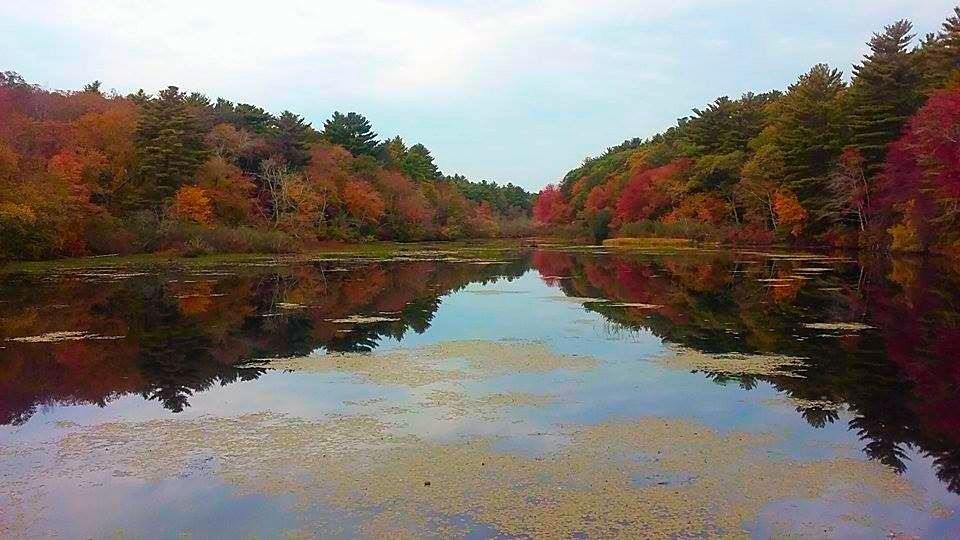
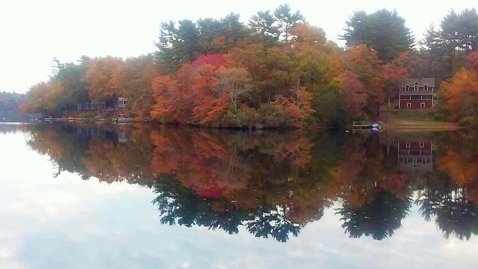
We also have foliage. Now, when you think of foliage, you think of New Hampshire, Maine, Vermont and even the Berkshires. You don't really think Cape Cod.
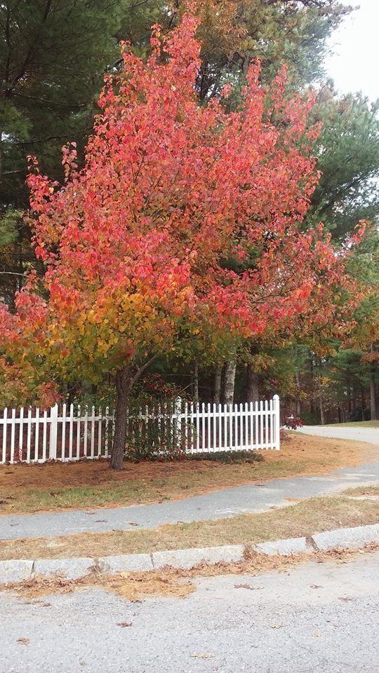
Middleboro certainly doesn't think so, and they planted this tree to prove it to you.
That's a shame, because we're the last region of New England to experience peak foliage. Maine trees are bare when we're just getting to the height of our season. Cape Cod, if you look at a foliage map, peaks right around when a Kentucky-Alabama swath is peaking, and those states don't do foliage like New England does.
We should be better known for it. Everyone who saw the beautiful foliage shots from New Hampshire on the news, and who then said "We should drive out in the country and see some foliage," but who then procrastinated... those people should be looking at Cape Cod as a Last Resort.
People aren't stupid, so there must be good reasons as to why we don't get Vermont's autumnal swagger. For starters, we lack the forest cover that northern New England has. We also have the wrong sort of trees.
That second problem can be fixed.
Trees drop acorns and so forth, and those can be harvested. Plant them in the ground, and they'll grow a version of the tree that they fell from. Come autumn, those trees will put off the same color that their parents did.
It's so simple, it pretty much takes care of itself.
I called a few tree farms, and the big difference a tree would see in Massachusetts as opposed to New Hampshire is that they would go into seasonal color changes later. Trees that turn in early October in Falmouth, Maine would have to wait until November in Falmouth, Massachusetts.
Let that fact roll around in your head a bit as we figure out how to make money off of this.
Cape Cod is a series of tourist towns, and the weakest link in the chain is Bourne.
Bourne is very nice when compared to Fitchburg or Holyoke, but it's in last place as far as Cape Cod tourism goes. Bourne has nice people living there and has a lot to offer, but we have Bay where everyone else has Ocean, so we sort of lag behind the other Cape towns when it comes to tourism.
There's not much we can do about the Bay, but the Cape Cod Canal is another animal entirely.
The Cape Cod Canal is an ocean river, The canal is 7 miles long, and it is framed on each side by a wonderful bike path. These paths are framed by a thick row of trees.
These trees tend to be pine, Pine is lovely, but it doesn't do much during Autumn beyond dropping pine needles into that gap between your windshield and the car hood. There's nothing wrong with pine, but no one is driving out from New York City to look at it.
So, we have several problems: a weak sister of a Cape Cod town, a poor foliage reputation, a short tourist season and a boring pine Canal.
If we could somehow wipe that slate clean, even if it takes a few generations, we could maybe get this town back on a payin' basis.
That's why we should do whatever it takes to plant ten thousand acorns along the Cape Cod Canal. Not just any acorns, either. We should take acorns from trees that produce spectacular foliage.
I won't make it to the mountain top with you, but once those acorns become trees, we'll have the premier foliage display in Massachusetts and perhaps New England.
It's all there for the taking.
New Hampshire and Vermont have it easy. They didn't plant those trees, and they only still have those trees because not enough people want to move to Vermont to warrant clearing space. They don't deserve that foliage.
Bourne, on the other hand, would aggressively select their trees. We'd be Mother Nature on steroids, ruthlessly saying which tree will grow where. With the tree huggers appeased by the planting of ten thousand trees. we'd be free to play God yet again with the Cape Cod Canal area.
If the right people (and I'm not one of them, I become useless as anything other than a laborer after the Idea Stage) are running this, we could have a ridiculous run of foliage down each side of an underutilized Canal.
Planned by experts, planted in rows fronting the Canal and dropping acorns of their own each year, the Canal Forest would both own and pwn the rest of New England as a foliage destination.
Bourne would then have some nice assets to work with.
We'd have a sweet location, maybe 25% of the drive someone might have to take to get to the Maine foliage. We'd have foliage that would kick in during the run-up to Thanksgiving, which also draws tourists into the region. We'd have hotels, gas stations and all that other stuff that leeches money out of tourists.
Most importantly, we'd have our ridiculous multi-colored Canal. The canal has plenty of parking, would feature easy access, boasts of long-but-not-too-long walks and would look like New Hampshire would look if it were planned.
You could probably sell boat tours of this new foliage run, with the added bonus of three bridges and one power plant. I think they already have Canal foliage boat tours, but this would become a larger venture if our Canal looks like the Mohawk Trail wishes it looked.
This would merge nicely with our present Tourist Season.
The majority of the tourists leave after Labor Day.
The old people are smart enough to do Cape tourism after Labor Day, and they help push the season into October.
A foliage explosion in the Canal would push that season into maybe mid-November (you can still see foliage driving around Cape Cod today)...
... where it would merge with the Pilgrim/Wampanoag/Thanksgiving connection, which we should also figure out an angle from which we could extract profit from exploiting it.
We just need the ten thousand acorns.
How to get those ten thousand acorns is the question we need to solve. I have no intention of standing up at a town meeting with this idea, as I'm not tree-savvy enough to answer the questions that citizens would rightfully ask if something that smells like Tax is spoken of.
I have no idea how much ten thousand trees would cost. I'll try to find out before we publish, as I tend to work during the Witching Hour. Hopefully, this section between the pictures will be bigger tomorrow.
Maple saplings go $20-30 or so, live 100 years, grow 6-12 inches a year, and need about 20-25 yards of space. Wisteria is $20, and Dogwood goes $15. Aspen is $18-29. Water and fertilizer would be needed for the first few years.
These prices are awesome if you have a big yard and plan to hold onto the house. If you have a 7 mile Canal to fill 2 sides of at $15-30 every 20 yards, that adds up to... like...uhm... carry the two..... a lot of money.
It's not too hard to grow trees from acorns. It's much cheaper. We can get the kids to do the labor for nada.
One reason that I'm not worried about town meetings and how much trees or acorns cost is that I have no intention of buying acorns.
I was never in the Cub Scouts or Boy Scouts myself, but I always thought of Scouting as an admirable pursuit. I assume that they spend a lot of their time in the woods, doing woodsy things.
I'd challenge the little SOBs. Give the world an eco-friendly, cash-grabbing project that shows off the beauty of nature, and help along a struggling resort town in the process.
I don't know how many Scouts there are on Cape Cod, but if a hundred of them could be trained to identify acorns from the proper foliage trees, would it merit a few bus trips worth of cash to send them up into the Enemy States to each steal one hundred of their acorns?
One trip to New Hampshire for supplies, another to Bourne for planting. Train the DPW people well enough that they don't cut down saplings. I'm not above using specially-trained prison labor, but residents may disagree.
If the Scouts won't do it, each Cape Cod high school should be coerced into sending their kids up to gather acorns.
Yes, every school or Scout troop on Cape Cod. I sit through a lot of traffic so that Orleans and Yarmouth Port can get their tourists, and we want some payback in the form of acorns. Before those brats get their diplomas, they pay the Gatekeeper fifty acorns.
Some of that cash will bleed into their towns too, as people who walk the Foliage Canal might decide to trek down 6A, or maybe watch the sharks kill the seals in Chatham. Its win/win, unless you're a seal.
Someone should be coordinating this effort. It's a tough sell, because we won't see the payoff in our lifetimes, but the kids will. When those trees sprout, we'll be in business.
For the bother of gathering and planting a few acorns, we'll be the most easily accessible foliage spot for what I'd gather is a large % of the leaf-peeping population.
Would you rather drive 6 hours into the Vermont wilderness and amble down endless East Bufu roads looking for bursts of foliage, or would you rather blast down to Bourne in an hour and take a leisurely stroll through what would essentially be a bursting-with-color foliage theme park set by an ocean river?
Bourne, who lost their end o' summer cash cow when the Scallop Festival skipped town, would slowly evolve into the Autumn anchorman of Cape Cod.
We've had sort of a slow summer for hurricanes. It's not like New England gets them very often, and we certainly are not a hotspot... but we at least get Threatened with one now and then. This summer? Nada.
There are good, valid, known reasons for this as-it-stands-now lack of tropical action. For one, we have seen tons of Sahara Desert dust being blown offshore. They've had a dry summer over there, and the Sahara dust interferes with water heating and surface-to-air evaporation... both of which are crucial to hurricane formation
We've also had a gorgeous summer. We get these summers because a big area of high pressure sets up near us. High pressure circulates clockwise. Low pressure circulates counter-clockwise. When they meet, the low pressure system gets sheared. When that happens, it's pretty much all she wrote for Tropical Storm Whoever.
So, to summarize, you've had a dry summer in Africa, and any tropical waves which come off the Dark Continent that aren't smothered by dust are then stopped by shear. Hence, the lack of hurricane reporting going on in these parts.
Conditions do not look favorable for development in the eastern Atlantic in the upcoming week, but things could yet pick up. However, we are not here today to talk about the future... we're here to talk about the past.
New England, despite not being Florida or Louisiana, does have an impressive hurricane history. We've been hit by some doozies. Cape Cod, which is sort of the chin of New England, usually bears the brunt of our hurricanes, although the body shot that is a Connecticut landfall also has an impressive history.
Since we're a Cape Cod news site, we'll use Cape impact as the deal-breaker when assembling this list of storms. We'll use impact on population as well, so many pre-Columbian monster storms will miss the list despite their power still being apparent 1000 years after the fact.
This history is also mis-calibrated into post-1620 bias due to the writes-down-their-history style of the Paleface. I'm sure that the Eastern Woodlands people had seen plenty of Biggies by the time that the Mayflower arrived. Either way, everything before 1635 gets to share one paragraph.
Conversely, many storms which are merely overgrown nor'easters will appear on this list solely because Cape Cod had more people living there when ranked Tropical Storm Irene hit in 2011 than when the similar but unranked 1683 tropical storm arrived and disturbed 1200 Pilgrims.
So, let's review some history, and set a benchmark for historic storms. If I have to re-write this list soon, you'll most likely have lost your roof.
We'll go by date, rather than ranking. If I skip your favorite storm, I guess it just wasn't a True Player.
Pre-Pilgrim
Recent innovations allow researchers to guess when big storms hit before recorded history.
I've seen them doing it at the Great Salt Marsh in Duxbury. They drill for soil samples, get a ten foot tube full of soil, then analyze layers of mud to see when some sand unexpectedly appears over marsh mud. This sand could only be put there by a storm big enough to wash beach sand over the dunes and into the marsh. Once they find sand, they do some Science/Math stuff (it is unbecoming to the sportswriter, all this Book Learning that you speak of...), and can determine when big hurricanes struck the area.
Therefore, we know that major storms hit the region in roughly 1100 AD, 1300 AD, and 1450 AD. Given the fact that recorded history shows dozens of hurricanes each century, we can assume that these storms really stood out, and were probably Katrina-style events.
I'm not sure if the soil method is valid for pre-Ice Age storms, but it is handy for any time post-Jesus... and, to be fair, if your hurricane research really needs to pre-date the Big Man, this column is probably several PhD's beneath you. I'm generally the Sports Editor here.
The Great Colonial Hurricane
1635 was a good year to be a Pilgrim, but August 25th of 1635 was a very bad day to be one. On this day, with absolutely no warning at all, what scientists say was a Category 3 hurricane dropped out of the skies onto the early Pilgrims and their Wampanoag friends.
Scientists and historians can actually piece together a pretty good idea of what this storm was like by primary source documents and computer storm surge models. These things speak of a 15 foot storm surge, a mile-wide swath of trees blown down, dozens of drowned Wampanoags, 125 mph winds and a reading of 27.7 inches on John Alden's barometer.
It was "the most intense hurricane in New England history" and would have done "a bazillion" dollars damage in 2013 dollars on 2013 Massachusetts. The first quote is from Brian Jarvenin, a National Hurricane Center expert and a noted authority in the field, and the latter one is from Stephen Bowden, about whom such things are not said.
A few funny things to ponder with this storm...
- The Pilgrims left Europe- where storms like this don't happen- in 1620. It is fairly safe to say that they saw a few nor'easters before 1635, but nothing like the GCH. I grew up in northern France, with a similar climate to the Dutch/English one they were used to... this storm must have seemed like the wrath of God.
One of my neighbors on Duxbury Beach had a nanny from the Gold Coast of Australia, where they also don't get things like hurricanes and blizzards. She was home alone when the April Fool's blizzard struck Massachusetts, and she was in a panic when I spoke to her on the phone.
It was a very English sort of panic, though... "When do the send the Army for us? And who makes all of this snow go away?"
- Duxbury was founded in 1637, by Myles Standish. Where he settled would be very much uphill from the Plymouth colony. Duxbury also has a very effective barrier beach. I never really put together the 1637 founding date with the 1635 hurricane. Myles probably lost his house in the GCH, and rebuilt on higher ground.
It's a shame that I found this out, because I liked the previous idea I held on Duxbury's founding... that Duxbury, which- depending on how you view Weymouth and Bourne- was America's first suburb, was founded by a guy for whom 1637 Plymouth had gotten just a little bit too crowded.... to the point where he decided to hack his own town out of the forest.
- If the Pilgrims had a National Hurricane Center and named each hurricane, this would have been named something like "Mercy" or "Prudence" or "Goody." "Headeth for yonder hills, 'ere cometh Hurricane Faith."
1778 Hurricane Season
Two storms of note struck Cape Cod during this Summer Of War.
The first storm hit in August as a weakening hurricane, and is notable only for cancelling a Revolutionary War naval battle between France and England off Rhode Island. Had the British won that battle, it would have only been a short march and a bit of shooting before they conquered Cape Cod.
Since, before the Canal, there was only one way to Boston from the southern colonies, British possession of Cape Cod would have essentially taken Boston out of the war effort. With the British holding both New York and Canada as well, it would have taken New England out of the war... and we'd probably be Old England still.
Another storm- possibly a nor'easter, possibly not- struck on November 1st. This direct-hit Cape Cod, and killed 70 people. 23 of those dead were British sailors from the HMS Somerset III, which ran aground off Cape Cod. This is generally known as the 1778 New England Hurricane.
October 17th, 1782
This mild one is listed only because it was a rare Snow Hurricane, although it probably rained on Cape Cod. We'd have been too close to the warm creamy center for any snow.
"Snow hurricane" makes me think "nor'easter," as a hurricane is more of a heat engine. Hurricanes draw their energy from warm ocean waters, while nor'easters draw theirs from areas of contrasting temperatures.
New England isn't that big, and if it's cold enough to snow in one part while warm enough for a hurricane-strength ocean storm not too far away, that sounds like contrasting temperatures.
Either way... Snow Hurricanes make the list, even if they were nor'easters.
The Storm of October 1804
This monster was/is also known as The New England Hurricane of 1804.
This was the second Snow Hurricane on the list, but it was definitely not a nor'easter. It left a path of destruction from Virginia (descrbed in one ship's log as "a dreadful squall") up to here. Experts estimate it as a Category 3, which is Bob-sized. Top winds were 115 mph. It dropped 3 feet of snow on Massachusetts, and was the first Snow Hurricane to gain national attention.
Cape Cod most definitely got rain from this. Salem, much further than the Cape from the storm's warm center, is recorded as getting 7 inches of rain.
If you knew that a storm blew the steeple off the Old North Church in Boston, now you know which one did it.... the New England Hurricane of 1804.
The Great September Gale of 1815
This storm was the worst to hit New England since that Pilgrim Hurricane 180 years before.
This is considered to be one of the 5 worst hurricanes to hit New England. Winds reached 135 mph, and Providence had a 17 foot storm surge.
The October Gale of 1841
This one, which actually passed off-Cape enough that it snowed in Connecticut, exacted a high cost on the coast.
81 fishermen were lost, as the storm wrecked the Georges Bank fishing fleet. It is also notable for destroying salt works on Cape Cod... an event which led to a profound economic slump for the region. Cape Cod was highly dependent on salt, and, when the British attacked Wareham during the War of 1812, the first thing they set on fire was Wareham's salt works.
Note that the word "hurricane" had not entered into common American English at the time (it's either a Carib word Juaracan, who is their storm god... or it's the Mayan creator god, Huracan), hence the use of the word "Gale" so often.
October, 1849
A late season storm hits Massachusetts, killing 143 people. It is the second deadliest hurricane to ever hit New England.
The Saxby Gale
This storm hit in October 1869, and was the last notable storm for some time. It even got a folk song written about it.
It was a category 2 storm, and- amazingly- wasn't even the biggest storm of the year. The eerie name actually comes from a naval instructor who weather-geeked an accurate storm forecast of some sort, years ahead of radar.
A category 3 storm struck SE Massachusetts in September 1869. This, and the cooler-named Saxby Gale, would have killed more people if SE Massachusetts at the time wasn't a series of small, far-apart farms.
After those hit, we enter into a down period. We still get storms, and some even come ashore as hurricanes (several in 1870s, 80s, and 90s) but nothing really makes big news for 50 years.
Even then, we only get a pair of storms that hammer Buzzards Bay in 1904 and 1916. Then, things get hectic.
August 1924
This was a category 2 or 3 storm, and the worst thing to hit Massachusetts since the Saxby Gale. It cut a line from New Bedford to Plymouth, through sparsely-populated areas.
The old-timers will tell you that damage from this storm to the Cape and Islands was worse than the damage inflicted in 1938. It was followed by another hurricane which killed an impressive 84 Vermonters in 1927.
Storms really do need names, because if this were Hurricane Vito or something, you'd have heard of it.
The Long Island Express
This is the biggest of them all. The 1635 hurricane was more intense, but it struck probably 400 people. This storm struck during September of 1938.
It started near the Cape Verde Islands, gained strength, and slammed into Long Island with 125 mph winds. SE Massachusetts, on the deadly northeast side of the storm, suffered terrific damage. If you ever hear about Blue Hills getting a hurricane-record 186 mph wind gust (and probably worse, as a different, stronger gust broke their anemometer), that was from this storm.
This storm owns the deaths record, at 600-800. The storm hit Cape Cod with 18-25 foot tides. Falmouth and Bourne were under 8 feet of water. New Bedford lost about 70% of their fishing fleet. The fire station in Buzzards Bay was under 5 feet of water, and that's inland a fair bit. One old-timer I know said that he saw a house wash down the Canal and finally get caught up on the Bourne Bridge. When they got out to it, it was full of water. Inside, they found a mother and her two daughters... dead. They also found the body of a guy who swam out to try to rescue them. All of them perished while trying to claw through the roof of the rapidly-flooding house with their bare hands.
Between the Saxby Gale and this storm, the USA had gained many immigrants from Europe. These people, like the Pilgrims who I mentioned earlier, had no idea how storms get. Only the oldest of old-timers remembered the Saxby Gale, and the 1924 storm wasn't all over the Internet or anything, seeing as Al Gore hadn't invented it yet.
Throw in some piddle-poor forecasting (a rookie at the National Weather Forecast center actually called the storm and the New England landfall, but was overruled by his superiors, who issued gale warnings and mentioned nothing at all of a killer hurricane flying up at New England), and people died by the bushel-friggin'-basket.
Damages were around $5 billion in 2013 money. 35% of New England's trees died. 25000 cars, 50000 homes, and 25000 telephone/electric poles were destroyed by the storm. Power was out for 2 weeks after the storm, and it was out for months in isolated places.
Things stayed active after this storm, which was also known as the Great New England Hurricane.
The Great Atlantic Hurricane
1944 was a bad year to be at sea. If some U-Boat didn't kill you, the Great Atlantic Hurricane would.
This storm was a monster, in both size and intensity. As such, it was given that name in the title by the NHC (then the Miami Hurricane Warning Office). Thusly, it was the first storm to get a name.
Peaking at 145 mph, it came ashore in Long Island and Rhode Island as a category 2 storm. It is famous in these parts for sinking the lightship LV Vineyard Sound, killing all 12 men on board.
Hurricane Carol
This is the 1954 Carol, not the 1953 Carol. If a named storm wasn't too bad, they kept the old name in circulation, so you'd get 2 or 3 Carols in a row if they all stayed out at sea. This one didn't.
Carol made landfall in Saybrook, CT as a category 3 storm. This makes Carol one of the Big 5... storms which were Category 3 or greater upon their New England landfall. The others were 1635, 1815, 1938, and and either, depending on which stats you believe, 1869 or Hurricane Bob.
Carol was the first storm where Cape Cod was evacuated, with 20,000 people bugging out. 1500 Wareham residents were left homeless, and a 20 foot storm tide inundated New Bedford. 65 people died, and about 1000 were injured. 1/3 of all New England lost power. 2 weeks later, Hurricane Edna arrived, doing even more damage. Edna passed right over Cape Cod as a Category 2, and killed 28 people.
After the 1938 storm and the Great Atlantic Hurricane, you started seeing seawalls go up along the Massachusetts shoreline. The seawall in front of my house in Duxbury has "Tony, 7/54" carved into it. They got the wall up just in time, although I don't know how much good it did.
This was also the storm which made them try dumping silver iodide into hurricanes to cool and kill them, something called Project Stormfury.
Carol was the first Atlantic hurricane name to be retired.
Hurricane Donna
This 1960 storm put a 140 mph wind gust onto Blue Hills, a 135 mph gust on Block Island, and a partially shaded 110 mph gust at New Bedford airport. Donna, a Cape Verdean storm, reached a peak of 160 mph while moving across the Atlantic towards us.
This was sort of the Storm before the Calm, as about 25-30 years passed before another major hurricane hammered Cape Cod. Gloria skimmed us in the 1980s, Belle drew a lot of attention in 1976, and Carrie put 90 mph winds on Plymouth in 1972, but Cape Cod was essentially off the hook until 1990.
Hurricane Bob
This gale is the benchmark that modern Cape Codders use when referencing storms. Bob whupped up on Cape Cod like we owed him money and were talking about his mother concurrently. Bob came in August, 1991.
The head of Buzzards Bay (Onset, Buzzards Bay, Cataumet, etc...) bore the brunt of this storm. Most of these areas were under 5-10 feet of water. The Massachusetts Maritime Academyy in Buzzards Bay recorded a 120 mph wind gust. Private anemometers in Falmouth recorded unofficial 150 mph gusts, and a fishing boat off Cuttyhunk reported a 162 mph gust.
Cape Cod evacuated, and an 11 mile backup gridlocked the Sagamoe Bridge. It was even worse in Maine, where an evacuating President Bush closed Route 95 so he could have direct access to the Air Force base he was bugging out of Kennebunkport to. Thousands of evacuees were delayed.
The storm hit during the height of Tourist Season, during yet another Bush-led recession. Cape Cod essentially shut down until the summer of 1992, and they were still resolving issues from it when I moved here in 2005.
500,000 people were left without power, including all of Cape Cod. Many places on Cape Cod were just getting it back by October, just in time to watch Perfect Storm highlights.
The Halloween Gale
I lived in Duxbury in 1991, and nothing happened to us at all during Bob... the water didn't even reach the seawall.
We paid for it in October, though.
A fading hurricane merged with a low pressure system to form a new hurricane. The fading one was Grace, the new one was eventually named Henri.
Henri actually wasn't named at first, and has only gained a title after the fact. The NHC felt that naming Henri would create a panic. Henri later inspired a novel and a George Clooney/Marky Mark film about some doomed fishermen.
Where Bob hammered south-facing beaches, Henri (aka the Halloween Gale, the No Name Storm, or/and the Perfect Storm, although locals use "Halloween Gale" or "No Name Storm" among each other, and only use "Perfect Storm" when talking to tourists) gave it to the eastern ones. My house in Duxbury was destroyed by this storm, which hung around for 6-8 tides.
This, and the more nor'easterish Blizzard of '78, were the ones where Boston TV weathermen acquired their reputation for uselessness. I can recall watching Dick Albert say "Hurricane Grace, way offshore, not an issue for us, may get windy at the coast for a while," about 16 hours before I was trapped in my house on some Andrea Gail sh*t.
After this series of beatings, we again entered another dormant stage where the best we could do were nor'easters and remnant storms from other states. We're still sort of in that dormant state, although the fringe storms are hitting us more frequently now.
Hurricane Earl
New England was fearing the worst in 2010 as Hurricane Earl made his way towards us. All indications pointed to another Bob. I think I wrote 20 articles chronicling Earl's approach. When I went to bed, Earl was heading straight towards us. By the time I woke up, he had veered out to sea. You could golf that day.
Earl did kick up tropical storm winds, and much of Cape Cod lost power to a not-that-bad storm. Due to inefficient asset allocation by NSTAR, power was out for more than a week in some spots.
Hurricane Irene
Much like Earl, 2011's Irene was a wimp that staggered no one but NSTAR. Power was out for almost 2 weeks for some people.
Hurricane Sandy
2012's heavy hitter whaled on Noo Yawk, but it wasn't that bad up here. More damage was done by a Wareham microburst a week later than was done during Sandy, and a series of blizzards and nor'easters also did greater damage than Sandy. Some Cape Codders lost power, but it was nothing like the power loss during the 2013 blizzard.
In yesterday's article, we talked about how Bourne would suffer from inundation in a hurricane. As you may have learned, it will flood heavily. If a bit of water gets in the basement, it is only a minor irritant, no big deal in the great scheme of things. If ocean water is getting into the chimney, that's a whole other animal. A big hurricane could render large sections of Bourne uninhabitable.
Unless you have a boat and even if you do, you probably want to make plans that involve fleeing before you can surf into someone's second story window. Chance favors the prepared mind.
I'm not here to say that I know better than you and that you should move when I say you should. I grew up in a coastal neighborhood, and always resented authorities who get all bossy and peremptory about beach conditions to people who live there. Ideally, the police would be asking the residents for their advice. Someone living in Monument Beach knows more about when and how Monument Beach floods than some rookie cop or some Bourne town reporter who might live in Bournedale. He even knows more than people from areas that flood worse, like Scituate or Florida.
What I plan to do is read the Cape Cod Emergency Traffic Plan and look over the FEMA Evacuation Zone Maps for Bourne, Massachusetts. I can then turn 15 pages of text into one lengthy blog entry, and leave you with the resources to find out additional information.
I could waste a lot of time defining the mission statement of the CCETP, but someone has already done that:
The Cape Cod Emergency Traffic Plan (CCETP) has been developed to facilitate the egress of a high volume of traffic from Cape Cod in the event of a hurricane, particularly during peak tourist season. Although developed for a hurricane scenario, this ‘All Hazards’ Plan has been designed to be utilized in a number of emergency situations. The plan’s main goals are to ensure the safety of the community in the event of destructive weather or other hazards requiring the orderly but rapid movement of motorists off Cape Cod and the Islands of Nantucket and Martha’s Vineyard; and prepare for the temporary sheltering of displaced persons resulting from the evacuation of potential flood areas and motorists unable to exit the Cape due to the closure of the Bourne and Sagamore Bridges.
That's a tall order. Let's see how they are going to handle that, shall we?
The CCETP was born after Hurricane Edouard's approach in 1996. It was five years after Hurricane Bob, and people fled the Cape in droves. Traffic on Route 6 was backed up 18-40 miles (Wikipedia said 18, FEMA said 40), to the Orleans rotary. Eddie stayed offshore, but the spectre of him slamming into a 30 mile convoy of trapped, car-bound refugees was too scary to ignore.
FEMA then gathered up all of the serious people to craft this plan, which I now have the 2013 version of.
It is not an evacuation plan. FEMA feels it is unlikely that an event would occur that would require the evacuation of the whole Cape. It is more of a plan to manage traffic in the event that low-lying areas of Cape Cod had to be evacuated. They anticipate that many coastal residents may just move inland a bit, utilize the emergency shelters offered, or just get off of Cape Cod before traffic emergency conditions go into effect.
I didn't see anything in the CCETP related to an accident at the Plymouth nuclear power plant. Unless the rumors of them closing the bridges to keep Cape Codders out of the way of Plymouth residents as they flee are true, a nuclear event would be a full-Cape evacuation, even if they didn't order it. I'm not sure if they have a plan in place for that, I'll try to find out.
It is also important to remember that the Governor of Massachusetts can order a traffic ban in blizzards. He's probably not above doing it in a hurricane, either. This adds a get-out-while-you-can aspect to any evacuation consideration.
FEMA and MEMA set this CCETP up in easy-to-follow blocs, and I'll work along their outline.
The concept of the CCETP is based upon the need to eliminate the causes of congestion and keep traffic flowing in the area of the Bourne and Sagamore Bridges and the main arteries leading up to them, Routes 6 & 28. This will be accomplished primarily by the application of four traffic pattern alterations that:
1) Prohibit off-Cape access to Routes 6 & 28 at the base of both bridges;
2) Control access to certain exits for the Scenic Highway, Sandwich Road and along Route 6 to limit traffic attempting to merge into the main stream of off-Cape traffic;
3) Create flexibility in the opening and closing of exits by the MSP in order to expedite off-Cape traffic flow across the Sagamore and Bourne Bridges; and
4) Detour traffic to alternate roadways in order to reduce congestion.
Whuh-whuh-what?? That's a pretty heavy opening salvo.
That going-on-Cape ban will break up families if Mom or Dad can't get home from work quickly enough. I'm not a cop- I'm kind of the opposite of one, actually- but I think I can speak for them when I say that the I-gotta-get-home-and-rescue-the-schnauzer argument for being allowed to cross the bridges during these sort of bans would be poorly met. Even if the cops were allowing it on a case-by-case basis, you would be going to the back of a very long line, and would eventually be telling your story to a man who has probably heard 1000 better ones in the last hour.
#2 looks like a ban on entering Route 6 at the Christmas Tree Shop on-ramp, which is actually a reasonable idea being proposed for peak-period non-emergency closings by no less than state rep Randy Hunt. That also looks like a ban on dipping out of the Bourne Capeside rotary and using Sandwich Road to get to the Sagamore Bridge.
Sagamore residents may find themselves in a situation where they get 50 yards from the bridge as they flee the storm, only to have to turn around at the blocked on-ramp, crawl through the masses on 6A and 130 back to Exit 2, and try again.
#3 seems to me to be a legal justification for the MSP (Massachusetts State Police, they have an appendix for acronyms in the FEMA report) to close Exits 2-6 westbound on Route 6 to keep people off of low-lying Route 6A. There is also some Route 28 stuff, but we'll get to that with the map talk.
The decisions to do this are made in several stages. The stage of Preparedness is ongoing, months and even years before a storm. The approach of the storm sets in motion the Stand-By Stage, where the wheels of the emergency response are set in motion. If all goes poorly enough, we get the Decision Stage, where the authorities activate the CCETP. This becomes the Execution Stage, where the roadblocks and detours start going up.
It is here that the authorities:
1) Prohibit access to Routes 6 & 28 at the southern, Cape side, base of both bridges;
2) Control access to the Scenic Highway, Sandwich Road and Route 6 to limit
traffic attempting to merge into the main stream of off-Cape traffic;
3) Allow MSP flexibility in the opening and closing of exits in order to expedite off-Cape traffic flow across the bridges
4) Detour traffic to alternate roadways in order to reduce congestion.
The Execution Stage has two components, Traffic Operations (Phase I) and Sheltering Operations (Phase II).
I'm going to cut-n-paste a lot, so bear with me. You want to be hearing this from Them rather than from Me anyhow. It works better for everyone.
Execution Stage: Traffic Operations (Phase I)
PHASE I
Off-Cape Traffic heading west on Route 6W to Route 3 can proceed over the Sagamore Bridge flyover and continue on Route 3N at exit 1B.
Off-Cape Traffic heading west on Route 6W traveling to the Bourne Bridge to access routes 25/195/495 will have multiple options:
a. Traffic can detour off Route 6W at Exit 2 in Sandwich, travel South on Route 130, enter the Joint Base Cape Cod (JBCC) (formerly Massachusetts Military Reservation) at the Convoy Gate and follow the detour through Otis AFB and Camp Edwards to Route 28N at the Otis Rotary. Traffic then travels north to the Bourne Bridge and Routes 25/195/495;
or,
b. Traffic can choose to disregard the detour on Rte 6W at Exit 2 above, and follow Route 6W to Route 3N where they can detour at Exit 7 in Plymouth and take Route 44W to the Route 44 rotary in Middleboro and access Route 495. Traffic can travel Route 495 North to access Routes 24, 95 and other points north; or Route 495 South to access Routes 25, 195 or other points south.
or,
c. As an option, the Massachusetts State Police will monitor traffic flow and may open or close detours as necessary. This includes the option of opening the Route 6 exit ramp (Scenic Highway) between exits 1A and 1B after the Sagamore Bridge. That exit will open or close as directed by the MSP in order to minimize congestion.
Local traffic traveling on Route 6W can utilize Exit 1A after the Sagamore Bridge for local traffic only. No access to Rte 28/25 via Scenic Highway.
Off-Cape Traffic heading north on Route 28 to Routes 25/195/495 can travel over the Bourne Bridge and continue to those routes.
The Cape-side Bourne Bridge Rotary will be blocked to prevent cross-rotary traffic. Plan allows only north-south access to and from the Bridge via Route 28, and local traffic only via Trowbridge and Sandwich Roads.
The big Take from this is that you will be detoured through the military base, but not and I repeat NOT via a forced detour. This would be the ideal way for someone in Sandwich who had to get to 495 to go. The first (1A) mainland exit off of Sagamore would be limited to people who could flash Bourne/Sandwich/Plymouth IDs. Drivers hoping to use the Scenic Highway to cut from Sagamore to 28/25 will get denied at the goal line.
Again, we point out that the Cape-side Bourne Bridge rotary will cease to be circular in the CCETP. If you approach it from Route 28, your only option is straight over. Traffic will be allowed to use Sandwich and Trowbridge Roads only if it is local.
But wait... there's more!
Off-Cape traffic heading north on Route 28 which needs to get to the Sagamore Bridge to go North of Route 3 should either: a) Access Route 151 in Falmouth to Rte. 28 to Rte. 130 to Route 6;
or,
b) Traffic can cross the Bourne Bridge, follow Route 25N, to Route 495N and take detour at Exit 5 (Route 18/44) and follow Route 44E to Route 3 north or south.
Local traffic traveling on Route 28N can use Waterhouse Rd. to access shelters at Bourne Middle School and Upper Cape Cod Regional Technical High School.
Local traffic traveling on Route 28N can cross the Bourne Bridge and use Exit 2 on Rte. 25W, to access local shelters and local destinations in Buzzards Bay and Wareham.
Exit 3 (rte. 6) on Rte. 25W will be closed and the Scenic Highway will not be accessible from the Mainland-side Bourne Rotary in Buzzards Bay, in order to eliminate cross rotary traffic.
This is a worst case scenario plan, meaning that it implies a direct hit from a strong storm at peak high tides is necessary to gain the inundation potential and evacuation necessity we're kicking around here.
Phase II involves an even worse-than-worst case scenario where the Bourne and Sagamore Bridges have been closed, most likely due to winds getting past 70 mph. You don't want to be up on a bridge and have this happen.
1. Both bridges must now be closed to all traffic.
2. Rte 6W will be closed at Exit 2 in Sandwich, and Rte 28N will be closed at the Otis Rotary.
3. All traffic between those points and the bridges will be allowed to cross. The bridges will be closed when this residual traffic has passed.
4. Any motorists still on the road will then have the option of going to designated emergency parking areas in the JBCC and being shuttled to shelter on the JBCC, or seeking their own shelter elsewhere, until the storm passes.
If you see a block-the-road sized DPW or Army vehicle being moved into place at the Otis Rotary, stomp the gas and get into that last mix of escape-the-Cape cars. Otherwise, you'll be sleeping at the same base they were going to stick those El Salvador kids in.
It will make great differences in the quality of your immediate future if you drive inland until you find a Motel 6 with electricity and vacancies than if you crowd in with 20000 people on a military base. You'll be happy, the family who got your cot at the shelter will be happy, and I- having helped the process along with my work here- will be happy.
If you're skipping through the article and just taking a quick look to plot your getaway, we remind you that this is Phase II of the plan, and Phase I involves blocking off Sandwich Road and the Scenic Highway.
Tow trucks will be in place to move disabled vehicles, and shuttles/parking will be provided for those still on the road when the bridges close. The tow trucks are already contracted for this potential event. They will just tow you off the road, not to your house in Quincy or anything. I can't say if or what they would be charging.
This is the nightmare, as neither you nor me nor the government knows how many people will be trapped behind enemy lines when the storm shuts down the bridges. They don't know how much water they'll need, how much food they'll need, how many beds they'll be short by, how many buses they'll need to move refugees, how long people will have to stay at the base, and a zillion other variables.
Maybe you won't have to worry about that. How do you know which areas of town authorities will be evacuating? For that matter, how do they know?
See below:
Doesn't that look like fun?
Here's how to read this map up above. The maroon areas represent places that would have evacuations (I'm not sure if these are mandatory or voluntary) in a Category 1 storm. The yellow areas are ones that would require evacuation in Category 2 storms. There are also other colors for stronger storms, but our maps seem to just cover up to Category 2. The other colors may just be for Southern states.
You'll notice that Sagamore Beach has it fairly nice, as does Sagamore itself. Just evacuate those beaches, and clear out along the Canal. Bournedale is like a hockey team, with barely any color at all. Just stay off the Canal in Bournedale, although I'll add right here that those colors on the map do NOT represent freshwater flooding potential. I looked it up and everything.
Bourne and Wareham are the very head of the body of water that we call Buzzards Bay, and the village that we call Buzzards Bay is smack dab in the path of the heaviest storm surge. Drive by the Buzzards Bay fire station if you wish to see a sign showing the water level in the 1938 storm, but I can save you the trouble by saying that it is about 4-5 feet high.
All of Buzzards Bay and most of East Wareham/Onset will have to be evacuated in the event of even a minor storm. This guaran-damn-tees that the roads will be jammed before the real Cape Codders get to the bridges.
Crossing the bridges is a bad move. Bourne Village, Pocasset, Gray Gables, Mashnee, Monument Beach and Cataumet all have areas that would have to be evacuated, many of them densely populated. Evacuation will be life-or-death for people in places like Mashnee.
As you can see from the snippets of Falmouth, Sandwich, Mashpee and Barnstable on the map, other towns will also be clearing people out in large numbers. One of the benefits of living in Bourne is that you get a little bit of a head start on the rest of the Cape Codders when it comes time for the quittin' and splittin'. The towns beyond Bourne and Wareham heading inland aren't evacuating. You also get first crack at hotels inland.
There isn't a map for getting back onto Cap[e Cod after a major storm, but we'll try to dig up some information on that for our next Hurricane Primer. We're thinking that Primer III may be History, and IV will be Preparations.
In closing, we'd like to remind you that informed people are likely to make better decisions, and those who make better decisions have a better chance of surviving in an emergency.
If you're reading this article, we definitely want you alive, so that you perform more site visits for us. We also want you alive for reasons of professional pride, i.e. "Well, at least the people who listened to me were OK." We also want you safe and sound in a not-overtaxing-emergency-services sense, and we want you alive in a friendly, neighborly way.