Showing posts with label hyannis. Show all posts

Monday, November 2, 2015

Massachusetts Town Names That No One Else Can Pronounce


Scituate

Sort of like "sit chew it," but not really.


Leicester

"Molester" without the first name of the slap-happy Stooge. Remember, the "r" is non-rhotic.


Billerica

Silent "e," and "rica" is pronounced like My Friend Flicka.


Gloucester

The people who make the Gorton's Of Gloucester commercials pronounce it wrong. It's actually sort of like "Gloss Stir"... if you pronounce that last R, that is.


Worcester

I was a security guard at the Worcester Centrum one year, and I saw Kenny Rogers botch this one. "Me and the boys travel across the land, but we always love it when we come back to War Chester." Someone up front shouted the proper word, causing Rogers to make a confused face and say, a bit more properly, something that sounds a bit like Rooster. The town is sometimes pronounced like the steak sauce, and vice-versa.


Somerville

The best way I can explain this without maxing out the syllable-syllable-syllable thing is to say that the Beach Boys or the Heat Miser should live here. Ironically, this is where Winter Hill is.


Leominster

Lemon-stir, quite possibly named so that people with a jar of water and some sugar would never forget how to make lemonade. Bree Sisson, the WBZ newsie from Jacksonville, always stumbles over this one. I forgive her.


Chicopee

Sort of like "chicory," but not really. This mostly just fools foreigners, but it fools them badly.


Sandwich

One thing that I discovered when I moved to Cape Cod is that about 20% of the people I know pronounce this as "Sammich." It goes up to 35% if the town name is dropped mid-sentence.


Tyngsborough

"Ting," not "Tying." Also, note the over-lettering of what should be "boro." Many towns, including Middleboro and Foxboro, refuse to use the ugh ending. No, none of these town names end in a way that rhymes with "cough."


Rehoboth

People who write dictionaries- who may just have one guy who specializes in the little ruh-hoe-buth parts of dictionaries- know how to tell you how to pronounce this. I can't do it, at least not in print.


Cataumet, Waqouit, Weqauquet, etc...

Cape Cod's town names are easy, but they make up for it by having impossible village names.


Woburn

The "o" is pronounced exactly like the "u" is pronounced in "tuba," because... well, f*ck you.


Haverhill

More "shave" than "have." A rare pronounced R sound in a Massachusetts town name.


Cotuit

"O" as "uh," then the last part of "Do it to it." Yes, the "o" is a "u" sound and the "u" is an "o" sound. We may one day be invaded by a foreign power, but they will not sneak up on us if they have to talk at all.


Fairhaven

You'd think that "fair" is in this word, but you'd be wrong. The "ir" was put in that word just to fool the British. The remainder of the prefix is pronounced like a longer way to run... provided that The Sound Of Music is set in Mission Hill.
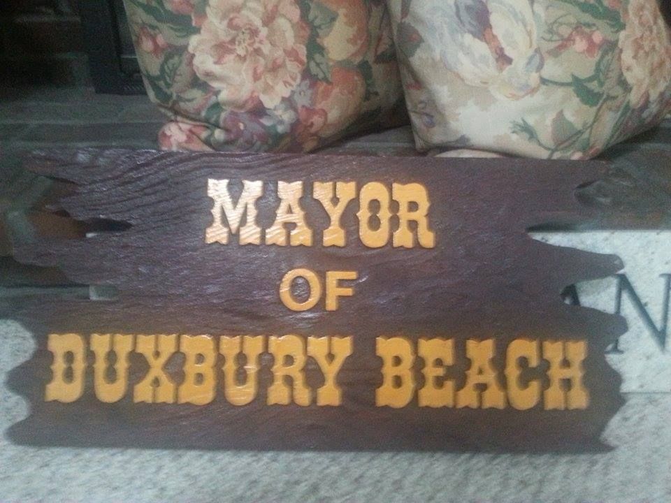


Duxbury

Childe Stephen made a relatively quick leap from Dorchester to Quincy to Duxbury in the 1970s. Duxbury is about where, after Busing, the Boston accent runs into the more clipped Cape Cod accent. I spent 4th and 5th grade being removed from regular class for Speech Therapy, and all of it was me, over and over, having to say words like "farther" and "carnivore" as they exorcised my Southie accent like I was Regan MacNeil. As for pronouncing Duxbury, some people pronounce the end like Miss Sisson's first name, some say it sort of like "berry," and some say it sort of like the last part of Kitty Purry. The first part is like "Ducks," and not at all like Frank Dux from Bloodsport.


Tyringham

"Tier," not Tie."


Cochituate

Next....


Hyannis

More "Buy Ann this" than "Uranus."


Nahant

Just as confusing backwards as forwards.


Eastham

Looks easy enough. The end can be a deal-breaker. I threw this article up on the Eastham FB page, and there is some debate ongoing. 'Ham or 'Hum, choose your side wisely. It is tied very heavily into how one pronounces "Chatham." I'm an Upper Cape guy, this is Outer Cape stuff, and I can't be the one who makes the call.


Housatonic

Should be in Texas, and used as an adverb.


Wellesley

Also should be used as an adverb.


Mattapoisett

This isn't that hard to pronounce, but you have to stare at it for a second before you do so.


Quincy

Your favorite TV coroner pronounces his own name wrong, there's a Z in this.


Assinnippi

A little bit of Mississippi, in Norwell.


Assonet

Sounds like a crude name for pantyhose.


Cambridge

More "I came, I saw..." rather than Cam Neely's first name.


Padanaram

The nice part of Dartmouth, but it sounds like a level of Hell.


Truro

A rare Massachusetts word that pronounces both "r" sounds. It fools people who try to fake a Boston accent by dropping every "r." The actor who portrayed Cliff Clavin would have Jacksonian seizure if "Truro" came up mid-sentence on the teleprompter.


Amherst

No "H."


Acushnet

"A cushy net," minus the "y." The town seems to be named after a hammock.


Groton

Rhymes with "cotton," I think. I don't get there much.


Athol


Saturday, September 19, 2015

Barnstable Hurricane Information


Barnstable is in a position not unlike that which Germany faced in the World Wars. They have a two front battle going on if a hurricane arrives.

We have two maps from FEMA to check out today. The map above is a Hurricane Inundation map, and it depicts storm surge from a direct hit hurricane visiting Barnstable at mean high tide. It also shows what sort of storm would be needed to soak certain regions, which we'll get to in a minute.

The map is from the combined efforts of FEMA, MEMA, NOAA and the NHC. They use the funny-weatherman-titled SLOSH model of storm surge estimation. They do not depict freshwater flooding.

The colors relate to the Saffir-Simpson scale of hurricane intensity, and break down like this:

Light Green = Category 1 hurricane. Hurricane Gloria was one of these, and the offshore Halloween Gale was, too. Although not a tropical system, the Blizzard of '78 did Cat. 1-style damage.

Dark Green = Category 2 hurricane. Hurricane Bob was one of these.

Yellow = Category 3 hurricane. We've only had five of these hit New England since the Other Man arrived in 1620, the most recent being Hurricane Carol in 1954.

Pink = Category 4 hurricane. We've had one in recorded New England history, and it struck in 1635.

Flesh = One Hundred Year FEMA Food Zone. This is the "100 year storm" you hear people speak of, but you have to go pre-Colombian to find them ("going pre-Colombian" means using salt marsh soil samples to look for sand layering associated with large hurricanes). New England has had storms in the Category 4+ level in the 1100s, the 1300s, and the 1400s.

Sorry about Flesh, but my knowledge of color names was and continues to be heavily influenced by whoever was in charge at Crayola in the 1970s.


We shall leave the street-by-street analysis to the reader, who can use the links I'll throw in at the end of the article to zoom in on their own house if it suits them.

Note that you don't need to be in a shaded area to get yourself a quick and sudden Ending. You can have a tree fall on you, have your car washed out in street flooding, step on a downed power line, get purged by looters, enjoy the Robespierre treatment from flying shingles, be summarily executed by National Guardsmen, or even stumble into a sharknado. There's no shortage of ways for you to get Left.

With that in mind, we now present to you the down-there-somewhere Evacuation Zone map.

Remember, you don't HAVE to leave when 5-0 tells you to. Also remember that the cop you read the Constitution to before the storm may be the one who has to fish you out of the drink when the ship hits the fan.

The E-map is easier to read, as it is made up of only two colors.

Red = Get Out.

Yellow = Get the f*** out.

Notice that Route 28 washes out in a few spots.

It's a big town, we break the maps down a bit to make it easier for you

Egad! The Hyannis Port Compound could get soaked!


Hurricane Inundation Maps

Evacuation Maps

Worst Hurricanes To Hit New England

List of all hurricanes to hit New England


Saturday, August 15, 2015

When The Levee Breaks...

(Editor's Note: This article is from about 5 years ago, we diggin' in the crates...)
The Boston Globe and Google Maps are doing a cool service with this map of Massachusetts seawall conditions. Clicking on the individual areas lists the location and repair costs. Every seawall pictured on that map would cost $160 million to repair.
You can see the real thing here at the Globe, but I took the liberty of pasting a few shots of local areas for educational purposes only.
The map shows who has seawalls. The color code is basically Green meaning high quality,Orange meaning poor and Red being critical/non-existent.
The Outer Cape has her own seawall, that being a mountain of dunes. They were what Massachusetts defended herself with before the people era. Anyhow, that's why there are no seawalls of any note on the outer Cape.
They didn't have any info on Nantucket and Martha's Vineyard. I'm sure there are some localized seawalls, at least.
Note that the lower Cape seawall system is designed to stop hurricanes, while the South Shore's is designed to stop nor'easters. That's not 100% exclusive, but it's a good rule of thumb.
Falmouth is heavily sea-walled, and another strip runs off and on from Yarmouth to Chatham.
Seawall repairs are costly. Provincetown alone needs $5 million in seawall repairs. We're coastal people, and we have coastal problems. Things will only get worse if that global warming/sea level stuff is true.
Barnstable is very much unprotected by seawall, so they at least may get to dodge some of this Cost Bullet. They may be penny-wise and pound-foolish, but time will tell.
I'm no expert on the Cape's specific coastal areas, so I'll leave it to you to draw your own conclusions. If you have your own observations, leave them in the comments section.
I did some zooming, and isolated the two wall-iest areas of Cape Cod.... Here's one of them, the Falmouth/Bourne/Sandwich/Onset area. Everything on the map below would cost about $50 million to repair.
Falmouth is obviously prone to terrible tides, and the extensive seawall construction speaks volumes. The areas of Bourne and Onset were devastated during Hurricane Bob, right about where that hurtin-for-certain seawall is.
Much of that seawall is in need of repair. Those repairs will be costly. $50 million dollars = costly. Those repairs are small change against what losing miles of beachfront property would mean in taxes and tourism.
Estimates include seawalls, jetties and anything else armoring the coastline.
The run of seawall that goes from Bourne Pond to Jeweler's Road in Falmouth adds up in several increments to equal $3 million in necessary repairs if you throw in the nearby Eel Pond seawall. 
The seawall on Ocean Avenue to the Great Pond area of Falmouth needs $3 million in repairs.
Falmouth Heights needs $4 million in seawall repairs.
Lewis Point in Buzzards Bay needs $500,000 in repairs.
Onset is looking at $1.5-2 million in repairs
Here's the Yarmouth-Chatham run... price tag: $36 million or so.
Red River Beach in Harwich to Cockle Cove in Chatham needs $1.5 million in repairs.
Wychmere Harbor needs almost $2 million in seawall repairs, as does West Dennis Beach.
A series of seawall repairs from Parkers River to Beachwood Avenue in Yarmouth will surge well past $2 million.
Town Fish Pier In Chatham needs $500,000.
I'm not sure if the Wampanoags built seawalls. Native Americans tended/tend to be more reasonable than Europeans, and most likely just didn't settle dangerously close to the beaches.
The picture below is my hometown, Duxbury Beach. I'll focus on it because A) I'm very familiar with it, and B) I have some pictures of it. It runs from the Gurnet Road area of Duxbury to Green Harbor.
The seawall shown via the stripes of different colors protects about 1-2000 people, depending on the time of the year. The Southern half is sparsely populated, making up maybe 3-500 of the total figure even in the summer. The seawall repairs will cost well over $6 million, mostly to the north (and some of which is off the map), in Marsh Vegas.
The red area on the map is a football field-sized gap between the Duxbury seawall and the Marshfield seawall. The Globe reported that there was wall there at some point that has disappeared, but no wall has been there since the 1960s. I'll ask around, but no one I know can remember there being seawall there.
The seawalls were put up in the 1950s, during a hurricane run that gave us Edna and Carol. The seawalls allowed coastal development in an area that was devastated during the 1938 Hurricane and the 1954 sisters.
The seawalls suffer from cracks, crumbling, collapse, erosion and other ailments. The seawall shown putting in work at bottom of the article is from this area.
The green area is where I'm from, and the seawall is just a big slab of concrete. It does the job we ask of it. The neighboring orange area was a portion of the wall (near the old Gurnet Inn) that had started to fall forward. The US Army Corps of Engineers is in charge of repairing the wall, and they dumped tons of boulders against it to arrest the Tower Of Pisa act.
The orange wall in more northern Green Harbor is much "taller" (more of it is exposed, where down-beach Duxbury gets a lot of sand washed up against it) than her sister to the south. Almost the whole length of it requires boulders be shoved against it to keep it from tipping forward. The houses are built right up to the seawall in many cases there.
The extreme top/north of the picture features two giant jetties, made out of piles of boulders, that protect Green Harbor.
Regarding the cost of seawalls, the old divorce joke works pretty well.
                                        Why do seawalls cost so much?
Because they're worth it!

Monday, July 27, 2015

Barnstable County Fair 2015

This year's Barnstable County Fair was a blast. There were many things to do and see there. It was nice to see some returning vendors and acts and also nice to see new ones, The Barnstable County Fair is located in Falmouth Massachusetts (Cape Cod, MA).

The BCF has been coming to town since 1844. It was originally a livestock/crafts sort of fair, and that is still a big part of the show today. They didn't have electric ferris wheels or anything like that back then, maybe they used horses or something, I have no idea. The big draw early on was the merry-go-round.

Other than a brief shutdown during WWII, the fair has been going strong ever since. They have since incorporated spectacuar rides, and have brought in performers and other acts.

One of my favorite acts was Wacky Chad with his Pogo stick tricks. He has been on America's Got Talent... twice!


The animals and petting zoo have always been a nice thing to look forward to. This cow is trying to go viral, I saw him practicing that look in front of the mirror before I shot.


Who wouldn't want to feed a goat or a yak out of the palm of your hand? 


If you were at the the fair you may have noticed the baby animatronic T-Rex. He was about half-done eating this old guy when I asked him to pose for me.


The Three Dog Night performance was spectacular, my phone's video recorded it in poor quality. I guess you'll have see them in person to get the real deal. We were so close to the stage that we could feel the beat through our entire bodies. I was so psyched to see them perform in person. Their hits include: "An Old Fashioned Love Song" featured in the video below, "Joy to The Word," "Shambala" and many, many more.


We can't forget about the rides and the amazing view of the fair from the Ferris wheel. 


I saw a little bit of the Lumber Jill's Performance - wish I had a better view (I was too short to see over everyone else). And I was really hoping to see the Willis Clan

But overall, this years fair was awesome.