
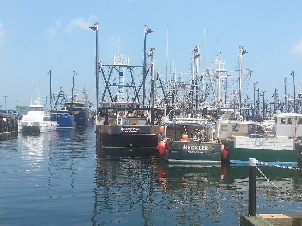
New Bedford is about as salty as it gets, and they get that salting by being exposed to the ocean, both as a profession and as residents.
This puts them in the path of some potentially serious storms.
New Betty had a 5.8 foot storm surge during Hurricane Bob, and one of her fishing boats off of Cuttyhunk reported a peak gust of 182 mph. NB had wind gusts over 90 mph during Hurricane Gloria, 110 mph during Hurricane Donna, and a 20 foot storm surge from Hurricane Carol.
Yup, you can get messed up pretty smooth in New Bedford, really get your hat handed to you. They also have bad hurricanes.
You have to be ready to deal with the sea if you're even thinking of living in New Bedford. The town does their best, throwing up a hurricane barrier to protect most of the city from anything but the worst hurricanes. You can see it up in the lead photo. It protects the Acushnet River, and, therefore most of New Bedford.
What you see below is a Hurricane Inundation Map for New Bedford. It shows what areas of New Bedford would be flooded in a direct-hit hurricane. The map comes from FEMA, MEMA, NOAA and NHC.
It also shows what strength of hurricane (strength measured by the Safford-Simpson hurricane intensity scale) would be needed to inundate certain areas. It does not depict freshwater flooding.
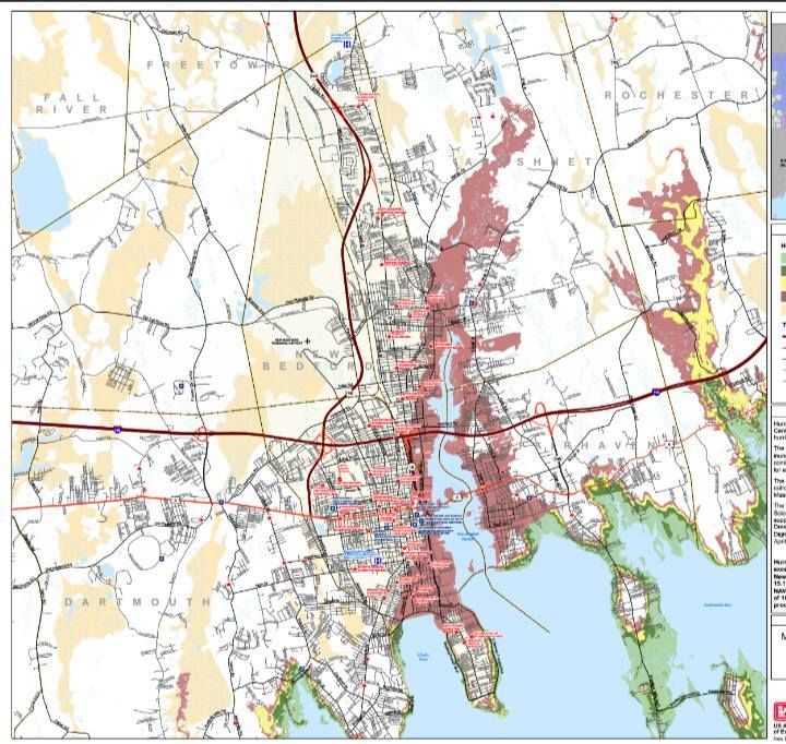
Light Green = Category 1 hurricane... Hurricane Gloria was a weak Category 1 hurricane. Yes, "weak" and "hurricane." are tough words to use in the same sentence, but this is how we Do.
Dark Green = Category 2 hurricane... Hurricane Bob was a Category 2, and he beat up New Beddy like she stole something while concurrently saying something awful about Bob's mother.
Yellow = Category 3 hurricane... only 5 of these have hit New England since the Other White Meat arrived in 1620, the most recent being Hurricane Carol in 1954.
Pink = Category 4 hurricane... we've only had one in our recorded history, in 1635.
Flesh = 100 Year FEMA Flood Zone. This is the hundred year storm you hear people speaking of, although you have to go pre-Colombian to find some in New England history. They (people who study this stuff) use salt marsh soil analysis techniques to study prehistoric hurricane histories, and New England was hit by storms above Category 3 in the 1100s, 1300s, and 1400s. Only the Native Americans saw them.
I don't have a better Art term for the 100 year storm color than Flesh. Blame whoever was running Crayola in 1973.
Here are a few things of note:
- FEMA and company developed these estimates based on the zany weatherman titled SLOSH model of storm surge inundation.
- I'll leave neighborhood-by-neighborhood analysis to you. I'm from friggin' Duxbury, what do I know?
- Once that hurricane wall goes, things get ugly fast in New Bedford. It's funny when the seawall gets topped over on Duxbury Beach, and 50 rich people have to drive the Land Rover up the hill. It's not so funny when 20 feet of water is rushing at 100,000 poor people.
- Just about anything south of the hurricane barrier faces a serious threat from even minor storms.
- Parts of Route 195 will be under Buzzards Bay in a bad enough storm.
- Clark's Cove didn't get a 20 foot boulder wall to protect her people.... so, uhm, have fun out there, folks.
- Cranberry County Magazine strongly advocates seeking out a local old-timer who was in your neighborhood for a major storm like Hurricane Carol. Find out whatever he/she can tell you about what happened to your neighborhood. The folks from the Old School watched hurricanes hit your neighborhood, and most of the FEMA kids haven't.
- New Bedford lost 2/3 of her fishing fleet in the 1938 hurricane.
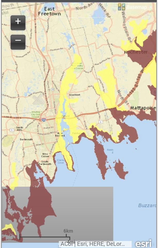
With all of this stuff we're kicking around, it might make sense to flee New Beige if a hurricane is coming. Which parts of town will the authorities be evacuating?
The map below is an Evacuation map, and it is what The Man will be using as a template when issuing evacuation orders.
The differing colors are for differing intensities of storms, with Pink meaning "Get Out," and Yellow meaning "Get the **** out, now!"
The hurricane barrier pays off here, as only the areas to either side of it would be evacuating in a milder hurricane. Once the barrier is topped, however, it's every man for himself.
Notice that Route 195 and Route 6 get cut off by seawater in several spots, so plan to be Audi early.
New Bedford doesn't evacuate for just any storm, but when they do evacuate, they evacuate several miles inland.
That's pretty much what we have for you today. You should learn it/know it/live it.
If you disagree with something in here, let me know in the comments section. I had some disagreement with FEMA on my own beach.
Check the maps for yourself:
Hurricane Inundation Maps
Evacuation Maps
No comments:
Post a Comment