Showing posts with label plymouth county. Show all posts

Monday, April 11, 2016

Regionalizing Southeastern Massachusetts


Life should be easier. That said, there sure are a lot of towns in Massachusetts. I'm not even considering the irrelevant parts out past Worcester. Eastern Massachusetts is bad enough.

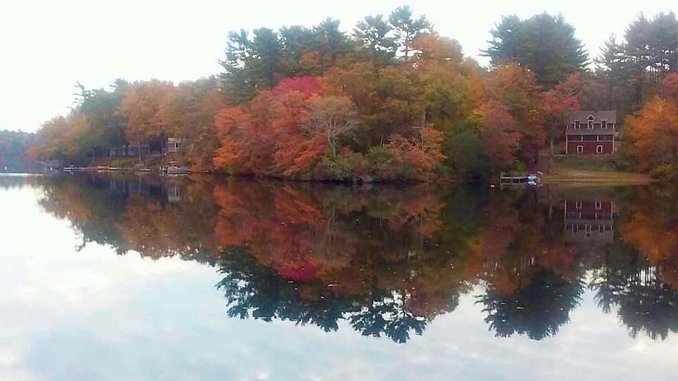
I grew up in Duxbury, and eventually moved to Monponsett. Prior to my move to Monponsett, I had never heard of Monponsett. You could write that off to me being a moron, and you wouldn't be the first... but it also speaks to the theory that there are too many towns in eastern Massachusetts for a reasonable man to keep track of.

It didn't used to be this way. Various kings of England didn't have the ability to commit memorization time to all of those piddling towns in the Massachusetts swamps. The king was a busy man, and needed his memory for more pressing matters. Memory is finite. If a man who is obliged to breed within a limited pool of people knows where Rehoboth is, it means that he may not know who that pretty girl at his coronation is. He might mess around with the royal scepter and become his own uncle or something.

You are most likely playing for lower stakes than that, but it's still a pain if you have some auto parts or pizza or something to deliver, and neither you nor your GPS can really say whether you are in Marion, Wareham or Mattapoisett.

How would Henry VII handle that problem? Simple. Eliminate some variables, just like one of those mathematician guys. You gotta know stuff like that to be the king.

A man doesn't have to know where Wareham or Marion is if Wareham and Marion don't exist. Call the whole area "Rochester"... yeah, that's the ticket. This also saves a monarch the bother of learning how to spell "Mattapoisett." Just think regional.

Similar regional logic applied around the area eliminates bothersome memory issues in town-sized hunks. Not sure where Mansfield is? Sha-ZAM!!! No more Mansfield. Think that Cape Cod has too many towns? Ka-POW!!! Not any more.

Queen Anne probably didn't spend part of her thirties pumping gas, so I assume that she most likely had more on the ball than your faithful author here does. When she thought about her Massachusetts colonies, how did she visualize them?

This map may help:


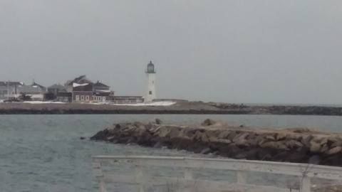
We use the same basic map to describe this website's coverage area, although we refuse to give up Weymouth and Hull. I've had some luck dating in Weymouth, and Hull is just too damn cool to give up without a war. We even claim parts of Quincy. If the website makes more money or if we get an eager and well-located intern, we'll include the Islands.

This map of Plymouth Colony is very concise. 17 towns fill up what is now Plymouth, Britsol and Barnstable Counties. Bristol County has 20 towns today. It gets bothersome quickly. Honestly, can you really tell me where Berkley is? (Editor's Note: South Coast readers can substitute "Rockland" or "Holbrook" for "Berkley") You can see why the royals did what they did.

Would this work today?

Some problems do show up immediately. I'm sure that Brockton residents would love paying for Duxbury Beach seawall repairs. Padanaram residents would most likely not align politically with the meaner parts of Fall River. Plymouth seems too big, as does Middleboro, Dartmouth and Taunton. Governance of these areas would be unwieldy at best.

Other things stand out when pondering a shift to colonial-era town maps:

- Freetown, a backwater these days, is one of the Big 17 in this alternate reality. Rehoboth also seems to have extraordinary influence.

- Freetown (and parts of Fall River and Assonet) was purchased from the Wampanoags for "20 coats, two rugs, two iron pots, two kettles, one little kettle, eight pairs of shoes, six pairs of stockings, one dozen hoes, one dozen hatchets, and two yards of broadcloth."

-  Plymouth looks a bit like Brazil.

- Scituate and Duxbury both enjoy a unique status as America's first suburbs. Building there was most likely spurred by the Great Colonial Hurricane... which is too bad, because we liked the idea of Duxbury being founded because 1636 Plymouth was getting just a little bit too crowded for one Myles Standish.

- Cape Cod is reduced to five towns with this map... Eastham, Sandwich, Barnstable, Yarmouth and Falmouth.

- Swansea, a tiny town these days, was also tiny then. They would have nearly doubled in size if a dispute with Rhode Island was worked out in their favor. They were also serving as a buffer zone with the Wampanoag-dominated area of Mount Hope, sort of a colonial Latvia.

- I'm not sure how they had the Worcester area worked out, but let the record show that Southboro was (and still is) north of Middleboro.

- The Mayor of Duxbury Beach claims rulership over Duxbury and all lands west to (and including) Bridgewater State University. She refuses to accept the various actions of incorporation of the western towns.

- Brockton used to be part of Duxbury.

- I think that Marshfield's borders have been unchanged since a 1640 dispute with Duxbury over Green Harbor was ironed out.

- Taunton could have built a Norton/Easton/Mansfield-sized casino within their original borders.

- Route 3 would have touched Scituate in this political (map) climate.


Wednesday, February 10, 2016

Coastal Flooding In Green Harbor And Duxbury Beach

Waves breaking on houses, Ocean Road North, Duxbury...
We went off-Cape to see what sort of action that the South Shore was getting from Momma Ocean. A blizzard had just blown through town, and we were getting reports of wild surf on Duxbury Beach. We were on our way up the moment we got Logo on the bus (2 hour delay). We made it just in time for high tide.

Surf photography is often easier if you go the day after the storm. The storm is usually just offshore a bit, and it is slow-rolling waves back to the coast. Unlike waves on the day of the blizzard, you can go outside and shoot waves without getting soaked by rain or blown around by the wind.

The Great Salt Marsh, Duxbury
The plan was to go to Duxbury Beach, hook up with some friends, and watch the storm from their house. That plan came to a stop when we were unable to get down Gurnet Road.

Duxbury Beach often floods backwards, as in "via the marsh." This happens before high tide, which brings the waves and their splashover water into the mix as well.

We made it through the first puddle easily enough, but we saw an SUV struggling with the next puddle. We called "No Mas" like Roberto Duran.


We tried the Bay Street/Bay Avenue turn where Marshfield meets Duxbury Beach, that wasn't happening, either.

We were in a Dodge Stratus, and she sits about 4 inches from the ground. She is not built for plowing through street flooding, especially where it's 11 AM in Duxbury and we have to get a kid off the bus at 3:30 PM in Buzzards Bay. It's tough to keep that schedule with a dead car.

We took pictures of the flooded roads, and they came out so well that we decided to double up on flooded-marsh pictures.


We finally made it to the beach around where the Green Harbor General Store is. We didn't make it by much, as the bridge by the Green Harbor Lobster Pound was almost washed over... as you can tell.

We were running the risk of getting trapped, but I liked our chances of escaping.

This was my favorite jump-off bridge as a kid, although I think I'd break both legs if I even stepped off of it now.


I parked down where that SUV is in the upper right, and this gave me access to the Burke's Beach section of town for my camera work.

Burke's benefits from having a jetty, which keeps the water off the houses.

OK, it does so when it's above water.


Small print, kills you every time.

The risk was worth it, because I ended up being behind the waves that were breaking on the houses along Green Harbor and Duxbury's seawall. You can do that due to the wave-blocking presence of Brant Rock, and due to the curvature of the seawall.


I only got my feet wet, and that was because I let my attention wander.

This is bad, but not as bad as it looks. The spray is the water hitting the seawall. This throws up spray, which catches the wind and gives me cool shots.


Brant Rock got it as badly as Green Harbor did, if not worse. BR, remember, is the part of town that got beaten down last winter.

I would have headed over, but I didn't want to go through the Esplanade splashover puddle... which, the last time I checked, encompasses all of the BR business district.


These are good-sized waves for the Duxbury Beach/Green Harbor region.

I saw at least one scientist paper claiming that the maximum height that waves can reach on this strip goes around 5 feet, but I saw much bigger waves during the Halloween Gale and the Blizzard of 78.


My camera actually has color and everything, it just was a grey day.

These shots are mostly Green Harbor, but some Duxbury Beach can be seen on the left end of any given pic.

Not these ones below, I zoomed in on Vegas. Duxbury starts about where the giant break in the seawall is.. you know, the one you can't see in these pics.


"The impact will blow trees back and crack statues."

Thanks to our host for the day, Green Harbor!

.

Monday, November 2, 2015

Pimping Plympton!


We have a large coverage area. We include Plymouth, Brockton, Barnstable, New Bedford, Fall River and Taunton in this area. None of those are Shanghai or London, but they are rather large when compared with Duxbury, Acushnet or Truro.

Plympton (pop. 2800 or so) is also much smaller than New Bedford or Brockton. Plympton is furthermore much smaller than Duxbury or Falmouth. It is Small Town, even by Small Town standards. I think of Plympton as a small town, and I live in a village of 4000 people.

However, the roads we travel making this website have led us to Plympton many times recently. We've been here for Halloween decorations, fall foliage, cranberry bogs and harvest festivals. I haven't had to even get near Fall River when doing these articles, which are admittedly rural in nature.

We'll use today's article to thank little Plympton for hosting us!


Plympton, once you dot the i's and cross the t's, is sort of the October capital of Southeastern Massachusetts. We recognize that the state champ is Salem, and that the reasoning is sound.

However, Plympton is as rural as eastern Massachusetts gets.

For 11 months of the year, there really is nothing there. I don't fear insulting Plympton residents by saying that, because I think that those people like it this way.

Some People Like Cities, or even the just-off-a-highway ease of a bedroom suburb. Some People, to put it simply, Don't.


I had time to kill with five students once when I was teaching. I got them on Mapquest, which was more of a novelty at the time. We were going to Halifax for a class fishing trip, so I thought I'd have them recognize the region a bit before they went.

While doing this, the kids- who were all from Dorchester and Cambridge and so forth- remarked on how sparsely populated the region is. I gave them the "people there like it that way" explanation that I used a few paragraphs ago. This led to a discussion where all of these city kids who live in tenement buildings with 500 people in them were pretty much united in their belief that the country people might be on to something with this trees-as-neighbors philosophy.

They phrased it more colorfully. "That's the kind of sh*t where Jason jumps out with the axe," said one. Another, who I'd gather had seen The Beverly Hillbillies opening at least once, thought that you could discover oil by shooting into the ground there.

Just for laughs, I had them zoom around on the map some, to try to find the Most Isolated Guy In The Region. I don't want to out the guy- whom it is safe to assume is a man who wishes to enjoy his privacy- but he lives in Plympton.


We did a few trips to Plympton in October. As opposed to, say, March, October holds plenty of reasons for someone to visit Plympton.

We hit Billingsgate Farm in early October. They are somewhat famous, as they are off Route 106 on the road from the Plymouth area to the Bridgewater area. Any commuting Bridgewater State College University kid from Duxbury or Marshfield probably spent some time rolling down 106.

We popped in to get some fresh produce (we like buying local when we can), and we also got a pumpkin. We were psyched to find that they had a pumpkin patch, a corn maze and all sorts of other stuff that you don't get to see in normal suburbia.

They also have a hay ride for the kids, which is something every kid should do at dusk as Halloween nears.

You can kind of see why people like Plympton just by looking around the fringes of the farm stand area.


Plympton has a lot of farms. You can spend several weekends during the Harvest Season banging around Plympton. I know this because I have spent several of the last few weekends banging around Plympton.

Even if you never get out of the car, Plympton is cool to drive though. This, early November, is the end of the foliage season in this part of the state.

If you do get out of the car, you have a lot of options. One of the better ones is Sauchuk Farm. Sauchuk is a working corn farm that doubles as a harvest theme park.

We were there on Halloween, just before they closed and we went trick or treating.


Sauchuk Farm rules if you are a kid. You have several awesome options. This is after you soak in farmland as far as the eye can see.

My kid liked the corn maze, part of which is visible in the picture above. We got deep in it without ever finishing, as we went out the same way we went in. We cheated, but we got to the elevated part for some panorama shots.

Estimates for maze-completion ranged from an hour to 30 minutes (with help), but I bet that we could have got 90-150 minutes if we continued to let the 8 year old be the head navigator.


We also liked the Corn Cannon, which is a deluxe potato-launcher thing they use to fire corn cobs 50 yards into the field. If you hit the furthest target, you get a pumpkin!

They had a food tent with fried dough, kettle corn and hot dogs, among other things. Eat there AFTER going on the bouncy house thing (no walls nor roof, not a house, but I don't know what you call it otherwise), if you know what's good for you.

They had a hay ride sort of thing that went out to the pumpkin patch. We didn't get that ride, as we arrived sort of late and decided to instead get lost in the corn maze. We also did the duck races, where the ducks are powered by hand pumps.

Of course they had a cow train, as any self-respecting farm should.


We could have spent a year there, as long as we didn't have to do the farm work. Farmers have a hard life, and I probably serve the world best here, entertaining.

We had to split, however. We had trick-or-treating to do, and the place shuts down at 6. Farmers go to bed early, so to better be up before the sun. Circadian cycle, or whatever they call that. That corn doesn't hoe itself, or whatever you do to corn.

We got one last shot before we split.


We spent Devil's Night in Plympton, as well.

We were invited to Snow Family Farm by Lindsay Snow herself, whose family was hosting their 24th annual Halloween party for the neighborhood. For the high price of nothing at all, they park you, feed you, light up a bonfire and take the kids on a haunted hayride. No one even came close to asking me for money.

My favorite part of this was the bonfire. Actually bonfires, plural. They had some steel drums with various Halloween stuff carved into them.

We'll end with those, because it's November 2nd and I really need to let go of my love for Halloween. We have Fall Foliage and Cranberry Bogs to shoot.

Thanks, Plympton!


Thursday, October 22, 2015

South Shore Foliage, 10/21/15

We rolled out with monster truck force all over the South Shore's interior as we tracked down the places that have already turned over. This is East Monponsett Lake, in Halifax.


This part of Massachusetts (Plympton, Route 106) gets some cool foliage. It just tends to be worked into the proverbial Sea Of Green. No, I have no idea why one tree is orange and every other one is green, that's between you and Mother Nature. I just click the camera and write the captions, friend.


You don't get those Vermont calendar pictures in Duxbury. I have no mountains to look down from, and too many pine trees. At times, I'm reduced to shooting at branches on a single tree.

We were gonna shoot video, but..well, trees don't really do that much. We were ready to turn the video on if a Sasquatch walked out of a South Halifax forest.

Kingston got some licks in, especially in the Jones River Reservoir area off Route 80. We started in Duxbury, then went into Kingston. We essentially flipped a coin as to left or right onto Rout 80, we went right and found this about 100 yards later.


If you take your glasses off, it looks like a tree fire. I should have rolled a smoke bomb under that, or maybe even exhaled a fat hit into the picture just before I clicked.


We got a cloudy day for Rural Exploration, but there was no wind, so we got some sweet lake-reflection shots.


We have mobile photography capabilities, they even come out sometimes.


With Monponsett Lake(s), we're in there like swimwear.
We're just warming up, so we have plenty of more work to do. We may still expand our reach up into the Athol/Ashburnham corridor, they're peaking right now.

We will also be all over the South Coast, South Shore, and Cape Cod. You know were good like that.


Tuesday, October 20, 2015

Early Season Bog-Trotting


With a name like Cranberry County Magazine, you know it's only a mater of time before we head out into the bogs.

One disadvantage we have is that, much like the foliage, the bogs are flooded and harvested from north to south, and we live in the far southern part of that equation. That means that our bogs aren't being harvested like the ones in other regions.

Of course, bogs tend to be large and difficult to manage, and they have to sort of draw a grid and work section-by-section. It takes time to cover all of those acres, so we will be able to get all stages of the cranberry harvest cycle just by stumbling around town.

Today, we'll roll through Carver, Wareham, Plympton, Duxbury and Buzzards Bay. There are bogs all over our reading area, and we'll try to pop in on the more scenic ones as the harvest season progresses.


Our light was sort of rough, as you can see. We get the kid off the bus at quarter to four, and we had to make our way out into Bog Country, aka Carver.

I'm not that into Creationism, but if I was, it wouldn't be hard to rationalize God making Carver right after He figured out that cranberry sauce was tasty... or perhaps even after He realized that you need cranberries to make a Cape Codder. He probably got to it very early in the Earth-making process.

"I'd better allot some space for cranberries... right abouttttt... HERE!" (points at map, about where Carver will one day be)... and it was Good.

I have no intention of digging up this information, but I would guess that there is more acreage devoted to cranberry farming in Carver than there is to housing the whole population of Carver.

Somebody- be it God or John Alden or whoever- really liked cranberries, because southeastern Massachusetts is literally covered in bogs.

That works for us. Gas is cheap, and so is Cranberry County Magazine.


As I said before, the light was less than ideal. I'd do better with a 11 AM start time. Notice here that the trees are lit wonderfully, but the bog was very dark. I was shooting with late-day sun and tall trees behind me. This is what you get.

This is sort of a warm-up for future articles where they are actually harvesting berries via flotation. We dipped all over Carver and her neighbors, and most bogs aren't being flooded yet around here. I know the guy in Buzzards Bay told me "after Halloween."

Only part of one bog on North Carver Road in Wareham was flooded and had floating berries, and that is the one you'll see splattered all over this article. The bog above is still getting ready to drop.

By contrast, this bog below (in Duxbury) was flooded by her reservoir. We'll come back and check her out later.


You need all of that water for the bogs. Most and maybe all bogs are built near a copious supply of water. They sort of pump it in and out of the bogs as they need it, either to feed the cranberries or to protect them from the cold.

I don't know how they did it before the Industrial Revolution, and this may have required the efforts of 100 men and a bucket line for all I know. Now, they just use pumps.

Those little houses that you see on cranberry bogs usually contain the water pumping equipment. One of the structures may be an outhouse, so don't drink any water from them until you talk to someone who works there.

We want you healthy.

Here are the little houses. It's a bit blurry. The shot REALLY sucked before I got into the editing, and I don't edit photos very well.


The reason that you flood bogs, besides doing so to loosen the berries for harvesting, is to protect them from freezing temperatures.

Otherwise, everything gets all icy. This is a bad thing to have happen to fruit which you plan to harvest.

We did have a freeze the other morning, and OF COURSE the team went out to find a frozen bog for some ice pictures. We are up at the dawn and driving for miles and miles to get you shots like the one below.

OK, it's across the road from where I live., and I stared at it for 5 minutes before "taking a picture of it" occurred to me.


They may have already harvested that part of the bog, or else that could be an Epic Fail. I'm not agricultural enough to know for sure. They are always very kind to my photographers and I, so I'm hoping this is No Big Deal.

That bog (Mann Farms, in Buzzards Bay) has some sort of project going on that merits having a giant crane out there. We'll sneak out there for a pictorial when the dice come up that way for the column.

Eventually, they flood the bog and let it freeze. Then, they put a skim coating of sand on it.

I knew at least one kid in my school days who thought that bog owners sanded the ice to keep kids from skating on a Liability Ice Arena. No. They're actually just giving the vines a fresh coat of sand.

The sand goes on the ice, the ice melts, and the sand settles into the bogs all uniform-like. Gravity handles the distribution process well enough. The sand method was invented on Cape Cod by a man who noticed that cranberries grew really well in areas that the ocean had covered with sand after a storm.

Therefore, bogs keep mountains of sand handy for the winter, just like the Highway Department does.


We worked until the sun set, so we'll give you some cranberry bog sunset shots.

Here's the one I took:


Here's the one I edited:


We'll be back with more soon, and I promise to put Jessica and Sara on the camera next time.

Tuesday, October 13, 2015

Thoughts On The Post-Pilgrim Nuclear Power Plant Future


The Pilgrim Nuclear Power Station in Plymouth will close in 2019, according to multiple sources.

They are citing low energy costs, market pressures and millions of dollars in necessary upgrades as the reasons for the closure.

The power plant was a source of both energy and concern for area residents ever since it was placed in the Manomet scrub coast. It helped keep the houses warm and the drinks cold for a few decades, and- Good Lord willing- we got it opened and closed without a Chernobyl-style disaster.

I took a tour of Pilgrm in 2008 or so, for an old article that I cant find in the archives. It looked very 1970s, with multiple dial labeled controls that made me think of the Batcave from the 1960s version of the Batman show. That's really what it looked like, sans Bat-mobile of course.

A few other things jumped out at me. The plant, while listed at 27 feet or so, seemed to be very, very close to sea level. They had two jetties and a jersey barrier between the Atlantic Ocean and a boiling water nuclear reactor.

The water flowing out of the plant, towards the ocean, was exactly the same color as Mountain Dew. I'm sure this has to do with sunlight and ionized water or something, and that nuclear power doesn't turn you green like the Incredible Hulk, but still...

The plant was also storing spent fuel on the site, hoping to send it to the Yucca Mountains in Nevada or somewhere like that. Amazingly, there aren't many takers when you're shopping Spent Nuclear Fuel storage.

The plant was also heavily, heavily guarded. I won't spill their details or anything, but you'd want to have a very good plan if you wanted to do some Bond Villain stuff. You'd be getting lit up before you even got exposed to the uranium or whatever they were using there.

The security force, which is 101% paramilitary, even wear their assault rifles while eating Chinese food. I kid you not. The guy I saw doing that immediately became my permanent visual definition of Badass Casual. You know he's gonna shoot you more than necessary if your terrorist attack makes him have to dump his General Tso's chicken on the ground and sling up Ol' Painless.

You can read about the shutdown here, or about the plant itself here... I'm not the expert. I'm more of the write-a-thought-provoking-article guy.

Here are some tangents we can explore together, if you like....

- Unless something bad happens quickly, we will never know if Pilgrim would have been able to stand up to a direct-hit monster hurricane. It had a nice bit of elevation, built on top of a sizable sand cliff. It also had Cape Cod blocking anything but a direct-hit storm.

Someone should put a marker about where the Fukushima line of reactor inundation would be, and maybe someday we'll see if the planners made a few crucial planning errors.

- If you wonder what the sudden loss of 14% of Massachusetts' power generation will do to your power bill, you'll find out in July of 2019. Remember, Cape Wind also got the Bozack from just about everyone, so we won't even have nascent wind technology to help things along.

- The plant's closure will cost the town 600 nice-paying jobs and $9.75 million a year in taxes. It also means we will need to import an additional 10 million barrels of oil and run our coal-fired power plant in Sagamore much harder.

- I'm already seeing a lot of "News Flash: Plymouth Economy To Collapse In 2019" things on Facebook. I'm seeing sympathy for the plant workers, too.

- I wonder what the NO ESCAPE FROM THE CAPE people who we used to see on the Sagamore Bridge will do for fun now.

- The closure of the plant means that Monster Hurricane becomes the only way we'll see a massive evacuation of Cape Cod, short of an Atlantic tsunami or the sudden arrival of Godzilla. We were looking at a Road To Basra type scenario of people cooking in their cars with a nuclear accident causing Cape Cod to empty.

- I planned to evacuate by boat, with the fact that I don't own a boat just being a minor obstacle in my world view.

- I'll have to go into the archives, find my Cape Cod Disaster Scenarios article, and revise the list from the top down. Pilgrim had the top spot there, I forget what #2 was, it may have been "series of shark attacks destroys tourist economy" or "asteroid strike" or "Sea AIDS."

- No, I don't know how long it will take to dismantle it, or how long before the area is safe for farming or anything like that. The line starts on the right for the Grown On The Site Of The Former Nuclear Power Plant produce.

- Will the towns keep the nuclear air-raid sirens up, on the off-chance we get a tornado or an air raid or something? We could have town-wide versions of the Morning Announcements we all remember from high school. I'd like Duxbury to use theirs to constantly broadcast reggae instrumental beats.

- Much of the area around Pilgrim, and I mean like Manomet to Bournehurst, is wildly underdeveloped scrub forest. If they start filling that in, we may need to carve a piece off of southern Plymouth and make a new town, maybe merging it with mainland Bourne. We'll do a whole article on that once some of the more serious people straighten me out on it in the comments or on Facebook.

- Will there be reluctance to develop that land around the plant? Will we have a Forbidden Zone?

- Would developing the Forbidden Zone around Pilgrim generate enough property taxes and carpenter jobs to offset the tax hit and plant job loss?

- It'd be funny if the land where Pilgrim presently stands is developed, someone puts a corny seafood restaurant there, Al Qaeda fails to get a series of memos, and a sorely-mistaken terrorist crashes a SEMTEX-loaded Cessna into a Seafood Shanty-type clam shack. Hopefully, it happens off-season.

- Fearless fishermen knew that the fishing was always good off Pilgrim. The water temperature differential plays a role or something, I don't know. It's always an Act Of Luck whenever I catch a fish.

- This pretty much kills the Cape Cod setting for my Nuclear Mutant Shark  movie script. I'm never gonna get that Oscar now...