 |
| Waves breaking on houses, Ocean Road North, Duxbury... |
Surf photography is often easier if you go the day after the storm. The storm is usually just offshore a bit, and it is slow-rolling waves back to the coast. Unlike waves on the day of the blizzard, you can go outside and shoot waves without getting soaked by rain or blown around by the wind.
 |
| The Great Salt Marsh, Duxbury |
Duxbury Beach often floods backwards, as in "via the marsh." This happens before high tide, which brings the waves and their splashover water into the mix as well.
We made it through the first puddle easily enough, but we saw an SUV struggling with the next puddle. We called "No Mas" like Roberto Duran.

We tried the Bay Street/Bay Avenue turn where Marshfield meets Duxbury Beach, that wasn't happening, either.
We were in a Dodge Stratus, and she sits about 4 inches from the ground. She is not built for plowing through street flooding, especially where it's 11 AM in Duxbury and we have to get a kid off the bus at 3:30 PM in Buzzards Bay. It's tough to keep that schedule with a dead car.
We took pictures of the flooded roads, and they came out so well that we decided to double up on flooded-marsh pictures.

We finally made it to the beach around where the Green Harbor General Store is. We didn't make it by much, as the bridge by the Green Harbor Lobster Pound was almost washed over... as you can tell.
We were running the risk of getting trapped, but I liked our chances of escaping.
This was my favorite jump-off bridge as a kid, although I think I'd break both legs if I even stepped off of it now.
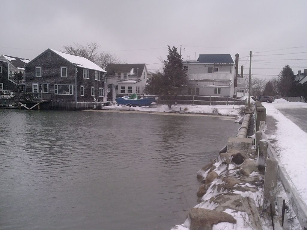
I parked down where that SUV is in the upper right, and this gave me access to the Burke's Beach section of town for my camera work.
Burke's benefits from having a jetty, which keeps the water off the houses.
OK, it does so when it's above water.

Small print, kills you every time.
The risk was worth it, because I ended up being behind the waves that were breaking on the houses along Green Harbor and Duxbury's seawall. You can do that due to the wave-blocking presence of Brant Rock, and due to the curvature of the seawall.

I only got my feet wet, and that was because I let my attention wander.
This is bad, but not as bad as it looks. The spray is the water hitting the seawall. This throws up spray, which catches the wind and gives me cool shots.

Brant Rock got it as badly as Green Harbor did, if not worse. BR, remember, is the part of town that got beaten down last winter.
I would have headed over, but I didn't want to go through the Esplanade splashover puddle... which, the last time I checked, encompasses all of the BR business district.

These are good-sized waves for the Duxbury Beach/Green Harbor region.
I saw at least one scientist paper claiming that the maximum height that waves can reach on this strip goes around 5 feet, but I saw much bigger waves during the Halloween Gale and the Blizzard of 78.

My camera actually has color and everything, it just was a grey day.
These shots are mostly Green Harbor, but some Duxbury Beach can be seen on the left end of any given pic.
Not these ones below, I zoomed in on Vegas. Duxbury starts about where the giant break in the seawall is.. you know, the one you can't see in these pics.


 |
| "The impact will blow trees back and crack statues." |
 |
| Thanks to our host for the day, Green Harbor! . |
No comments:
Post a Comment