Showing posts with label snowstorm. Show all posts

Wednesday, March 8, 2017

Three Chances At Snow In The Next Week


You may have been fooled by that Strawberry Spring we had this month, but Cranberry County Magazine wasn't fooled. It takes a good man to fool Cranberry County Magazine... it just doesn't take him very long.

As it turns out, we have not one not two but THREE shots at some Siberian Marching Powder in the next 7 days.

Friday looks like the best bet. 1-3" are forecast to fall on us. Friday morning looks to be the time for that one, although- as we always say in this business- a slight wobble in the track could mean rain, no precipitation at all, or even 3-6". Freezing cold air moves in behind this storm for the weekend, so get the shovel work done early, lest you be chopping at ice on Saturday.

Sunday Night/Monday Morning has a lower floor and a much higher ceiling. The floor, made more likely by the length of time between Now and Then, could be a non-event. The ceiling would be a powerful nor'easter with heavy snow. Yup, I just gave you a forecast of "nothing or two feet." If you want odds, go with the non-event, as it is the more likely scenario. Just remember that we also told you about the ceiling.

Monday Night/Tuesday Morning is a storm which (currently) is forecast to move along a more northerly track than the fellow we're watching for Sunday night, and is more of a bet to put some powder on us. Accuweather, which is very conservative, is giving Bourne, MA three inches of snow for this one.

Please remember that these events are not set in stone. They could be better or worse than I am telling you. You want to check the forecasts frequently during the upcoming week, as it is constantly evolving and has the chance to mess up your commute.

We'll be back with an update.


Thursday, February 9, 2017

Blizzard Warning, School Closings, Snowfall Total Predictions


BLIZZARD WARNING 
REMAINS IN EFFECT FROM 9 AM THIS MORNING TO
8 PM EST THIS EVENING...

* LOCATIONS...Eastern Plymouth County...Cape Cod...Martha's
Vineyard...Nantucket and Block Island.

* HAZARD TYPES...Heavy snow...strong to damaging winds and Blizzard
conditions.

* Accumulations...Snow accumulation of 12 to 16 inches.

* TIMING...Precipitation will overspread the region between 6 and
9 am this morning and may begin as a brief period of rain. Any
rain will change to snow by late morning. The snow will then
fall heavy at times this afternoon before tapering off to snow
showers this evening.

* IMPACTS...Heavy snow and strong to damaging winds will result in
blizzard conditions this afternoon and early evening. Intense
snowfall rates of 2 to 3 inches per hour will be possible at times
this afternoon. Strong winds will create blowing and drifting snow
and near-white out conditions at times. Travel is not
recommended this afternoon and evening. In addition strong to
damaging winds may result in isolated power outages.

* Winds...Northeast 30 to 40 mph with gusts up to 65 mph.

* Visibilities...One quarter mile or less at times.

* Temperatures...In the upper 20s.

PRECAUTIONARY/PREPAREDNESS ACTIONS...

A Blizzard Warning is issued when sustained winds or frequent
gusts over 35 mph are expected with considerable falling and/or
blowing snow. Visibilities will become poor with whiteout
conditions at times. Those venturing outdoors may become lost or
disoriented. So persons in the warning area are strongly advised
to stay indoors.

**************************************************

Here is a list of

School Closings

**************************************************

Snowfall Predictions, by local TV stations, 6 AM:


WBZ... 8-14" for most of Massachusetts. 4-8" for Cape Cod

WFXT... 10-14" for most of Massachusetts, 7-10 on Cape Cod

WHDH.... 12-16" for Estern Massachusetts, 16-20" from Worcester to NE CT, NW RI, 8-12 Cape

WCVB... 12-18" Massachusetts, 10-15" Cape Cod

NECN.... 12" Cape, 15" South Shore, 18" interior SE MA

**********************************************

Coastal Flooding is a threat. The good news is that the storm won't be at full speed at the morning high tide, and will be waning (with north instead of northeast winds) for the evening high tide (11ish). It's an astronomically high tide, so keep an eye to the sea.

**********************************************

Yes, this blizzard roughly coincides with Blizzard of '78. This won't be so bad, but it may be the worst of the year... and we had a 12-18" blizzard already this season.

We'll be bopping around for much of the storm, and we'll get some pics/videos. I may not get to the shore for the storm, but you never know.

We'll be back with an update if need be.

Red skies in morning.... unless my camera disagrees, which happens now and then.


Saturday, January 7, 2017

Blizzard Warning For South Shore, Cape Cod And The Islands


We apologize for being all over your Facebook feed, but we did promise to be back with an update if things changed... and, by God, change hath come. Someone at the NWS dropped the B Word.

The National Weather Service has issued a Blizzard Warning for Cape Cod, East Coastal Plymouth County (roughly anyone with a shoreline from Quincy to Plymouth) and both Martha's Vineyard and Nantucket.

The South Coast, which will not get the ocean-effect/enhanced snow from the NE winds, only gets a Winter Storm Warning.

This storm isn't messing around. It also seems to gain 4 inches in the forecasts every time I take a pause from my Journalism to get high, stalk ex-girlfriends and/or peruse internet pornography. I could use a large Funky Fanabla from Marylou's right now, seeing as I'm at the tail end of a Werewolf Shift, but I'm afraid that we'll be due for 3 feet of snow by the time I get back... if I get back.

We're looking at 18-24" in a stretch running from Chatham west to Onset, then north (about 10-15 miles in from the coast) up to Duxbury Beach. You get 12-18" from Duxbury to Boston, and running south (and to the west of the coast) down to the Rhode Island border. The whole South Coast is in the 12-18" window, as is the entire interior of Plymouth County.

This is also falling on a good 5" or so left over from yesterday's entertainment with Storm #1 for much of SE Massachusetts.

This is a dangerous storm. Thank the gods that it isn't hitting during a weekday commute. Wish that this was happening when the Patriots host some sunny-weather team like Miami or Houston in the AFC playoffs. While we wouldn't anticipate you being snowbound for a week, it may not hurt to buy necessary things like beer and tobacco in bulk.

We aren't anticipating a driving ban, but you never know. Only fools and emergency personnel will be on the roads Saturday. You could get a thousand kinds of messed up if you had a car accident in this weather, and only about half of those will be injuries sustained in the accident.

Frozen in place like Jack Torrance? Could happen. Hit by a plow, left in the street, then hit by another plow? Signs say Possible. You think you're walking down Shore Road somewhere, but you instead are walking off a pier into the stormy Atlantic, where a late-staying Great White Shark devours you? OK, that's not too likely, but if it was going to happen, today would be a prime candidate.

You want to read this article quickly, because blizzards have a funny way of knocking out power to the area. It will take Eversource a long time to get you back on if that happens. Today is a day to settle whatever grudges you may have with the neighbor who has the fireplace and the huge wood pile.

We're pretty much done with forecasting, and our next articles will involve me heading out (on foot, I don't trust my beater car in this weather) to get pictures. We'll publish them as long as we are able to. Feel free to hit up our Facebook Page with any pictures that you wouldn't mind seeing up on these pages.

Hunker down and stay safe, folks. As Fred G. Sanford once said, "This is the big one, Elizabeth."


Friday, January 6, 2017

UPDATE: Heavy Snow To Hit SE Massachusetts Saturday

4 PM Update

Shawna Costa, on the cam...

Uhm, yeah, about that "not too bad" snowfall forecast for Saturday that we issued yesterday.

Ooops.

As it turns out, Saturday's storm may have a bit of the hot sauce on it, if you know what I mean. The National Weather Service has a Winter Storm Watch up for Saturday.

Snowfall totals, previously thought to be in the 2-4" range, are now in the 9-12" range. The 9-12" is actually a scaled down version of the 8-15" that the National Weather Service dropped in their morning forecast.

The fun should start around noon tomorrow, and it should snow through midnight, easily. There could be some ocean enhancement along the coast, and some ocean effect flurries could hang around on Sunday morn.

In all, the Canal area of Cape Cod could have a stretch where someone gets 20" of snow this weekend. Bourne, for instance, picked up 5" today, and are forecast to be in the epicenter of tomorrow's entertainment.

I haven't heard an actual weatherman (or Cindy or Shiri) say that coastal flooding is a concern. However, the winds should be whipping up from the NE at a 15-20 mph clip right around when the afternoon high tide hits. The Irish Riviera, the Cape and the Islands could get NE wind gusts up to 40 mph, so keep an eye on the sea, coasties!

We'll pop back in for an update tomorrow if the forecast then is as radically different from today's as today's was from yesterday.


BARNSTABLE:

...WINTER STORM WATCH FROM SATURDAY MORNING THROUGH SUNDAY
MORNING...

* LOCATIONS...INCLUDE COASTAL PLYMOUTH COUNTY...CAPE COD AND THE
ISLANDS.

* ACCUMULATIONS...SNOW ACCUMULATION OF 6 TO 12 INCHES POSSIBLE
SATURDAY AFTERNOON AND EVENING.

* TIMING...SNOW OVERSPREADS THE AREA SATURDAY MORNING AND LIKELY
BECOMING HEAVY AT TIMES SATURDAY AFTERNOON AND EVENING...THEN
TAPERING OFF LATE SATURDAY NIGHT.

* IMPACTS...UNTREATED ROADS WILL BECOME SNOW COVERED AND SLICK.
VISIBILITY WILL BE REDUCED. TRAVEL WILL BECOME HAZARDOUS AS
SNOW BECOMES HEAVY AT TIMES ALONG WITH GUSTY NORTHEAST WINDS
RESULTING IN CONSIDERABLE BLOWING AND DRIFTING WITH NEAR WHITE
OUT CONDITIONS POSSIBLE.

PRECAUTIONARY/PREPAREDNESS ACTIONS...

A WINTER STORM WATCH MEANS THERE IS A POTENTIAL FOR SIGNIFICANT
SNOW...SLEET...OR ICE ACCUMULATIONS THAT MAY IMPACT TRAVEL.
CONTINUE TO MONITOR THE LATEST FORECASTS. BE PREPARED TO MODIFY
TRAVEL PLANS SHOULD WINTER WEATHER DEVELOP.

Buttermilk Bay


SOUTHERN PLYMOUTH:

...WINTER STORM WATCH FROM SATURDAY MORNING THROUGH LATE SATURDAY
NIGHT...

* LOCATIONS...INCLUDE EASTERN AND INTERIOR SOUTHEASTERN
MASSACHUSETTS...NORTHEASTERN CONNECTICUT...AND ALL OF RHODE
ISLAND.

* ACCUMULATIONS...SNOW ACCUMULATION OF 4 TO 8 INCHES POSSIBLE
SATURDAY AFTERNOON AND EVENING.

* TIMING...SNOW OVERSPREADS THE AREA SATURDAY MORNING AND LIKELY
BECOMING HEAVY AT TIMES SATURDAY AFTERNOON AND EVENING...THEN
TAPERING OFF LATE SATURDAY NIGHT.

* IMPACTS...UNTREATED ROADS WILL BECOME SNOW COVERED AND SLICK.
VISIBILITY WILL BE REDUCED. TRAVEL WILL BECOME HAZARDOUS AS
SNOW BECOMES HEAVY AT TIMES ALONG WITH GUSTY NORTHEAST WINDS
RESULTING IN CONSIDERABLE BLOWING AND DRIFTING WITH NEAR WHITE
OUT CONDITIONS POSSIBLE.

PRECAUTIONARY/PREPAREDNESS ACTIONS...

A WINTER STORM WATCH MEANS THERE IS A POTENTIAL FOR SIGNIFICANT
SNOW...SLEET...OR ICE ACCUMULATIONS THAT MAY IMPACT TRAVEL.
CONTINUE TO MONITOR THE LATEST FORECASTS. BE PREPARED TO MODIFY
TRAVEL PLANS SHOULD WINTER WEATHER DEVELOP.


Tuesday, February 9, 2016

Post-Super Bowl Blizzard Pics From Around Cranberry County

When in doubt, get behind the plow and never give up the spot.

Brant Rock, via Sara Flynn

More from Sara, of the Duxbury marsh, the Powder Point Bridge is obscured.

Road to Duxbury Beach blocked off.... (Sara again)

Snow trees in Bourne....

Minor-moderate coastal flooding, Duxbury Beach (via Libby Carr)...

Jack-knifed big rig on the Rte 25 on-ramp in Bourne (cleared as of 11:25, courtesy of the BPD)

There's a good 150-200 yards of visibility in Hyannis (via Scott Rodrigues)

Bourne, MA, this may be from Saturday's atmospheric entertainment....

The camera skills go downhill fast like Ramadan when I shiver....

A bit at a time, can't over-exert...

Thursday, February 4, 2016

February Snow


I think that even the wimpiest of us would agree that we have had a mild winter so far. That may or may not change in the coming weeks, but that's not what we're here to discuss today.

We're at roughly what I consider to be mid-winter. I may not be correct officially or technically, but it's a good working model. A little bit of November, all of December, January, February and March, plus a bit of April... early February is smack dab in the middle of that.

With that in mind, let's sort through some weather facts and speculation that may get you some proper mojo for those times when you ponder the weather at great lengths.

There will be a bit of a Boston focus, as I have a lot of Boston weather data handy. Your town may be different, but it's good enough to work with. I'm leaning heavily on a Weather Channel page. I refuse to use Winter Storm Names.

- Some of our worst storms, like the Blizzard of '78, came in the shortest month of he year.

-Top Boston Snowstorms
1. Feb. 17-18, 2003: 27.6 inches
2. Feb. 6-7, 1978: 27.1 inches
3. Feb. 24-26, 1969: 25.8 inches
4. Mar. 31 - Apr. 1, 1997: 25.4 inches
5. Feb. 8-9, 2013: 24.9 inches
6. Jan. 26-28, 2015: 24.6 inches
7. Feb. 7-10, 2015: 23.8 inches
8. Jan. 22-23, 2005: 22.5 inches
9. Jan. 20-21, 1978: 21.4 inches
10. Mar. 3-5, 1960: 19.8 inches

- Three of Boston's five snowiest months (including #1 overall, with a bullet) were, as you'll see, various forms of February.

- People looking at Top Boston Snowstorms charts in the future will be like, "Damn, it must have sucked in 2015 to get 24.6 inches of snow on January 28th and then get 23.8" on February 7th," and they could quite possibly be completely unaware that there was also a Groundhog Day blizzard in 2015 that did like 18". We just fail to mention it, because History of any sort is full of these little nuances.

- Top Snowfall Totals For A Month in Boston, and remember that you lose about 10% of the calendar with February:
1. February 2015: 64.8 inches
2. January 2005: 43.3 inches
3. January 1945: 42.3 inches
4. February 2003: 41.6 inches
5. February 1969: 41.3 inches

- It's odd that December or March didn't force their way in the mix up there in that list. I suppose that Spring is asserting herself by March, and that the ground is too warm in December.

- April, which has had some heavy blizzard-type snowfalls, just doesn't get enough follow-up events to break into that very close (one inch of snow stands between the second worst month of snow ever and the fifth worst) pile of months that make up rankings-2-5.

- March had a 19.8 inch head-start in 1960 and failed to get near the top 5. April had about 24" by April 1st of 1997, but couldn't generate enough powda to be a true player.

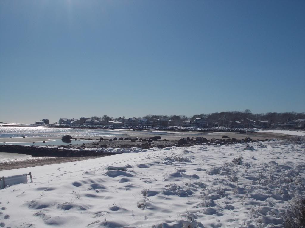
- Barnstable, which is in the middle of Cape Cod and gets Gulf Stream water, has had a worse winter so far than more-northern Boston has chalked up. Boston has had 10" of snow this winter, while parts of Cape Cod took in 15" of snow from just that last storm.

- Boston does about 43.6" of snow per winter. I think that Barnstable clocks 25" or so per winter.

- Boston's 10 Worst Winters:
1. 2014-2015: 110.6 inches
2. 1995-1996: 107.6 inches
3. 1993-1994: 96.3 inches
4. 1947-1948: 89.2 inches
5. 2004-2005: 86.6 inches
6. 1977-1978: 85.1 inches
7. 1992-1993: 83.9 inches
8. 2010-2011: 81.0 inches
9. 1915-1916: 79.2 inches
10. 1919-1920: 73.4 inches

- Notice that nearly 2 feet of snow stand between #2 and #5 on this list, while 1 inch stands between #2 and #5 in snowiest months. Those were some genuinely awful winters.

- Boston got 94.4 inches of snow in the thirty days between January 24th and February 22nd, 2015. It would be the third snowiest winter overall, just those 30 days.

- Any kid about 25 years old or so who has lived here all of his life can hold his own with any old-timer, no matter how salty he may be, in a discussion about difficult Boston winters. Even a 105 year old man will have only seen three other winters that would place in the top ten.

- A 128 year old man would have seen the Blizzard of 1888, albeit as a child. However, at that point, the 128 year old man would be more interesting than Blizzard of 1888 discussion.

- Old folks would have recourse against whippersnappers in things like Ice Storms and Really, Really Cold Weather. It generally goes without saying that this current generation has better plowing and forecasting. It also generally goes without saying that old people have a better feel for the weather, and always will.

- In 2015, Boston had a Boston-record 37" snow pack. We had 6 feet of snow fall between January 24th and February 10th, and 90" between 1/24 and 2/15. We had 4 days where we had at least 12 inches of snow (a record shared with 1978 and 1960-61). Boston had 6 days in a row with at least a half-inch of snow. They also had 28 straight days where the temperature didn't get above 20.

- Some perspective:

Heaviest One-Day Snowfall (inches and centimeters)
Georgetown, Colorado 63 160 Dec 4 1913
Thompson Pass, Alaska 62 157 Dec 29 1955
Giant Forest, California 60 152 Jan 19 1933
Mount Washington, NH 49 125 Feb 25 1969
Millegan, Montana 48 122 Dec 27 2003
Gunn's Ranch, Washington 48 122 Jan 21 1935
Deadwood, South Dakota 47 119 Mar 14 1973
Watertown, New York 45 114 Nov 15 1900
Heber Ranger Station, Arizona 38 97 Dec 14 1967
Morgantown, Pennsylvania 38 97 Mar 20 1958
Wolf Ridge, Minnesota 36 91 Jan 7 1994

Snowiest Average Winters, (inches and centimeters)
Mt Rainier, Washington 671 1704
Alta, Utah 546 1387
Crater Lake Park, Oregon 483 1226
Brighton, Utah 411 1044
Echo Summit, California 407 1035

Most Days With Snowfall 
Mt Rainier, Paradise Station, Washington 121.4
Mt Washington, New Hampshire 118.5
Climax Mine, Colorado 104.4
Crater Lake Park Headquarters, Oregon 101.3
Shemya Island, Alaska 98.3
Yellowstone Park South Entrance, Wyoming 94.5

Snowiest Large US Cities, Average Year, (inches and centimeters)
Rochester, New York 99.5 252.7
Buffalo, New York 94.7 240.5
Cleveland, Ohio 68.1 173.0
Salt Lake City, Utah 56.2 142.7
Minneapolis, Minnesota 54.0 137.2
Denver, Colorado 53.8 136.7
Milwaukee, Wisconsin 46.9 119.1
Boston, Massachusetts 43.8 111.3
Detroit, Michigan 42.7 108.5
Pittsburgh, Pennsylvania 41.9 106.4
Hartford, Connecticut 40.5 102.9
Chicago, Illinois 36.7 93.2
Providence, Rhode Island 33.8 85.9
Columbus, Ohio 27.5 69.9
Indianapolis, Indiana 25.9 65.8
New York, New York 25.1 63.8

- Boston, and Massachusetts in general, rules 'Merica in one weather-related category... Wind Speed. Boston has an average wind speed of 12.4 mph. Massachusetts owns 4 of the top 5 spots when ranked among cities with more than 50,000 people. Weymouh, Brockton, Framingham, Newton, Peabody, Waltham, Quincy, Lowell, Brookline, and Lynn are all in the top 20.

Windiest US Cities (>50,000 people)
1. Weymouth Town, MA (housing) (pop. 55,419) 14.7 mph
2. Brockton, MA (housing) (pop. 94,089) 14.3 mph
3. Framingham, MA (housing) (pop. 68,318) 13.6 mph
4. Amarillo, TX (housing) (pop. 196,429) 13.3 mph
5. Weymouth, MA (housing) (pop. 54,393) 13.2 mph
6. Cheyenne, WY (housing) (pop. 62,448) 12.9 mph
7. Fort Collins, CO (housing) (pop. 152,061) 12.8 mph
8. Newton, MA (housing) (pop. 87,971) 12.7 mph
9. Casper, WY (housing) (pop. 59,628) 12.7 mph
10. Waltham, MA (housing) (pop. 62,227) 12.6 mph
11. Loveland, CO (housing) (pop. 71,334) 12.6 mph
12. Quincy, MA (housing) (pop. 93,494) 12.5 mph
13. Greeley, CO (housing) (pop. 96,539) 12.5 mph
14. Rochester, MN (housing) (pop. 110,742) 12.5 mph
15. Great Falls, MT (housing) (pop. 59,351) 12.5 mph
16. Peabody, MA (housing) (pop. 52,044) 12.5 mph
17. Brookline, MA (housing) (pop. 58,732) 12.5 mph
18. Lowell, MA (housing) (pop. 108,861) 12.5 mph
19. Lubbock, TX (housing) (pop. 239,538) 12.4 mph
20. Lynn, MA (housing) (pop. 91,589) 12.4 mph
21. Boston, MA (housing) (pop. 645,966) 12.4 mph

- Viewed in the Year Without A Sana Claus weather logic that I use in lieu of any formal meteorological training, New England is often brought up in arguments where people propose that there are actually several Misers involved in our weather. You could make a case for Warm Miser, Mild Miser and/or Seasonably Cold Miser.

It my be a case where Heat Miser and Cold Miser are General Grant and General Lee, and Seasonably Cold Miser is a subordinate, Jubal Early-style figure.


Sunday, January 31, 2016

Snowstorm Intensity Scale


Americans have become accustomed to having their storm information categorized to some extent. It's very handy. If you fear cyclones, don't buy a house in Tornado Alley. If you love snow, don't move to the Sun Belt. Don't sucker-punch anyone from Marblehead, don't eat at the E-Coli Deli, and don't swim in Hungry Crocodile Lake.

With just a few moments of study, you can even get a relative view of any large storm that hit your area. The storm that ruined your picnic might not seem so bad if you became aware of what storms have done to places like Gavelston, TX or Xenia, OH.

If you know the wind speed of the hurricane or tornado that hits your town, you can easily grade it along the lines of the rubric provided by the Saffir-Simpson hurricane wind scale or the Fujita tornado intensity scale.

Those may not be household names, but you are most likely familiar with the terms associated with them. Saffir-Simpson is where we get the "Category 1 Hurricane" ranking from, and Fujita is where you get the "F-5" tornado" classification from. Cali has the earthquakian Richter Scale.

New England sort of ranks poorly with these rubrics. We get very few tornadoes when compared to, say, Kansas. That's why Dorothy was a farm girl instead of a lobsterman's daughter. Although we are nautical and have a hurricane scored in the higher percentile of the rankings, Florida has several storms ranked ahead of the worst storm Massachusetts ever got hit by. I'm pretty sure that a California wildfire doesn't even get on the news until it burns an area the size of Plymouth County.

They won't do it when we're watching, but you get a sense that other states might talk about us being Weather Wimps.

We do have one area that we rule, albeit as a small part of a sprawling Meglopolis. The NESIS (North East Snowfall Impact Scale) is a ranking system designed for high-impact snow events. Other regions have similar scales, but the population of the Northeast generally wins us the title.

It uses a complicated rubric that, if I am simplifying it properly, takes Snowfall Total, Area Of Snowfall, and Population Impacted By The Event and works a score from them.


It's a tricky scale. For starters, I don't even know how to read that Good Will Hunting math that they're using.

(Readers should know that I took only one math class during my college days... Prob and Stat. I scored an A on my first quiz, then a B, then a C, then a D, then a series of Fs. I never missed a class, always took part in the lessons, and did my homework, so I was hanging around C- when the final exam was scheduled. I'm just not that smart, especially if you don't count Creativity as a form of Intelligence.

On the day of the final exam, a man was maimed at the factory I was working at to put myself through college. It sort of fell on me to save the man's life. OSHA sent a shrink down to counsel the people who witnessed the bloody accident. When I told her that I had a Stat final in a few hours, she wrote a very good note for my professor.

When I gave the note to the Professor, he looked at it, looked at me (I went to the class right from the factory, and still had blood on me), looked at his grade book, and asked me "Are you planning on working for NASA or anything brainy like that?" When I told him I wasn't, he opened his wallet, gave me $10, and said "Go home, get a six pack, don't worry about the test,  you'll get a B for the term."

Anyhow, that's why I don't know what that E thing in the math equation is. I think it means Epsilon, and has something to do with fraternities.)


Minnesota (once you get away from Lake Superior's moderating effect) has far snowier winters than we do. Boston complained for 3 months about a winter that barely gave us 100 inches of snow. Minnesota has had 170 inches of snow fall on it in a winter.

You'd think that Minnesota would score wildly on NESIS... but nobody lives in Minnesota. OK, about five million people live there, so "nobody" might be unfair. However, the Greater Boston Metropolitan Area also has about 5 million people, and you could fit 50 Greater Bostons into Minnesota's land area.

So, Minnesota wastes a 40 inch snowstorm on a few thousand people who were already isolated before the storm. Boston, however, gets maximum misery out of every snowflake.

When I look at NESIS, the sportswriter in me immediately thinks "Quarterback Ratings." Saffir-Simpson is like the Home Run leader in baseball. Babe Ruth hit 714 home runs. That means that he hit 714 balls that either left the park or caused such confusion staying in the park that Babe was able to cover 4 bases with that 1920s newsreel speed-waddling he used. Saffir-Simpson is easy like that.

Fujita is the same. Got the wind speed? Look at the Fujita chart. There's your answer. No math, as Roberto Duran once didn't say.

NESIS is like the QB ratings in the NFL. I was one of AOL's main football writers for several years, and I have no idea how they figure out QB rankings. There's an answer somewhere, but I'm not interested in anything that ends in 158.3. If you're arguing Quarterback Merit in a bar and you say "So and So has a 137.6 rating, while your guy only has 121.9," the answer you get should be a big fist slamming into your nose.

Rather than coming up with some fancy term like "Category 3 hurricane" or F-4 Tornado," they have 5 grades:

Notable

Significant

Major

Crippling

Extreme

There are some flaws to NESIS.

Wind Speed doesn't seem to be a factor, nor does Coastal Flooding. Everyone in Massachusetts remembers the Blizzard of '78, but fewer people remember the storm a few weeks before the Blizz which dropped 10-20" from Maine to West Virginia. The Blizzard, which was a far more devastating storm that touched a smaller land area, ranks lower than her January of '78 sister storm.

The list seems to have some notable exclusions. I don't see any Winter 2015 action there, although I may have an old article I'm using for my stats (Ed. note: his list is from 2010). March of 1993 was the worst storm they ranked, but we got a measly 10 inches out of that one, as the heavy snowfall fell elsewhere.

New England also loses out on this list a lot because some of our more notable storms are either nor'easters which form just off of our shores and drop White on only us, or they are storms which pass out to sea by most of the US before clipping us. Some large snowfalls that only hit Cape Cod would fail to make the list over Population reasons, even if they were worse storms than milder ones which hit a lot of people.

NESIS also sounds like the acronym for a bunch of Muslims that Donald Trump wants to kill, but we're starting to drift away from the Science.

Some of the top snowstorms in US history that touched Eastern Massachusetts:

March 1956, late season storm does 10-20" in MA, NYC and Long Island
February 1958, 10-20" for all of New England, snow in Alabama, Georgia and Mississippi
December 1960, 10-20" from Maine to the Old Dominion
March 1960, 20-30" for all of Massachusetts east of Worcester, including the Cape.
February 1961, 10-20" in MA, 3 feet in upstate NY
January 1964, a Category 4 ("Crippling") does 10-20" in MA
January 1966, I think Buffalo got buried by previously-fallen snow blowing off a frozen Lake Erie.
February 1967, 10-20" snow hit New England with monster-truck force.
February (8-9) 1969, 20" across Massachusetts, even NYC... had a worse storm 2 weeks later.
February (22-29) 1969, 3 feet in all of Maine and NH, 20" all over MA
January 1978, 20+", This snow was still on the ground when the Blizzard of '78 hit.
February 1978, speaking of the Blizzard....
April (6-7), 1982, late season storm, 10-20" west of 495
February 1983, I-95 special
January 1987, Cape Cod is the northern fringe of a storm that made it snow in both Carolinas.
March 1993, Cat. 5 (Extreme), 30" from Vermont to Tennessee, the highest ranked NESIS storm
February 1994, 20-30" of snow hitting the Cape, the South Coast and South Shore
January 1996, #2 on the list as of 2010
April 1997, the April Fool's Day Blizzard
February 2003, 10-20" in Plymouth County
January 2005, 3 feet of snow in EMass, the most snow I've personally seen fall.
February 2007, snow from MA to Texas
February 2010, snowstorm touches 20+ states, one of three Major storms in a month
February 2013, The start of our current run.
January-March, 2015... I sort of count it as one big Event.
January 2016, a Cat. 4 (Crippling), set NYC's all-time record, 10-15" on Cape Cod

Notes:

- There wasn't an impact storm 9 months before my birthday, nor Jessica's.

- I do not believe that the list goes back before 1956, most likely due to population growth with the Baby Boom. The Blizzard of 1888 would have topped this list if it hit when NYC had 10 million people.

- Eastern Massachusetts gets little lulls, like the early 1970s, most of the 1980s, and the early-mid 1990s. We've been getting fairly regular impact events since 2003 or so.

- I assume that these lulls were periods where the Heat Miser was winning his mano y mano with the the Cold Miser. Southeastern Massachusetts, and especially Cape Cod, is sort of a buffer zone between the two rivals... sort of a Boston accented Latvia. The Cold Miser has been dominating lately.

- February of 1969 and January-February 1978 rivaled the January-March 2015 snow blitz for a few storms, but the winters then ran out of gas. 2015 had staying power.

- I can dig up info on the post-2010 storms, perhaps even rank them, but they won't have handy maps.

- The two worst NESIS-ranked storms up until 2010 (1993 and 1996) just grazed us, relatively. March 1960 is the highest Eastern Mass ranks on this NESIS list.


Saturday, January 23, 2016

Fun Snow Facts For The Whole Famn Damily

Bourne Rotary

New England is one of those cold places. We get a bit spoiled in Cranberry County, as our lows aren't as low as they get further inland. We're actually the balmy part of New England, which- as good as it sounds- means that we are currently 29 degrees when inland locations are 26 degrees. I doubt that this is of any great comfort to you.

New Englanders are logical, and we'd be quick to point out to someone who is suffering in our climate that many parts of America have it worse than we do with Old Man Winter. Everything from the Great Lakes west to the Rockies along our latitude is colder than we are, as our climate is influenced by the Gulf Stream. As cold as our air is right now, there is a touch of Florida to it that is saving us from the true Ice Bowl stuff.

Still, New Englanders sometimes forget that a lot of the country is comprised of states that are much warmer than we are. Any state which once had slaves picking cotton is warmer than us. Any state Mexicans sneak into is warmer than us. Any state where people surf, any state with a Disney park in it, any state with palm trees, any state with more than one NASCAR track... you guessed it, warmer than us.

Winter is officially when the axis of the Earth is tilting away from the sun in our hemisphere. Weathermen sometimes call winter the 3 months with the coldest temperatures. Other people go by length of day, vernal equinox dates, animal migrations, and a ton of other omens. I personally bracket winter by the first and last snowfalls, although it is a flawed method.

Winter brings the coldness. Cold is a subjective perception thing. Someone from New England might scoff at what someone from Georgia considers to be cold, while someone from Alaska might find the Yankee to be a bit of a wuss.

Even tonight, we're not the coldest place on Earth. The coldest temperature ever recorded reliably was above Lake Rostov in Antarctica, which clocked in at -128 Fahrenheit. That's colder than Mars, if you need a scale of reference.

Cold will happily kill you if you don't protect yourself from it. Humans have an optimal operating temperature in the upper 90s. We're not designed (fur, down, blubber) for colder conditions, and we only survive in places like New England or Scandinavia because we're crafty suckers who figure out stuff like fire and electricity. Without that, we'd be Peopsicles.

How cold does it get around here?

Although it is not Cranberry County, Boston has extensive weather records. Boston is a bit north of Cranberry County, but it also has a more concrete-ish urban heat effect. They are generally just a bit colder than coastal Cranberry County, and warmer than inland Cranberry County.

The same basic logic applies to snowfall, with Boston getting the lesser snow of an East Falmouth rather than the heavier snowfall of the eastern Berkshires.

I just happen to have the January weather records for Boston right here. They go back to 1920. Let's roll through some fun facts, shall we?

- January is the coldest month, with an average high/low temperature range of 36/22. Second coldest? February, followed by December, March, November, April, and October.

- Rolling through the lowest January temperatures, we get a -2 in 2011, a -7 in 2004, -4 in 1994, 1988 and 1981, and an ungodly -12 in 1957. For highs, we hit 69 degrees in 2007 and a lay-out-and-tan 72 degrees in 1950.

- Boston's record for coldest high temperature in a January day is 7 degrees. It was -4 that night, so people were happy with the 7. However, the temperature never dropped below 55 degrees on a day in 1950.

- The state in January has an Average Daily High temperature range in the  of 21.9 degrees in the Berkshires to 29 in Boston to 31 on Martha's Vineyard.

- The lowest temperature ever recorded in Massachusetts was -37 F, in Chester. Nominally warm states like Arizona, California, Missouri and Mayland have all had colder days than that. California also somehow owns the national snowfall event total record at like 20 feet or something.

- Cape Cod, the South Shore, Bristol County and Boston get, generally, about 2/3 of the snow that Worcester gets.

Average annual snowfall totals (days with at least .1" of snow, and inches of snow per year) for towns in our area:

Boston 22.4 days/43.6"

Boston is our standard, and we'll lead off with it.

Chatham 11.7 days, 28.9"
Martha's Vineyard, 9.7 days, 23.6"
Hyannis,  6.1 days, 15.6"

Chatham and Martha are further out into the ocean, and get clipped by storms more than closer-to-the-mainland Hyannis. The totals spike upward when we go to the mainland, although the South Coast is subject to the same Gulf Stream effect that Cape Cod gets regarding moderate temperatures.

Taunton, 10.3 days, 28.0"
New Bedford, 14.7 days, 33.2"
Wareham, 14.3 days, 36.1 inches
Plymouth, 13.1 days, 36.2"
Hingham, 25 days, 47.1"

Hingham's totals illustrate how the snow is more regular as you move North. Plymouth, Taunton and Wareham (and even the Cape and Islands, once you stare at the numbers a lot) illustrate how, when they do get snow, they tend to get a lot of it. Plymouth gets rain half of the time that Hingham gets snow, but they get more than 2/3 of Hingham's snow in that same time frame.

Blue Hill, 29.1 days, 62.7 inches
Lowell, 20.3 days, 51.9"
Amherst 16.6 days, 36.9"
East Brimfield, 23.1 days, 59.0"
Worcester, 31.7 days, 64.1"
Great Barington, 22.1 days, 61.0"
Worthington, 52.6 days, 79.7"
Ripton, 366 days, 1968"

Worcester, which is in the hills a bit, is used as the Central Massachusetts benchmark on most news programs. Blue Hill is a mountain, or what passes for a mountain in EMass. Amherst is in the Connecticut River Valley, which gets lower totals than, say, Great Barrington. I'm amazed that there is a need to differentiate between the eastern and western pats of Brimfield, but it probably matters a lot to Brimfieldians. Ripton is a fictional community, so I gave it fictional snowfall totals.

- Boston is the windiest of major US cities, with an average wind speed of 12.3 mph.

We're windier than Chicago, the Windy City, which clocks 10.3 mph. Tornado-ridden Oklahoma City only gets 12.2 mph.

January snowfall totals in Boston

2015, 30"+


2014, 21.8"

2013, 4.8"

2012, 6.8"

2011, 38.3"

2010, 13.2"

2009 23.7"

2007, 1.0"

2005, 43.30"

1996 39.80"

1992, 0.40"

1986, 0.80

1978, 35.90 (that's BEFORE the Blizzard, btw)

1957, 20.6" (They also had a 72 degree day that month)

1945, 42.3"


1920, 24.8"


- Boston's Top Snow Events

2003 Blizzard, 27.5"

Blizzard of '78, 27.1"

Feb. 1969 Blizzard, 26.3"

April Fool's Blizzard, 1997, 25.4"

February 2013 nor'easter, 24.9


Blizzard of 2015, 24.6"

Blizzard of 2005, 22.5"


Blizzard (Feb) 2015, 22.0"

Winter, 2014-2015, 108.6"


- Snowstorm records

* New Hampshire got 13 feet, 8 inches on Mount Washington in one storm.

* Blizzards in 1997 and 1992 dumped over 30" of snow in Worcester.

* When I was at Worcester State College, we got 18" of snow on April 28th, 1987. I had to drive a girl to Berlin, MA and then go back to Worcester in the height of it. What makes the story cool is that, before the storm, I had picked her up at West Boylston High School, because that's how I rolled back in 1987.

* I lived in Monponsett, MA when they got 36" of snow in 2005. I actually had to shovel my way out of the house. There were no high school girls hanging around for this storm.

* The Massachusetts single-event snowfall record is 62", which fell on Great Barrington in a 2013 Blizzard.

* Massachusetts ranks 23rd in a list of Worst US Snow Events, State By State. We lack the mountains or lake-effect lakes to fight the contenders.

The state with the most snow ever from one event is, as you might have guessed, California, where 451 inches fell in the Sierra Nevada mountains in 1911.


- Some historical snow and cold information:

* The British started shooting at the Boston Massacre partly because they were angry that American kids were throwing snowballs at them.

* Russia would be French or Nazi if the Motherland didn't have such rotten winters.

* Cold or snow killed the Frankenstein monster, the Nicholson character in The Shining, several Jack London protagonists, and- via colds, which increase in cold weather- the Martians in The War Of The Worlds. Mr. Freeze of the Batman rogues gallery is dependent upon cold.

* Rudolph only got to drink from the white reindeer fountain because his red nose could be seen through snow.

* Songs about snow include Let It Snow, Hazy Shade Of Winter, Snowblind, Frosty The Snowman, No Quarter, Jingle Bells, Freeze Frame, Winter Wonderland, She's So Cold, The Immigrant Song, Winter Wars, Cold Shot, and just about every Christmas song. I'm not sure if The Wreck Of The Edmund Fitzgerald involved or mentioned snow.

- Rappers love chilly names, as Ice Cube, Ice T, Vanilla Ice, LL Cool J, Snow, and Kool Moe Dee prove. White guys who rap stand a strong chance of getting a snow-related nomme de guerre.

* No, Walt Disney is not cryogenically preserved, and yes, Ted Williams is.

* Military engagements with Cold themes include Cold Harbor, the Battle of the Ice, the crossing of the Delaware, the Battle of Quebec, the Battle of the Bulge, Napoleon's invasion of Russia, the Winter War, and the Cold War. There was even a Snow King, but Gustavus fell at the Battle of Lutzen.

* The ditzy blonde on Three's Company was named Christmas Snow, aka Chrissie.

* If a substance is brought down to Absolute Zero, even the molecules in it aren't moving.

* The first documented snowman in history dates back to 1380 AD.

* The tallest snowman ever stood 122 feet high. She was named Olympia Snow, after a Senator in the state (Maine) where the snowman was built.


- Famous New England Cold Events

* The Year Without A Summer

Volcanic activity leads to climate abnormalities, lowering the planet's temperature by a degree.

Frosts in June, July and even August 23rd killed food crops. Famine followed. Massachusetts had snow on June 8th. Massachusetts was not getting western grain at this point, and the death of her corn crops led to spikes in food prices.

The effects were felt world-wide, and didn't go away until several years later.


* The Great Blizzard of 1888

This one followed the unspeakably tragic Schoolhouse Blizzard in Nebraska, although it was not the same storm. This storm was known as the Great White Hurricane. It set up over Cape Cod and beat the Northeast for 2 days.

It dumped 50 inches of snow on parts of Massachusetts and New York. Hurricane force winds mauled the coast. They had just figured out telegraphs at this time, and this was the storm that made them realize that telegraph wires suffer heavily in ice storms.

If your city has their telephone and power wires underground, this is the storm that made them do it. Boston was isolated once her telegraph lines fell, and the drifting snow made it impossible to move goods (especially food and fuel) into the city. New York and Boston were cut off from the rest of the world for some time after the storm.

Factory workers had to work to eat, and many died trying to get to work. This, and the isolation after the storm, is why Boston started working on the nation's first subway system.


The Blizzard of '78

This is the benchmark storm for anyone over 45 or so. Any large storm since has been compared to it. Storms that dumped more snow in recent times are still considered to be less fearsome than the Blizzard.

This was the perfect storm, and not just in a weather sense. Forecasting figured into the chaos. They actually called the storm properly, but people tended to not believe them. They were still blowing storms as recently as 1991, so some sympathy can be extended in this instance. As it stands, almost everyone went about their daily business, and did nothing to prepare. This is where the bread and milk panics as storms approached were born.

Boston had also had 35" of snow in January (including a 20" storm a few weeks before the blizzard), and it was all still on the ground when this nightmare hit us in early February. This snow would either blow around and drift, or stay on the ground as an shovel-impossible bottom layer of ice.

Snow fell for 2 days, and ended as an ice storm. Boston picked up 27 inches of snow. Highways were full of abandoned cars, and people were trapped in their homes for weeks. The coast was smashed by a full moon storm tide, and the damaged matched or surpassed that done in hurricanes.

I lived on Duxbury Beach for this storm. We never saw a flake of snow, but waves were tearing houses in half. We were evacuated on a fire truck, and lived at either the Governor Winslow School or the Kingston Howard Johnson's for the next few months. Winds passed 85 mph before my wind gauge thingy was torn down.

This storm ended the weather complacency ("Hurricanes are the South's problem, and blizzards are the midwest's concern.") that many New Englanders felt. This monster, plus the additional media focus on weather and weather forecasting technology, meant that future storms wouldn't sneak up on us any more.

If you say nothing more than "the Blizzard" to someone over 50 from Massachusetts, they assume that you are talking about '78.

1997 April Fool's Blizzard

April is usually when you start preparing for summer, but that all went up the chimney when this beast laid into us.

Very much like the Blizzard, it dropped tons of snow and gashed the coast with heavy surf. It actually put down more snow (25.something inches) in one day than the Blizzard of '78 did, although '78 rallied to take the overall title on Day 2.

Prior to this storm, the snowiest MONTH of April in history could only ring up 13.3" of snow. This storm beat that in 6 hours.

I was still in Duxbury for that one. I had the only fireplace in a neighborhood of cottages, and I had 10 neighbors sleeping on the floor in front of it once the power was knocked out.

I also had an Australian nanny in the neighborhood, and she was from the part of Australia that has Florida's climate. She had seen snow before, but nothing like this. She kept calling my house and asking "When does the Army come for us?" and "How and where does all of this snow go away to? Does the Army move it?"

April storms are rare, but they are hardcore when they do hit. Coastal New Englanders do no yard repair at all until mid-to-late April.

* The Blizzard of 2003


There are actually two of these, a December storm and one that hit on President's Day. Both dropped 30-40" of snow on Massachusetts.

The PDII stormowns Boston's single day and full-storm total of 27.5 inches of powder.

Everyone had The Weather Channel by this point, so the only people who got snuck up on by this deserved it.


* The Blizzard of 2005

As far as Cranberry County goes, you can choose between this one and the Blizzard of '78. The '78 storm did worse damage and fell on a deeper snowpack, but this storm generally owns the local snowstorm total records.

Sagamore Beach got 40" of snow, while a Bridgewater-Plympton stretch of tiny Route 106 got between 30-38". Most of Cranberry County, from Duxbury to Cape Cod to New Betty to Brockton got between 2 and 3 feet of snow.

I was teaching in the area for this storm, and I got 2 weeks off from it. Highlights include driving a Jeep through the whiteout to pick up some smoking supplies, falling off my roof and landing unharmed on my back in a snow drift, and having my border collie dig our way out of the side door through a snow drift.


February 2013 Nor'easter

This was our most recent monster. It was like a B+ version of the Blizzard of '78.

This was notable for a few things. It dumped 24.9 inches of snow on Boston, and more on surrounding areas. It was the 5th highest storm total for Boston, and Portland, Maine set a town record with 31.9"

Fearing a sea of abandoned cars of the highways, Governor Deval Patrick declared a state of emergency to send everyone home, and then implemented a driving ban. It was the fist time we have had a ban since the '78 storm.

This was also a storm, along with Hurricane Irene, which showed us that NSTAR needed to step up their game. This storm ravaged much of the eastern USA, and NSTAR crews were spread thin. It took a long time to get the power back on, and this- unlike Irene- was during a period where low temperatures were in the teens during the blackout.

I got home from work one day during the blackout to find an empty house. Soon, my girlfriend called. "I have the kid and the cat, and we're driving South until we find a hotel with electricity." A state trooper turned her around in Connecticut.

* Late January-March, 2015

Yeah, we all remember THAT.