Showing posts with label plymouth. Show all posts

Friday, February 10, 2017

Blizzard Snowfall Totals


MASSACHUSETTS

...BARNSTABLE COUNTY...
   1 E TRURO             10.2   645 AM  2/10  COCORAHS
   ORLEANS               10.0   849 PM  2/09  TRAINED SPOTTER
   MARSTONS MILLS         9.0   831 PM  2/09  HAM RADIO
   EAST SANDWICH          9.0   929 PM  2/09  NWS EMPLOYEE
   1 NW EAST FALMOUTH     8.7   707 AM  2/10  COCORAHS
   EAST FALMOUTH          8.5   849 PM  2/09  HAM RADIO
   POCASSET               8.0   844 PM  2/09  NONE
   WELLFLEET              8.0   539 PM  2/09  HAM RADIO
   3 E FALMOUTH           8.0   700 AM  2/10  COCORAHS
   WEST HARWICH           7.5   906 PM  2/09  HAM RADIO
   WAQUOIT                7.5   513 PM  2/09  HAM RADIO
   BREWSTER               7.0   823 PM  2/09  HAM RADIO
   BOURNE                 6.8   335 PM  2/09  TRAINED SPOTTER (the Bourne spotter- me- actually had a 10.5" measurement later that evening, but may have reported it wrong.
   1 NNE SANDWICH         5.0   700 AM  2/10  COCORAHS

The snow drives back the foot that's slow...


...BRISTOL COUNTY...
   1 ESE WESTPORT        13.5   700 AM  2/10  COCORAHS
   NORTH DIGHTON         13.2   607 PM  2/09  HAM RADIO
   ASSONET               13.0   753 PM  2/09  HAM RADIO
   WESTPORT              13.0   516 PM  2/09  HAM RADIO
   FREETOWN              13.0   815 PM  2/09  TRAINED SPOTTER
   MANSFIELD             13.0   815 PM  2/09  TRAINED SPOTTER
   NEW BEDFORD           13.0   850 PM  2/09  HAM RADIO
   DARTMOUTH             12.8   553 PM  2/09  TRAINED SPOTTER
   4 NW TAUNTON          12.4   753 PM  2/09  NWS OFFICE
   TAUNTON               12.3  1102 PM  2/09  TRAINED SPOTTER
   NORTH ATTLEBORO       12.3   856 AM  2/10  NWS EMPLOYEE
   NORTON                12.2   749 PM  2/09  HAM RADIO
   ATTLEBORO             12.0  1111 PM  2/09  TRAINED SPOTTER
   SWANSEA               12.0   525 PM  2/09  TRAINED SPOTTER
   ACUSHNET              10.0   630 AM  2/10  SOCIAL MEDIA
   4 N TAUNTON           10.0   700 AM  2/10  COCORAHS
   WEST ACUSHNET         10.0   812 PM  2/09  HAM RADIO
   FAIRHAVEN-POPE BEACH   9.5  1025 PM  2/09  HAM RADIO
   FAIRHAVEN              9.5   847 PM  2/09  HAM RADIO
   REHOBOTH               9.2   524 PM  2/09  NWS EMPLOYEE
   3 NW TAUNTON           9.0   339 PM  2/09  TRAINED SPOTTER

...DUKES COUNTY...
   OAK BLUFFS             5.5   839 PM  2/09  HAM RADIO

The Buzzards Bay Biggie Blizzard remix... it's amazing how a song about shooting Tupac actually sounds a bit like a Christmas carol if you have the right visual...


...NORFOLK COUNTY...
   FOXBORO               15.4   741 PM  2/09  NONE
   SO. WEYMOUTH          13.0  1003 PM  2/09  MEDIA
   RANDOLPH              13.0   810 PM  2/09  TRAINED SPOTTER
   MEDFIELD              12.5   515 PM  2/09  BROADCAST MEDIA
   NORWOOD               12.1   756 PM  2/09  NWS EMPLOYEE
   QUINCY                11.8   910 PM  2/09  GENERAL PUBLIC
   BELLINGHAM            11.5   215 PM  2/09  HAM RADIO
   DOVER                 11.0   536 PM  2/09  BROADCAST MEDIA
   MILLIS                10.3   735 PM  2/09  TRAINED SPOTTER
   BROOKLINE             10.0   728 PM  2/09  TRAINED SPOTTER
   NEEDHAM HEIGHTS       10.0  1005 PM  2/09  HAM RADIO
   WRENTHAM              10.0   418 PM  2/09  HAM RADIO

...PLYMOUTH COUNTY...
   PLYMOUTH              16.5   832 PM  2/09  GENERAL PUBLIC
   KINGSTON              14.5   855 PM  2/09  TRAINED SPOTTER
   3 WNW KINGSTON        14.5   600 AM  2/10  COCORAHS
   2 SE BRIDGEWATER      13.5   700 AM  2/10  COCORAHS
   BRIDGEWATER           13.5   953 PM  2/09  NONE
   MARION                13.5   916 PM  2/09  TRAINED SPOTTER
   BROCKTON              13.3   527 AM  2/10  TRAINED SPOTTER
   WHITMAN               12.0   545 PM  2/09  TRAINED SPOTTER
   ROCKLAND              12.0   505 PM  2/09  HAM RADIO
   MIDDLEBORO            12.0   800 AM  2/10  CO-OP OBSERVER
   HINGHAM               12.0   700 PM  2/09  COOP OBSERVER
   HANOVER               11.0   626 AM  2/10  NONE
   LAKEVILLE              9.0   851 PM  2/09  TRAINED SPOTTER
   HULL                   8.9   930 PM  2/09  NONE


Snowbound, at a hotel... "I corrected them, Sir"


...SUFFOLK COUNTY...
   SOUTH BOSTON          12.0   422 PM  2/09  MEDIA
   CHELSEA               11.3   409 PM  2/09  HAM RADIO
   WINTHROP              10.9  1136 PM  2/09  NONE
   1 N EAST BOSTON       10.7   702 PM  2/09  AIRPORT
   BOSTON                10.5   535 PM  2/09  THE FENS


The better pics are from Monument Beach. Tristan and Mikina are way nicer with the camera than ol' Steve is.


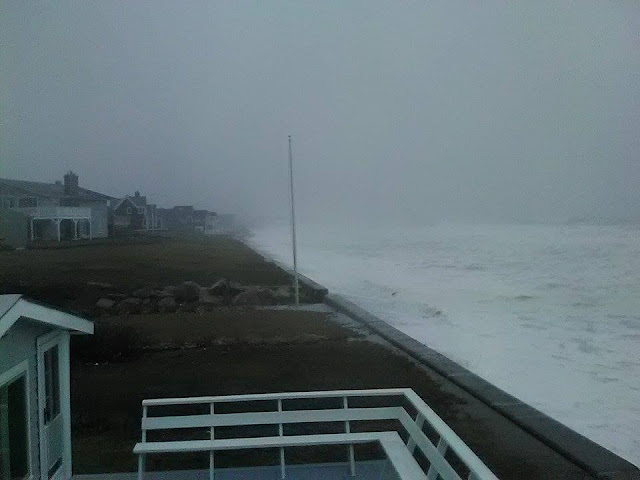
Cape Cod met blizzard conditions yesterday.


They weren't joking about that Red Skies In Morning bad weather omen stuff...


Pre-blizzard sunrise


Same vantage point, 12 hours later.


Here's another Vantage Point exercise. This is at the height of the blizzard...


Same vantage point, once darkness settled in and things calmed down some...


A tree, during the height of the storm....


Same tree, from a few yards back once the whiteout lightened...


Shovel all night, go to get some refreshments, and  a dog took my favorite bar stool. Know that the Trowbridge Tavern provided a Hawaiian Pizza to the author at the height of the storm. 


Thursday, February 9, 2017

Blizzard Warning, School Closings, Snowfall Total Predictions


BLIZZARD WARNING 
REMAINS IN EFFECT FROM 9 AM THIS MORNING TO
8 PM EST THIS EVENING...

* LOCATIONS...Eastern Plymouth County...Cape Cod...Martha's
Vineyard...Nantucket and Block Island.

* HAZARD TYPES...Heavy snow...strong to damaging winds and Blizzard
conditions.

* Accumulations...Snow accumulation of 12 to 16 inches.

* TIMING...Precipitation will overspread the region between 6 and
9 am this morning and may begin as a brief period of rain. Any
rain will change to snow by late morning. The snow will then
fall heavy at times this afternoon before tapering off to snow
showers this evening.

* IMPACTS...Heavy snow and strong to damaging winds will result in
blizzard conditions this afternoon and early evening. Intense
snowfall rates of 2 to 3 inches per hour will be possible at times
this afternoon. Strong winds will create blowing and drifting snow
and near-white out conditions at times. Travel is not
recommended this afternoon and evening. In addition strong to
damaging winds may result in isolated power outages.

* Winds...Northeast 30 to 40 mph with gusts up to 65 mph.

* Visibilities...One quarter mile or less at times.

* Temperatures...In the upper 20s.

PRECAUTIONARY/PREPAREDNESS ACTIONS...

A Blizzard Warning is issued when sustained winds or frequent
gusts over 35 mph are expected with considerable falling and/or
blowing snow. Visibilities will become poor with whiteout
conditions at times. Those venturing outdoors may become lost or
disoriented. So persons in the warning area are strongly advised
to stay indoors.

**************************************************

Here is a list of

School Closings

**************************************************

Snowfall Predictions, by local TV stations, 6 AM:


WBZ... 8-14" for most of Massachusetts. 4-8" for Cape Cod

WFXT... 10-14" for most of Massachusetts, 7-10 on Cape Cod

WHDH.... 12-16" for Estern Massachusetts, 16-20" from Worcester to NE CT, NW RI, 8-12 Cape

WCVB... 12-18" Massachusetts, 10-15" Cape Cod

NECN.... 12" Cape, 15" South Shore, 18" interior SE MA

**********************************************

Coastal Flooding is a threat. The good news is that the storm won't be at full speed at the morning high tide, and will be waning (with north instead of northeast winds) for the evening high tide (11ish). It's an astronomically high tide, so keep an eye to the sea.

**********************************************

Yes, this blizzard roughly coincides with Blizzard of '78. This won't be so bad, but it may be the worst of the year... and we had a 12-18" blizzard already this season.

We'll be bopping around for much of the storm, and we'll get some pics/videos. I may not get to the shore for the storm, but you never know.

We'll be back with an update if need be.

Red skies in morning.... unless my camera disagrees, which happens now and then.


Wednesday, February 8, 2017

Blizzard Conditions Possible Tomorrow


BLIZZARD WARNING REMAINS IN EFFECT FROM 6 AM THURSDAY TO
MIDNIGHT EST THURSDAY NIGHT...

* LOCATIONS...southeast Massachusetts and Rhode Island.

* HAZARD TYPES...Heavy snow.

* Accumulations...Snow accumulation of 6 to 12 inches.

* TIMING...Snow will begin early Thursday morning and last
through much of the day before ending Thursday evening. Snow
could fall heavy at times and impact both the morning and
evening commutes.

* IMPACTS...Hazardous travel due to snow covered roads and poor
visibilities. Blowing and drifting snow is possible.

* Winds...North 20 to 30 mph with gusts up to 50 mph.

PRECAUTIONARY/PREPAREDNESS ACTIONS...

A Winter Storm Warning for heavy snow means severe winter weather
conditions are expected or occurring. Significant amounts of snow
are forecast that will make travel dangerous. Only travel in an
emergency. If you must travel...keep an extra flashlight...food...
and water in your vehicle in case of an emergency.

&&

===================

SOUTHERN PLYMOUTH: (same)

+++++++++++++++++++++++++++++++++++++++++++++++++

Not much to add to that. There is a coastal flooding threat, and a high astronomical tide. The tide will be tempered somewhat by the timing of the storm, which will just be warming up for the morning high tide and will be blowing a wave-killing North by the time of the evening tides.

There is a strong possibility that the current Winter Storm Warning will be changed to a Blizzard Warning later this morning or early this afternoon.

We should certainly have the snow for a blizzard, and the winds will be up for most of the day. Both commutes should feel the pain, although I'm currently betting on the evening commute being the bonecrusher.

After ol' Mr. Blizz leaves town, we'll be in for a deep freeze.

We're looking at another snow event for Saturday. That's looking like 3-6", probably closer to the 3. Keep in mind that tomorrow's storm was a 3-6" forecast a few days ago.

We'll be back with an update if need be.


Tuesday, January 24, 2017

January 2017 Nor'easter Pictures, Videos


A powerful nor'easter hit Massachusetts this week. We missed last night's tide, but we got all up in this morning's offerings.


We mostly worked Duxbury Beach, but we did manage to snap-shot Green Harbor. The tide, normally a 9 foot nothing, got big ups from the storm surge.


I was using a thirty dollar Wal-Mart phone camera and a badly battered laptop, while shooting in the teeth of a nor'easter. The laptop served as the video host, and you will probably be able to tell that I usually have someone else do the filming.


This wasn't a bad storm, maybe a B minus. No structural damage that I could see, although some beach erosion surely went down by the dunes.


I grew up on this beach, and watched a lot of gulls in my time. The smarter ones hunker down somewhere leeward, but sometimes one of them gets bored enough or hungry enough and works the surf. Joe Deady II on the camera for this one.


My old front yard, just after the porch there. It was great fun and easy work repairing that law every spring. We used to have a cobblestone patio, too... cobblestones that my father either bought or "acquired" from some road in Boston. They were very fun to re-arrange every time the ocean did something like this, and I'm a masochist.


The main problem residents here will have is that the ocean splashed a few million gallons of salt water over the wall and onto a great many lawns. You can see it happening between the stairs.


My 35 mph photography is improving, but it is a slow process.


The legendary public stairs of Duxbury Beach, home to much 1980s teen debauchery.


I had to get off of Ocean Road North before it lived up to the name. That took me through this puddle of seawater. I was pretty much that U-Boat Commander joke from the Tom Cruise pimp movie.


Joe Deady made it outside before I did, but I made up for it later with intensity.


Libby Carr gets into the mix with a bit of second story work over some Hummock Lane flooding. Hummock Lane is named after "Rouse's Hummock," which is what Cable Hill was called either A) before they put the trans-Atlantic cable in, B) when Rouse lived there, C) both, or D) neither.


The guy who owns the house with the flooded lawn worked at a golf course when I lived there. No matter what sort of maelstrom befell Duxbury Beach that winter, you could drop a 30 foot putt on it by summer. My yard, by contrast, looked like what grows over a shallow grave after a while if the killer is particularly good at choosing spots that the cops don't look in.


This is what Duxbury's Great Salt Marsh looks like with a spring full moon tide. Unfortunately, this was a mid-cycle 9 foot tide. Any water you can see in this picture is storm surge. I'm at the beach, shooting towards Duxbury Proper.


This is when I decided that moving my car from the driveway of the house I was shooting at would be a good idea.


As bad as this may look, A) it didn't get any, uhm, badder, and B) this is getting off very, very easily. as a full moon tide when this storm hit would have probably wrecked some homes.


You never ever let Ol' Glory get slapped around by a nor'easter. A wind sock would have made my job easier, but that's not this guy's problem.


They say that a waves don't get  more than 5 feet off this beach in all but extreme conditions, and we were in that neighborhood today. They had a rough tide the night before, and were very lucky that those waves weren't rolling into houses on a full moon tide.


You can tell that I shot this one instead of Joe... because it's blurry as heck. The surf covers up for a lot of my errors.


"I'z unda yoor howz.... shootin' at yer ocean."


I got up on the seawall for a few, but it was camera suicide until the tide eased back some.


Even the porch was a rough go.


I got in where I fit in.


Hummock Lane, with Cable Hill/Rouse's Hummock in the background. A newly located Cape Cod Bay, now a street pool, is in the foreground.


RAIN TOTALS AT NOON

North Weymouth, 3.5"
Sandwich 3.24"
East Mashpee 2.75"
Falmouth 2.52"
Duxbury 2.0"

...'been raining since, too.


Rain is actually what washes the salt water out of the lawns, if you're lucky. It's all sand once you go down far enough, and sand drains well.


You can almost see Green Harbor in the background. Green Hahbahhhh... obscured by the mists of the storm.


WIND GUSTS

Wellfleet 59 mph
Minot 40 mph
Cuttyhunk 44 mph
Plum Island 62 mph


Duxbury Beach, summer 1978, after the Blizzard. The house I was doing most of my shooting from is a much larger version of the 4th house from the right. I grew up in #2 from the right.


We made our way south for the tail end of the storm, and got some Sagamore work in.


We got to Saggy well after high tide, so don't think that we don't represent hard down this way.


Sagamore benefits greatly from the presence of Cape Cod, which keeps it from the heaviest of the storm surf.


You could still get knocked off a rock two hours after high tide. Bourne representin'...

We went to the White Cliffs in Cedarville (Plymouth), but the party was pretty much over by then.


Monday, January 23, 2017

Powerful Nor'easter Hits Today, Coastal Concerns


A powerful nor'easter is sizing up New England, bringing the potential for heavy rain, high winds, power outages and very dangerous seas.

We'll let the National Weather Service tell you:

**********************
Monday Morning Briefing:

The coastal storm that we've been talking about for the past few days is set to arrive today. There is a lot to talk about, so here's a rundown of the potential hazards. Check out the images below for more information.

If you have any questions, feel free to post them here. We'll do our best to answer them as soon as we can.

Winter Weather: Today into Tuesday

- Mix of snow, sleet, and some freezing rain expected across much of western and central MA and northern CT.

- Higher accumulations (2-4") expected across higher terrain near Berkshires and northern Worcester County. There could be as much as 1" of sleet in some areas.

- Less icing is expected than was previously forecast (now under 1/4 inch).

Wind: Strongest Later This Afternoon and Tonight

- East winds gust as high as 60-70 mph along the immediate eastern Massachusetts coast including Cape Ann, coastal Plymouth County, Cape Cod, Martha's Vineyard, Nantucket, and Block Island.

- Gusts of 40-50 mph expected elsewhere, except 30-40 mph in Franklin and Hampshire Counties.

- Strongest winds expected from late this afternoon into tonight, before winds subside quickly Tuesday morning.

Heavy Rain: This Evening into Tuesday Morning

- 1 to 3 inches of rain is expected, with the higher amounts in RI and eastern MA where locally higher amounts possible.

- Potential for significant urban flooding in RI and eastern MA, possibly flooding of small streams as well.

Coastal Flooding: This Evening and Tuesday Morning

- Pockets of minor coastal flooding expected along the eastern MA coast during this evening's high tide. A storm surge of around 2 ft is expected.

- More widespread minor coastal flooding is expected in the same areas with Tuesday morning's high tide, when there could also be pockets of moderate flooding. A storm surge of 3 to perhaps even 4 ft is expected.

- Most favored areas for moderate flooding include Newburyport, Scituate, and possibly Gloucester and Nantucket Harbor.

- Minor coastal flooding is also possible Tuesday morning along parts of the South Coast including Newport, Westerly, and Block Island. Coastal Flood Advisories may be issued for these locations later today.
********************************************************************************

Snow isn't expected anywhere in our reading area. This is good, because 3 inches of precipitation can crank out 2+ feet of snow very easily. Throw in several hours of tropical storm force winds, and we'd be using that B Word which rhymes with lizard.

Instead, we'll get soaking rains, howling winds and pounding surf. The storm should produce 2 fierce tides before the winds shift. Prior to what we previously thought, winds are now forecast to be from the NE at high tide on Tuesday morning, which is bad news for anyone owning a beach house.

Tides are astronomically low, but that will be cancelled out by the 2-4 foot surge. The end result is equal to the worst full moon high tide of any month. After that, it's just a question of how big the waves are when they hit the shore. You can use the math from the chart up at the top to see how the tides will be altered by the surge.

The winds may also take down some power lines, especially when you get closer to the coast. You can check the wind forecast for your area in the picture at the bottom of this article.

Some more NWS stuff. We're doing watches and warnings pertaining to Duxbury, just because...

High Wind Warning

Areal Flood Watch

Coastal Flood Advisory (Monday)

Coastal Flood Watch (Tuesday)

As for us, we plan to take to the road for this storm. The surf will be better on the Cape at the height of the storm, but it might be more practical for us to work the Irish Riviera, maybe Scituate to Plymouth to Sandwich. I may not see my own house for two days.

We'll post our pictures as we get them. Anyone who wishes to contribute can reach us through our Facebook page. We love reader submissions. You're probably a better photographer than ol' Steve here, so you'd have a good chance of taking the best picture used in the article.

We'll be back with an update.