Showing posts with label Cape Cod Canal. Show all posts

Saturday, March 5, 2016

Admission Of Fault In Sandwich Beach Erosion Dispute


The good people of Sandwich got some welcome news recently, as a recently released US Army Corps of Engineers report determined that the Corps was at fault in a Sandwich coastal erosion matter.

The issue at hand is beach sand erosion at Town Neck Beach. The cause is said to be the jetty at the east end of the Canal, on Scusset Beach.

Erosion along Cape Cod Bay is generally a give and take thing. Every wave carries off a bit of your beach, but those waves also steal sand from further up the current from you and dump it on your beach. Nobody wins, but nobody loses that badly... well, for the most part, generally.

Responding to one problem (shipwrecks happening as shipping rounded the treacherous waters off of Cape Cod), the Man created another one. The US Army Corps of Engineers now manage the Canal that was cut through Bourne and Sandwich to circumvent that nastier voyage. That management responsibility includes accessories like lighthouses and jetties.

These accessories, like the jetty off of Scusset Beach, have several functions. Some, like slowing down waves before they mess up Canal shipping, were intentional. Others, like the traffic jams on the bridges spanning the Canal, were matters more of the OOOPS! variety.

"OOOPS!" isn't so bad when you stub your toe or pour too much tequila into a drink, but it becomes Very Bad Indeed when it starts washing your yard away.

The jetty off Scusset stops the flow of sand down from the South Shore beaches as Mother Nature intended it. This fills in Scusset Beach with a nice, fresh layer of sand every X amount of years. By doing so, it deprives anything east of the jetty of the sand that they normally would gain via the motion of the ocean.

For 'bout a third of a mile immediately east of the Canal, it's a fair bargain. You lose out on new sand, but you get the protection of a big, federally-funded-and-maintained rockpile against the storm surf. Every beach gets hammered if the wind hits it, but the jetty blocks the worst of the surf from the dreaded north wind that always beats up Sandwich as a storm pulls away.

Storms aside, the real killer is the Western Maine Coastal Current, which flows southeast along the South Shore before hooking east around where the Canal is. The jetty protects that first area against the current, but the beach beyond it has no such protection.

Look at it from a satellite, zoom in close (Go ahead... look), and you'll see right where that protection runs out.


Beaches like Brewster and Dennis also lack the protection of a jetty of that magnitude, but they at least get the sand that is flowing away from Sandwich and Barnstable. Sandwich, and Town Neck Beach in particular, get hit by the current, they hit by the storm waves.... but they miss out on the replenishing beach sand washing down from Scituate and Manomet. It's lose/lose.

Even things that seem logical and symbiotic, like filling in Town Neck Beach with sand dredged out of the Canal, instead become illogical and parasitic when our friend D. Next Storm comes to town and that new sand washes down to Barnstable and Beyond. "Gone, gone, like the snows of yesteryear."

Sandwich has been losing 2.5 feet of beach a year since the flow of sand was cut off, and that jumped up to over 6 feet a year during the recent rash of coastal storms.

Generally, that's between Sandwich and God. God can't be sued. However, if someone plays God with the coastline, you can take your best James Sokolove at them
.
The admission of fault in the USACOE report (an honorable result, as giving the defendant the right of determining fault often ends up like when the wolf, the coyote and the chicken vote on what to have for dinner) opens up some doors as far as How To Fix This Problem goes.

Section 111 of 1968's River And Harbor Act authorizes up to ten million smackeroos in compensation for damage resulting directly from federal navigation projects.

According to the USACOE's own report, they are directly at fault. That saves Sandwich a lot of money, never a bad thing these days.

If the repairs cost less than ten million dollars, they are Uncle Sam's treat. Anything after that, the town and the feds split it 50/50.

That could also cost Sandwich millions, but they get millions in property taxes from houses along a tourist-drawing beach that pays for itself all over the friggin' town. Even if it's a fortune, it's money well-spent.

The decision should perk up ears in any town along the coast that may, say, have a USACOE seawall or something like that. One must be vigilant. Duxbury Beach residents barely dodged a similar bullet on seawall repairs, with the town about to lay all the costs on the residents before the people spoke up.

Sandwich hasn't won the war yet, but they did just take the Dub in a major battle.


Monday, November 9, 2015

The Cape Cod Canal Foliage Project

Quint wasn't talking about Cape Cod when he laid down the facts in Jaws, but he may as well have been. We are a summer community, and we need summer dollars, or we'll be on the welfare all winter... something to that effect.

However, money grows green in all seasons. Why not make some Autumn money? Does money really grow on trees?

Autumn money is sort of up our alley. We're the Thanksgiving ground zero for America. We have quaint little cranberry bogs scattered all about. As long as you don't go swimming, those beaches are fine on a warm autumn day, even in November.

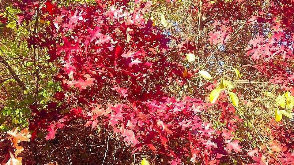
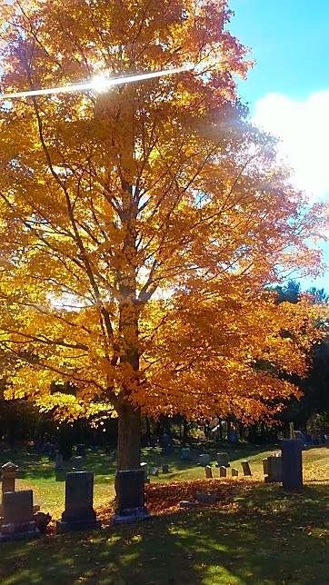
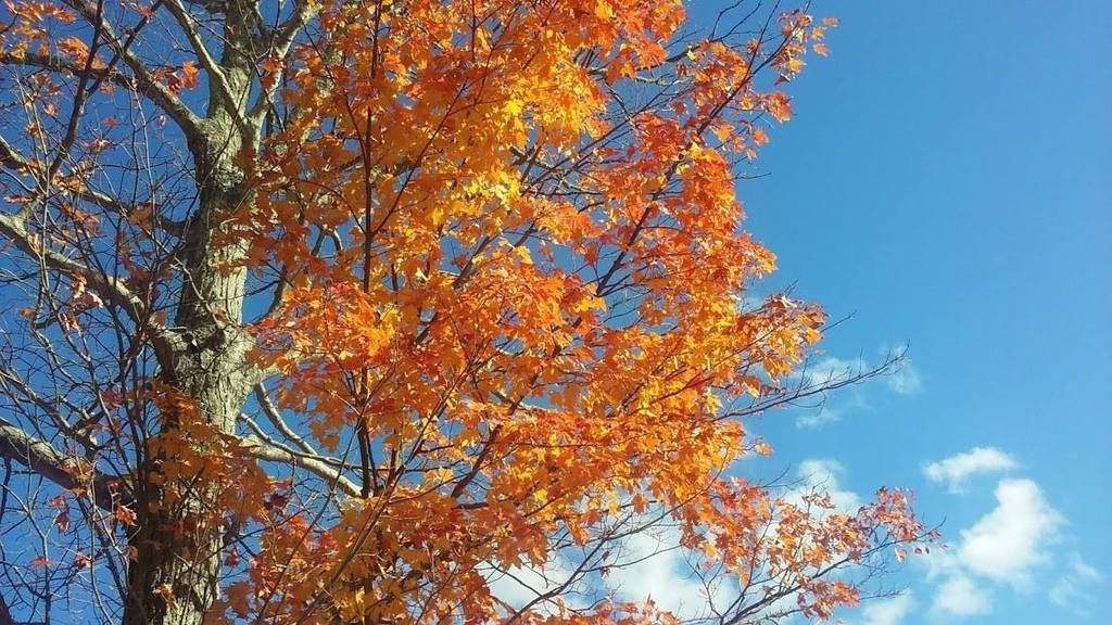
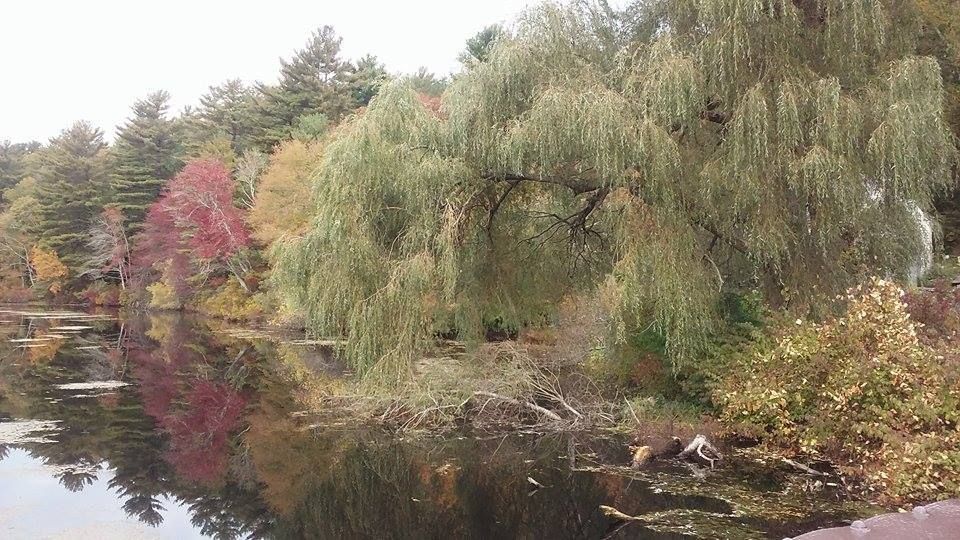
We also have foliage. Now, when you think of foliage, you think of New Hampshire, Maine, Vermont and even the Berkshires. You don't really think Cape Cod.

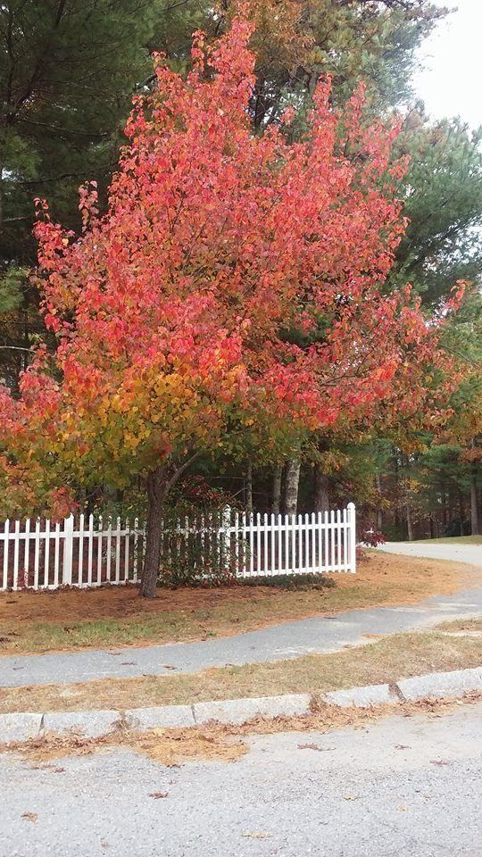
Middleboro certainly doesn't think so, and they planted this tree to prove it to you.

That's a shame, because we're the last region of New England to experience peak foliage. Maine trees are bare when we're just getting to the height of our season. Cape Cod, if you look at a foliage map, peaks right around when a Kentucky-Alabama swath is peaking, and those states don't do foliage like New England does.

We should be better known for it. Everyone who saw the beautiful foliage shots from New Hampshire on the news, and who then said "We should drive out in the country and see some foliage," but who then procrastinated... those people should be looking at Cape Cod as a Last Resort.

People aren't stupid, so there must be good reasons as to why we don't get Vermont's autumnal swagger. For starters, we lack the forest cover that northern New England has. We also have the wrong sort of trees.

That second problem can be fixed.

Trees drop acorns and so forth, and those can be harvested. Plant them in the ground, and they'll grow a version of the tree that they fell from. Come autumn, those trees will put off the same color that their parents did.

It's so simple, it pretty much takes care of itself.

I called a few tree farms, and the big difference a tree would see in Massachusetts as opposed to New Hampshire is that they would go into seasonal color changes later. Trees that turn in early October in Falmouth, Maine would have to wait until November in Falmouth, Massachusetts.

Let that fact roll around in your head a bit as we figure out how to make money off of this.

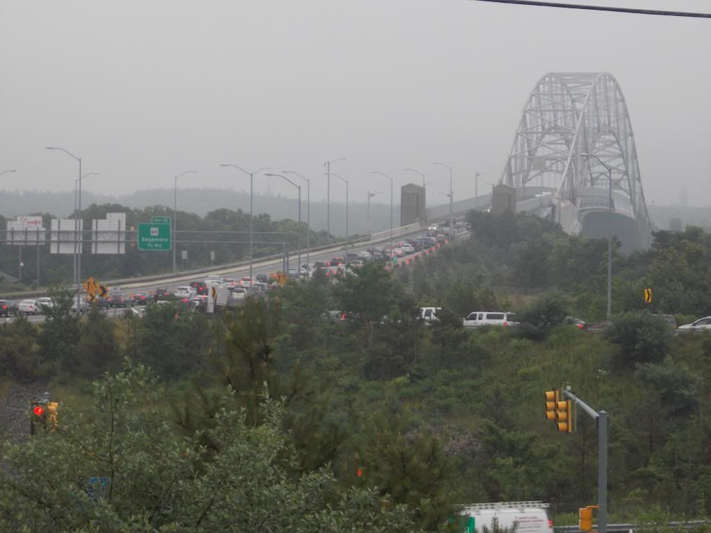
Cape Cod is a series of tourist towns, and the weakest link in the chain is Bourne.

Bourne is very nice when compared to Fitchburg or Holyoke, but it's in last place as far as Cape Cod tourism goes. Bourne has nice people living there and has a lot to offer, but we have Bay where everyone else has Ocean, so we sort of lag behind the other Cape towns when it comes to tourism.

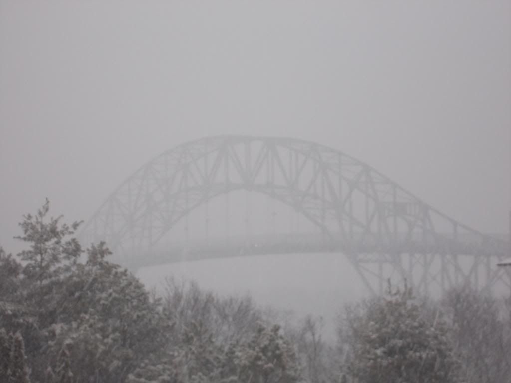
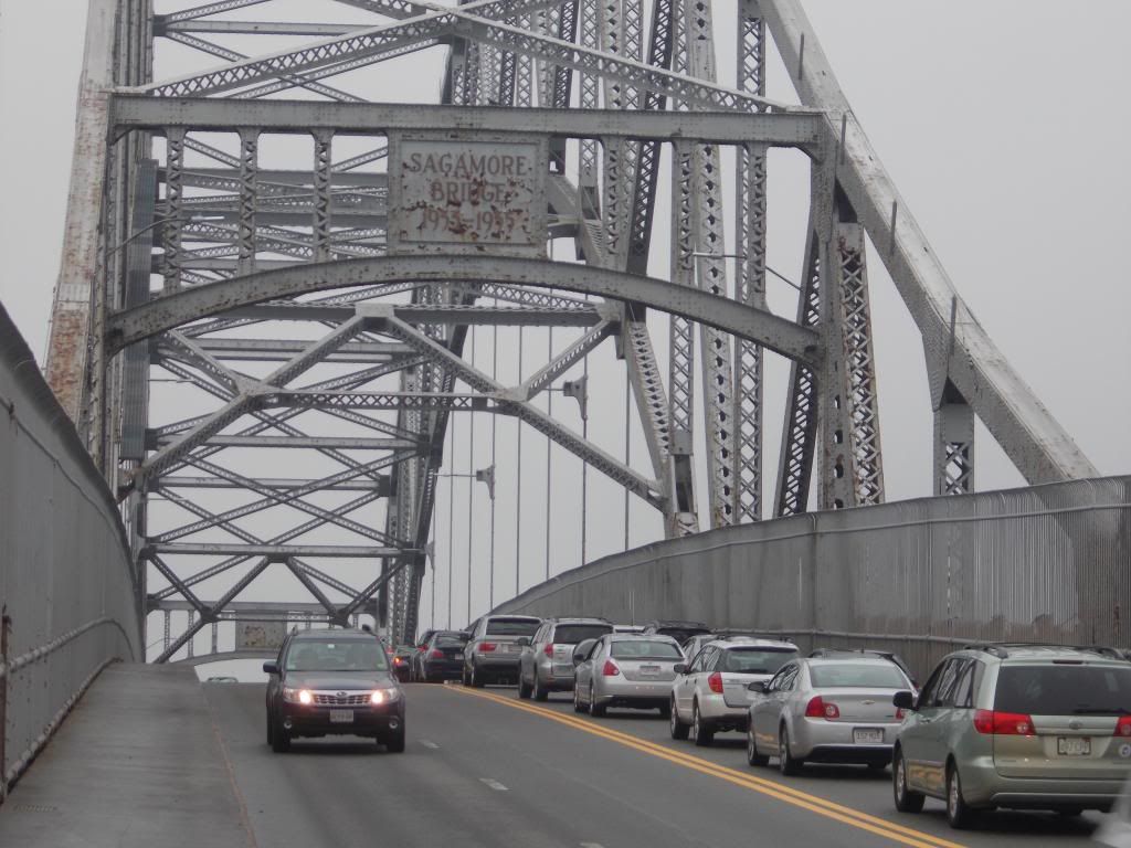
There's not much we can do about the Bay, but the Cape Cod Canal is another animal entirely.

The Cape Cod Canal is an ocean river, The canal is 7 miles long, and it is framed on each side by a wonderful bike path. These paths are framed by a thick row of trees.

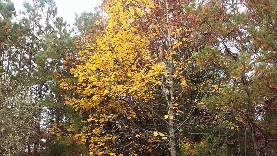
These trees tend to be pine, Pine is lovely, but it doesn't do much during Autumn beyond dropping pine needles into that gap between your windshield and the car hood. There's nothing wrong with pine, but no one is driving out from New York City to look at it.

So, we have several problems: a weak sister of a Cape Cod town, a poor foliage reputation, a short tourist season and a boring pine Canal.

If we could somehow wipe that slate clean, even if it takes a few generations, we could maybe get this town back on a payin' basis.

That's why we should do whatever it takes to plant ten thousand acorns along the Cape Cod Canal. Not just any acorns, either. We should take acorns from trees that produce spectacular foliage.

I won't make it to the mountain top with you, but once those acorns become trees, we'll have the premier foliage display in Massachusetts and perhaps New England.

It's all there for the taking.

New Hampshire and Vermont have it easy. They didn't plant those trees, and they only still have those trees because not enough people want to move to Vermont to warrant clearing space. They don't deserve that foliage.

Bourne, on the other hand, would aggressively select their trees. We'd be Mother Nature on steroids, ruthlessly saying which tree will grow where. With the tree huggers appeased by the planting of ten thousand trees. we'd be free to play God yet again with the Cape Cod Canal area.

If the right people (and I'm not one of them, I become useless as anything other than a laborer after the Idea Stage) are running this, we could have a ridiculous run of foliage down each side of an underutilized Canal.

Planned by experts, planted in rows fronting the Canal and dropping acorns of their own each year, the Canal Forest would both own and pwn the rest of New England as a foliage destination.

Bourne would then have some nice assets to work with.

We'd have a sweet location, maybe 25% of the drive someone might have to take to get to the Maine foliage. We'd have foliage that would kick in during the run-up to Thanksgiving, which also draws tourists into the region. We'd have hotels, gas stations and all that other stuff that leeches money out of tourists.

Most importantly, we'd have our ridiculous multi-colored Canal. The canal has plenty of parking, would feature easy access, boasts of long-but-not-too-long walks and would look like New Hampshire would look if it were planned.

You could probably sell boat tours of this new foliage run, with the added bonus of three bridges and one power plant. I think they already have Canal foliage boat tours, but this would become a larger venture if our Canal looks like the Mohawk Trail wishes it looked.

 This would merge nicely with our present Tourist Season.

The majority of the tourists leave after Labor Day.

The old people are smart enough to do Cape tourism after Labor Day, and they help push the season into October.

A foliage explosion in the Canal would push that season into maybe mid-November (you can still see foliage driving around Cape Cod today)...

... where it would merge with the Pilgrim/Wampanoag/Thanksgiving connection, which we should also figure out an angle from which we could extract profit from exploiting it.

We just need the ten thousand acorns.

How to get those ten thousand acorns is the question we need to solve. I have no intention of standing up at a town meeting with this idea, as I'm not tree-savvy enough to answer the questions that citizens would rightfully ask if something that smells like Tax is spoken of.

I have no idea how much ten thousand trees would cost. I'll try to find out before we publish, as I tend to work during the Witching Hour. Hopefully, this section between the pictures will be bigger tomorrow.

UPDATE: I bothered a few people, including Stephen Davis and Chuck Teravainen.

Maple saplings go $20-30 or so, live 100 years, grow 6-12 inches a year, and need about 20-25 yards of space. Wisteria is $20, and Dogwood goes $15. Aspen is $18-29. Water and fertilizer would be needed for the first few years.

These prices are awesome if you have a big yard and plan to hold onto the house. If you have a 7 mile Canal to fill 2 sides of at $15-30 every 20 yards, that adds up to... like...uhm... carry the two..... a lot of money.

It's not too hard to grow trees from acorns. It's much cheaper. We can get the kids to do the labor for nada.

One reason that I'm not worried about town meetings and how much trees or acorns cost is that I have no intention of buying acorns.

I was never in the Cub Scouts or Boy Scouts myself, but I always thought of Scouting as an admirable pursuit. I assume that they spend a lot of their time in the woods, doing woodsy things.

I'd challenge the little SOBs. Give the world an eco-friendly, cash-grabbing project that shows off the beauty of nature, and help along a struggling resort town in the process.

I don't know how many Scouts there are on Cape Cod, but if a hundred of them could be trained to identify acorns from the proper foliage trees, would it merit a few bus trips worth of cash to send them up into the Enemy States to each steal one hundred of their acorns?

One trip to New Hampshire for supplies, another to Bourne for planting. Train the DPW people well enough that they don't cut down saplings. I'm not above using specially-trained prison labor, but residents may disagree.

If the Scouts won't do it, each Cape Cod high school should be coerced into sending their kids up to gather acorns.

Yes, every school or Scout troop on Cape Cod. I sit through a lot of traffic so that Orleans and Yarmouth Port can get their tourists, and we want some payback in the form of acorns. Before those brats get their diplomas, they pay the Gatekeeper fifty acorns.

Some of that cash will bleed into their towns too, as people who walk the Foliage Canal might decide to trek down 6A, or maybe watch the sharks kill the seals in Chatham. Its win/win, unless you're a seal.

Someone should be coordinating this effort. It's a tough sell, because we won't see the payoff in our lifetimes, but the kids will. When those trees sprout, we'll be in business.

For the bother of gathering and planting a few acorns, we'll be the most easily accessible foliage spot for what I'd gather is a large % of the leaf-peeping population.

Would you rather drive 6 hours into the Vermont wilderness and amble down endless East Bufu roads looking for bursts of foliage, or would you rather blast down to Bourne in an hour and take a leisurely stroll through what would essentially be a bursting-with-color foliage theme park set by an ocean river?

Bourne, who lost their end o' summer cash cow when the Scallop Festival skipped town, would slowly evolve into the Autumn anchorman of Cape Cod.

New Hampshire won't know what hit them.


Wednesday, October 14, 2015

For Whom The Bridge Tolls: Thoughts On A New Cape Cod Canal Bridge


Let's start with some numbers:

Bourne Bridge
Year round daily average (2011) = 42,505 vehicles
Summer daily average = 58,467

Sagamore Bridge
Year round daily average = 51,489
Summer daily average = 70,674

Those numbers lead to impassable traffic jams, jams where ten mile drives take 3 hours.

You've all heard the war stories. "25 mile backups during Hurricane Bob," or "90 minutes from the the 6A/130 intersection to the Sagamore Bridge during the Mother's Day Massacre of 2012."

Bourne residents literally can't go anywhere and hope to come back on Friday afternoons, Saturday/Sunday mornings, Sunday nights, during the Monday commute, and/or during any holiday/event.

Emergency evacuation is impossible, property values suffer, the quality of life is lowered, and the last sentence of the previous paragraph is literally saying "as a Bourne resident, you sacrifice a sizable % of your waking life to traffic."

This would be tolerable in Boston, where there are a million people zipping about. It shouldn't be the case in Buzzards Bay, where 3000 souls can be found on any given day. It makes me want to scream at someone more than I care to admit.


Here's how I see it....

* We need a third bridge.

* We need a third road leading up to and away from that bridge.

* If we want it, we'll have to pay for it.

* We'll pay for it with a toll bridge.

* The tolls will be there forever, even after the bridge is paid off.

* Prices will increase as businesses pass the toll costs onto the consumers.

* We shall eventually pay billions for a $300 million bridge.

* Splitting traffic up at the Christmas Tree Shop and then merging it back together 400 yards across the Canal will not resolve our traffic problems. It may in fact make it worse.

* The bridge will not meet the stated goal of easing traffic volume at all, and it serves no other purpose.

* We'll pay for this useless bridge for the rest of our lives and the lives of our descendants.

* If we don't do something, this nightmare is imminent.

* It seems to have fallen to me to brainstorm something.


I'm not picking on MA State Rep. Randy Hunt or Cape Cod Commission CEO Wendy Northcross there. Randy is obviously putting thought and effort into the problem, and Wendy answered almost everything I asked her about the topic. They just don't seem to see the basic problems inherent in this situation, or they feel that the problems are tenable and/or unavoidable.

Pols are sort of bound by what they think they can sell in Washington or the State House. They know they will have to claw through miles of red tape to even get the idea mentioned. They know that there will be many hands reaching into our pockets once the project gets green-lighted, especially with a Massachusetts highway project.

All of that real world stuff gets them used to operating in a way that somehow prohibits Thinking Big.

The intricate solution is beyond my capabilities. If I showed any Urban Planning skill in high school, a series of guidance counselors failed to mention it to me. However, the basic philosophy on what we need to do is well within my skill set. You'll see it, too.

The toll will generate billions in revenue, without reducing traffic at all. It is almost punitive. Only someone with a financial stake in a road-construction industry or highway management can like the idea. Any politician who supports it should be chased through the streets by a mob of angry constituents, and perhaps be kicked in the ribs a bunch of times.

If we and our tourists are going to spend billions over the life of a toll bridge, we should at least get what we pay for.


50,000 cars a day times $5 a pop = $250,000 a day in toll revenue.

Let's lower the toll rate so that I can just say "a million a week" and "maybe $5 a car is a doomsday estimate" without stretching the truth too far.

300 weeks pays off the project. 300 weeks is like, uhm, 6 years or something.

But the toll will last forever.

Heck, we'll even throw in a decade or two to cover any/all maintenance costs, and a third decade to cover the eventual replace-the-old-Sagamore-Bridge costs. Over an assumed 100 year lifespan of the bridge, this still has the Man needlessly in your pocket for 65 years.

The only way for us to get any value out of this is if our project is so massive, it takes a century of tolls to pay for it.


Off the top of my head, I'd drop a third bridge right in the middle of the other two. I would gut Bournedale with roads connecting to Route 25 and Route 3, seizing Bournedale Road and Herring Pond Road by Eminent Domain if need be. I'd make the road into a big Y, with the bottom part of the Y being the third bridge.

I'd do an upside down version on the other side of the bridge, after taking some land from the gub'mint. The forks of the letter can sort of ^ towards Route 28 and Route 6 through the military base.

Shoot, why not build it in such a way that we can line it with Burger Kings, Cumberland Farms and Exxons? I have never met a local economy that couldn't use a rush of jobs. Perhaps even a Bournedale Mall would not be out of the question.

It would actually solve the problem that Main Street in Buzzards Bay has had since the freeway went in. Route 25 cut off our Tourist Flow, so we get back at Route 25 by cutting into it to run those same tourists by our businesses again. Main Street could slowly re-design itself to suit more immediate local needs, which it is sort of doing now anyhow.

There would be some ugliness to They Tore Down The Carter Beal Nature Preserve And Put Up A Gas Station With A Dunkin' Donuts In It, no doubt. We could mute the environmental damage by building an elaborate Arc de Triomphe bridge over the herring run in Bournedale.

I'd also go with a wrap-around fishing pier along the bottom of the bridges, and light all of the bridges up like they do with the Zakim Bridge. I'd celebrate the opening with a party so huge and chaotic, it would make V-J Day look like someone just won a Scrabble game.

It's being paid for... why not?


Hold on, someone did the map better than I did.


In my world of the future, we now have a third bridge. It is fed by roads which break off from highways which are already in place. The roads break off at the exact points (the Ingersoll Bend and Herring Pond Road) where we currently begin our present bumper-to-bumper congestion. We strike at the areas with the lowest population densities, mostly swamp and wasteland. Anyone we displace is compensated handsomely.

Locals can still use Main Street, Sandwich Road, the Cranberry Highway, the Scenic Highway and 6A for local-type stuff, which leads us to the best part. Before I get to that best part, I'd like to add that this plan would probably allow us to get rid of the two Bourne Bridge rotaries, and just have intersections like normal towns do.

The best part? The third bridge would be almost 100% Tourist. The current bridges feed the Bourne villages, while this hypothetical third bridge would empty into a discontinued military base and some Bournedale swampland. It would be of little use to locals, and it would only be used by tourists.

And it is this bridge that would bear the dreaded Toll. Holler if you hear me.


Now we have the burden where it should be. Tourists can pay for their own bridge. Smarter hotels and tourist destinations can comp guests for the toll. Bourne residents have suffered for years to fill Harwich restaurants with tourists, so cry me a river, Mooncussers.

Bourne and perhaps Sandwich residents will be exempt from any tolls, of course. We've been tolled in Traffic Patience for the last 100 years. F*** you.

The toll bridge can also be used by the rich man to skip heavier traffic at the free bridges via a small shedding of excess wealth, as the new bridge would sport a very low traffic volume for most of the week.  A five dollar toll for an empty bridge may also be an acceptable and necessary luxury to a working stiff who is running late for work on an important day.

We may have to somehow divert traffic to the toll bridge on certain Touristy days while preserving the free bridges for local traffic, and perhaps even invest in some of that Urban Warfare stuff that the cops get in larger cities where the people riot a lot. Maybe we can borrow some tanks from the military base.

We'll cross that bridge when we come to it, if you'll pardon the pun.


Sunday, September 27, 2015

Cape Cod Canal Fog


Good Morning, Cape Cod!

Early morning folk know that the Cape Cod Canal, on spring and autumn mornings, often develops her own little Fog River.

There isn't a puff of fog anywhere else in town right now.


I wasn't the only shutterbug around, but I'm savvy enough to not bother the fishermen.

This fog will be gone soon enough, but it's a beautiful show this morning, at least while it lasts.

If you read this right as I post it, come on down and walk in a cloud.


Only on the Canal this morning can you shoot directly at the sun.

At least one person asked me if there was a wildfire burning somewhere. Indiana plates.... shakes head.

I can't imagine how you'd pilot a boat in that. Dead reckoning sounds too ominous.


I love fog, I'd like part of the town to be like this all day.

There is a striper tournament on the Cape this weekend, and you know that a few of them wandered down to the Canal for some morning casts.

They most likely parked their cars on Sandwich Road in unlimited visibility, cut through the woods, and ended up in a film noir scene.


I had to hop around on the Sagamore Bridge for some of these, so be appreciative.

Yes, should have hopped off, I get it, very funny.


I shot this over Route 6 on the Sagamore siply by holding the camera over my head and hoping I got lucky with the clicking.

It may do this tomorrow as well, with the added bonus of a Supermoon descent.


Have a good day, folks! Go Pats!

Monday, September 21, 2015

Sandwich Hurricane Information

Sandwich is a town with a funny name, even in a state that has a Marblehead and an Athol in it. Sandwich is also a town with gorgeous beaches and marshes, which are awesome for 364 days a year. Those beaches and marshes become a problem when a hurricane comes to town.

We come to you today to talk about hurricane maps. These maps come from FEMA, MEMA, NOAA and NHC. The map at the top of the page is a Hurricane Inundation Map.

Here's how it works:

Light Green = Category 1 hurricane. Hurricane Gloria was one of these, and the offshore Halloween Gale was, too. Although not a tropical system, the Blizzard of '78 did Cat. 1-style damage.

Dark Green = Category 2 hurricane. Hurricane Bob was one of these.

Yellow = Category 3 hurricane. We've only had five of these hit New England since the Other Man arrived in 1620, the most recent being Hurricane Carol in 1954.

Pink = Category 4 hurricane. We've had one in recorded New England history, and it struck in 1635.

Flesh = One Hundred Year FEMA Food Zone. This is the "100 year storm" you hear people speak of, but you have to go pre-Colombian to find them ("going pre-Colombian" means using salt marsh soil samples to look for sand layering associated with large hurricanes). New England has had storms in the Category 4+ level in the 1100s, the 1300s, and the 1400s.

Sorry about Flesh, but my knowledge of color names was and continues to be heavily influenced by whoever was in charge at Crayola in the 1970s.

Yes, that's Duxbury, and yes, that's from a nor'easter and not a hurricane, but it is Inundation.
"Inundation" is a big word for "storm surge," which are two small words for "saltwater pushed ashore ahead of an incoming cyclone." Feel free to develop more colorful terms like Deathwash or Liquid Doom if that gets your people serious. Flooding is the big killer in hurricanes, sort of what artillery is to warfare.

This map is based on the zany-weatherman-titled SLOSH model for storm surge inundation. It depicts the inundation that FEMA thinks will occur with a direct-hit hurricane arriving at mean high tide. It does not account for freshwater flooding. It also shows what intensity (on the Saffir-Simpson hurricane intensity scale) of storm would be needed to soak certain parts of Sammich.

I have written this very same article for every town in SE Massachusetts with a coastline, and many towns are tricky with flooding. Pembroke, which isn't even near the ocean, will get some salt water in a bad enough hurricane. Mattapoisett floods several miles inland, while New Bedford should- in theory- hardly flood at all.

Sandwich isn't even a little bit tricky. Most of her flooding will occur very close to shore, and you can pretty much guess where it will happen if you take a Sunday drive through town. Granted, someone with my job has looked at a lot of hurricane inundation maps and gets sort of jaded with coastal destruction, but nothing on the Sandwich map makes me say "Damn... who woulda thunk?"

That's not snow, it's, uhm, stubborn hurricane wave foam...
Now, don't look at that map, see that your neighborhood isn't colored (FEMA is very egalitarian, and "colored" neighborhoods on FEMA maps are generally populated by less swarthy, waterfront-property-having folks... towns with significant minority populations usually have them in the White neighborhoods), and think that you are off the hook from hurricane damage if one comes up on us. No.

You can get Ended in an innumerable amount of ways if a hurricane hits Sammich, only a few of which involve saltwater inundation. You could step on a downed power line, get the Charles I treatment from flying debris, drown in pond flooding, have a tree fall on your car, get crucified by purging looters, get swallowed (either up into a cyclone or down into a whirlpool), drown in your attic, suffer summary execution by the National Guard, stumble into a sharknado... trust me, I'm just scratching the surface here, player.

We want you alive. Beyond base reasoning like "If you actually looked at this article, we cherish you and cannot fiscally afford to lose your potential site visits," we also have a sort of "If they utilized the article properly, they live" professional pride thing going on. We also want you alive for regular, nice-person reasons. You're our kind of people.

This leads into our next map, the Evacuation Zone map. This one is much less nuanced than the Inundation map, in that there are only two colors.

They basically break down to:

Pink = These people should leave.

Yellow = You should leave, too.


Here are a few things that my highly trained eye sees with these here maps of ours:

- Storms will be very, very capable of washing out Route 6A in some spots. This makes Scorton Neck into an island.

- Add that to "the bridges close when the winds top 70 mph or so," and you have a Trapped Sandwich.

- Marylou's of Sandwich is vulnerable to Category 4 storms, a problem I expect them to have solved before the next Category 4 storm hits. I need Marylou's, as I don't like Red Bull and this site doesn't make enough for me to afford cocaine.

- The Sandwich fire and police stations are vulnerable to even a minimal hurricane.

- You're safe off Route 130, and I'd encourage coastal people to befriend someone off 130 well enough to be granted asylum from the storm.

- Even a minor hurricane will at least temporarily end Sandwich's above-water presence on the mainland.

- The Canal would only spill over in Category 3 and above.

- The power plant is safe from flooding in all but the worst storms, according to FEMA.

- Ridiculous shoreline change is likely, with much sand loss into the marshes. Thanks to the Canal jetty and certain legislative failures, no replenishing sand will be forthcoming.

- We'll leave the street-by-street analysis to the reader. You can use the maps on the site to zoom in to your very home. We'll link you up at the end of the article, no worries.

- Seek out and question whichever old-timer has lived in your neighborhood the longest. Ask him or her what happened in Hurricane Carol. Find out how bad the road flooded, what happened to your house, how impossible escape was, and all that. You should never fail to utilize the Old School when planning your personal emergency response.


Bone up on the Hurricane Information with these handy links:

Hurricane Inundation Maps

Evacuation Maps

Worst Hurricanes To Hit New England

List of all hurricanes to hit New England


Sandwich Flood Mitigation Plan

(pictures by FEMA, Stacey Moreau and Carter Malpass)

Sunday, September 13, 2015

Fisher Cats In Bourne

I nearly ran over a Fisher Cat on Head of the Bay Road in Bourne last night (right around where it meets Bournedale Road),so I dug up this article from our 2014 archives at the old rag:

I forget where I got this picture, may be MassWildlife.gov
You thought they were gone, but you were incorrect. Fishers are alive and well on the Upper Cape... except, of course, for the one that was run over in Sandwich on February 22nd.
The fisher (also known as a Fisher Cat, though it is not a feline) is a member of the Mustelid family that also gives us weasels, otters, badgers, and wolverines. They are mammals, omnivores (they are carnivores, but eat enough Other to get the omni tag). They can grow to 4 feet, although Cape Cod is far south for them and the larger versions of many creatures tend to be the more northern ones. We can get a 3 footer here. A lot of that distance is Tail. It looks like an angry ferret.
They live on the forest floor, although they are skilled tree-climbers. They eat small rodents like mice and bunnies, but are not above killing a wild turkey now and then. They eat carrion, and yet they have a berry-nut-mushroom vegan section of their diet. They have been reported to have killed bobcats, which also live on Cape Cod. They are crepuscular, dawn and dusk operators.
Fishers are rare in that they are one of the few predators to hunt porcupines (they make repeated bites to the face), no mean feat. They love chicken coops. While they can do it, it is rare for a fisher to actually catch and eat fish. The name comes from the French word fichet, which refers to the pelt of a polecat.
Fishers once ran free on Cape Cod in large numbers, before we chopped down all of our trees for farmland, heat and industry. Cape Cod was importing firewood from Maine long before the Civil War. The fishers vanished as their natural habitat did, and they were also the victim of large-scale trapping for their valuable pelts. By the mid-1800s, the fisher no longer lived on Cape Cod.
As farming and industry left the region, the forest began to claim back some of the land. Fishers began to inhabit central Massachusetts in the 1950s, and diffused eastward over the decades. There is also talk that they were introduced along the Canal as mousers about a century ago, when canal-digging displaced the region's rascally rodents.
Fishers were spotted on Cape Cod around the turn of the century, although wildlife officials generally laughed off reports. A 2005 fisher roadkill in Sandwich ended the debate. Wildlife officials are slow to accept change. For instance, not a decade before a bear was seen wandering all over Cape Cod, Thomas French (assistant director of the Massachusetts Division of Fisheries and Wildlife) said "It's going to be... decades and maybe never.... before.... a bear crosses the Canal."
Fishers seem to have established at least a ten-year foothold in Sandwich, and they can be seen scampering around the Canal in Bourne during evening hours. They seem to be in the Massachusetts Military Reservation grounds, as well as the Shawme-Crowell State Forest.
Although they can and will kill a pet (a fisher was discovered with cat fur in his tummy up in New Hampshire), it isn't their normal modus operandi. Even a small dog would give a fisher a terrible fight, let alone a big Rotty or something of that ilk. A study of fishers in New Hampshire showed that 1% of their diet was cat.
Bobcats and coyote, which also inhabit Cape Cod, are a far greater threat to the local pet population.
Properly motivated, a fisher could do terrible damage to a small child (there is at least one report of a fisher attacking a 6 year old in Hopkinton), but attacks are beyond rare. An angry soccer mom can kick one away. One also attacked a kid in Rehoboth recently.
If you are kicking one away and happen to kill it, skin it and make a hat out of it. Fisher hats are going for between $195 and $500 on EBay. I may be incorrect, but fisher fur is more costly than mink.
There's no need to panic, and the fisher is actually pretty cool in his own way. He is a sign that wildlife which we thought was lost forever is instead returning to the region. "Moose" and "beaver" are the next wild animals to wish for on Cape Cod.
Note: Mountain Lion tracks found in Winchester?
A fisher in Carver, photo from Donna Paulin