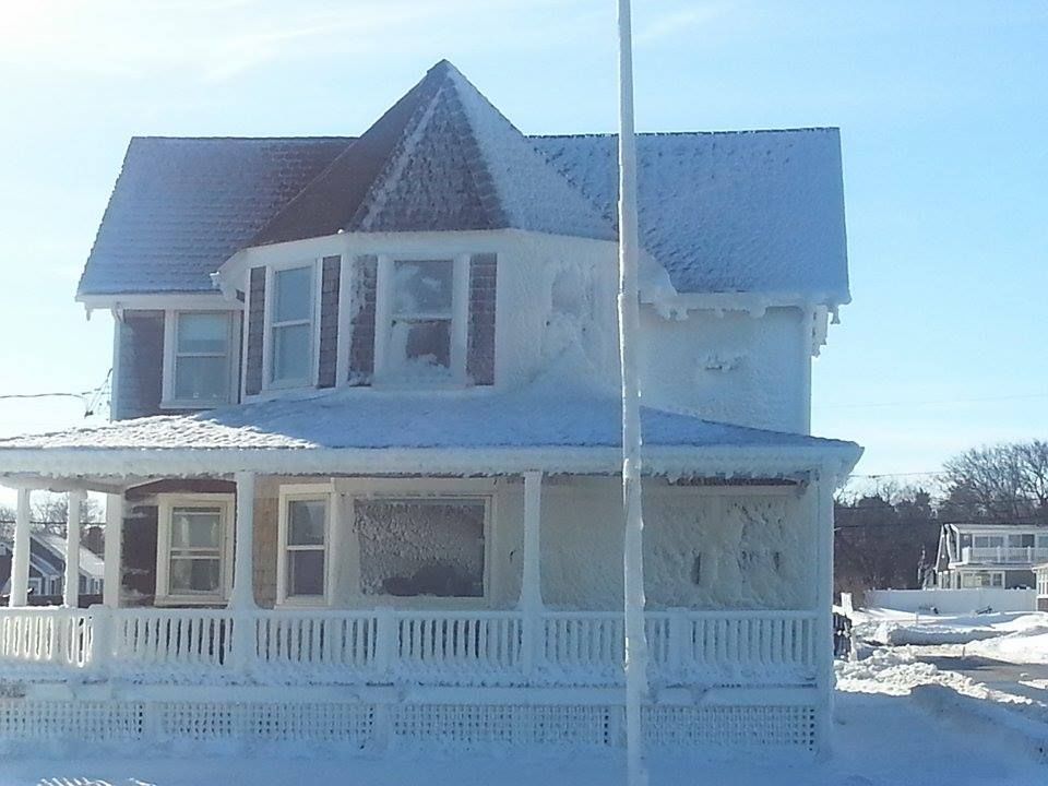
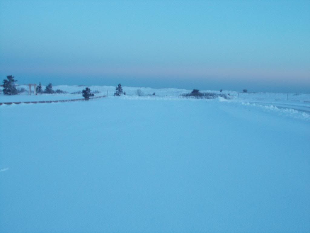
Thursday, February 12, 2015

Another Blizzard? Why Not?

Bourne, MA

"Every normal man must be tempted, at times, to spit on his hands, hoist the black flag, and begin slitting throats."

- H.L. Mencken.

I hear ya, H.... we all love a little sugar on our cereal, but this is getting rucking fidiculous. We can't seem to begin or end a week without a major snow event, and this weekend.... oh, we'll get to that in a minute.

We'll be getting a bit of snow today, maybe 2-4" over SE Massachusetts. I'd bet on the 2" more than the 4". That barely makes a blip on the radar, with what we have coming this weekend. It really gets friggin' ponderous after a while.

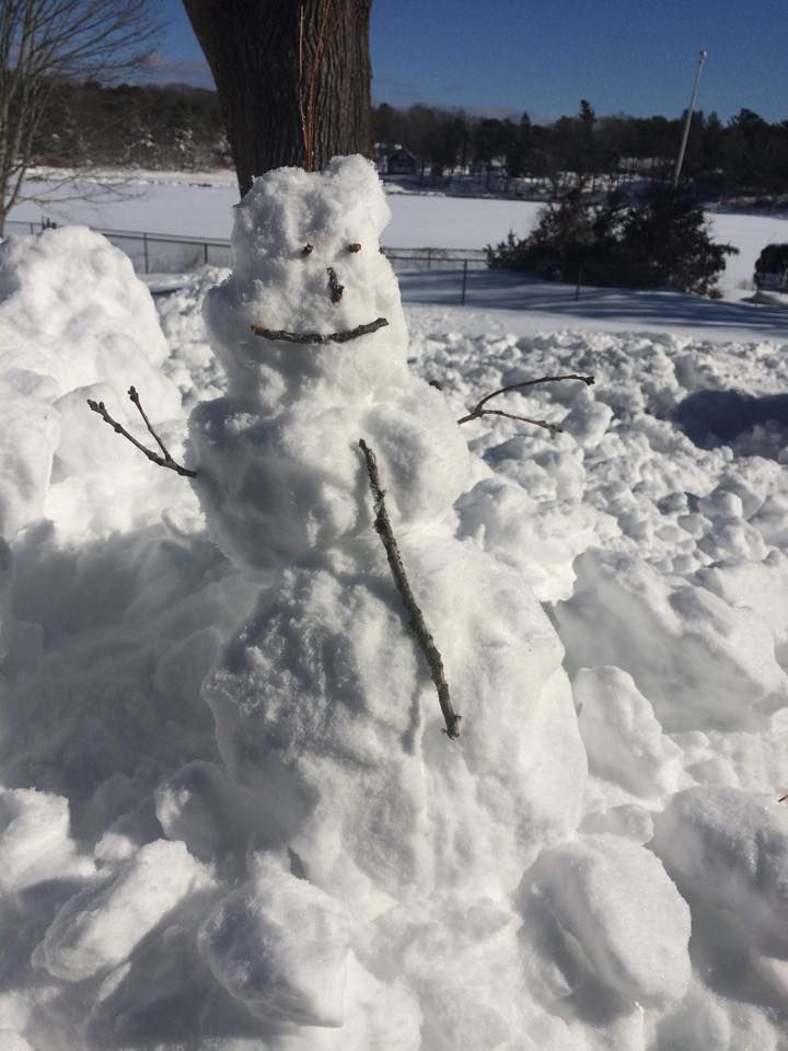
We're not Canada, or Alaska, or Wisconsin, or even upstate New York. We get snow, but it's that pleasant Currier & Ives snow, the kind you go caroling in and build talking snowmen in. This is some straight-up Siberia we'e getting, and it sucks so hard that you are physically pulled towards the snowbank.

You start to wonder if Pat Robertson might have been on to something, and that we may right now be getting Smited by the good lord for some sin I can't quite put my finger on. Maybe it's gay marriage, maybe it's Governor Baker, and a great part of me feels that God is making us pay for the Snow Bowl/Tuck Rule game against the Oakland Raiders. We have offended ye, oh Lord, and the payback is Powder.

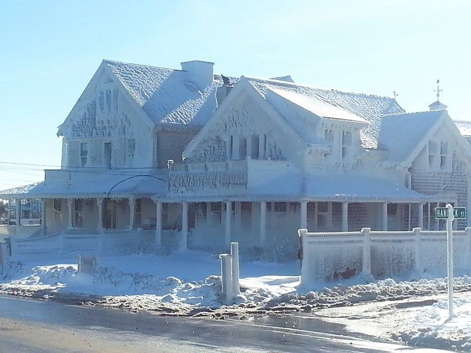
You could sort of see it coming. This is shaping up as a bad, bad, bad winter. Blizzards are a part of bad winters. You add the extra bad when we get a second blizzard, and throw in the third bad if the second blizzard happens before you clean up the first one. It gets even worse if it snows between those events, including two huge storms.

The Groundhog Storm and last Monday's storm, which dumped 2 feet over a wide area, barely crack the headlines. The Groundhog Storm was lucky enough to fall on a holiday, but I'm actually referring to a fairly historical storm from this week as "last Monday's storm." I can't see Sebastian Junger naming a book that.
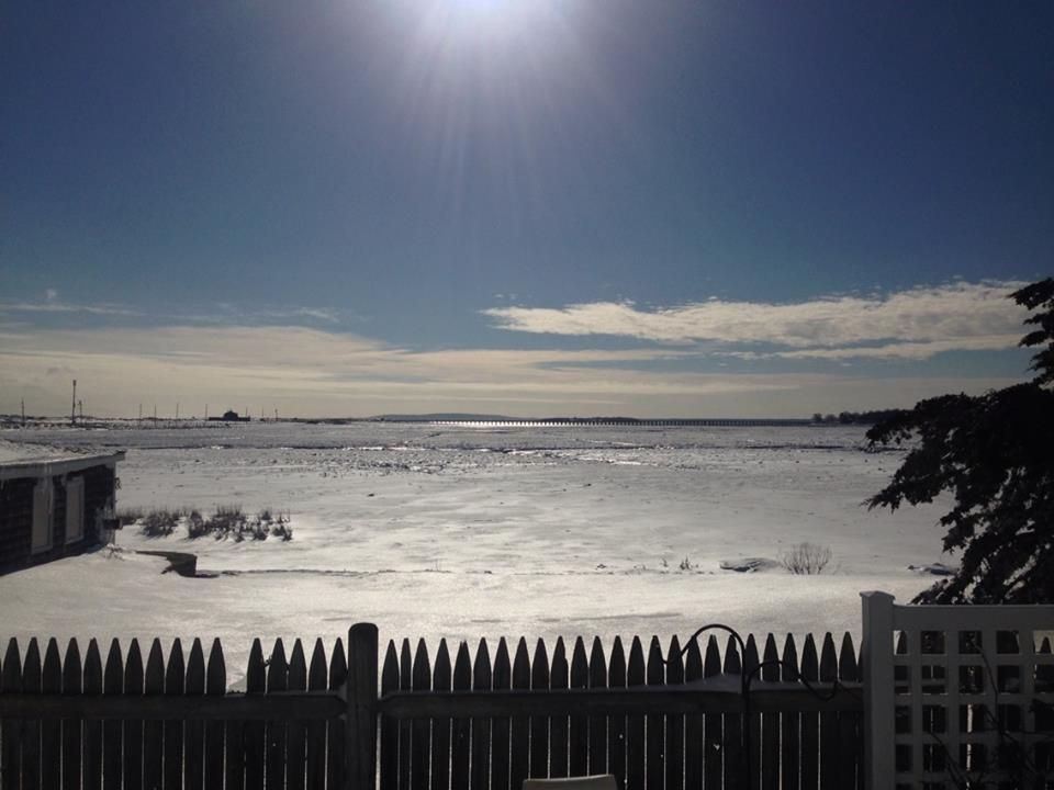
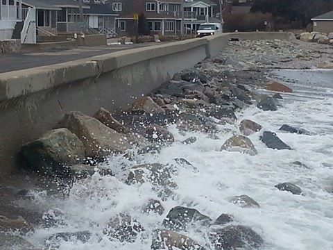
Brant Rock, MA
Here are a few things to ponder about this Snowathon we've been having:

- One of the reasons that the Blizzard of '78 was so bad (and, concurrently, why no one talks about the 1969 storm that dropped .8" less than the '78 gale) is that the Blizz fell shortly (17 days) after we got nearly two feet of snow.

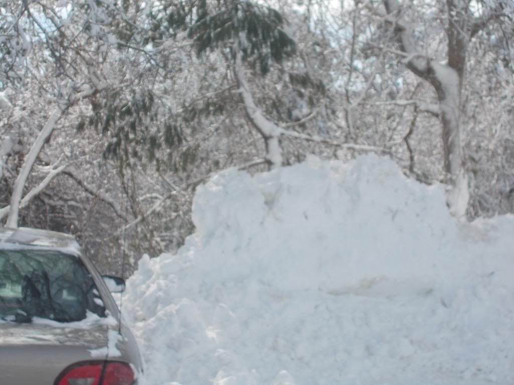
That snow had nowhere to go but on top of the old snow, which hadn't melted much. This led to those mammoth snow piles you recall if you lived through '78.

We have the same scenario now, just with more snow already on the ground. This storm isn't forecast to be a 2 footer, but any additional snow is trouble.

- You may not see 100% of your supermarket's parking lot until May. We had drifts last into June in the interior a few years ago.

- As you know, a blizzard is when you have three hours of blowing snow, 35+ mph winds, and markedly-reduced visibility. We should have that, no problem.
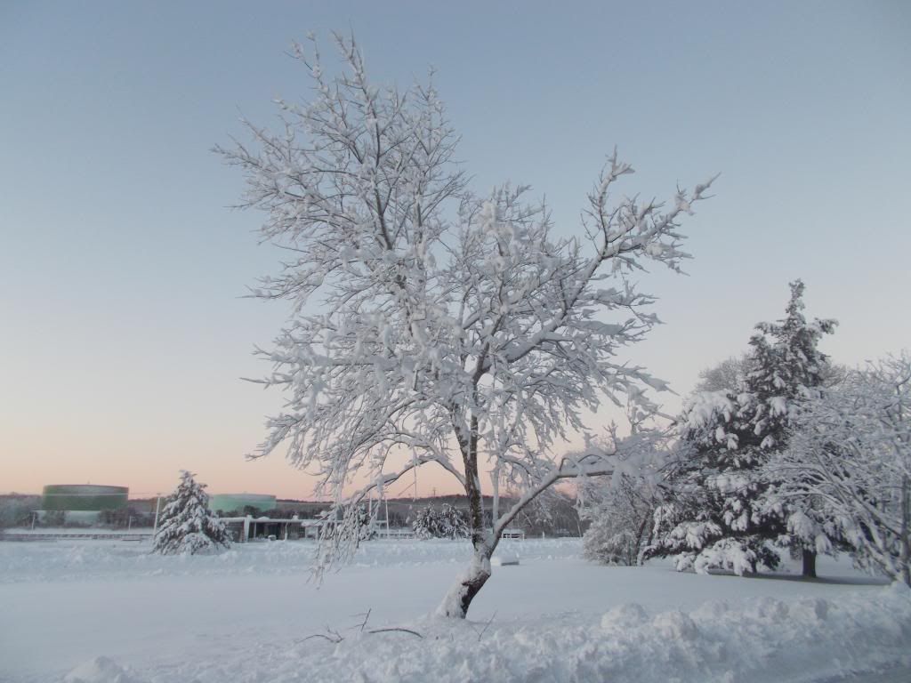
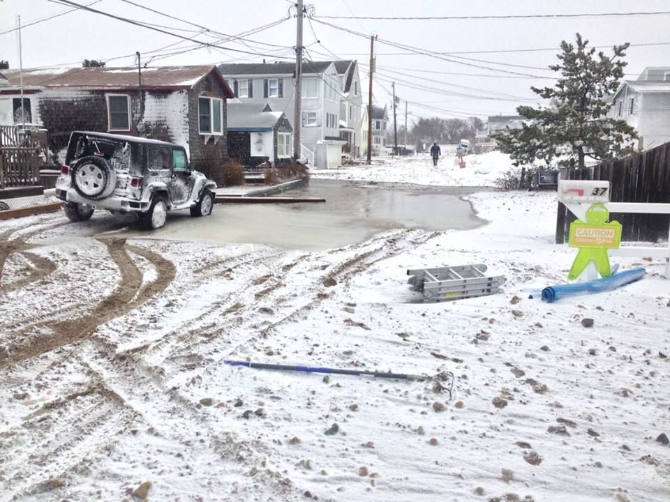
Sagamore, MA

- We wouldn't need much snow to have a blizzard, provided it is blowing around a lot. This will be important to keep in mind on Cape Cod, where a smaller amount of snow will still bring blizzard conditions with the wind she'll be seeing.

- Buffalo once had a blizzard just from a windstorm billowing up already-fallen snow that was resting on frozen Lake Erie. With our snowpack, that could happen with this storm even if we got no snow from it... but don't you worry, we'll get lots of snow.

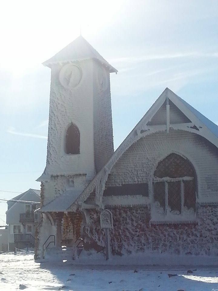
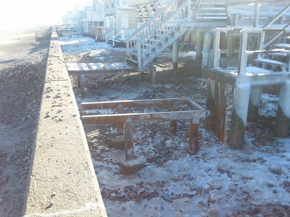
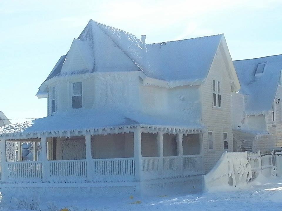
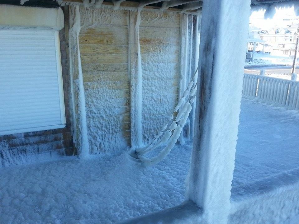
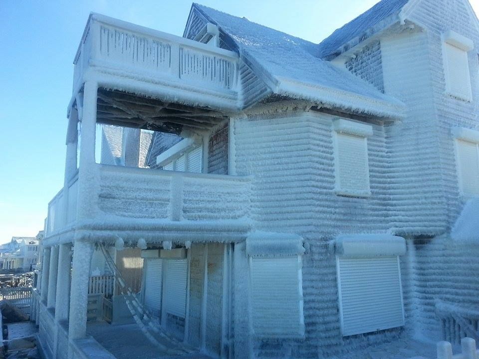
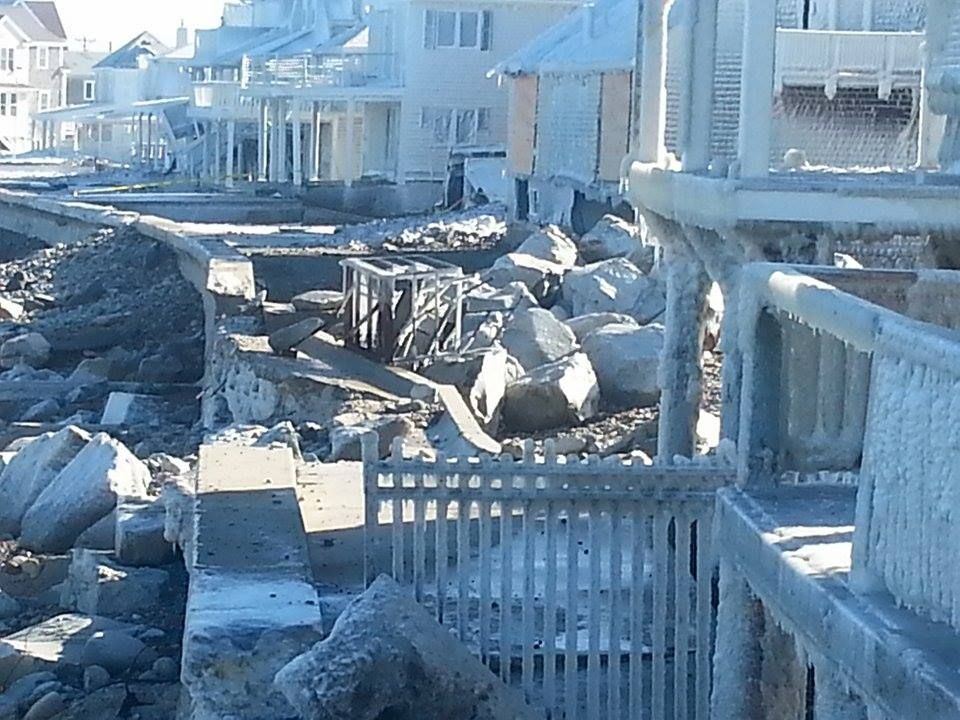
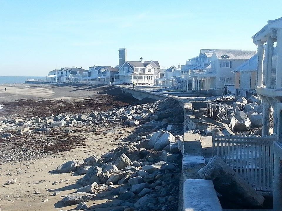
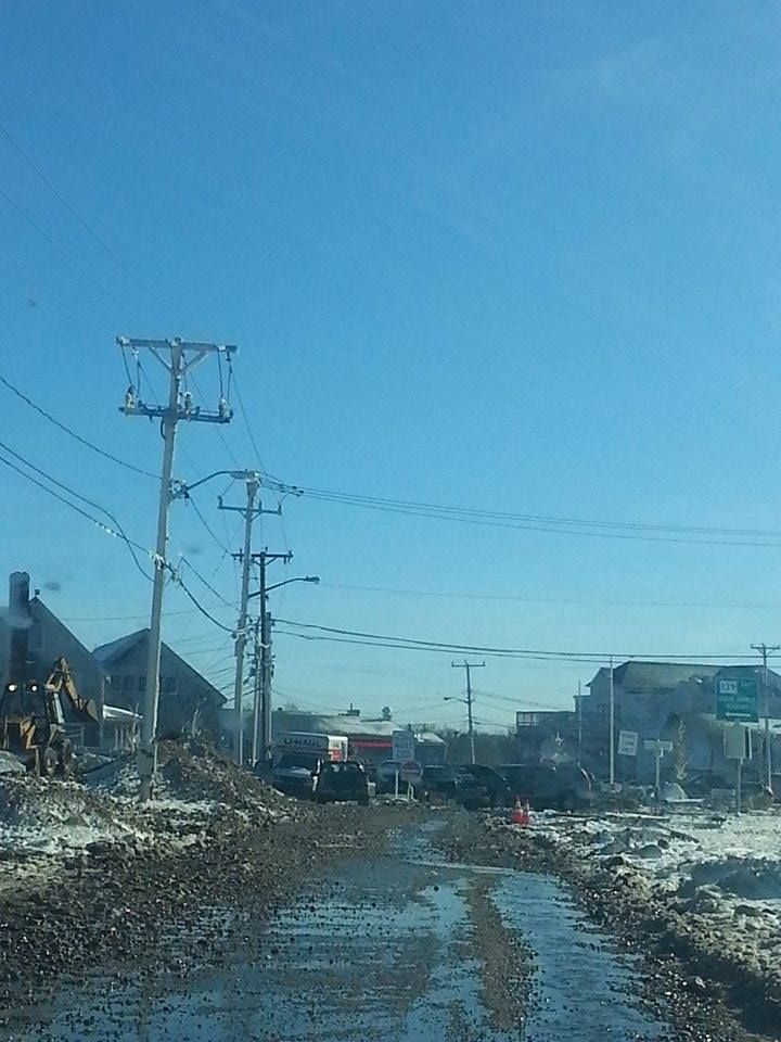
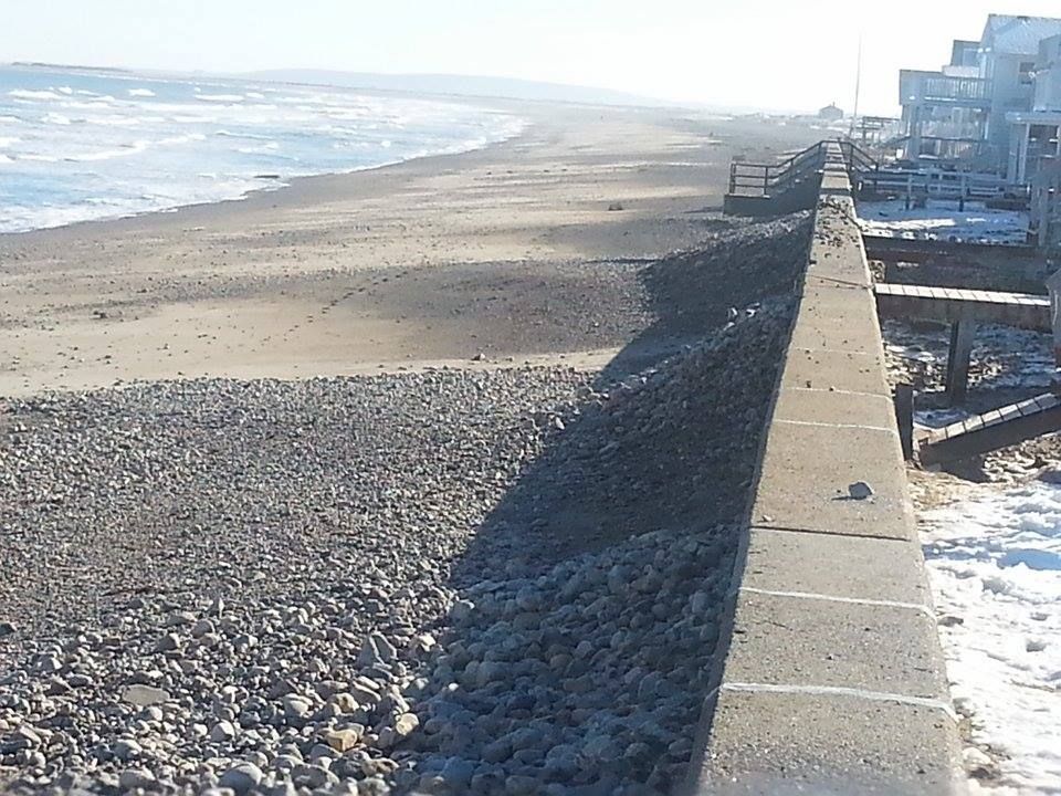
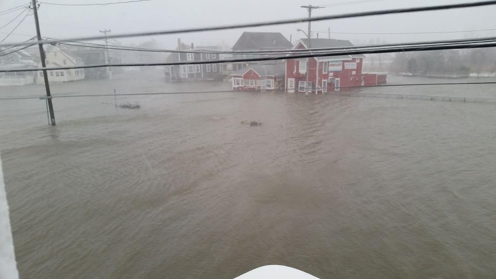
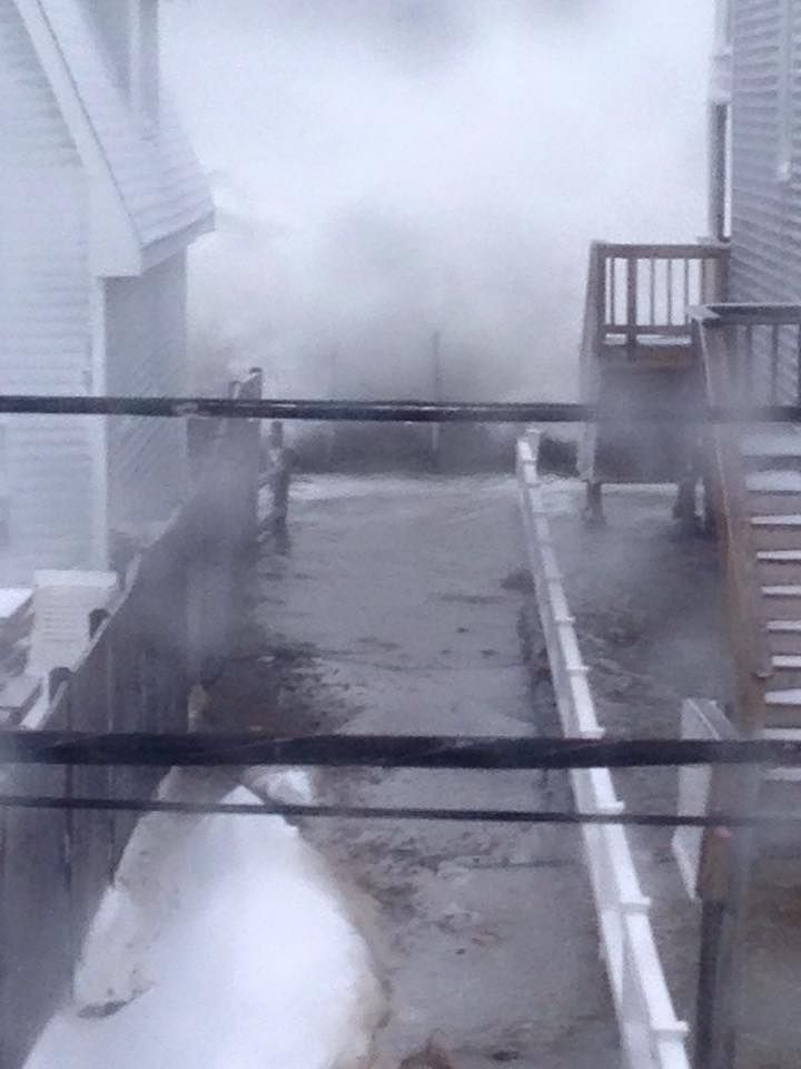
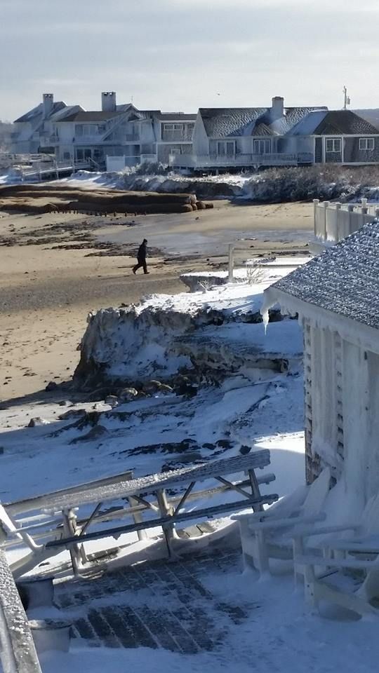
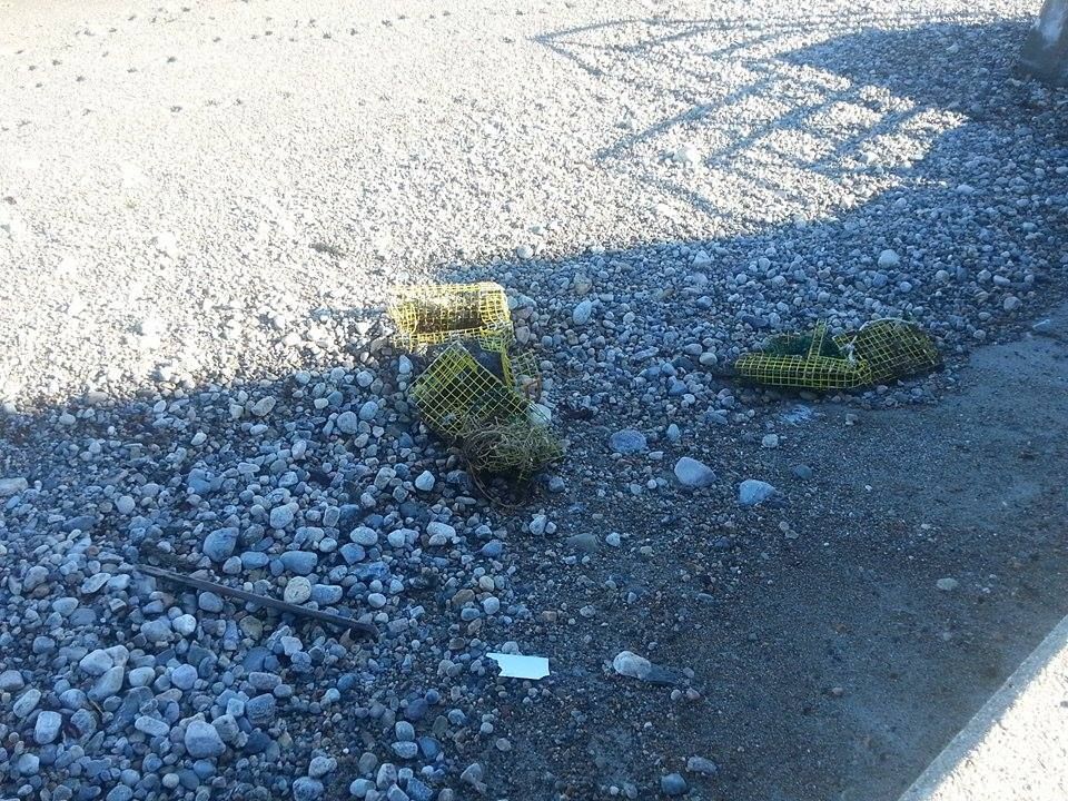
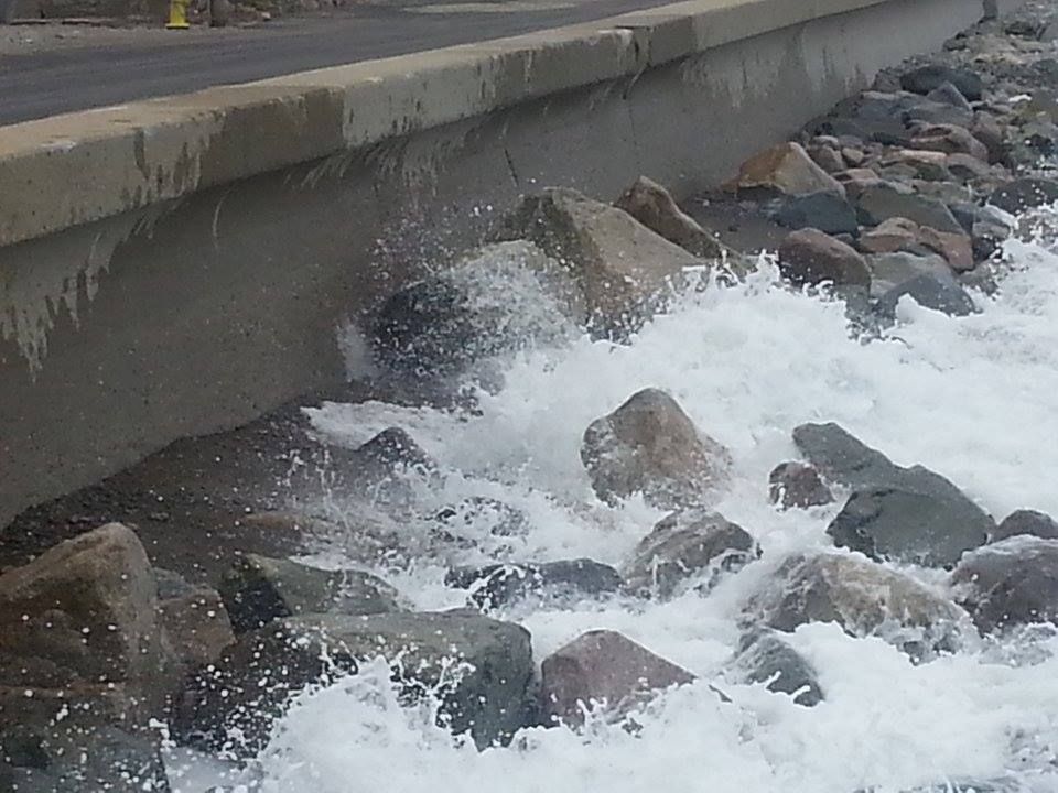
- Beaches had tons of rocks and sand wash up against the seawalls. That will make for a ramp that will amp up an otherwise modest storm tide. This tide will slam into very vulnerable coastal locations who A) have nowhere for the floodwater to go, and B) have already taken a blizzardy beating a few weeks ago.

- We're some time away, but I think that the worst of the storm may high-tide us with the north wind. That would be good news for places like Chatham or Plymouth, and bad news for places like Scituate or Sandwich.

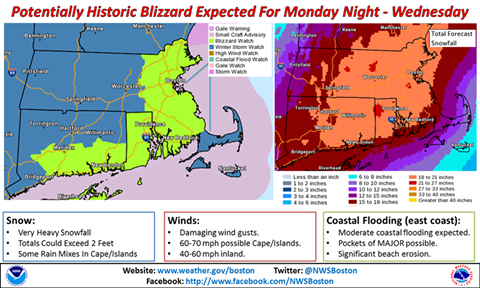
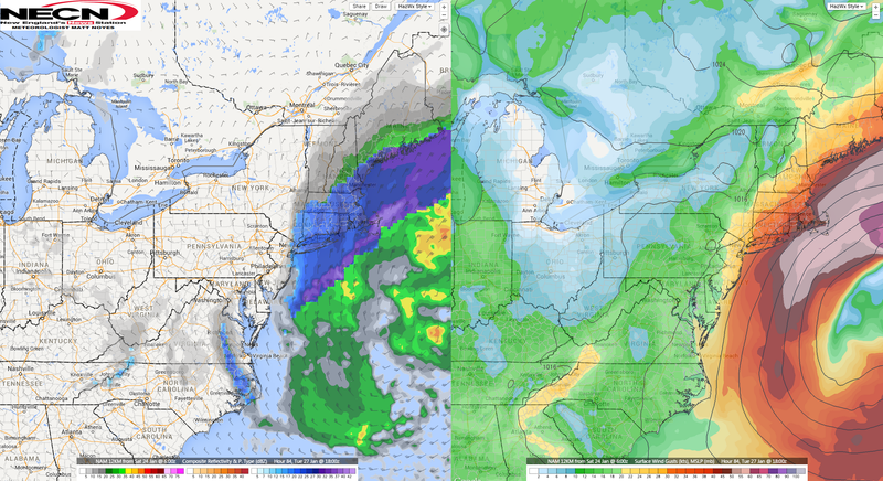
- A big issue will be the track of the storm. American forecast models show an Alberta Clipper plowing through New York and moving over Cape Cod on Saturday night and Sunday. The European models show it coming at us through Pennsylvania and tracking east just under Nantucket.

The American model speaks of heavy snow for coastal Massachusetts, about the same area that got slammed in the last storm. SE Mass would be spared the heavy hit, and the trouble would run from Boston north into Maine. The European model is more indicative of a SE Massachusetts inclusion in the epicenter.

It's the difference between 4-8" of snow and more than a foot of it.

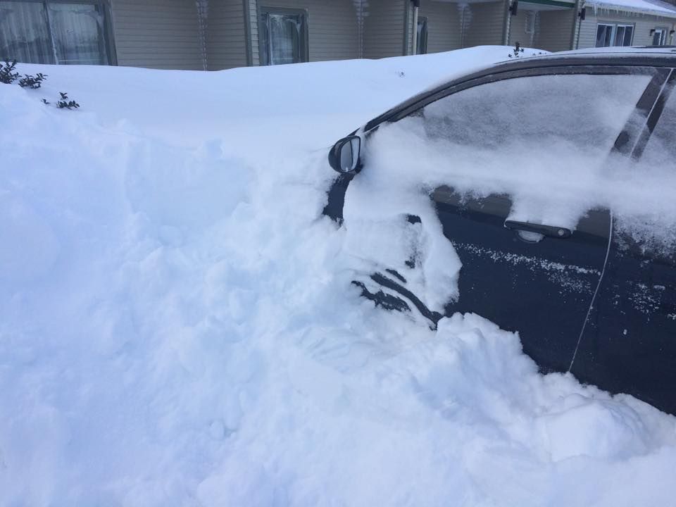
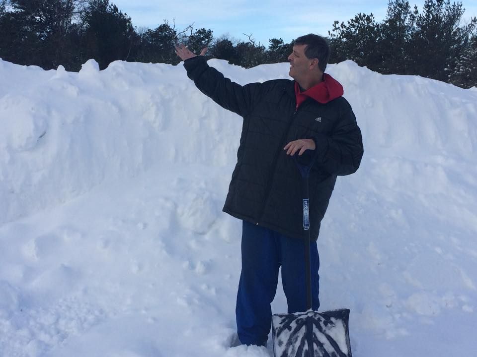
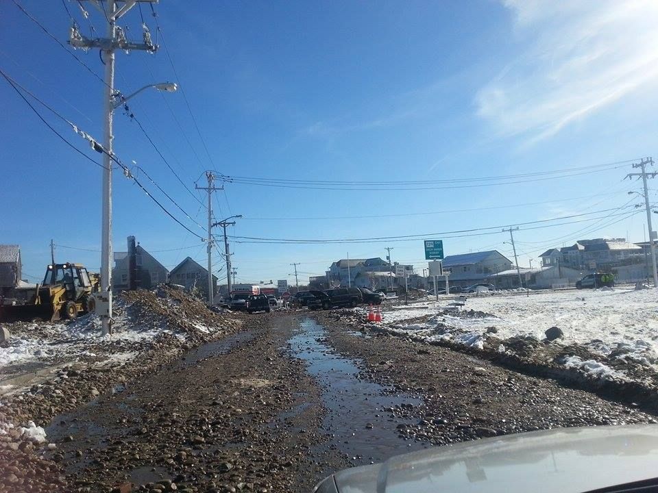
- Cranberry County has taken a beating this year. We're not as bad as Worcester (we never are) or even as bad as MetroWest, but we bore the brunt of the last storm (Cohasset had 26.5" of snow), and stand a good chance of getting socked again.
Bridgewater, MA

Duxbury, for instance, got 2 feet from the blizzard. They got 6 more inches 3 days later, and then got 18" or so from the Groundhog storm. They got about 6 inches between that storm and last Monday, when they got almost 2 more feet. They have a very good chance of adding another foot or two this weekend.

- Duxbury is the same physical size as Boston, and has much more open area that needs plowing. Boston has 700,000 residents and countless businesses paying taxes to support clearing out Boston, while Duxbury has 13,000 or so.

- Truro, for instance, probably has a whole town to plow with the same amount of people you might find in two Boston housing projects that take up a supermarket's footprint on a map.

- Winds will be gusting up over 60 mph for much of the storm. That will snap power lines. Forecast low temperatures for relatively-temperate Bourne will be two degrees above zero. It should be fun with no heat and lights.

- Those winds and temperatures will make it very, very dangerous to be outside. If your car breaks down and you're a mile from help, you may die trying to get to it.

- If it helps ease the strain any, you can't call off school during school vacation, so we won't be adding June days to the school year for this storm. There is, somewhere, one family in Massachusetts who will be staring at the TV Monday, wondering why there are no school cancellations, and I wish I could be a guest in their kitchen that morning.

- Boy, I'd hate to live near a river when all of this snow starts melting in the spring.

- I haven't heard a peep from any local forecasters regarding a changeover to rain for anyone, even Cape Cod. That would be one of the things that could change with a wobble in the forecast track.

- Want me to mention that we weather geeks are already monitoring the possibility of another snow event, about a week from yesterday or so? Didn't think so!

- Please check out the GoFundMe page for Officer Jared MacDonald of the Bourne PD.

- Photo credits: Tristan, Jessica, Abby and Michelle.

We'll be back with an update as the storm nears. Remember, the storm's track could wobble a bit, and we would get off the hook . That doesn't seem likely, but I like to throw a disclaimer into these things.


Saturday, January 31, 2015

Groundhog Day Storm Coming, And Storm Damage Discussion

God is chilin', Brant Rock, MA
"He can surely turn the tide.... he can push the tempest byyyyyyyyy..."

We hope you enjoyed last week's atmospheric entertainment, because we have another pile of powder pending.

An appetizer wil be served today, with the coast picking up 2" from a storm offshore. The storm could clip the Outer Cape harder, to the tune of 4" or so. It's snowing in Buzzards Bay as I start this (6 AM), so be prepared. It's just a preliminary to the main event, however.

The fun starts Sunday night, and should go straight through Monday. This won't be a blizzard to my knowledge, but more of a sustained snow event.

We'll get to all of that- and more- in a second, but let's scope some more damage first.

Duxbury Beach, MA
Yes, but the other 364 days of the year on Duxbury Beach are very nice.

We were taking the pictures during bright sunshine, so I apologize if some of the shots don't look gloomy enough.

Duxbury Beach, Brant Rock, Ocean Bluff and Green Harbor all took it on the chin during the Blizzard last week, especially Ocean Bluff and Brant Rock.

I'm lucky that I don't still live on Duxbury Beach, because I was heavily reliant on the Brant Rock Super Market for a lot of my food and tobacco. I'd need a boat and a deathwish to get there during the Blizz.

I did make it there during the Halloween Gale in 1991, but that was between tides and I had a Jeep.

Back to the snowstorm, yes....

Ocean Bluff, MA

This will be a Groundhog, a rare weather-watcher term for a February 2nd snowfall. It's usually a terrible omen, worse than rai-ai-ain on your wedding day. I know a girl who got married during a tropical storm to some jerk, and it lasted maybe 6 months.

Groundhog Day, as you know, is when a rat in Pennsylvania crawls out of his little burrow. Depending on whether he sees his shadow or not, we get a longer winter or an early spring. It's an old tradition, brought to Pennsylvania by German immigrants.

If his shadow scares him and gives us 6 more weeks of deep winter, you can only imagine how he is going to react if he comes out and sees this particular stretch of weather we're having.

It will be a lot like how Hunter Thompson described Ross Perot... "He came out of his hidey-hole and saw that there were indeed many shadows about, and none of them were his."

Poof! Right back down the hole for six weeks. See you when the weather improves... in April.

Duxbury Beach, MA
This sounds like Doomsaying, and it is so to an extent. I'm not one of those scientific weathermen, you can see one of those on the TV up in Boston. I am more attuned to omens, local knowledge, numerical patterns, pain in certain joints, nautical lore, horse-sense.... you know, I make shit up.

However, I do as well as the TV folks do, and beat them to the punch on the Blizz last week.

I do follow their forecasts, and they are on top of this storm we have coming Monday. We all seem to agree, although I'd argue (not too heartily, however) against a mix with rain on Cape Cod... something I, personally, was wrong about in the Blizz.

Ocean Bluff, MA
WBZ has most of Massachusetts getting a 6-12".

WCVB has 6-12", with some mixing on the Cape. No one else has a mix presently forecast.

WHDH is going all-in with a 12-15" forecast for south of the Pike.

FOX gives us 9-13", with the worst in a Providence/New Bedford/Plymouth triangle.

NECN puts the 12" mark along a line from Duxbury to Providence.

Accuweather gives Bourne 7.9", Duxbury gets the same, Orleans gets 8.3", Bridgewater 7.7", and New Bedford gets 7.8". We'll get some more variety to those fiures as the storm nears.

There is some concern about coastal flooding. Winds aren't going to be insane, but there is a full moon high tide on Tuesday. It is an astronomically low full moon tide (Brant Rock has an 8.6 feet on Sunday night and 9.7 feet on Monday, as opposed to the 10.4 and 10.1 tides they had Monday and Tuesday, or the 11.5 they had a week before with the new moon), but the area is very vulnerable.

Brant Rock, MA
Using the port of New Betty as our early warning station, we'd have a midnight start running through 9 PM Monday.

It is a bad omen that the snow will start right about when a lot of bars are emptying after the Super Bowl.

The oncoming storm will blend nicely with the drunken revelers to produce what will be a distinct local disaster, Hurricane Brady.

It will be worse if the Pats lose, or even fail to cover. Drunks in a snowstorm are bad enough without factoring in potentially suicidal ones.

Ocean Bluff, MA

Note that we have had very little melting between now and then, so this snow will fall on top of all of that lovely snow that you already have.

There is talk of more snow on Thursday, but we'll bury that bridge when we get to it.

That would make 4 storms in seven days, or 5 storms in 10 days (one of which was a monstahhh blizzard). That's straight-up Siberian, babe. Mother Nature shouldn't go and do me like that.

This is also happening during a frigid stretch. We'll have a low of 5 degrees in Buzzards Bay on Monday morning, and a high of 17 degrees on Tuesday.

Marshfield, MA
That's the infamous break in the seawall that had Marsh Vegas all over the news during the Blizz. It's a catastrophe of the highest order, right in the big green heart of the Irish Riviera.

I get a little confused as to just where the Marshfield villages of Ocean Bluff and Brant Rock begin and end. I should know this, I lived in the area forever and am somewhat of a historian/map person. Duxbury Beach and Green Harbor are divided by a clear town line, some socioeconomic factors, and a giant gap in their shared seawall.

Ocean Bluff and Brant Rock aren't so easy, however. I use that Ice Church in the top photo as the cutoff point for the villages, with one wall facing the sea, one facing Ocean Bluff, one facing Brant Rock, and one facing Green Harbor in the distance. It's next to the Brant Rock Super Market, but on the bottom of the little hill that Ocean Bluff Package Store is on.

The newly-formed border village of Ocean Rock, MA!

It's never a good sign for the houses when the tide breaks through a yard-thick seawall that has stood up to the Blizzard of '78, the Halloween Gale, and everything else since her 1950s birthdate.

I know that at least two houses were condemned, and several more may be on the chopping block from what I saw. Notice that the piles of stones against the surviving seawall give the ocean a nice ramp with which to tee off on these waterfront homes.

The boulders you see around it were partially put there to support the wall, but many others came to visit during the height of the Blizz.

You never realize just how many rocks are on the beach until the sea starts pouring them through a break in the seawall.

Brant Rock, MA
When the rocks and sand come through that break ("Not listening in high school," "stoner memory loss," "stubborness," and "laziness" are all claiming responsibility for my refusal to open the dictionary site and see if "breaches" are what happens to walls and "breeches" are what happens to pants) in the seawall, they have to go somewhere. Those two somewheres are 1) somebody's house, and 2) the road.

Having lived next to the boat ramp opening in the Duxbury Beach seawall for 32 years, I can assure you that the ocean loves to pour itself through a breach. You get a funnel effect similar to what destroyed Bangladesh in that cyclone George Harrison did the concert about.

That's not some hick side street in the picture up above, that's Route 139 through Marshfield. The picture below is from my old house in Duxbury Beach.

Duxbury Beach, MA
Brant Rock and Ocean Bluff usually have higher seawalls than Duxbury Beach, and-when coupled with their northern facing beaches- are spared heavier storm damage. All of those flooding shots you see of Arthur and Pat's are caused by seawall splashover flowing to the lowest point in the neighborhood, not by direct wave action. You can eat a  nice meal at the Fairview in storms that make Haddad's Aptly-Named Ocean Cafe unapproachable... you just have to get there by boat.

However, sand and stones shift with the tide, and much of Scituate is washing down and filling up the armored coastline of Marshachusetts. When you can step down to the beach from the top of the seawall like you can in Duxbury, you don't really have much protection left. A five-foot storm surge means that waves roll directly into houses. I've been in that, and it isn't fun.

The damage you see in these pictures are indeed direct wave action damage. At this point, we're not that far from a Sharknado scenario, where a Great White is washed ashore and eats someone coming out of the Venus II. It's not pretty, even when shot well.

Brant Rock, MA
There are other things to worry about with storms. You'll notice that a lot of houses and signs in these pictures have a layer of ice on them. That's seawater, frozen.

Yes, the ocean can freeze. After the Blizzard of '78, there were giant ice floe blocks extending down from the seawall to the low tide line on Duxbury Beach. This wasn't that bad, but that ice you see on the houses can collapse roofs, tear off gutters, break windows, or fall on your friggin' Marsh Vegas head.

It does look cool, though. I'd leave it up until the newsies stop coming 'round.

Note that the houses and the church with the ice coatings are across the street from the ocean, with a row of large houses in front of them. That's some ridiculous seaspray, player.

Ocean Bluff, MA
If they still make Icehouse beer, this guy should drink it. Lots of it.

Ocean Bluff, MA

The picture below shows how they are patching the breach in the seawall.

Brant Rock, MA
As you might imagine, Brant Rock and Ocean Bluff are high on the list of seawall projects facing emergency status.

We did a whole huge ahhhticle about it back at the old paper, check it out, it will scare both you and your wallet.

Here's my old street in Duxbury Beach down below, taking shots but still looking good. The public stairs pictured there were my main hangout as a youth... right up until I was about 30, to be honest.
Duxbury Beach, MA
Duxbury Beach suffers mightily in storms. It would probably be on the news more, but the only road in and out is impassable for about 4 hours during a storm tide. Your morning news reporter wouldn't get back to the mainland until the evening news was on.

Duxbury Beach is also, aside from Cable Hill, 100% at or below sea level. My cellar there was 3 feet below sea level.

Ocean Road North doesn't look that bad, until you realize that it isn't normally a dirt road. Duxbury Beach got off easy in this storm, hardly any damage at all. Brant Rock took the title with this storm.

Duxbury Beach, MA
One of the fun parts of being from Duxbury is that we're one of the few places in America that act snobby towards Cape Cod.

However, Cape Cod took their lumps with this storm.

Sandwich is a north-facing beach, and is normally protected by the Outer Cape. It also used to have a dune and replenishing sand-wash from the South Shore. Those things are gone now, and they are taking Scituate-style damage when a storm's wind turns North at the wrong time.

You can be hit by a wave while driving down Route 6A if you aren't careful, player.

Sandwich, MA
There are positives to storms like these. If you're into Storm Porn, you can live in it if you save wisely and watch the local market. I'm sure there are some deals forthcoming in, say, the Brant Rock/Ocean Bluff area.

If a Democrat in the Oval office isn't enough for you and you still want to see rich people suffer, you can enjoy a chuckle or two here. However, more of these houses are owned over several generations of blue-collar family history, and not everyone can just snap their fingers and make this all go away.

You can also get free lobster.

Duxbury Beach, MA
The storms wash ashore a little bit of the local lobstering apparatus every time we get huge waves, and the traps that come ashore often have tasty little stowaways in them.

It was a more common thing to see in the 1970s, before lobstermen (and women) switched from the wood pots to the wire ones. They, uhm, wash ashore less frequently for some reason, but no one is perfect.

The lobstermen got out on the beaches as soon as they were able to, to search for their gear. Every beach kid I knew was schooled to not touch the gear, but the lifted lobsters were the price for that respect. While I never poached one myself (I'm allergic), I can recall several lobsterfests after these Shady Harvests.

It may be an urban legend among beachfolk, but I think that lobstermen can shoot you if they catch you poaching their pots. I know a few, I'll ask them once I finish this and post it on the Facialbook.

Duxbury Beach, with the Gurnet in the background.

It was not unusual for lobsters to wash ashore in storms before they were a) harvested commercially, and b) depleted massively. They were easy food for the Wampanoags and Pilgrims. It was go-to poor people food, Soul Food for the Pilgrim Poor.

Indentured servants in Plymouth during the Pilgrim times were fed lobster enough that they complained to at least one public official about it. Time, tide, water temperature, evolution and overfishing have pushed them deeper offshore in modern times.

The lobsters were pushed offshore, not the poor people. They get pushed inland, by storms and gentrification.

At least one live lobster came ashore sans lobster trap, although a resourceful seagull may have plucked him from a damaged trap. Either way, he didn't last long.

Duxbury Beach, MA


Photos by Jessica, Stephen, Murph, Sara, Carter and Joe.


Wednesday, January 28, 2015

Local Stations Blow The Forecast, Blizzard Snowfall Totals

Duxbury Bay, MA
Holy Mackerel! What a storm!

We had ridiculous snow, possibly record setting in some places. We had coastal flooding that was tearing down seawalls in Green Harbor and coastlines in Nauset. We have widespread, multiple-day school closings, and we even had a statewide driving ban.

Not too shabby, especially for a storm which the local news stations never mentioned until 48 hours before it started. I had an article up a full news cycle before the local TV forecasters (who were too busy hyping the piddling Saturday snow) did, a truly disgraceful black mark on their reputations.

When I published, only NECN had anything up about a potential blizzard, and their headline ended in a question mark. Accuweather, who I don't work for, had the blizzard forecast and some conservative snowfall totals up several hours before local stations even mentioned that it may snow.

Several generations of Boston forecasters have enhanced the town's reputation for spotty forecasting. The Blizzard of '78, the Halloween Gale/Perfect Storm, Hurricane Earl and now this storm... all blown forecasts to some extent, and forecasts that left Massachusetts residents unaware and unprepaed.

Of course, the Boston forecasters are scientists, and have forgotten more about weather than I shall I ever learn. I'm a sportswriter, by trade. But I also was the one who got the forecast correct...

Bourne, MA

This was a major blizzard, and I'd imagine that some local town records were challenged. It basically snowed from about noon Monday through Wednesday morning, heavy and hard like a fat porn star.

Cranberry County's coastline also furthered our reputation for impact snow events. We get rain when the rest of the state gets snow a lot... but when we get snow, baby, we don't f*ck with the small totals.

I'm always more impressed when Plymouth gets 15" at sea level than when some higher elevation gets 20". Plymouth pretty much doubled that 15" figure, and flooding was catastrophic all up and down the South Shore. Worcester doesn't get coastal flooding.

Marsh Vegas seems to have won the Worst Storm Damage award, as they lost some seawall and several houses. Scituate gets most of the attention, but Marshfield and especially Duxbury usually get the worst damage.

Duxbury people, when walking around Scituate, always remark that they (Scituate gets ridiculous flooding, don't get me wrong... the Duxbuy/Scituate coastal flood rivalry involves a lot of one-upping comparisons, akin to two guys in Hell arguing about who has the better heater) couldn't flood that badly. When asked why, the answer is always "The beach houses in Scituate are all 1940s-looking... the 1940s beach houses have all been destroyed in Duxbury."

Thusly, Duxbuy Beach is the epicenter of "Watch some yuppie over-renovate a cottage, then move away the next year after they see a nor'easter up close for the first time" activity. Veterans of that stretch of coastline can usually spot these types as they are moving in.

Duxbury Beach, MA


Let's peep some snowfall totals, shall we?

Remember, these are NWS trained spotters, which means that they were told to find an undisturbed meadow and average out 10 yardstick measurements. If they say that your town only got 11" but you couldn't find your car in your own driveway, remember that snowfall totals can vary wildly as you cross a town. Duxbuy, to use a local example, is about as large physically as Boston.

For instance, most of you remember the Blizzard of '78 as a snow event. "I could step out of my 10th story apartment window into a snowbank," and so forth. On Duxbury Beach, I never saw a flake. I remember that storm as a coastal flood, of the highest order.

Also remember that Boston measures at the airport, which is right on the coast. That gives them some odd totals. Marshfield, Hanson and one of the Plymouth measurements are also airport-based.

Oh yeah, snowfall totals....

Duxbury Beach, MA


...BARNSTABLE COUNTY...
   WEST HARWICH          30.5   915 AM  1/28  SPOTTER
   HYANNIS               27.0   748 PM  1/27  HAM RADIO
   EAST FALMOUTH         24.8  1000 PM  1/27  TRAINED SPOTTER
   WEST YARMOUTH         24.0   250 PM  1/27  HAM RADIO
   HARWICH               23.0   749 PM  1/27  HAM RADIO
   NORTH FALMOUTH        22.5  1055 AM  1/28  HAM RADIO
   SOUTH HYANNIS         22.0  1054 AM  1/28  HAM RADIO
   CENTERVILLE           21.0   700 PM  1/27  TRAINED SPOTTER
   SOUTH DENNIS          18.2   728 PM  1/27  EMERGENCY MANAGER
   ORLEANS               17.6   547 PM  1/27  TRAINED SPOTTER
   WELLFLEET             17.5   136 PM  1/27  HAM RADIO
   CHATHAM               17.1   800 AM  1/28  CO-OP
   BREWSTER              14.0   308 PM  1/27  HAM RADIO

...BRISTOL COUNTY...
   EAST FREETOWN         26.0   458 PM  1/27  HAM RADIO
   FALL RIVER            24.1  1111 AM  1/28  HAM RADIO
   SOMERSET              24.0  1235 PM  1/27  HAM RADIO
   ACUSHNET              22.2   605 PM  1/27  TRAINED SPOTTER
   NEW BEDFORD           21.0   808 PM  1/27  HAM RADIO
   TAUNTON               20.8   416 AM  1/28  NWS OFFICE
   MANSFIELD             19.8   548 PM  1/27  TRAINED SPOTTER
   NORTH DIGHTON         19.5   839 AM  1/28  HAM RADIO
   FAIRHAVEN             19.0   629 PM  1/27  HAM RADIO
   NORTH ATTLEBORO       18.9   306 PM  1/27  HAM RADIO
   WEST ACUSHNET         17.5   808 AM  1/28  HAM RADIO
   NORTH ACUSHNET        16.0   806 PM  1/27  HAM RADIO

...DUKES COUNTY...
   OAK BLUFFS            27.0   237 PM  1/27  HAM RADIO
   EDGARTOWN             20.0   800 AM  1/28  CO-OP
   WEST TISBURY          19.0  1053 AM  1/28  HAM RADIO

...NANTUCKET COUNTY...
   NANTUCKET             12.0   411 PM  1/27  HAM RADIO

Bourne, MA
...NORFOLK COUNTY...
   SHARON                31.0   923 AM  1/28  GENERAL PUBLIC
   MILTON                30.8   927 AM  1/28  COOP OBSERVER
   3 SSW MILTON          30.8   800 AM  1/28  BLUE HILL
   BRAINTREE             26.0   407 PM  1/27  GENERAL PUBLIC
   BLUE HILLS            25.5   100 PM  1/27  CO-OP OBSERVER
   WALPOLE               24.6   619 PM  1/27  HAM RADIO
   NORTH WEYMOUTH        24.5  1119 AM  1/28  HAM RADIO
   QUINCY                24.5   840 PM  1/27  GENERAL PUBLIC
   SOUTH WEYMOUTH        24.0   907 PM  1/27  MEDIA
   NEEDHAM HEIGHTS       23.0   956 AM  1/28  TRAINED SPOTTER
   WEYMOUTH              23.0   404 PM  1/27  HAM RADIO
   RANDOLPH              23.0  1003 PM  1/27  TRAINED SPOTTER
   NORWOOD               22.3   700 AM  1/28  NWS EMPLOYEE
   FOXBORO               22.0   624 PM  1/27  HAM RADIO
   WRENTHAM              22.0  1249 PM  1/27  HAM RADIO
   FRANKLIN              21.0   800 AM  1/28  CO-OP
   NORFOLK               20.0  1251 PM  1/27  HAM RADIO
   MEDFIELD              19.0   430 PM  1/27  HAM RADIO
   COHASSET              18.3   235 PM  1/27  TRAINED SPOTTER
   WEST WALPOLE          18.0  1107 AM  1/27  HAM RADIO
   STOUGHTON             17.0   429 PM  1/27  HAM RADIO
   MILLIS                16.5   620 PM  1/27  HAM RADIO

...PLYMOUTH COUNTY...
   PLYMOUTH              30.7  1139 PM  1/27  GENERAL PUBLIC
   NORWELL               28.0  1116 AM  1/28  HAM RADIO
   KINGSTON              28.0   526 PM  1/27  TRAINED SPOTTER
   MARSHFIELD            25.0   841 AM  1/28  TRAINED SPOTTER
   HANOVER               24.0   736 PM  1/27  GENERAL PUBLIC
   HULL                  23.5   817 PM  1/27  HAM RADIO
   PEMBROKE              23.0   432 PM  1/27  HAM RADIO
   ROCKLAND              22.0   913 PM  1/27  TRAINED SPOTTER
   BROCKTON              22.0  1135 PM  1/27  TRAINED SPOTTER
   WEST WAREHAM          21.5   230 PM  1/27  TRAINED SPOTTER
   CARVER                21.3   900 PM  1/27  NWS EMPLOYEE
   HANSON                20.0   605 PM  1/27  HAM RADIO
   MIDDLEBORO            19.5  1112 AM  1/28  HAM RADIO
   BRIDGEWATER           18.0   800 AM  1/28  CO-OP
   ROCHESTER             18.0   800 AM  1/28  CO-OP

Sandwich, MA
...SUFFOLK COUNTY...
   SOUTH BOSTON          31.0   100 AM  1/28  TRAINED SPOTTER
   BOSTON                26.0   300 PM  1/27  NONE
   1 N EAST BOSTON       24.6   700 AM  1/28  AIRPORT
   WINTHROP              24.6   700 AM  1/28  NONE
   BOSTON CITY           17.6   534 PM  1/27  HAM RADIO

...WORCESTER COUNTY...
   AUBURN                36.0   947 PM  1/27  TRAINED SPOTTER
   LUNENBURG             36.0   717 PM  1/27  TRAINED SPOTTER
   3 WNW WORCESTER       34.5  1200 AM  1/28  AIRPORT
   CLINTON               34.1   419 PM  1/27  GENERAL PUBLIC
   WEST BOYLSTON         33.5   730 PM  1/27  COCORAHS
   WORCESTER             32.0   421 PM  1/27  NONE
   HOLDEN                32.0   546 PM  1/27  TRAINED SPOTTER
   UPTON                 31.5   754 AM  1/28  TRAINED SPOTTER
   MILFORD               31.0   800 AM  1/28  CO-OP
   SHREWSBURY            30.9   740 PM  1/27  TRAINED SPOTTER
   WHITINSVILLE          30.0   503 PM  1/27  TRAINED SPOTTER
   FITCHBURG             30.0   305 PM  1/27  TRAINED SPOTTER
   NORTHBOROUGH          29.3   217 PM  1/27  TRAINED SPOTTER
   STERLING              29.3   352 PM  1/27  NONE
   SPENCER               29.0   735 PM  1/27  TRAINED SPOTTER
   NORTH GRAFTON         29.0   805 PM  1/27  TRAINED SPOTTER
   LEOMINSTER            29.0   437 PM  1/27  NONE
   LANCASTER             28.5   302 PM  1/27  HAM RADIO
   BOYLSTON              28.0   534 PM  1/27  TRAINED SPOTTER
   LEICESTER             27.0   222 PM  1/27  HAM RADIO
   NORTHBORO             27.0  1217 PM  1/27  HAM RADIO
   HARVARD               27.0   910 PM  1/27  TRAINED SPOTTER
   BERLIN                26.5  1102 AM  1/27  GENERAL PUBLIC
   BOLTON                26.0   318 PM  1/27  HAM RADIO
   NORTH WORCESTER       24.0   914 PM  1/27  HAM RADIO
   DOUGLAS               24.0   312 PM  1/27  TRAINED SPOTTER
   MENDON                23.0   249 PM  1/27  HAM RADIO
   SOUTHBRIDGE           22.3   700 AM  1/28  TRAINED SPOTTER
   SOUTHBORO             22.1  1133 AM  1/27  HAM RADIO
   FISKDALE              21.0   800 AM  1/28  CO-OP
   OAKHAM                18.0   301 PM  1/27  HAM RADIO
   WESTMINSTER           16.0  1052 AM  1/28  HAM RADIO
   HUBBARDSTON           13.0   223 PM  1/27  HAM RADIO
   ASHBURNHAM            10.0   426 PM  1/27  CO-OP OBSERVER
   HARDWICK               9.3   800 AM  1/28  CO-OP


Monument Beach, MA
RHODE ISLAND

...KENT COUNTY...
   WEST WARWICK          20.5   954 PM  1/27  TRAINED SPOTTER
   2 NNW WARWICK         19.1  1200 AM  1/28  AIRPORT
   GREENE                18.0   351 PM  1/27  TRAINED SPOTTER
   WARWICK               11.0   930 AM  1/28  NONE

...NEWPORT COUNTY...
   TIVERTON              19.0   807 PM  1/27  HAM RADIO
   MIDDLETOWN            16.0   738 PM  1/27  TRAINED SPOTTER

...PROVIDENCE COUNTY...
   BURRILLVILLE          28.5   731 AM  1/28  GENERAL PUBLIC
   WEST GLOCESTER        25.6   714 AM  1/28  TRAINED SPOTTER
   N. CUMBERLAND         24.0  1140 AM  1/28  TRAINED SPOTTER
   GLENDALE              23.5   254 PM  1/27  HAM RADIO
   NORTH FOSTER          21.7   800 AM  1/28  CO-OP
   CRANSTON              19.5   828 AM  1/28  GENERAL PUBLIC
   PROVIDENCE/NORTH PRO  18.5   709 AM  1/28  GENERAL PUBLIC
   SMITHFIELD            18.0   627 PM  1/27  HAM RADIO
   CUMBERLAND            18.0   213 PM  1/27  NWS EMPLOYEE
   N. CIMBERLAND         18.0  1221 PM  1/27  NONE
   PAWTUCKET             17.0   925 AM  1/28  GENERAL PUBLIC
   PROVIDENCE            17.0   622 PM  1/27  MEDIA
   WOONSOCKET            16.0   800 AM  1/28  CO-OP
   NORTH PROVIDENCE      16.0  1215 PM  1/27  TRAINED SPOTTER
   1 W PROVIDENCE        15.5   509 PM  1/27  TRAINED SPOTTER
   EAST PROVIDENCE       14.5   837 PM  1/27  TRAINED SPOTTER

...WASHINGTON COUNTY...
   WESTERLY              21.0   624 PM  1/27  TRAINED SPOTTER
   HOPE VALLEY           18.5   527 PM  1/27  TRAINED SPOTTER
   NORTH KINGSTOWN       16.0  1208 AM  1/28  FINAL
   HOPKINTON             14.5   203 PM  1/27  NONE
   SAUNDERSTOWN          12.0  1145 AM  1/27  GENERAL PUBLIC

Bourne, MA
We also have some peak wind gust measurements, and I seem to be stuck in this font now:

MASSACHUSETTS

...ANZ235...
   6 WSW CUTTYHUNK         62   200 AM  1/27  BUOY BUZM3

...ANZ250...
   8 SSE BASS ROCKS        67   804 AM  1/27  BUOY 44029

...ANZ251...
   8 NNE MINOT             64   450 AM  1/27  BUOY 44013

...BARNSTABLE COUNTY...
   CHATHAM                 75   926 AM  1/27  CHH UPPER AIR
   CENTERVILLE             72   915 AM  1/27  TRAINED SPOTTER
   SAGAMORE                70   313 AM  1/27  GENERAL PUBLIC
   PROVINCETOWN            68   655 AM  1/27  PVC AWOS
   FALMOUTH                68   415 AM  1/27  FMH AWOS
   WELLFLEET               65   515 AM  1/27  HAM RADIO
   SOUTH DENNIS            64  1240 PM  1/27  EMERGENCY MANAGER
   BARNSTABLE              63   325 AM  1/27  HAM RADIO
   YARMOUTH                61  1229 AM  1/27  HAM RADIO
   2 NW CHATHAM            59   249 AM  1/27  ASOS
   EAST FALMOUTH           56   621 AM  1/27  TRAINED SPOTTER
   BOURNE                  54   623 AM  1/27  HAM RADIO
   WEST CHATHAM            50   100 AM  1/27  HAM RADIO

...BRISTOL COUNTY...
   FAIRHAVEN               64   340 AM  1/27  HAM RADIO
   FALL RIVER              55   506 AM  1/27  HAM RADIO
   3 NW NEW BEDFORD        55   120 AM  1/27  ASOS

...DUKES COUNTY...
   AQUINNAH                74   133 AM  1/27  GENERAL PUBLIC
   EDGARTOWN               67   641 AM  1/27  HAM RADIO
   3 S VINEYARD HAVEN      66   149 AM  1/27  ASOS
   OAK BLUFFS              60  1224 AM  1/27  HAM RADIO
The Great Salt Marsh, Duxbury MA 

...ESSEX COUNTY...
   ROCKPORT                64  1253 PM  1/27  MEDIA

...NANTUCKET COUNTY...
   NANTUCKET               78  1244 AM  1/27  HAM RADIO
   2 ESE NANTUCKET         76   535 AM  1/27  ASOS

...NORFOLK COUNTY...
   MILTON                  51   547 AM  1/27  COOP OBSERVER
   3 SSW MILTON            49   132 AM  1/27  ASOS

...PLYMOUTH COUNTY...
   HUMAROCK                74   553 AM  1/27  BROADCAST MEDIA
   PLYMOUTH                72  1039 AM  1/27  TRAINED SPOTTER
   4 SW PLYMOUTH           65  1002 AM  1/27  ASOS
   MARSHFIELD              61  1110 AM  1/27  HAM RADIO
   SCITUATE                58   251 AM  1/27  HAM RADIO
   NORWELL                 50   236 AM  1/27  HAM RADIO

...WORCESTER COUNTY...
   NORTH MILFORD           57   412 AM  1/27  TRAINED SPOTTER
   3 WNW WORCESTER         55   752 AM  1/27  ASOS
   NORTHBOROUGH            52   220 PM  1/27  TRAINED SPOTTER

RHODE ISLAND

...ANZ236...
   3 ENE KIEFER PARK       54   454 AM  1/27  NOS QPTR1
   1 SSW NAYATT            53   454 AM  1/27  NOS CPTR1

...KENT COUNTY...
   2 NNW WARWICK           49   431 AM  1/27  ASOS

...NEWPORT COUNTY...
   NEWPORT                 53   612 AM  1/27  NOS NWPR1
   4 NE NEWPORT            53   432 AM  1/27  ASOS
   MIDDLETOWN              50   130 AM  1/27  HAM RADIO

...WASHINGTON COUNTY...
   NARRAGANSETT            51   357 AM  1/27  HAM RADIO


Bourne, MA
Finally, we have some peak sustained (3 minutes or more, I think) winds:

MASSACHUSETTS

...ANZ235...
   6 WSW CUTTYHUNK         53   100 AM  1/27  BUOY BUZM3

...ANZ250...
   8 SSE BASS ROCKS        54   204 AM  1/27  BUOY 44029

...ANZ251...
   8 NNE MINOT             47   450 AM  1/27  BUOY 44013

...BARNSTABLE COUNTY...
   PROVINCETOWN            53   415 AM  1/27  PVC AWOS
   WELLFLEET               52   515 AM  1/27  HAM RADIO
   2 NE HYANNIS            45   957 AM  1/27  ASOS
   FALMOUTH                45   255 AM  1/27  FMH AWOS
   EAST FALMOUTH           44   621 AM  1/27  TRAINED SPOTTER
   CENTERVILLE             44   915 AM  1/27  TRAINED SPOTTER
   2 NW CHATHAM            33   728 AM  1/27  ASOS

...BRISTOL COUNTY...
   FALL RIVER              38  1242 AM  1/27  NOS BLTM3
   3 NW NEW BEDFORD        35   152 AM  1/27  ASOS

...DUKES COUNTY...
   3 S VINEYARD HAVEN      46   435 AM  1/27  ASOS

...ESSEX COUNTY...
   ROCKPORT                44   733 AM  1/27  MEDIA
   5 WNW BEVERLY           33   343 PM  1/27  ASOS

...NANTUCKET COUNTY...
   2 ESE NANTUCKET         59   609 AM  1/27  ASOS
   NANTUCKET               40  1006 AM  1/27  NOS NTKM3

...NORFOLK COUNTY...
   3 SSW MILTON            32   355 AM  1/27  ASOS

...PLYMOUTH COUNTY...
   4 SW PLYMOUTH           47   225 AM  1/27  ASOS
   MARSHFIELD              31  1135 AM  1/27  GHG AWOS

...SUFFOLK COUNTY...
   1 N EAST BOSTON         32   541 AM  1/27  ASOS

...WORCESTER COUNTY...
   3 WNW WORCESTER         31  1141 AM  1/27  ASOS

RHODE ISLAND

...ANZ236...
   1 SSW NAYATT            44   430 AM  1/27  NOS CPTR1
   3 ENE KIEFER PARK       39   812 AM  1/27  NOS QPTR1

...KENT COUNTY...
   2 NNW WARWICK           38   441 AM  1/27  ASOS

...NEWPORT COUNTY...
   NEWPORT                 39   542 AM  1/27  NOS NWPR1
   4 NE NEWPORT            37  1257 AM  1/27  ASOS

...WASHINGTON COUNTY...
   NEW SHOREHAM            43  1215 AM  1/27  BID AWOS
   NARRAGANSETT            37   900 AM  1/27  POTTERS COVE NAXR1

******************************************************************


Thanks to our embedded photographers, Tristan (Bourne), Sara (Duxbury Beach), Joe II (Duxbury Beach), Carter (Sandwich), Bill (Duxbury) and Jessica (Bourne).

Our author, in a moment of reflection....

Sunday, January 25, 2015

Blizzard Prep


Oh, what a busy few days your weatherman has coming up. This, for instance, is my day off.

We got the drop on Boston TV stations yesterday warning you about this blizzard. The article we wrote yesterday did more traffic than every other article we have put up on this admittedly-new site... combined... and quadrupled. The article had over 400 likes... our previous high, I think, was 6.

In today's article, we'll kick around a few important things to know regarding this blizzard. Among them are:

- What advisories and warnings do we have?
- When does it start?
- How much snow do we get?
- Will it rain on Cape Cod during the height of the storm?
- Could the storm miss us?
- How bad will the winds be?
- How bad is the coastal flooding threat?
- If we get a rain/snow line, where does it set up?
- School cancellations?
- Power outages?
- Where would a worst-case scenario rank among historic storms?
- Will the Governor issue a driving ban?

Ayup, ol' Steve isn't getting much rest and relaxation this Sunday. I want you to remember these sacrifices that I make for you if the storm misses and we get rain.

Warnings, Watches And Advisories

Well, to start off, the officials have given us a slew of advisories, warnings and watches. We have a Blizzard Watch, a Winter Storm Watch, a Storm Watch (a Storm Watch is for people at sea, it doesn't cancel out the Winter Storm Watch or anything), a Coastal Flood Watch, a High Wind Watch, a Small Craft Advisory and a Special Weather Statement concerning black ice this morning.

Watches are issued when these conditions are possible. They upgrade it to a Warning if the conditions are imminent within 24 hours. We'll probably turn over to Warnings tonight.

Note that, on at least the NWS map, the Blizzard Watch is for the North Shore, Boston, the South Shore, The South Coast, Rhode Island, and southern Connecticut. Cape Cod does not have a Blizzard Watch at the moment.

The Winter Storm Watch extends into Indiana, and runs due East from there. You can trace the future path of the storm just by the advisories being issued.

Speaking of which....

Sagamore Beach, MA


The Path And Nature Of The Storm

The storm will drop into the US, run east to New Jersey or Carolina, emerge offshore and rapidly intensify. It will then move NE towards Nova Scotia.

The snow will start on Long Island at 7 AM Monday, and it should be snowing heavily in Gloucester by 7 PM. Cranberry County will get the party started (I agree, Natasha) in the late morning.

We're pretty cold, so it will start off as snow. As the storm draws up southern ocean moisture, it may shift to rain on Cape Cod. To be honest, I have no idea. Even if it does shift to rain, it will turn back to snow as the storm moves away.

As near as I can tell from the advisories, the rain line will set up around the Cape Cod Canal. At least one local station is giving a circle around Boston 1-3 feet of snow, then calling for a Coating elsewhere. They have Duxbury facing 1-3 feet of snow, while they have Plymouth getting only a coating. Either they lost their mind, or they expect the rain to move into mainland Massachusetts.

Please keep in mind... "rain line" generally means "someone else gets snow, you get rain." Not this time. The rain line which I speak of just means that it will be raining during the height of the storm. If the blizzard conditions hit but it starts raining, there goes your blizzard. You're not getting off the hook, though. The rain will be bracketed by snow, perhaps even a foot of snow on each end.

I'd be one pretty perplexed precipitation prognosticator if Cape Cod went all rain. My own forecast from the top of my head gives them 10-20" of snow. Most local stations aside from Channel 7 give them over a foot of snow.

Everyone else gets snow. The worst of the precipitation will be near the coast, in whatever form it may take. Channel 5 had a line of 24-30" running along the coast from Portsmouth, NH to Plymouth MA. Moving west lowers the totals a bit, with Worcester getting 20" and Providence getting 17".

Channel 4 has 1-2 feet across the state, with a jackpot area running from the Canal to Gloucester, then moving inland at a SE angle through all of Rhode Island into southern Connecticut. They show a sharp cut-off for Cape Cod, and don't think that the Cape will clear a foot.

Accuweather gives Bourne 19.3" of snow, Foxboro gets 23.2", Duxbury gets 22.3", Worcester gets 20.6", Ashland gets 22.9",  Fall River gets 23.2", Brockton gets 23.9", and you get the general idea.

They do have totals dropping on the Cape. Hyannis gets 9.9" of snow, Orleans gets 9.2", and Nantucket gets 9.5". Nantucket is forecast to get ocean effect snow on Wednesday. Forgot to link to those, sorry....

Scusset Beach, MA

Historic Snowstorm?

Boston is forecast to get 28.4" of snow, which puts it in historic territory. Boston has the best historical stats, so let's compare the past and the future. This one could break a record.

Here are the 10 worst snowfall events to hit Boston.

1. February 17-18, 2003 27.5 inches
2. February 6-7, 1978 27.1 inches
3. February 24-27, 1969 26.3 inches
4. March 31-April 1, 1997 25.4 inches
5. January 22-23, 2005 22.5 inches
6. January 20-21, 1978 21.4 inches
7. March 3-5, 1960 19.8 inches
8. February 16-17, 1958 19.4 inches
9. February 8-10, 1994 18.7 inches
10. January 7-8, 1996 18.2 inches
10. December 20-22, 1975 18.2 inches
10. December 26-27, 2010 18.2 inches

Yup, that's not good.

Boston has lower storm totals than her surrounding areas. Monponsett had 38" of snow in 2005. Great Barrington, MA owns the Massachusetts single-event snowfall record at 62 inches in 1995.

Scituate, and just look how close the road and houses are!

Winds, Flooding and Power Outages

Snow will not be our only problem. We will also have the three Ws... Wind, Waves, and When will the power come back on?

Let's start with the winds.

We're looking at 35-45 mph sustained winds for large parts of the storm, which is big trouble. 35 mph is the cutoff point for blizzard conditions. Wind like that, when combined with all of the snow, will reduce visibility to about as far as you can stretch your hand out.

We can have gusts to 60-75 mph, and maybe isolated spots with even higher gusts.

Remember, the Bourne and Sagamore Bridges close when winds reach 75 mph in a hurricane, and hurricanes don't cover the bidges in snow and ice.

That wind will whip the power lines around. If those lines are covered with snow- or worse, ice- they will snap. When that happens, you get a blackout. It will be hard for NSTAR to get their trucks around in a blizzard, so the power will stay out once it goes out.

Lows will be in the teens in the days following the blizzard, and may even hit single digits a week after. That will make some Peopsicles, no doubt.

Even if the power stays on, it won't stop the ocean.

We will have the advantages of a waning new moon (if this storm hit last Tuesday with the new moon, we'd have seen Blizzard of '78 type coastal destruction), which gives us lower tides. Brant Rock had an 11.5 foot tide on the new moon, it will only be 10.1 Tuesday.

The storm will be a slow mover, being close enough to rile the seas on both Monday morning (no flooding then, but the process begins) through maybe Wednesday night. That will build the seas, and built seas have nowhere to go but up against coastal development.

You want to keep an eye on the ocean, because Tuesday's high tide will be at 4:30 in the morning, after 20 inches of snow has fallen. It will be a very difficult time to try to escape. Locals know their beaches better than any weatherman, but the weatherman is urging you to have a plan in place.

We'll try to get some pictures and video up (we have several embedded reporters in areas like Duxbury, Bourne, Plymouth and so forth), but no guarantees. I'll probably be stuck at my night job for a few shifts.

Compared to being isolated from the outside world with no heat in 14 degree weather with the ocean washing through your living room, not seeing my storm pics will be the least of your problems.

Bournedale, MA

School Closures, Driving Ban?

Don't forget that Governor Deval Patrick banned all non-essential in the state of Massachusetts for a much weaker blizzard recently. You could only drive if you were a cop, a firefighter, an EMT, a nurse, or media.

I have a perfectly good Press Pass, which won't matter very much because I drive a Dodge Stratus that probably won't get out of the parking lot for 3 days. I'll walk around a bit, and I'll need a Marylou's coffee badly enough that I'll do some whiteout driving before too long.

Will new Governor Charlie Baker ban driving? Remember, anyone in Boston named Charlie is very much afraid of using the MBTA, for the last one never returned (Oh, he never returned), and his fate is still unlearned.

We also have an army of perfectly capable snowplow guys who have been dying for work in this mild winter we've been having.

Schools will almost certainly be called off for Tuesday, and maybe Wednesday. If one kid can't be guaranteed safe access to the school (even/especially kids who walk to school down snowy sidewalks), the whole district has to cancel.

Some schools, especially on the southern coast of the state, might not be wrong doing a day off or even an early release on Monday. Likewise, a day off or a delayed start looks good for Wednesday.

I'd give a lot of thought to unilaterally declaring a No Schools, All Schools as a parent if your kids might end up getting hauled home on a bus during the start of a blizzard Monday afternoon.

Anyhow....

That's what we have for now.

We'll be back with an update tomorrow morning, but you might want to spend today filling the gas stank, storing some water and having some non-perishable food in the house.

It could end up missing us or giving us rain, but you never know....


Saturday, January 24, 2015

Blizzard To Hit Massachusetts Tuesday

courtesy: NECN


Don't hate me, I'm just the weatherman!

Snow has been sparse this winter, but we're about to trim quite a bit off of the deficit this week. A blizzard is sizing us up and liking how we look.

Today, we're getting a storm from the Gulf of Mexico that came up the coast at us and got cold. The blizzard will be more of an Alberta Clipper that drops down onto us from western Canada.

It will be a rather large storm, and it will be a cold storm. Our storm today will move NE, and that will usher in cold air for when this storm arrives. Moisture should stream in from the ocean and fall as all snow.

It looks to be from Worcester towards the coast, with maybe the coast getting the worst of it. Accuweather is giving Buzzards Bay 15" of snow. We are also forecast to have very high winds, gusting well over 50 mph.

The snow should start as flurries Monday afternoon, steadily get worse, and then snow all day Tuesday. We should have 3-6" of snow by the end of Monday night, then pick up another 10" on Tuesday.

Coastal flooding will be a concern, as the winds will be high. The seas are already churned up from today's entertainment, so be ready. There will be a waning new moon tide of 10.9" on Duxbury Beach.

We're a few days away, and the forecast can change. However, we're also fairly close, and the present forecast is a monster. A wobble in the track could mean rain, or even no precipitation at all... but it could also mean More Snow.

As you know, a blizzard is combo platter of snow, high winds, and low visibility. We'll have all that, playboy.

We'll be back with an update.


Monday, January 19, 2015

Love And War: The Super Bowl On Valentine's Day


2016 and 2021  AD. Two dates that may live in infamy.

There is a lot of talk regarding the extension of the NFL regular season, as the owners aren't getting enough money and the players aren't getting enough concussions. The basic idea is adding two weeks to the regular season.

Hey, that's good for me! Two more weeks of football! I can repress any thoughts about added danger to the players, or wanton greed by the owners. Yup, I'll sell all of that out for more football. If not for one thing, I'd sign off on the contract without looking at it.

That one thing is a doozy, though.

The NFL is a male-dominated game. I'm not sure if there is a female owner, but I know that there are  no females involved in any sort of important decision-making process in the NFL beyond "Which cheer should we do next?" The most important woman in the NFL last season was the one who Ray Rice snuffed in that elevator. How do I know this? Let me explain.

Assuming that they grow the regular season to 18 games, and assuming that there are no exhibition games axed in the process, the Super Bowl would be two weeks later than it usually is. If they did it this year, it would fall on February 15th.

February 15th is no problem at all. February 14th? That, folks, is what we call a capital "P" Problem.

February 14th is St. Valentine's Day.

St. Valentinus was a martyr, put to death for performing marriages for soldiers in Africa during a period where Rome was persecuting Christians. There were actually several Valentinuses running around, and several were canonized. I'm sort of merging a few stories with mine. He signed his last letter (written to the blind daughter of his jailer, who he healed and who eventually underwent baptism) with a Latin version of "Your Valentine."

You can go see Valentine's skull at some Roman church, where it is preserved and venerated as a relic. It has a crown of flowers, and may be the world's prettiest skull. During the courtly love (not Courtney Love) era in the High Middle Ages, Geoffrey Chaucer first associated the day with romance, and by the 1800s, it was pretty much a flowers/card/candy Lovers Day.

None of that is important. What is important is that the expansion of the NFL regular season by two weeks would inevitably put the Super Bowl on Valentine's Day, maybe every 5 years or so. 2015 AD is the next one, and then men are safe until 2021 AD.

Unless we get an American Pope who changes the date of a saint's feast day, we can't dodge this collision. This is the irresistible force crashing into the unmovable object.


Girls love football. Not as much as guys, but my Facebook is proof enough that a large % of girls were all worked up about the game last night (writing this after the conference championships). Several of my friends would ditch their whole family to run off with Brady or Gronk or even Chandler Jones.

I don't know who did the survey, but the Washington Post reports that women make up 45% of the 150 million football fans in America. Even the Post doesn't know how many are in Asia, Europe, Africa, Oceania.... but it's a lot. An ESPN survey said 34%, but that is still 50 million plus.

Not only are the women 45% of the audience, they are the empowered 45%. Women, even these days, tend to be in charge of the household budget. Whoever is in charge of that budget is also the person you aim the advertising at. Advertising fuels the NFL.

In a house where the man watches football and the woman does something else, advertisers are in a quandary. Not only are they counting on the man being swayed by their commercials, but they are counting on him being swayed to the point where he tells the Ol' Ball and Chain about it.

Even then, they are counting on him to be able to convince her that she needs to buy a particular type of beer or pickup truck. They are also counting on him being able to do so without the bells, whistles, rock music and large breasts that commercials use to make you want to try out a particular brand of cereal.

Fortunately for places like Battle Creek and the Chevrolet plant, football is awesome. It can be tough to get a pigskin virgin into it, but once they get hooked, you own them for life. Some women love it right off the bat, while others are more like Diane Chambers from Cheers.... "Not only have I progressed to the point where I can now watch a hockey fight without covering my eyes, I even took a side once."

The NFL has ended up with a large female demographic. For instance, the NY Times has a fact of interest from a 2011 article. The top 4 shows among women, 18-49? Dancing With The Stars... Glee... Grey's Anatomy... and Sunday Night Football... and SNF beat Glee.

The NFL does do their best to drive women away. I can't imagine a female coach in my lifetime, and only the death of a billionaire will put a widow woman in charge of a team. I have secretly rooted for Oprah or Madonna to buy a team, but that's probably not going to happen. While girls do play football at lower levels, you probably won't see one in the NFL unless someone makes a Great Leap Forward.

Here's the pom-poms. Shake what Momma gave ya. We have no other role for you.

Women are not only eye candy cheerleaders in the NFL, however... they are also plaintiffs. When you get some monster who is trained to be aggressive, arguments about fidelity or the budget turn bloody, and the blood is almost always shed by the female.

Now, that 45% is a real number, but it is also a real vulnerable number. I have no idea how to gauge this, but that 45% may be the less invested 45%. I'm sure that the NFL lost some women fans during the Rice debacle, and there were 76 other cases recently where a baller got physical with his better half. At least one woman has been murdered by an NFL player in the last few years, and I may be missing a few.

Throw in an occasional serial date-rapist, a double-murderer, and a guy who hangs dogs, and that can turn off a lot of TVs.

The NFL is still winning the battle, to the tune of 45%.  As we said, though, it is a fragile 45%. What the NFL can't afford to do to woman is, say, ruin their favorite holiday. That is gonna end up with a lot of motherf***ers unhappily watching Glee.

They actually have a good thing going now, with the present schedule. It empowers the woman, especially the non-fan (or, as we'll see near the end of this article, the fan who can still manipulate her husband somewhat over it). I draw power from it, and I actually like football.

We always host a Super Bowl party, I always cook enough food to feed a platoon, I mix drinks, I open beers, I ferry  plates of Yummy in and out of the room, and I even do most of the cleaning after. I'm a f***ing soldier, as Kellen Winslow II once said.

I also always make a point of reminding my husband of this as Valentine's Day approaches, seeing as it is just 2 weeks after. I prefer vacations, but I'll settle for gifts. If he does a good job, he earns complete freedom for March Madness, which I don't care about.

It's win/win. The NFL, in their male-dominated thought process, fails to realize this. This failure, as failure often does, will compound itself when the owners get greedy and add 2 weeks to the season.


I'm in a bit of a moral quagmire with this issue.

I'm a woman, and I owe some debt to my gender.

I'm also a football fan, and don't want to screw over my fellow football fans.

I'm going to hand they keys to the castle to the women.

The only thing I can tell the guys reading this is some variation of "I have presented you with a potential problem, and I have even provided the dates when the problem will become catastrophic."

What you do with that information is up to you. Godspeed.


I already know how I'm going to handle this, and the answer is to Exploit My Husband's Fears. Keep in mind, I have maintained a football blog for years. I'm an easy sell. Throw in the fact that my husband, as much as I love him, is a bit of an oaf, and I'd most likely be happier watching the Super Bowl than watching him try to order in French at a nice restaurant.

(adopts deep voice)

"Yeah, I'll have one of those bif-techs, maybe some of those pommy doo terry..."

Of course, HE doesn't know that I'd prefer to watch the game, and I'd give him no clue that I feel this way. This is all part of the plan. I have the advantage, because I'm already thinking about something that won't occur to him until it's too late.

Girls, you can borrow my plan as long as you give me credit for it. What you do is wait for the NFL to expand the season, wait for the Super Bowl to fall on February 14th, and then- most imporatntly- wait for him to put two and two together regarding all of this. You want to be with him when he figures it out, because every second afterwards is time that he has to do his own scheming.

It will, in the end, come down to three critical sentences, with some body language and grunting.

"Hey, the Super Bowl is on Valentine's Day."

I will not speak when he says this, but will instead stomp one foot, furrow my eyebrows, put my hands on my hips, and stare at him. Be very afraid to know that I am already practicing noises I will make when he speaks the sentence I ascribed to him above, all some variation of "Hmmmf." I will not speak until he figures out why I am doing this, and I will make him speak the critical words himself.

"This is going to be a problem, isn't it?"

Now, if he and I were fish and fisherman, this is the part of the process where I have cast my bait out to sea, the gods have moved the fish near it, and he has just bitten the piece of mackerel that I was offering... the mackerel with a big hook in it. He is at his lowest point here in the argument, and is at his most vulnerable... which is why it is then that I strike with my Finishing Move.

"I'd be willing to forego Valentine's Day and watch the Super Bowl...."

(pause, let his hopes rise)

"... in Paris!"

I will then exit the room, signifying the end of negotiations.


- Stacey