 |
| courtesy: NECN |
Don't hate me, I'm just the weatherman!
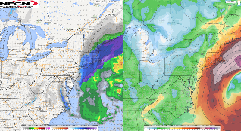
Snow has been sparse this winter, but we're about to trim quite a bit off of the deficit this week. A blizzard is sizing us up and liking how we look.
Today, we're getting a storm from the Gulf of Mexico that came up the coast at us and got cold. The blizzard will be more of an Alberta Clipper that drops down onto us from western Canada.
It will be a rather large storm, and it will be a cold storm. Our storm today will move NE, and that will usher in cold air for when this storm arrives. Moisture should stream in from the ocean and fall as all snow.
It looks to be from Worcester towards the coast, with maybe the coast getting the worst of it. Accuweather is giving Buzzards Bay 15" of snow. We are also forecast to have very high winds, gusting well over 50 mph.
The snow should start as flurries Monday afternoon, steadily get worse, and then snow all day Tuesday. We should have 3-6" of snow by the end of Monday night, then pick up another 10" on Tuesday.
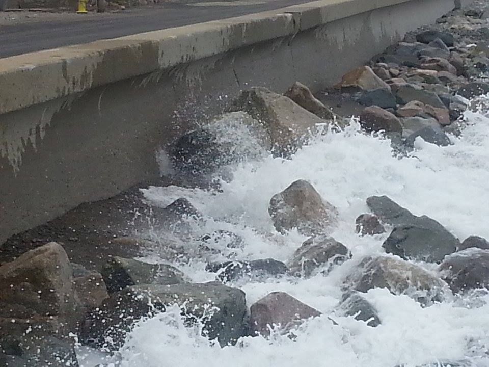
Coastal flooding will be a concern, as the winds will be high. The seas are already churned up from today's entertainment, so be ready. There will be a waning new moon tide of 10.9" on Duxbury Beach.
We're a few days away, and the forecast can change. However, we're also fairly close, and the present forecast is a monster. A wobble in the track could mean rain, or even no precipitation at all... but it could also mean More Snow.
As you know, a blizzard is combo platter of snow, high winds, and low visibility. We'll have all that, playboy.
We'll be back with an update.
No comments:
Post a Comment