Oh, what a busy few days your weatherman has coming up. This, for instance, is my day off.
We got the drop on Boston TV stations yesterday warning you about this blizzard. The article we wrote yesterday did more traffic than every other article we have put up on this admittedly-new site... combined... and quadrupled. The article had over 400 likes... our previous high, I think, was 6.
In today's article, we'll kick around a few important things to know regarding this blizzard. Among them are:
- What advisories and warnings do we have?
- When does it start?
- How much snow do we get?
- Will it rain on Cape Cod during the height of the storm?
- Could the storm miss us?
- How bad will the winds be?
- How bad is the coastal flooding threat?
- If we get a rain/snow line, where does it set up?
- School cancellations?
- Power outages?
- Where would a worst-case scenario rank among historic storms?
- Will the Governor issue a driving ban?
Ayup, ol' Steve isn't getting much rest and relaxation this Sunday. I want you to remember these sacrifices that I make for you if the storm misses and we get rain.
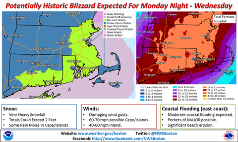
Warnings, Watches And Advisories
Well, to start off, the officials have given us a slew of advisories, warnings and watches. We have a Blizzard Watch, a Winter Storm Watch, a Storm Watch (a Storm Watch is for people at sea, it doesn't cancel out the Winter Storm Watch or anything), a Coastal Flood Watch, a High Wind Watch, a Small Craft Advisory and a Special Weather Statement concerning black ice this morning.
Watches are issued when these conditions are possible. They upgrade it to a Warning if the conditions are imminent within 24 hours. We'll probably turn over to Warnings tonight.
Note that, on at least the NWS map, the Blizzard Watch is for the North Shore, Boston, the South Shore, The South Coast, Rhode Island, and southern Connecticut. Cape Cod does not have a Blizzard Watch at the moment.
The Winter Storm Watch extends into Indiana, and runs due East from there. You can trace the future path of the storm just by the advisories being issued.
Speaking of which....
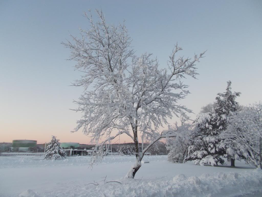
 |
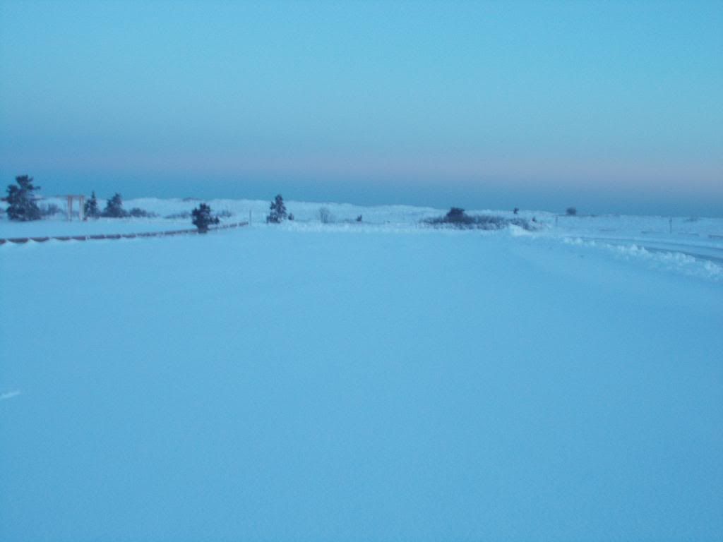
| Sagamore Beach, MA |
The Path And Nature Of The Storm
The storm will drop into the US, run east to New Jersey or Carolina, emerge offshore and rapidly intensify. It will then move NE towards Nova Scotia.
The snow will start on Long Island at 7 AM Monday, and it should be snowing heavily in Gloucester by 7 PM. Cranberry County will get the party started (I agree, Natasha) in the late morning.
We're pretty cold, so it will start off as snow. As the storm draws up southern ocean moisture, it may shift to rain on Cape Cod. To be honest, I have no idea. Even if it does shift to rain, it will turn back to snow as the storm moves away.
As near as I can tell from the advisories, the rain line will set up around the Cape Cod Canal. At least one local station is giving a circle around Boston 1-3 feet of snow, then calling for a Coating elsewhere. They have Duxbury facing 1-3 feet of snow, while they have Plymouth getting only a coating. Either they lost their mind, or they expect the rain to move into mainland Massachusetts.
Please keep in mind... "rain line" generally means "someone else gets snow, you get rain." Not this time. The rain line which I speak of just means that it will be raining during the height of the storm. If the blizzard conditions hit but it starts raining, there goes your blizzard. You're not getting off the hook, though. The rain will be bracketed by snow, perhaps even a foot of snow on each end.
I'd be one pretty perplexed precipitation prognosticator if Cape Cod went all rain. My own forecast from the top of my head gives them 10-20" of snow. Most local stations aside from Channel 7 give them over a foot of snow.
Everyone else gets snow. The worst of the precipitation will be near the coast, in whatever form it may take. Channel 5 had a line of 24-30" running along the coast from Portsmouth, NH to Plymouth MA. Moving west lowers the totals a bit, with Worcester getting 20" and Providence getting 17".
Channel 4 has 1-2 feet across the state, with a jackpot area running from the Canal to Gloucester, then moving inland at a SE angle through all of Rhode Island into southern Connecticut. They show a sharp cut-off for Cape Cod, and don't think that the Cape will clear a foot.
Accuweather gives Bourne 19.3" of snow, Foxboro gets 23.2", Duxbury gets 22.3", Worcester gets 20.6", Ashland gets 22.9", Fall River gets 23.2", Brockton gets 23.9", and you get the general idea.
They do have totals dropping on the Cape. Hyannis gets 9.9" of snow, Orleans gets 9.2", and Nantucket gets 9.5". Nantucket is forecast to get ocean effect snow on Wednesday. Forgot to link to those, sorry....
 |
| Scusset Beach, MA |
Historic Snowstorm?
Boston is forecast to get 28.4" of snow, which puts it in historic territory. Boston has the best historical stats, so let's compare the past and the future. This one could break a record.
Here are the 10 worst snowfall events to hit Boston.
1. February 17-18, 2003 27.5 inches
2. February 6-7, 1978 27.1 inches
3. February 24-27, 1969 26.3 inches
4. March 31-April 1, 1997 25.4 inches
5. January 22-23, 2005 22.5 inches
6. January 20-21, 1978 21.4 inches
7. March 3-5, 1960 19.8 inches
8. February 16-17, 1958 19.4 inches
9. February 8-10, 1994 18.7 inches
10. January 7-8, 1996 18.2 inches
10. December 20-22, 1975 18.2 inches
10. December 26-27, 2010 18.2 inches
Yup, that's not good.
Boston has lower storm totals than her surrounding areas. Monponsett had 38" of snow in 2005. Great Barrington, MA owns the Massachusetts single-event snowfall record at 62 inches in 1995.
 |
| Scituate, and just look how close the road and houses are! |
Winds, Flooding and Power Outages
Snow will not be our only problem. We will also have the three Ws... Wind, Waves, and When will the power come back on?
Let's start with the winds.
We're looking at 35-45 mph sustained winds for large parts of the storm, which is big trouble. 35 mph is the cutoff point for blizzard conditions. Wind like that, when combined with all of the snow, will reduce visibility to about as far as you can stretch your hand out.
We can have gusts to 60-75 mph, and maybe isolated spots with even higher gusts.
Remember, the Bourne and Sagamore Bridges close when winds reach 75 mph in a hurricane, and hurricanes don't cover the bidges in snow and ice.
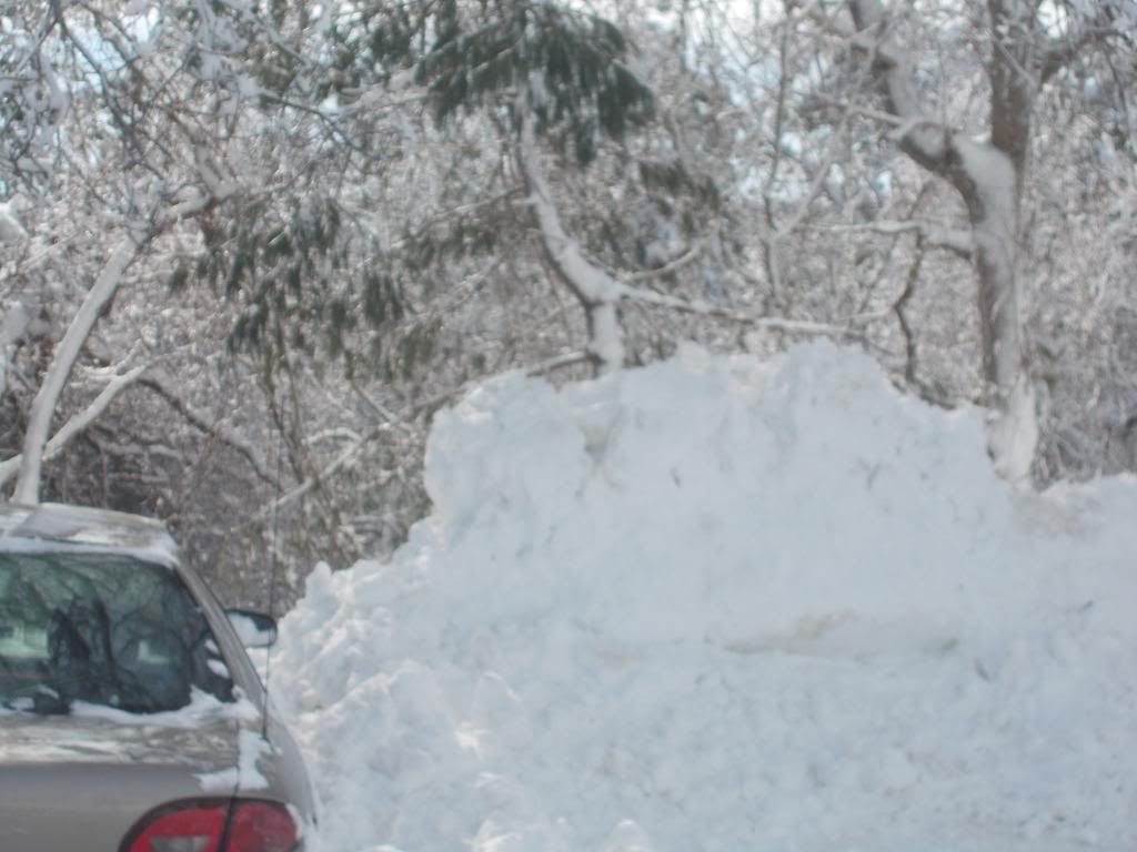
That wind will whip the power lines around. If those lines are covered with snow- or worse, ice- they will snap. When that happens, you get a blackout. It will be hard for NSTAR to get their trucks around in a blizzard, so the power will stay out once it goes out.
Lows will be in the teens in the days following the blizzard, and may even hit single digits a week after. That will make some Peopsicles, no doubt.
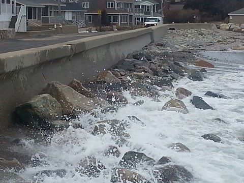
Even if the power stays on, it won't stop the ocean.
We will have the advantages of a waning new moon (if this storm hit last Tuesday with the new moon, we'd have seen Blizzard of '78 type coastal destruction), which gives us lower tides. Brant Rock had an 11.5 foot tide on the new moon, it will only be 10.1 Tuesday.
The storm will be a slow mover, being close enough to rile the seas on both Monday morning (no flooding then, but the process begins) through maybe Wednesday night. That will build the seas, and built seas have nowhere to go but up against coastal development.
You want to keep an eye on the ocean, because Tuesday's high tide will be at 4:30 in the morning, after 20 inches of snow has fallen. It will be a very difficult time to try to escape. Locals know their beaches better than any weatherman, but the weatherman is urging you to have a plan in place.
We'll try to get some pictures and video up (we have several embedded reporters in areas like Duxbury, Bourne, Plymouth and so forth), but no guarantees. I'll probably be stuck at my night job for a few shifts.
Compared to being isolated from the outside world with no heat in 14 degree weather with the ocean washing through your living room, not seeing my storm pics will be the least of your problems.
 |
| Bournedale, MA |
School Closures, Driving Ban?
Don't forget that Governor Deval Patrick banned all non-essential in the state of Massachusetts for a much weaker blizzard recently. You could only drive if you were a cop, a firefighter, an EMT, a nurse, or media.
I have a perfectly good Press Pass, which won't matter very much because I drive a Dodge Stratus that probably won't get out of the parking lot for 3 days. I'll walk around a bit, and I'll need a Marylou's coffee badly enough that I'll do some whiteout driving before too long.
Will new Governor Charlie Baker ban driving? Remember, anyone in Boston named Charlie is very much afraid of using the MBTA, for the last one never returned (Oh, he never returned), and his fate is still unlearned.
We also have an army of perfectly capable snowplow guys who have been dying for work in this mild winter we've been having.
Schools will almost certainly be called off for Tuesday, and maybe Wednesday. If one kid can't be guaranteed safe access to the school (even/especially kids who walk to school down snowy sidewalks), the whole district has to cancel.
Some schools, especially on the southern coast of the state, might not be wrong doing a day off or even an early release on Monday. Likewise, a day off or a delayed start looks good for Wednesday.
I'd give a lot of thought to unilaterally declaring a No Schools, All Schools as a parent if your kids might end up getting hauled home on a bus during the start of a blizzard Monday afternoon.
Anyhow....
That's what we have for now.
We'll be back with an update tomorrow morning, but you might want to spend today filling the gas stank, storing some water and having some non-perishable food in the house.
It could end up missing us or giving us rain, but you never know....
No comments:
Post a Comment