Showing posts with label saquish. Show all posts

Thursday, August 11, 2016

One Of These Things Is Not Like The Other....


"Cranberry County" is a sweeping term that we use to cover the South Shore, the South Coast, Cape Cod and the Islands. It's a relatively homogeneous area.

While great differences exist from town-to-town (and even from one section of a town to another), they are a degree of Great where the differences might not be so apparent if you aren't from the region.

While people from Duxbury may think of people from Marshfield as a lower species of talking ape, we all look alike to someone from Angola.

However, the differences are often extraordinary when examined by a local.

Some of the differences are socioeconomic, some are racial, some are urban/suburban, some are ageist (not sure if that's a word, but it is now) and some are so subtle that I'm not sure what they are and I am only writing about them because I am aware that some locals feel that differences exist.

We'll see what's up with these differences... this week, in Cranberry County Magazine!


Plymouth and the Pinehills

Plymouth is a huge town. It is the largest municipality in Massachusetts. It has more land area than Boston and Worcester combined, with Everett, Charlestown and Somerville thrown in.

A working understanding of Population Density can explain the population differences between Boston and Plymouth, and that means a lot here. Much of Plymouth is rural or even undeveloped.

It's not as bad Now as it was Then. Much of Southern Plymouth was forest until recently. There were parts of the forest that had higher Wampanoag population totals than White Guy totals. Population booms in towns just north of Plymouth in the 1970s showed that maybe the limits of "tolerable commute from Boston" had not been reached yet. Many developers noticed this.

Soon enough, you had some massive building projects going on down there in the hinterlands. The 12.4 kilometer land area of the Pinehills neighborhood is about the same size as Arlington, Massachusetts (population: 44,000). The Ponds Of Plymouth neighborhood is large enough that it redrew a Congressional district. Both of these areas were literally carved out of the forest.

The Pinehills have 3000 homes, many of which are Luxury homes. They pay $9.5 million in taxes, making them the second largest taxpayer in town after the Pilgrim Nuclear Power Plant ($9.7 million in 2011, the Pinehills may have passed them).... and the PNPP ain't in town for the long term, Jack. The Pinehills are the proverbial 9.5 million pound gorilla, and that influence will skyrocket soon enough.

The arrival of these heavyweights forever changed the landscape of Southern Plymouth. Formerly a ponds-driven resort community dotted with cottages and cabins (a Boston Globe article said that the Pinehills area was "only good for hunting" before development), the formerly uninhabited areas- consisting of sort of Cedarville, sort of West Wind Shores Shores, sort of Manomet, and really none of the above- bleed over into the Irish Riviera-influenced coastline.

The long-term, pre-Pinehills residents of the area seem pretty cool about the arrival of the luxury housing. The Pinehills are generally self-sufficient, and were dropped down where they aren't in anyone's way. Most recognize that people paying $10 million a year in taxes are worth whatever problems may arise with traffic, population density and water concerns.

The one form of resentment that I saw (and I went trolling for Pinehills hatred on several area-themed Facebook pages) involved the belief that the Pinehills live in their own little world. It is very self-contained, having their own shops, gas stations and even a fire station. Pinehills people have very little reason to mix in among the rabble, and everybody knows it. "It's like a town unto itself" was a prevailing sentiment.

It does make you wonder when the Pinehills people and the Ponds Of Plymouth people will realize that they are carrying a large % of the town's tax burden on their shoulders, and maybe strike out on their own? Annex Cedarville's White Cliffs neighborhood for beach access, swallow up some pond neighborhoods for future gentrification... and then secede. They could probably apply for admission to Cape Cod, if they keep the Median Household Income high enough.

Google Map that ish and tell me that I'm not on to something. Sounds like a good future article.


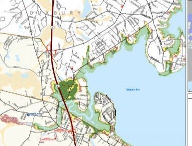
Duxbury and the Irish Riviera 

Duxbury is a tony town of 15,000 souls, and the folks from other local towns call it "Deluxebury."

While the wealth is not ostentatious (if you drive through town expecting to find Versailles on every block, you'll be disappointed), everybody on the South Shore knows what's up. It even drifts out to the Cape. Radio talk-show host Ed Lambert from WXTK, who works in Hyannis and lives further out on the Cape, always says "Deluxebury" when referring to the Plymouth County town.

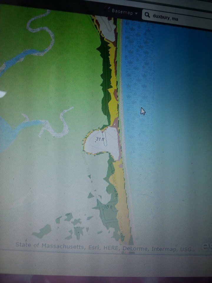
So, in posh Deluxebury, what's up with that sandy cottage village on the ocean side of the Powder Point Bridge? Why, it's none other than Duxbury's little slice of the Irish Riviera!

The Irish Riviera is a strip of often seasonal coastal housing built more along cottage standards than as a place where you might think about hanging a chandelier. It is a distinct cultural entity which runs mostly unchanged down the Massachusetts coast from Quincy to the edge of Cape Cod.

Access to Boston via Route 3 in the 1950s and especially the Boston Busing Crisis of the 1970s doubled the population of most South Shore towns. This made the Irish Riviera more of a year-round thing.

While Duxbury Beach is mostly uninhabited, what inhabitants there are stand firmly in the camp of the Irish Riviera. Heavily blue collar, overwhelmingly Catholic, generally seasonal and very, very Irish (my friends growing up there included Kerrigans, Branns, McDaniels, Deehans, McLaughlins, Duffys  and several spellings of "Reed")  the residents differ noticeably from the Pilgrim descendants roaming through Duxbury Proper.

I grew up on Duxbury Beach, and most of my classmates instantly recognized me as a non-native Duxburian. Many of them to this day think that I grew up in Marshfield, either literally or culturally.

The neighborhood is slowly being gentrified, as wealthier people buy up cottages and jam as much lumber as they can into the footprint of the original cottage. Property values soar, and the blue collar Irish Riviera crowd will be squeezed out of the neighborhood by whatever they call Yuppies these days. Many of my old neighbors (I migrated to the Cape a dozen years ago) tell me that it isn't the same neighborhood these days.

For now, however, the Irish Riviera still runs through Duxbury.

Note that Mosquito Village very nearly took the Duxbury section of this article, but I went for my old neighborhood as a sort of professional courtesy.


Brockton and the South Shore

Duxbury Beach is the story of an Irish-American, Boston-to-suburbia exodus. Brockton is an older tale, and it involves putting shoes on people.

Brockton was originally a part of Duxbury, but you wouldn't guess that now. They are completely unalike. It's a lot like the old George Carlin "baseball is pastoral, football is technological" routine. Duxbury is suburban, almost rural. Brockton is urban. Duxbury is very white. Brockton is very black. Duxbury has a small population over a large land area, while Brockton jams a lot of people into a small space. Duxbury is wealthy, Brockton is poor. Duxbury kids are pampered, Brockton kids are among the toughest in the world.

Duxbury is basically like every other town in Plymouth County.... Brockton, uhm, isn't.

How did that come to be?

Brockton's position on the Salisbury Plain River allowed it to operate mills, and these mills expanded steadily throughout the early Industrial era.  While the Carvers and Marshfields of the area were primarily farming communities with sparse peopling, Brockton's burgeoning industries (by the time of the Civil War, they were America's leading manufacturer of shoes) produced a high-density, urban entity.

The differences soon became apparent. Wareham is a good-sized Plymouth County town, home to 22,000 people in 2010. Brockton had that reached that population in 1875. By 2010, Brockton (93,000 peope or so) made up about 20% of Plymouth County's nearly half million residents... jammed into 2% of the land area.

As you may have guessed, very few of those people are white millionaires who prefer to live in a triple-decker with two Dominican families. The median income in Brockton is about $21K, well below the Plymouth County's $35K. 14% of Brockton residents are below the poverty line, as opposed to 4-6% in Plymouth County... which, I hate to add, includes the Brockton numbers as 20% of the total.

Brockton kids are as tough as it gets. Two of Brockton's residents have ruled very competitive and prestigious boxing weight classes in the last 50 years or so, no mean feat for a city that is just 1 of the 25,375 cities, towns and incorporated places in the US. If your town's "notable residents" has "Marvin Hagler" listed, and he isn't the immediate undisputed answer for the "toughest guy who ever walked these streets" argument... you live in a pretty tough town, my friend.

This is funny, because if you went to Central Casting and asked for a typical Plymouth County resident, you'd probably get some butter-soft Cohasset trust fund WASP.

Brockton provides almost all of Plymouth County's street credibility, sporting a robust 43.1 black majority.  Plymouth County's 7-8% blackness is almost entirely based in Brockton. Duxbury, holding down the other side of the see-saw, is .6% black. Duxbury does rank above Brockton in "drive-by shootings of a prominent rapper."


The Wedge and Hyannis Port

Following the Rich Man, Poor Man theme, let's carve up a region where the Kennedy Compound and a very busy Salvation Army center are 5000 feet apart.

"The Wedge" is a part of Hyannis that has a higher poverty/crime rate than her surrounding neighborhoods. It is the area south of Route 28 around where the Cape Cod Mall is. It forms a sort of Triangle, which draws unfortunate comparisons to the ones in Bermuda and Bridgewater.

It hosts a goodly portion of Cape Cod's poor, and some of them are lacking Camelot levels of cash flow. There is also a lively drug trade at work in the region, and you can get your hat handed to you if you mess with the wrong group of people.

It's not Roxbury. You could put on a shirt made of money and walk through the toughest part of the Wedge yelling threats at midnight, and your chances of survival would be a healthy 46%.  It would be about .46% if you did it in certain parts of Dorchester, and it would only get that high because a good portion of Americans believe that the gods speak through the mentally ill.

The Wedge (aka "Captain's Quarters) is not as bad as this article makes it out to be, an article where the author urges Zero Tolerance/Shock And Awe tactics on a neighborhood about the size of a mall, but you have to view things in their proper context.

Not that far down the road, you have a Summer White House, perhaps the most well-known one ever. It's where Jackie O and JFK got in the yacht and had those "How many butlers and maids should we hire this summer" conversations that you and I don't have.

I doubt that, when Jackie O was deciding which one of her hats to wear, she ever said "Oh dear, I'd better not go with blue, it could be mistaken for Crip affiliation five blocks over. Someone might blow my husband's head off."

Note that we almost went with Onset Waterfront/Shangri-La for a Wareham tangent, but the article is getting lengthy. Both towns battle over the "Brockton-by-the-sea" nickname, with "Sea Lowell" and "she's like a baby Lynn" also in the mix in SE Massachusetts conversations about the 'Ham. I personally know a guy in Wareham who has performed more murders in his travels than the entire town of Duxbury has suffered for as far back as my admittedly-shoddy memory goes.


Chatham and Harwich

Here's one of those comparisons that makes no sense to an out-of-towner. I live on Cape Cod, too... albeit the Upper Cape. I consider this to be close to a family-style dispute that anyone with a brain stays out of. So, into the dispute we go...

The differences between these two towns are piddling, if that's the right word. Chatham has a $45K median income, while Harwich is at 41K. That's like, uhm, $80 a week or so, no? Chatham and Harwich are 95-96% white. They are both tourist-dependent, like a junkie and the smack. If you say something stupid at a tavern about fishing or driving a boat or lobstering in either town, there will be no shortage of people willing to correct you.

I list them here because I recall there being some acrimony when they regionalized the schools and created Monomoy High School. I voted for Charwich (which would have given restaurants in both towns the opportunity to create a hyper-local sandwich), but I'm not a resident.

I think that the beef was over how to fund the high school. Harwich is just about twice as large as Chatham, and the financial split may have been less than fair originally.

There may also be questions about the rate of development and the changing face of the Outer Cape. In 1960, Chatham had 3273 residents, and Harwich had 3747 residents. Harwich then almost tripled their population by 1990, while Chatham barely doubled theirs. I should add that these differences vanish quickly when Chatham's summer population skyrockets to 30K and Harwich moves past 40K. Then, they just all hate summer people.

There is an element of two twins fighting over which one is prettier here, but I think that I may have overestimated the acrimony that exists between the two towns. If I missed some point of contention, hit me up in the comments.


Gurnet/Saquish and the Post-Industrial Era

Whatever problems Brockton may have, somebody at least was decent enough to run a power line through town. You don't need an off-road vehicle to get around. A really big wave doesn't cut it off from the rest of the word.

Residents of Gurnet Point and Saquish Head have those problems. The cool part? They like it that way.

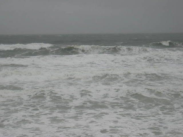
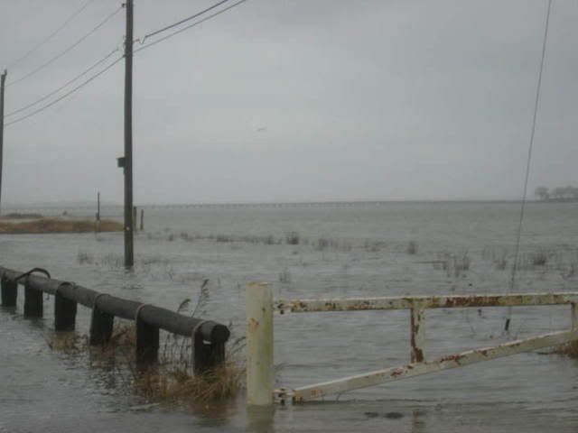
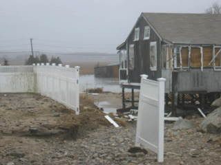
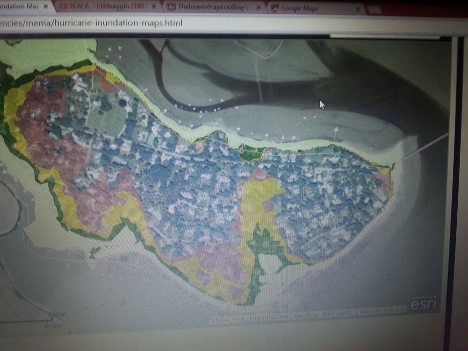
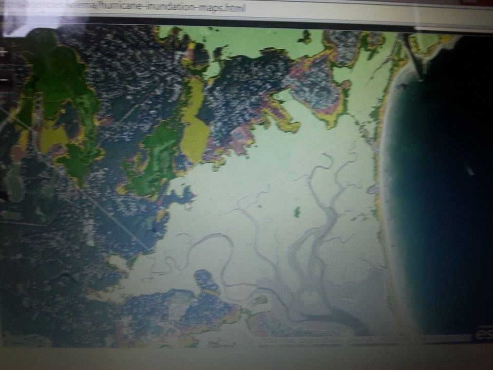
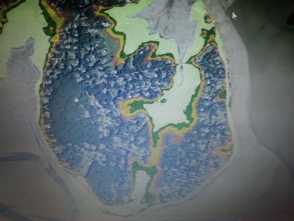
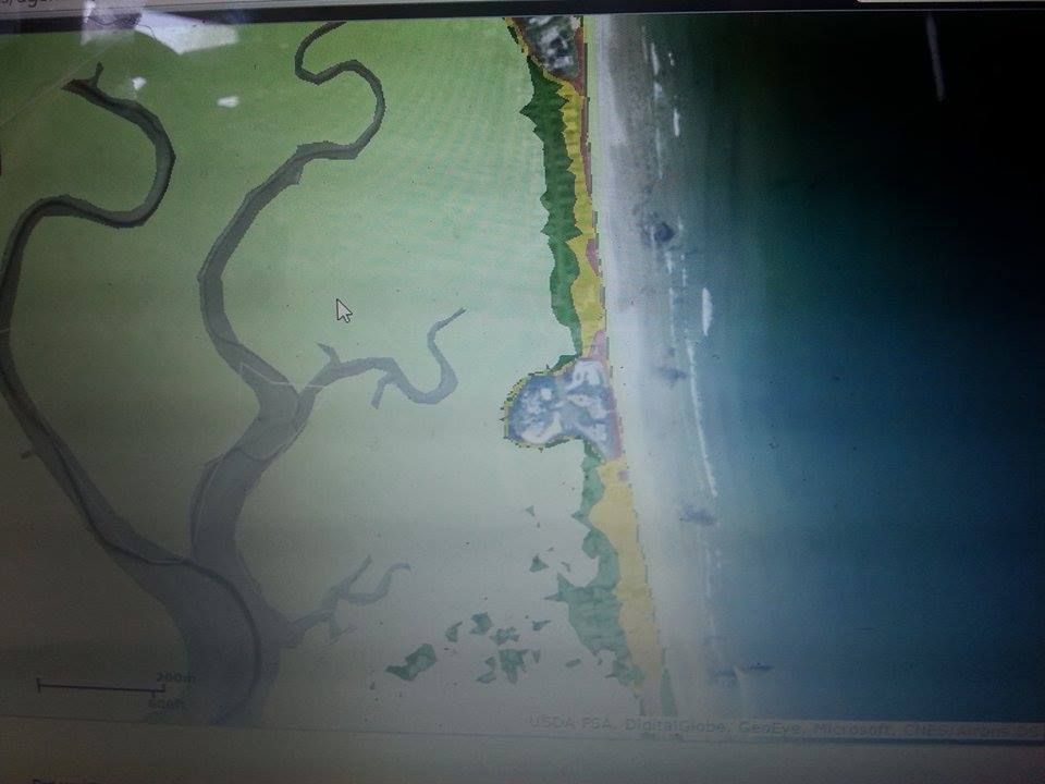
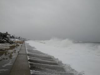
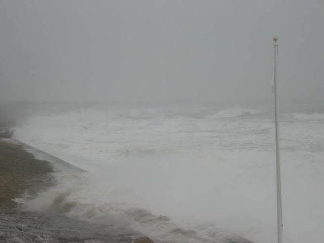
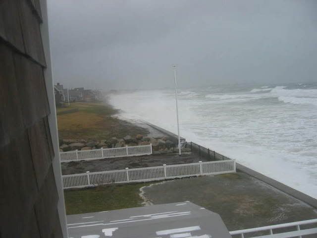
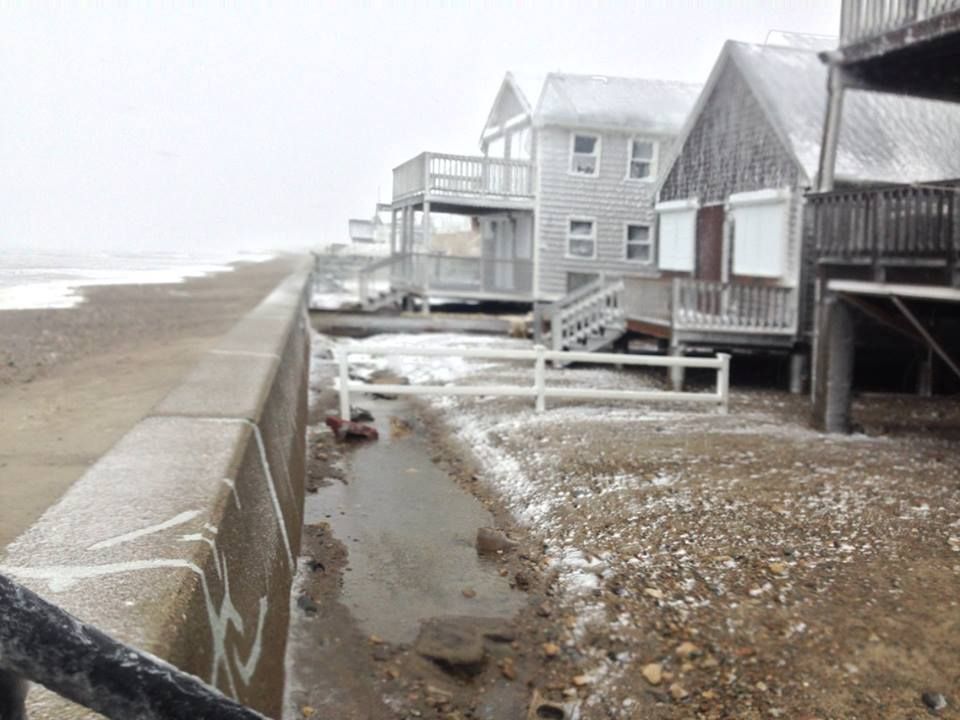
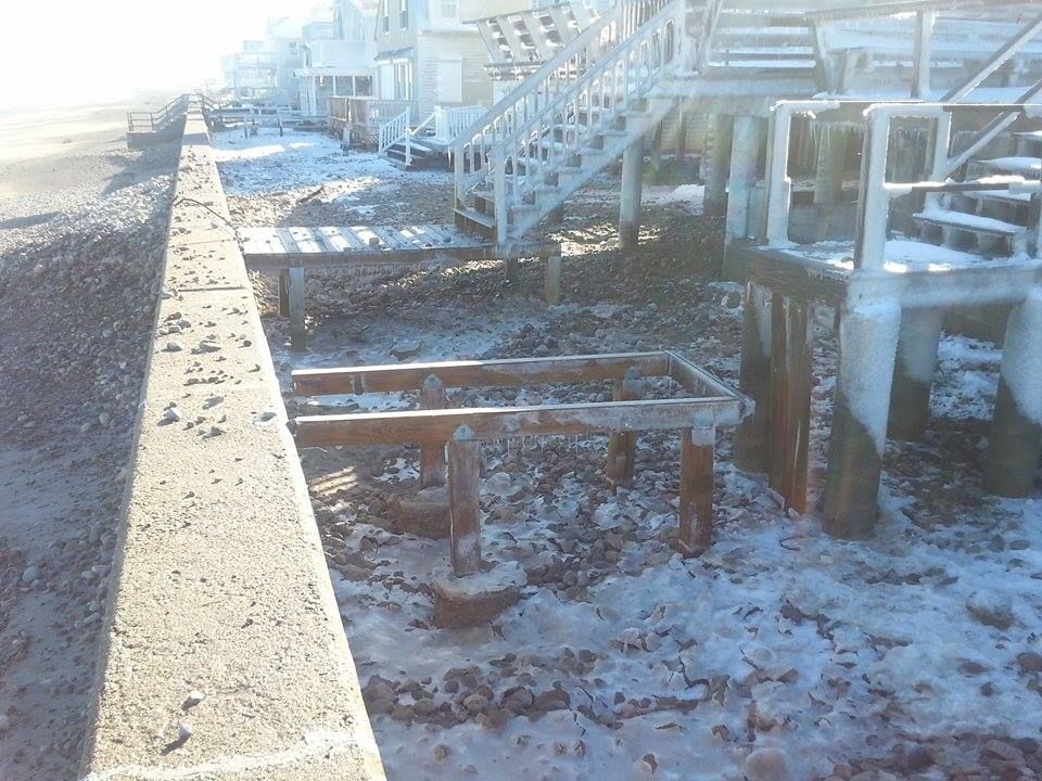
Way out on the end of Duxbury Beach (it's actually Plymouth, but that would only confuse you if you were looking for it on a map), there are two tiny villages.

They have no electricity out there, and survive on firewood, propane, solar and wind energy. It is as Cottage as any beach gets around here, or pretty much anywhere.

Many who see it up close think that it may just be the greatest place ever, myself included. If you take away the Jeeps, it's basically 1850 until you look in the cottages and see laptops, portable radios and newspapers writing about a black US President, space shuttles and so forth.

They're aware of the modern world, so it's not like that M. Night Shyamalan (?) village movie out there. It'd never work... not enough trees. They could see modern stuff, including a nuclear reactor, just across the bay in Plymouth proper. You could maybe pull it off with a bunch of fog machines, but a good wind might spoil the ruse.


Dennis-Yarmouth/Yarmouth-Dennis

They're here at the end because I have always admired how they worked out the naming thing. Chatham and Harwich have Monomoy to fall back on when circumstance forces them to team up. D-Y found another way.

Simply put... the high school is known as Dennis-Yarmouth, and the baseball team in the Cape League is known as Yarmouth-Dennis. D-Y is in effect for more months of the year, but Y-D is in effect when the population is at the highest point.

Everything balances, and everyone goes home happy.


Speaking of which, I'm out of towns. Let me know who we forgot!

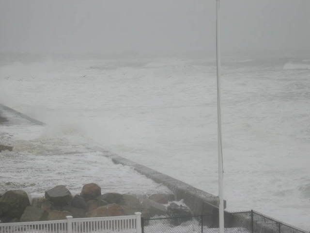
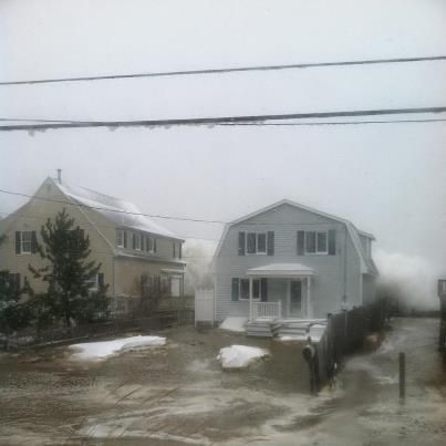
Thanks to Heidi Woodmansee Sullivan, Kerri Yankovicth-Smith (Marine Mom!), Scott Rodrigues and the Duxbury Beach Resident's Association for help with the pics.

.

Friday, November 13, 2015

Body Of Missing Malden Teen Washes Up On The Gurnet

Gurnet Head is in the background of this picture, and that stuff in the foreground isn't a body...

A body was discovered on a remote Plymouth Beach yesterday, and it has been identified as a Malden teenager who had gone missing from Quincy in October.

A man loading his truck with rocks discovered the body, which was in a deep state of decay. The man initially thought he had found a mannequin, but that did not prove to be the case.

Josue D. Quispe-Almendro was last seen by his brother in October. A Nissan Pathfinder linked to him was found on Moon Island Road, in the Squantum section of Quincy. A somewhat cryptic Facebook post and a bit of the new friends/coming home late routine added intrigue to the mystery.

A massive land/sea/air search failed to locate the child, who was reported missing on October 18th.

Authorities are mum as to how and in what condition Josue entered the water. They can not yet determine if foul play was involved.

Saquish Head and Gurnet Point are remote headlands at the end of the Duxbury Beach peninsula. They jut out into Cape Cod Bay quite some distance, and this isn't the first time that bodies have washed up there.

Two men missing/presumed dead in the 1982 World Airways Flight 30 crash at Logan Airport were reportedly hauled up- still belted into their seats- by  fisherman off of Saquish a few months after the crash. He lost control of the bodies, and they were never recovered.

Josue's body was taken to the Office Of The Chief Medical Examiner, who will perform an autopsy.

A body floating aound and washing up out there may be proof that the Great White Shark population which Duxbury had in the summer has gone South.


Wednesday, September 2, 2015

The Duxbury Beach Hurricane Super Special: Inundation And Evacuation!

Ocean Road North
Duxbury is the heart of a very dangerous strip of coastline, one running from about Hull to Manomet. Duxbury is the first town getting northeast winds coming off the ocean which haven't been broken on Cape Cod first. This means that we get the Big Trouble in storms.

Duxbury (like Poseidon's other punching bags, Marshfield and Scituate) suffers more from nor'easters than it does from hurricanes. For example... Hurricane Bob, which tore Bourne to shreds, didn't even get a wave to the seawall 20 miles north on Duxbury Beach.

That nor'easter bias is partially because hurricanes are infrequent visitors to Massachusetts, and partially because the South Coast and Cape Cod act as our barrier beach to blunt the direct-hit effect of a hurricane.

You don't see Duxbury on the news when nor'easters come, as:

A) the reporters tend to favor the safer, more accessible beaches of Scituate area (if you go to Gurnet Road during a storm, you're going to be staying there until an hour or two after high tide... unless you have a boat), and:

B) Duxbury Beach, in the winter, is home to about 50-150 souls.

However, Duxbury Beach may get the worst of nor'easter coastal flooding, beating out Scituate and Marshfield because:

- A drive around Scituate's beach areas shows a lot of 1950s-style cottages on the front rows, facing the beach. None of those houses survived 1978 and 1991 in Duxbury.

- Marshfield and Scituate don't suffer permanent breaches in storms, to the extent that Duxbury Beach does.

- Much of Duxbury Beach is unarmored (no seawall) or ineffectively armored.

- Duxbury Beach is very, very low-lying. Take a good look at Saquish, where the lighthouse is. That's 40 feet higher than the Gurnet Road area. My old cellar on Ocean Road North was 3 feet below sea level, no joke... at least it's no joke when an insurance adjuster is telling you.


I apologize for the rotten shot, something on the site was making it impossible to SAVE AS or PRTSC. I took pictures of the screen with the map up, with my girlfriend's phone. Some detail has been sacrificed, but you can check out your own spot (or have a laugh at the expense of your less fortunate neighbors) by going here.

We'll be speaking of two Duxburys. However, the divide I speak of today is not Socioeconomic. It is instead Catastrophic. You can see how the town is divided in the Inundation map above.

Duxbury Proper is protected by a barrier beach. Duxbury Beach is the barrier beach. It's the difference between the bay rising up into your yard and waves breaking on your house. Proper makes up a lot of the difference by being loaded with trees, which suffer the wind poorly.

You'll be able to see the difference with the maps we have for you today. The first ones will concern Inundation. "Inundation" is a fancy word for "storm surge," but you can amp it up to "Deathflood" or "Liquid Doom" if that gets your people moving faster. These maps are made by FEMA, MEMA, NOAA and NHC, and are built along the zany-weatherman-titled SLOSH model.

The maps are color-coded along the lines of the Saffir-Simpson hurricane intensity scale. Areas where the color changes show a place where the storm would have to be more intense to inundate. They depict a direct-hit hurricane at mean (not full moon) high tide.

Please note that these maps do not depict flooding that will almost certainly occur relating to high rainfall totals, river/stream overflow, sewer spillover, rising groundwater and people running their hose into the street just for the sheer sociopathic joy of it.

They also do not show trees falling, power lines coming down, debris blowing around, cyclones, car accidents, looters being shot, gangs of youths purging down the side streets, sharknadoes, and the wrath of God himself.

The colors work like this, and keep in mind, you can zoom in more than I was able to on your own computer:

Light green = Category 1 hurricane. The Halloween Gale was a good example of a strong Category 1, at least along the shore. While not a hurricane, the Blizzard of '78 is also a good example of Cat. 1 hurricane-style damage.

Darker green = Category 2 hurricane. Hurricane Donna was a textbook case of this kind of storm. Hurricane Bob, at least on Cape Cod, hit as a weak Category 2 hurricane. Yes, I'm aware that "weak" and "Category 2 hurricane" are tough words to chain together, but that's how we roll here at the NWS.

Yellow = Category 3 hurricane. New England has had five Category 3 storms in her history since the Other Man arrived in the 1600s. The last one was Hurricane Carol in 1954.

Red = Category 4 hurricane. The storm in 1938 could make a case for Cat. 4 status, at least temporarily. A wind gust over 180 mph hit Blue Hills in this storm.

Flesh = 100 Year FEMA estimate. I assume they mean "100 year storm." They probably should say "prehistoric storm," as scientific estimates of these storms (You know those people drawing up tubes of mud in the marsh? They are doing sand deposit tests which can show when monster storms hit the area) show that Category 4 and 5 storms hit Duxbury in 1100 AD, 1300 AD and 1400 AD.

This would be a low end of Hurricane Katrina's landfall, and a high end of Hurricane Andrew's landfall. Such a storm would tear Duxbury to shreds.

Sorry about the "Flesh" color name. My knowledge of color is largely dictated by whoever was in charge of Crayola in the early 1970s. I suppose it's "apricot" or "off-whitey" these days.

Let's break out the disaster porn, and why not start with some rich people? Here's Powder Point:

Sharper-eyed people will notice that the author was listening to NWA while writing about Powder Point in Deluxebury.
Ouch. You can kind of work this one by the house.

People out on the barrier beach may snicker at "damage" done inland, but Powder Point's map does not present a pretty picture. A hurricane of Carol strength would stand a good chance of making Powder Point into a series of islands.

Elevation is key here. The area around Crooked Lane is at around 25 feet, while areas east of Weston Road are 30 feet above sea level. Other areas, well, aren't. Those are the colored neighborhoods.

Yes, it's fun to use "colored neighborhoods" when writing about tony Powder Point and her Ubeyuppies. I've found that Inundation maps are very egalitarian, with "white" neighborhoods being inland and poorer, while "colored" areas are comprised of the less swarthy people who tend to own waterfront property. The effect is muted somewhat by the Irish Riviera, but not too much.


Next up is the area around the town's schools.

The schools are caught between the marsh and the Bluefish River. They are roughly (my topographical maps are very limited) 40 feet above sea level, and protected by a huge barrier beach.

The creepy part of this photograph is the water coming up towards the new high school (perhaps ruining some athletic fields with salt water and marine life... fortunately, Duxbury High School has a Coach Fisher on their speed dial), as well as the water coming up along Railroad Avenue threatening to cut off St. George Street. Combined with flooding going bay-to-bay around Camp Chappa Challa, you get Duxbury K-12 Island!

You'd need an apocalyptic storm to go for a Schoolhouse Blizzard effect, and we most likely won't have school in session as a Hurricane Andrew comes flying up the coast at us.... but those conditions have hit Duxbury before, so don't say that we didn't warn you.

Since you asked, flooding would be very, very close to Benchwarmer Subs, and maybe 50 yards from Farfars.


Blurry, yes.... but also clear.

As you can see, seawater pushed into the Bluefish River will spread out to enjoy parts of Duxbury which normally aren't riverfront property.

Water will also push across Washington Street around River Lane, Holmes Place, Beaverbrook Lane and Mattakeesett Court.

It's tough to see with my interpretation of MEMA's map, but a really bad storm will push seawater up either side of Harrison Street and threaten to cross Tremont Street. It will also be a bad time to golf, although a lot of "He couldn't hit the ball into the ocean" bets could be settled.

Surplus Street, Stetson Place and poor little Christmas Tree Way would also be within the reach of a strong hurricane.

You don't expect to get salt water in your basement when you live a mile inland near Tremont Street... but hey, you're rich, it's all good eventually.

I sort of sawed Washington Street into pieces, my bad. Here's the middle part:


Not my best work on the camera, nope.

After the deluge caused by the hurricane filling the Bluefish River, things become more predictable as you move down Washington Street.

You can sort of follow the color change inland with heavier and more intense storms. The storm surge doesn't get too far, but it will flood a lot of very expensive houses.

Washington Street's lower part isn't near a big river, gets no wave action at all, and benefits mightily from all the land between it and the open Atlantic

As of this time, even a Category 5 storm shouldn't wet up either Duxbury Pizza or Duxbury Deli, so you'll at least be able to get a nice lunch as you rebuild. As you'll see below, Duxbury Pizza would at least attempt a delivery to a flood zone during a hurricane in 1991.

Yes, in a nearly medieval aged town like Duxbury, the reader will notice that- beyond the schools- I'm concerned only with eating establishments I favored in my youth. I'm rooting for everyone, though... I just root harder if they make me sandwiches.


This pic is so bad, I would have skipped that part of town if my sister didn't live there.

Water from ol' Marsh Vegas flooding will move South and threaten to cross Route 3A around where Screenhouse Drive is, but it would only get across where Partridge Brook Circle is.

Someone trying to flee would find wide swaths of 3A washed over once they got into Marshfield.

Duck Hill Road and The Marshes would see water move towards them, as little-known branches of the Duck Hill River start flooding houses.

The marshes (not The Marshes) will flood during a minimal hurricane, and it would start moving into yards in larger storms.

In fact, the Duck Hill River would threaten the one streetlight in town in a bad, bad storm, although the water should stop around Back River Way.

Tremont Street would almost certainly be crossed around where the Wildlands Trust/ Cow Tent Preserve is. No, I've never been there, either.


Standish Shores, reporting for duty. It looks like the Wu Tang Clan logo from space and covered with water, no?

Before we even talk about seawater inundation, has anyone ever pondered how nightmarish it would be if the Myles Standish statue tipped over? Imagine looking up during a hurricane and seeing a 100 foot high stone Pilgrim falling onto you... he'd be like a colonial Godzilla, and might wipe out 10-20 millionaire families if he rolled a bit.

Standish Shores has a tidal creek running through it. It doesn't look like much on a nice day, but we're not talking about nice days. The creek flooding doesn't cut across the whole of Standish Shores, but it goes to where Allens Pond is, and it is there that it meets water moving in from the south. At that point, everything east of what I just described is an island in a bad storm.

The north and south inland flow should meet around Allens Lane, and just who the heck is this Allen guy, anyhow?


Bay Road follows the blueprint laid by southern Washington Street, with the added bonus of Standish Shores blocking for her. This will also be seawater pushed ashore by surge, not the crashing waves we'll see in the Gurnet Road section.

Bay Farm, which is squishy on a dry day, would be a huge puddle in a storm of hurricane strength. It would spread out and visit several properties in the area.

Island Creek and various tidal creeks would push water inland, and would wash over Bay Road in several places. Island Creek Pond or whatever they call it may also flood with rainwater.

Bennett's and other Tinkertown areas would be safe from seawater. This area, and any other area near ponds, would be threatened by freshwater flooding if the rain gets to falling heavy.

Now, let's get to the truly dangerous areas of Duxbury Beach:


That's Saquish, which means "many clams," and it would indeed take many clams to put Saquish back together again if a storm hit. Gurnet Point (a gurnett is a fish that resembles the land mass) would be no small bill, either.

It's Plymouth, but we include it here because it's the end of Duxbury Beach. We're paternal about it.

Other than Gurnet Point, which is 50 feet above sea level, and 20 foot high Saquish Head, most of this area would be underwater in even a moderate storm. The houses, which survive nor'easters, will survive to some extent through different storm intensities. Only the two high-ground areas would be dry during a Katrina-style event.

What's worse, it will be cut off from the mainland, perhaps for some time. Residents need to buy milk by the gallons, smokes by the carton and beer by the cases. It was scarier in the pre-cell phone era, but it's still as isolated as you can get in Eastern Massachusetts these days.

Good news? They have no electrical power, and are quite used to being energy independent. Everyone out there is ultra-salty, and isolation is what they sought out in the first place when they moved there.

Bad news? You may have to remove your own appendix if it becomes an issue after a major storm breaches the beaches.

Worst news? Saquish and Gurnet Point are the safe parts of this beach during a storm. Our last maps are for the most dangerous part of Duxbury in a hurricane... the meat of her barrier beach.


Behold.

I want to start off by saying that I wildly disagree with the SLOSH estimates for this section of Duxbury Beach, to the extent that I feel as if they could get someone killed.

Ocean Road North and South go underwater during nor'easters just about every year. During the two modern, post-JFK peak flooding events, there was 2-8 feet of water from the beach to the marsh. Those (the Halloween Gale and the Blizzard of '78) were, at best, strong Category 1 hurricanes. Both of these storms smashed houses to matchsticks or moved entire houses 50 feet into the road. They certainly inundated the neighborhood.

Granted, these yearly nor'easter floodings I speak of were during full moon or new moon high tides, but the winds were 50% and perhaps 20% of what MEMA says would be needed to flood the region.

The little red dot just south of Cable Hill is where the house I grew up in stands. MEMA says that only a Category 4 storm like Katrina would put it under. I've seen the whole neighborhood inundated in 1978, 1985, 1991 and 1997. Gurnet Road washes over on full moon high tides even without a storm happening.


Notice how the Gurnet Road village falls victim to her lack of elevation. Cable Hill is the highest point, maintaining a dry 31 feet height above sea level. 31 feet is a no-question-about-it first down in the NFL, and it is higher than even a Katrina storm surge. Cable Hill is where all the Ocean Road North people flee to when ORN becomes untenable.

I should add that I have seen ocean waves rip a porch off of a house on Cable Hill during the Cat.1 Halloween Gale, which is something to keep in mind when judging the validity of the FEMA estimates. To be FEMA-fair, the Perfect Storm didn't come close to flooding Cable Hill.

Gurnet Point, which an observer would think is really, really vulnerable, is about 5 times higher than Ocean Road North when you talk sea level.  GP is just about twice as high as Cable Hill is.

This area of the beach is armored, which means that it has a seawall. The seawall, for the most part, is what keeps houses from taking direct hits from 8 foot storm waves washing in from wherever the storm is.

I have seen the ocean be level with the seawall, thus allowing waves to come in unimpeded and smash off the front of my house. I've watched it happen from Cable Hill, and I've watched it happen from inside the house on Ocean Road North.


The map pretty much explains itself, but there are a few things to take note of:

- All of Duxbury Beach, with the exception of little hills and such, should be light green.

- A minimal hurricane is expected to fill the marsh, and these maps depict the mean high tide, not the full moon tides.

- The same minimal hurricane would flood The Horseshoe, which is west of Gurnet Road.

- The Horseshoe usually floods last, but the storm surge scenario (as opposed to the wave water flooding scenario seen with the nor'easters) pushes water from the marsh ashore before the waves start making things squishy.

- The guys who determined my rate of insurance also don't buy the Category 4 theory of when my house will flood.

- If enough of Duxbury Beach washes over and the waves can keep some momentum, it will be fun watching houses on King Caesar Road take direct hits from Poseidon.


Sorry for snow pics in the hurricane article, but Duxbury hasn't been hit by a hurricane since Al Gore invented those Internets. We use what we have at hand, and what we have at hand are blizzard and nor'easter shots. That's spray hitting the houses, but this was also a minor storm.

We here at Cranberry County Magazine urge you to do two things in regard to hurricane preparation. First, we want you to learn/know/live this FEMA stuff. We also want you to talk to some old local who was in the neighborhood when a hurricane hit it.

Like I said, I disagree with this map. I'm also a NWS weather spotter, which makes me far less qualified to make these calls than whoever made these maps. I have, however, been in a house on the waterfront on Duxbury Beach for the Blizzard of '78, the Perfect Storm, the April Fol's Storm and a hundred other nameless hood-flooders, which is more than the FEMA people can say.

FEMA and I do agree on evacuation. The weakest hurricane will be equal in power to our worst modern blizzard or nor'easter. The worst storm anyone under 60-70 years old has seen would be about as bad as a minimal hurricane. Someone who wasn't thinking critically in 1991 hasn't seen a really big storm hit Duxbury Beach.

I'd recommend fleeing if a hurricane comes. Go to Duxbury, Vermont. It's lovely this time of year.


This map is easier to read. FEMA uses the same color coding to determine who will be subject to evacuation orders. Red is the first level, while yellow is used for larger storms.

Essentially, Red means "You have to go." Yellow means "They have to go, too."

You don't HAVE to obey evacuation orders. However, a cop who you read the Constitution to before the storm will be the cop who has to pull you out of the maelstrom once the fun starts, and your life may become what cops refer to as a Judgement Call.

Anything in Duxbury near the coast will be under evacuation orders. Harrison Street will be evacuated if the storm gets intense enough.

Duxbury would no doubt open Chandler School or something for evacuation refugees, although their Town Page evacuation plan is drawn up for an emergency at the Pilgrim nuclear power plant. Their listed shelter is in Braintree.

Have 1% of your evacuation plan focus on a possible incident at Pilgrim, although it's about as high as Cable Hill.

It goes without saying that, if you decline to evacuate anything on Gurnet Road south of the Marshfield town line, you may be stuck for a while. This is true times a million for Saquish.


Storm Stories, from a Duxbury Beach kid... none of these stories are fake, and my storm pedigree only goes back to Hurricane Belle. Old timers have worse stories.

- The Blizzard of '78 threw a retaining wall made of railroad ties into the side wall of my house, causing the flood that finally made us evacuate. A set of stairs washed through the sliding glass doors on the ocean side during the Halloween Gale.

- In '78, we evacuated on a fire truck to Cable Hill, and we were eventually removed with a 1978 version of an Armored Personnel Carrier.

- Hurricane Gloria was the last storm I left Duxbury Beach for when I lived there. I was outvoted 1 to 1 by my mother. I watched it in Quincy, from about where the Montclair Deli used to be.

- I found a dead dogfish in my cellar after both '78 and the Perfect Storm.

- I watched the Halloween Gale from my house, with pretty much the view you see above (but with far worse conditions). I had fought/swam my way down to the house to save my schnauzer (who, carried away by a neighbor earlier, was watching the storm from a safe, warm house), and decided staying was a lesser risk than leaving. I watched the whole storm with a buddy, while the police shined a searchlight on us from Cable Hill. This slowed but did not stop my marijuana intake.

- For laughs, just before running to my house from the Ranch House (Duxbury's finest block the road right at the town line during even minor storms), we phoned in a delivery order to Duxbury Pizza for 65 Ocean Road North duing the Halloween Gale. I came to understand later that DP did deliver, and a couple of National Guardsmen appropriated the pies at the Duxbury/Marshfield border.


- Ocean Road North got electricity back in late November after the Halloween Gale. My house wasn't fit for even lamp-strung-directly-to-fuse box electricity until about Christmas.

- There were charges made that Duxbury town vehicles were removing branches from rich people homes on Washington Street in Duxbury Proper while ruined houses were strewn across the street on Ocean Road North after the Halloween Gale. There were also allegations that the Horseshoe was ignored by the town while they worked on the Ocean Roads.

- Once the town started on the beach, their top priority was filling the breach that made Saquish into an island.

- During the Halloween Gale, the Bedford house lifted up, washed 20 yards back onto Ocean Road, and did not spill two wine glasses left on the table. I have multiple witnesses to this, if you think I'm fibbing.

- While swimming across the channel (before the Perfect Storm, it was a dry public boat launch between Cable Hill and Ocean Road North, where the opening in the seawall is), I got hit with a Coke machine that had been pulled into the surf. I'm very lucky that it didn't pin and drown me.

- My brother, at the time, managed Boston's Avalon nightclub. He bought home material from the club, and we made a very distinctive black and white checkered tile dance floor for the keg parties we used to throw. It washed out of the house during the Halloween Gale, and we later found it in a trash pile outside of Sweetser's, which is several miles across Duxbury Bay from us.

- While not a bad storm at all, Hurricane Belle blew my lab/collie mutt off the seawall. He didn't appreciate the experience. Side note... the dog's name was Blackie, and we were wintering in Dorchester at the time.

- I've taken 3 electric shocks during nor'easters. One was me pulling a lamp plug out of the socket at the exact moment when a cellar window broke and seawater poured onto me. The other two were when ocean spray hit me as I was putting up plywood over the oceanfront sliding glass doors. The first electrocution was painful, but you develop a taste for them after that. After the initial shock, it feels pretty much exactly like what you feel after you smoke the yay... or so I'm told.

- The Red Cross was at my house the day after the Halloween Gale, they took care of me, and I had vouchers for Marshall's and whatever Howard Johnson's was at the time.


- I need help from a local on this, but did the Perfect Storm blow down the steeple on the Holy Family Church?

- The Blizzard of '78 finished off the stilted cottages that used to be in front of the dunes just before Duxbury Beach Park. After those, everything else was behind a seawall or a dune.

- After the Halloween Gale, new houses on Duxbury Beach had to be built on stilts/pilings.

- Sump pumps in cellars on Ocean Road North run during full moon tides even without storms happening.

- In case you ever find yourself in this position, the key to watching hurricanes from waterfront houses on the Duxbury Beach seawall is to not be in front of the windows when waves break on the house. Waves carry a lot of rocks, especially big waves.

- We neglected to board up our house for the Halloween Gale, which was swung/missed by all Boston forecasters... even the guy they show in the Perfect Storm movie calling the storm before it hit. I have actually spoken sternly to Todd Gross about this, and he- cool guy, actually- didn't disagree.

- When I waded to my front door and opened it during the Halloween Gale, a zillion gallons of water poured out of my house and nearly knocked me over. If I didn't open the (street-side) door and effectively drain the main floor of the house, water would have filled the house until it blew the windows out from the inside.

- If you're familiar with the former Bowden Compound on Ocean Road North, know that, in the Halloween Gale, the basement was full of seawater all the way up the stairs, and that there was three feet of standing water in the main floor of the house between waves. When waves would hit the house, water would wash up the stairs and hit the back wall of the second floor of the house.

- The Halloween Gale was as close as I have come to being killed, and I was a Boston high school teacher, a Mangler-style factory worker, a fight-five-times-a-night security guard at the Worcester Centrum, and a twice-armed-robbed Sagamore/Wareham gas station attendant in my life.


- After we evacuated during the Blizzard of '78, we lived at the Governor Edward Winslow Elementary School in Green Harbor/Cedar Crest for a few days, before beginning a lengthy residence at the old Howard Johnson's off 3A. By my own consevative estimate, I played the HoJo's pinball machine 3 zillion times.

- Aside from the dogfish, there was 3 feet of sand in my cellar after the Halloween Gale. We got rid of it by having a ruined-house keg party where you had to show up with a shovel.

- During the Halloween Gale, my wind speed anemometer thingy racked up an 85 mph high score. It was about a decade past the last calibration, however.

- I suppose he's retired by now, although his kids may be in the trade... but if Bobby Reed (formerly of East Marginal Road) builds your house and the Halloween Gale hits it, your house is still standing after. That's more than a few houses on my street can say.

- Cellars that are below sea level aren't covered by most insurers.

- Duxbury Beach is very Irish Riviera. However, it is slowly gentrifying into something Yuppie. Most of the newcomers haven't seen a really big storm. I grew up there when houses passed through the families, along with local knowledge. These new folk often have no idea what they got thmselves in to, until their nor'easter hits. If you're into real estate and notice a high rate of turnover on some houses, it's not because they're haunted.

Leftover storm pics: