I may have run these before, not sure if I did it on this site or not. I lifted the pics from this site.
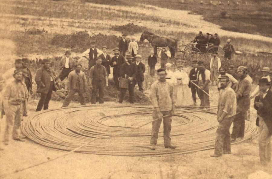
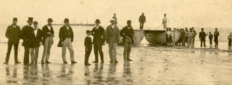
This is the Trans-Atlantic Cable coming ashore on Duxbury Beach on July 23rd, 1869. It's what Cable Hill is named for.
At the time, it was a big event. The cable stretched 3500 miles, from Brest, France. It cost a then-ridiculous $1.5 million. Everyone in town came out to watch it come ashore (there aren't many on the beach, but there was a 600 person tent on Abram's Hill across the bay), as did dignitaries from around the state. One of the first messages was sent to Napoleon III.
It came ashore at what is now Cable Hill. Since the cable hadn't landed at the time, locals called the area "Rouse's Hummock," after a farmer who was the sole inhabitant of the area for a while. Rouse's Hummock is what Hummock Lane is named for. Ironically, a "hummock" is a hill, while Hummock Lane is the lowest-lying inhabited land in the Gurnet Road area.
Nothing in the Gurnet Road area of Duxbury bears Rouse's name, and it is lost to history.... save for here, of course.
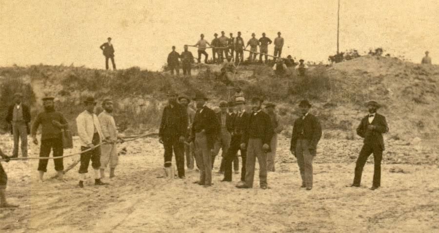
Duxbury had a very impressive dune in place. It seems much larger than the dunes down on the uninhabited parts of Duxbury Beach are presently. There was no jetty in Green Harbor at the time. The jetty there went up after the Portland Gale in 1899, limiting the flow of sand down to Duxbury Beach.
Notice that there are no houses around the dunes. A storm in 1806 (my source says 1806, but a Category 3 hurricane hit Massachusetts in 1804) closed the outlet to the sea for the Green Harbor River, Her mouth was further South than it is now, with "now" meaning where the Green Harbor Marina is. The water in the area became stagnant, and was a mosquito factory for 150 years or so. The Cut River was dug out after the GHR mouth closure, but Duxbury Beach was just sand and dunes for a while.
They did subdivide 300 cottage lots in 1888 further down the beach (they're why the Powder Point Bridge was built... prior to the bridge, if Duxbury residents wanted to go to the beach they just took a boat across the bay), but the Portland Gale tore Duxbury Beach to shreds and nixed those plans with the quickness 10 years later.
I'm not sure when the cottages on the north end of Duxbury Beach went up. Duxbury historians have generally been very interested in the Beach Reservation part,of Duxbury Beach while concurrently having no interest at all in the Irish Riviera part further North on the beach. Many people from Duxbury Proper think that this neighborhood is in Marshfield.

Back to the cable....
They (the workers, who may be French, are the ones in the light-colored work shirts, and were the only barefoot ones in the pictures when they are on the actual beach) dragged the cable into what most residents of the area refer to as Bradford's Parking Lot. You can see Bradford's in the bottom picture.
It went into the wooded area at the foot of Cable Hill. If you stalk into the scrub pines on the south end of the hill, you can still find some of the wreckage from the relay station.
From Cable Hill, it went across the marsh into Duxbury Proper, ending at the Cable Office house on the banks of the Bluefish River.
The cable was very busy for a while, and 40 francs would buy you 10 transmitted words.
It was used heavily until a 1929 Grand Banks earthquake/tsunami created an undersea avalanche that destroyed several cables. The Duxbury/France cable was among the casualties.
My dad, in a good example of making busy work, used to pay me $5 per foot for hack-sawing pieces of the cable. It was already snapped by this point, and the sharp edges were sticking up from the beach, so it was more of a public service than it sounds like.