Saturday, July 30, 2016

Why Are Sharks All Over the South Shore These Days?


OK, it's a misleading headline, and I did it on purpose.

Sometimes we headline-generating types try to assume the viewpoint of the common man who doesn't have a job which requires that he think about sharks for long periods of time. It's easier and more practical than having me try to write from the viewpoint of an actual expert who studied Marine Biology and has hours in the field. It also sets up a straw man for me to knock down.

This is important, because my last paying work as a writer where I wasn't my own boss was as a "Fantasy Football Consultant." You'll notice that, when the shark ate up that kid in Jaws, nobody was clamoring for Chief Brody to call in the Fantasy Football Consultant. Keep that in mind as I flesh out my theories for you.

Sharks are not "all over the South Shore," and it's not a case of them just being around "these days." Only the question mark at the end of the headline saves it from being an outright Lie.

Sharks pre-date humans in Massachusetts. The Wampanoags- who, whatever their faults may have been when dealing with the English, were much more environmentally reasonable than the Palefaces- never really developed Swimming as a mass hobby.  There may have been several reasons for that, but a top contender would be "the English hadn't fished Cape Cod Bay to exhaustion yet, and the larger fish stocks drew in both seals and their toothy predators."

Swimming didn't even catch on with Mr. White until a few hundred years ago, and it wasn't feasible to travel from inland to the beaches until the Industrial Revolution brought about trains and so forth. It wasn't long after the English pushed inland from the coast that a majority of people in America bore young who lived and died without even once thinking about a shark. Until the release of Jaws in the 1970s, the only sea-villains in entertainment were Pirates, Leviathans, U-Boats and the mighty White Whale.

Coastal people tended to work the seas, and sharks were just by-catch to them.  While they undoubtedly saw and perhaps even feared sharks, it was only something to worry about if the ship sank or if the Captain made you walk the plank. Remember, most of the time that man has taken to the seas was well before radios, distress calls and search planes. If your ship sank, you died, and you didn't make it back to shore to tell everyone how sharks ate the rest of the crew.

Sharks were in Cape Cod Bay long before 2010. If I remember to put it in, you can see a pic of the big Great White that was caught a few miles off of Duxbury in the 1930s. Two of the three fatal shark attacks in Massachusetts history happened off Scituate and in Boston Harbor. They went down in the 1800s and 1700s, respectively.

In between then and now, a few strange things happened. The waters off of Massachusetts, which were the first ones to be overfished by Europeans, had their fish stocks drop to very low levels. This was felt up the food chain, through the seals and right to Great White Sharks.
Cape Cod had a bounty on seals for a while, and this drove their numbers down markedly. Low seal totals meant that sharks brought their game elsewhere.

This happened as many areas of formerly isolated Massachusetts coastline were brought under development. It also coincided with the emergence of Beaching as the go-to summer activity. People began to develop formerly empty sections of Duxbury, Plymouth and what have you.

Fish stocks were plummeting, and reached all-time lows by the 1990s. The government intervened, catch limits and keeper sizes went into effect for both commercial and recreational fishermen, and fish gradually started coming back to our waters. This brought back the seals, who began showing up in notable numbers on Cape Cod around the turn of the century.

That's generally a good thing, nature-wise. However, it only took a few years for the sharks to figure out where the seals went, and they began arriving off the shores of Cape Cod in numbers that couldn't helped but be noticed.

It didn't take long for the sharks and seals to grow in number to where Suburbanization became necessary. You could see a seal sunning himself on Duxbury Beach in the 1970s, but it was an unusual thing. It became much less unusual after the century turned.

Likewise, only so many sharks can cruise a particular area. Monomoy, the primary seal and shark hangout, soon spread her apex predator bounty to Orleans, Wellfleet and Truro.  Unlike Monomoy, these are towns with people going to the beach. Truro, not Monomoy, caught the first two shark attacks of the modern era.

We know by shark tagging that the Great Whites summer here, and then head to Dixie for the winter.... regular snowbirds, they are. They sort of follow the Gulf Stream back up here every summer.  To a shark moving north along the US coast, Cape Cod is going to be sort of a roadbock. The seals keep them hanging around once they get here. Competition moves them up along the Cape.

Once they hit Provincetown, they have a decision to make. North equals open sea, East equals open sea and West equals the lovely curved shoreline of Cape Cod Bay. For a fish that primarily eats shore-hugging seals, there's really no debate.

Seals and then sharks have rounded the corner and are now occupying Cape Cod Bay. It's ironic, because one of the selling points of South Shore beaches is "no Cape traffic."

It's more of a trickle than a flood, which makes a lie of the "all over the South Shore" part of the headline. You can learn a lot by judging the results found when sharks are tagged. Monomoy, which is sort of the seals' capitol city, had 14000 shark detection buoy pingings last summer. Duxbury and Plymouth combined for about 200.

Granted, Dr. Gregory Skomal (the shark-tagging guy) focuses his efforts out on Monomoy. I don't think he has ever been tagging in Cape Cod Bay. The South Shore does have shark buoys, however, and these buoys show that sharks are coming from Cape Cod to the beaches of the South Shore. Plymouth was the site of the last shark attack in Massachusetts.

Two bad factors ("bad" for people on the South Shore who are afraid of sharks) kick in at this point.

1) There is nothing to stop the sharks and seals from populating Cape Cod Bay

and

2) It's actually a pretty cool place for seals (and the sharks who eat them) to hang out.

Other than carnivore whales and larger Great Whites, the list of creatures willing to f*ck with a Great White Shark is a small one. Not many of these creatures (Orcas and the like) end up in Cape Cod Bay. The only regular inhabitant of Cape Cod Bay who could kill them is a human. They have a free hand in this town, as the former Sheriff of Lago once said.

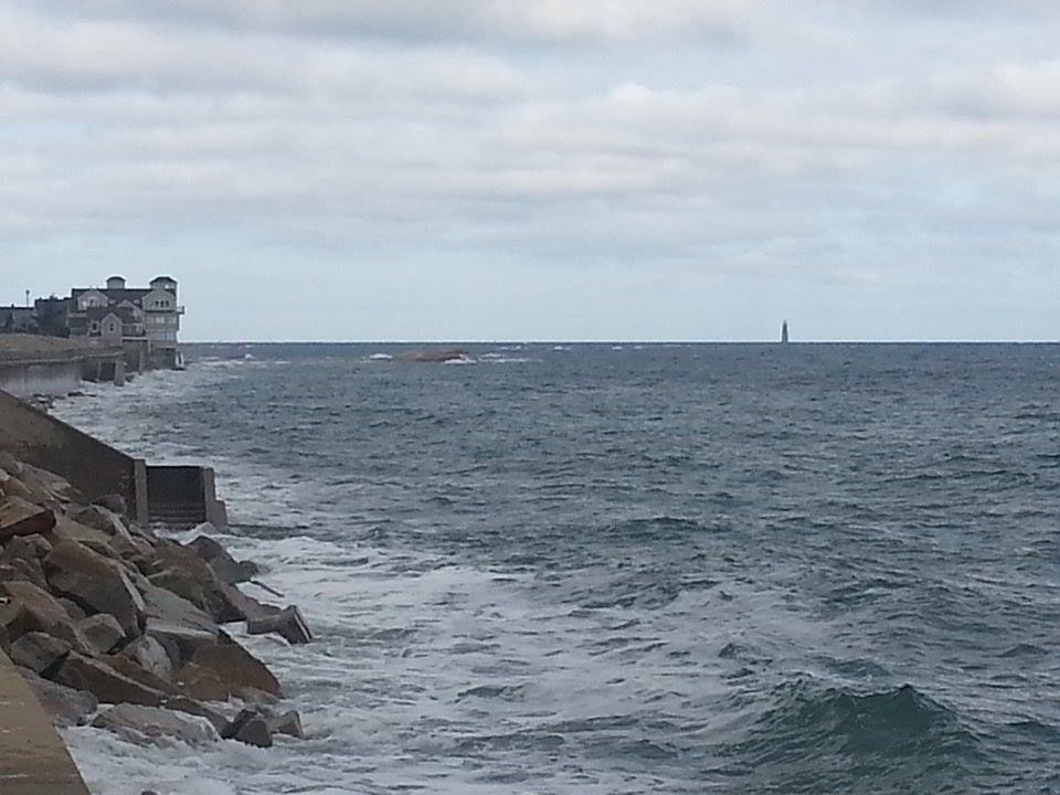
The South Shore also has long stretches of uninhabited or sparsely inhabited beach. Duxbury Beach is mostly uninhabited. Plymouth has a lot of coastal housing perched on towering sand cliffs, making it hard for those residents to just trot down to the beach. Seals can come ashore on either spot without much concern over human interaction... I mean, it's tough to sun yourself properly when people keep trying to get you to bounce a ball on your nose, yaknowwhati'msayin'?

Both species could easily get to likin' it here... and there's no reason for them to leave.

The South Shore is populated by people who aren't used to sharks being off of their coasts. I am no superhero type at all, but as a child of the 1970s on Duxbury Beach, I would have saw no threat at all in jumping off of a boat where people had been fishing with big bloody mackerel chunks all day and swimming 100 yards to shore. Even in my 30s, I'd have guessed that Smoking would be the one thing that would kill me over a long swim from a boat to shore.

That is no longer the case. If you view summer as 100 days, like Cape Cod does, Plymouth and Duxbury's numbers show that there was a shark off of each beach every day of last summer... and those were only the ones they got tags into off Monomoy. Perhaps only Poseidon, God and Aquaman know how many Great White Sharks are actually in Cape Cod Bay.

While the threat of a shark attack is still minor if not minuscule, the threat is much greater than it was 40 years ago. The risk is little... but little things mean a lot in a game where the loser is Devoured.


Friday, July 29, 2016

Much Needed Rain Coming Friday Morning


Massachusetts has been in quite a drought, and we have a rain deficit of several inches. That's not going to be a problem today, as soaking rains are set to enter the region.

From the National Weather Service:

BARNSTABLE (and PLYMOUTH) COUNTY:

...FLASH FLOOD WATCH REMAINS IN EFFECT THROUGH THIS EVENING...

THE FLASH FLOOD WATCH CONTINUES FOR

* PORTIONS OF SOUTHEASTERN MASSACHUSETTS AND RHODE ISLAND...
INCLUDING THE FOLLOWING AREAS...IN SOUTHEASTERN
MASSACHUSETTS...BARNSTABLE MA...DUKES MA...EASTERN PLYMOUTH
MA...NANTUCKET MA...NORTHERN BRISTOL MA...SOUTHERN BRISTOL
MA...SOUTHERN PLYMOUTH MA AND WESTERN PLYMOUTH MA. IN RHODE
ISLAND...BLOCK ISLAND RI...BRISTOL RI...EASTERN KENT RI...
NEWPORT RI...NORTHWEST PROVIDENCE RI...SOUTHEAST PROVIDENCE
RI...WASHINGTON RI AND WESTERN KENT RI.

* THROUGH THIS EVENING

* RAIN MAY BE HEAVY AT TIMES IN RHODE ISLAND AND SOUTHEAST
MASSACHUSETTS. RAINFALL TOTALS OF 1 TO 2 INCHES ARE
FORECAST...WITH 2 TO 4 INCH AMOUNTS POSSIBLE IN LOCALLY HEAVY
DOWNPOURS. LOCATIONS NEAR THE SOUTH COAST...CAPE COD AND THE
ISLANDS ARE MOST LIKELY TO RECEIVE THE HIGHEST RAINFALL TOTALS.

* SIGNIFICANT URBAN FLOODING IS POSSIBLE INCLUDING ROADS AND
UNDERPASSES THAT ARE PRONE TO FLOODING IN HEAVY RAIN. SOME
SMALL STREAMS MAY ALSO RISE OUT OF THEIR BANKS.

PRECAUTIONARY/PREPAREDNESS ACTIONS...

A FLASH FLOOD WATCH MEANS THAT CONDITIONS MAY DEVELOP THAT LEAD
TO RAPID AND LIFE THREATENING FLOODING. BE PREPARED. IF YOU LIVE
OR WORK IN AN AREA PRONE TO FLOODING...KNOW A SAFE PLACE TO GO IF
FLOODING OCCURS OR IF A FLASH FLOOD WARNING IS ISSUED.

DRIVERS SHOULD PLAN TO AVOID FLOODED ROADS AND HAVE AN ALTERNATE
ROUTE AVAILABLE.

STAY TUNED TO LATER FORECASTS AND BE PREPARED TO TAKE ACTION
SHOULD FLASH FLOOD WARNINGS BE ISSUED


The rain should start this morning, and clear off the Cape by the afternoon. We're looking at anywhere between a half inch and 4 inches of rain. Tropical rainstorms (not a tropical storm) are fickle girls, and you never know where the bounty will be until it falls.

This won't erase our rain deficit. In heavy rains, much of the rain is lost to runoff, once the ground becomes saturated.

Your lawns, flowers and vegetables are already doing their happy dance. The person paying $3000 a week to rent a Cape cottage? Maybe not so much.

Here's the radar shot from 6:45 AM Friday.


Monday, July 25, 2016

Tracking Bridge Traffic Over A Summer Weekend


Just for laughs, we summoned up Google Traffic every hour or so during peak commuting periods.

We struck during mid-summer, which is a peak period around here. We did it before the end of the month, so we spared ourselves the cottage monthly-rental crowd.

We chose a weekend without some major event like a Scallop Festival or the Pan Mass Challenge. We did, however, choose a scorcher of a weekend.

Overall, I'd say we got as easy of a weekend as we could ask for in the summer. We may do another version of this when the PMC is in town (early August), just to see how it compares.

Here's the volume:

Bourne Bridge
Year round daily average (2011) = 42,505 vehicles
Summer daily average = 58,467

Sagamore Bridge
Year round daily average = 51,489
Summer daily average = 70,674

Here's what we found this week. We had no way of counting cars, even though we did do a few drive-bys just to make sure that Google Maps wasn't fibbing.


Friday, 5 PM.... 1 mile backup heading on-Cape at the Bourne Bridge, 1.5 mile backup at the Sagamore.

Friday, 6 PM.... traffic flowing freely over Bourne, minor delays approaching and crossing Sagamore.

Friday, 7 PM-Midnight.....hardly any traffic at all


Saturday, 8 AM.... 1 mile backup at Bourne Bridge, 2 mile backup at the Sagamore Bridge. Accident reported on Route 3 South just before the Sagamore Bridge

Saturday, 9 AM,... Accident at Sagamore still there, traffic back 4 miles, well past Exit 2. Bourne Bridge has 2 mile backup.

Saturday, 9:30 AM... Sagamore delays still back 4 miles, Route 6 East jammed to Chase Road.

Saturday, 10 AM.... Sagamore accident cleared, traffic still back 4 miles, pushing 5. Route 6 East jammed almost to Meetinghouse Road. 2 mile backup at Bourne Bridge, Scenic Highway jammed. Cranberry Highway filling up in Buzzards Bay.

Saturday, 11 AM... Route 3 South jam approaching Exit 3, Route 6 still jammed to Meetinghouse Road, entire Scenic Highway is bumper-to-bumper heading towards Buzzards Bay. Bourne Bridge jam 3-4 miles back onto the mainland. Bounedale Road, which may have 10 houses on it, has several ominous red sections on Google Traffic.

Saturday, 1 PM.... 3 mile backup heading on Cape towards the Bourne Bridge, accident just reported, this delay may grow substantially. One of our scouts tells us that Rte 25 heading to the Bourne Bridge sems to be moving 25 feet a minute. Both the Scenic Highway and the Cranberry Highway have multiple accidents, and are bumper to bumper. Traffic already on the Cape has eased up, just a brief jam after the Quaker Meetinghouse Road area. Traffic easin g up slightly approaching the Sagamore from Plymouth, maybe 3.5 mile backup now instead of 4.

Saturday, 2-4 PM.... 3 mile backups at both bridges, multiple accidents. Both rotaries are jammed. t 4 PM, there had been at least a 3 mile backup at Sagamore for over 8 hours.

Saturday, 6 PM on.... accidents are cleared, traffic flowing smoothly over both bridges.


Sunday, 9 AM... minor delays crossing Sagamore, a mile of bumper-to-bumper on traffic on Route 6 leaving the Cape. The Belmont Circle rotary in Buzzards Bay s getting full, might be church-related.

Sunday, 10 AM.... All clear, other than Route 6 leaving the Cape. The traffic jam is back two miles now.

Sunday, 11 AM... Mile long backup at the Boune Bridge, heading on-Cape. Six mile backup leaving Cape Cod on Route 6. Scenic Highway jammed.

Sunday, noon... Scenic Highway cleared, but Sandwich Road bumper-to-bumper. Mile long backup at the Bourne Bridge, Route 6 leaving the Cape is backed up to Chase Road.

Sunday, 1 PM... Route 6 jammed to Quaker Meetinghouse Road, accident in effect, 6A now jammed back to the Stop & Shop, perhaps people trying to get around the accident. Mile length backup at Bourne. Sandwich Road heading towards Bourne Bridge jammed a mile back.

Sunday, 6 PM.... very little traffic, minor delays leaving the Cape at both bridges. Ungodly good beach day, could be heavy volume later.

Sunday, 7:30 PM... The Exodus.... Rte 6 jammed back to Exit 6. One mile backup at Bourne Bridge. Sandwich Road and 6A have pockets of heavier traffic. Bumper to bumper on 495 around the Middleboro rotary.

Sunday, 9 PM.... One mile backup approaching Bourne Bridge rotary, pockets of traffic on 28 in Falmouth, Yarmouth, Harwich and Chatham. Route 6 approaching Sagamore back to Route 149.

Sunday, 11 PM..... except for a small stretch of 28 in Harwich, all traffic on the Cape is moving unimpeded.


Monday AM.... no Monday traffic, a sure sign of a slow summer weekend


Sunday, July 24, 2016

Great White Shark Sighting Just Off Of Duxbury Beach

My man C.L. Smooth was at White Horse Beach for this picture, but that sign may need to go up off Duxbury Beach this morning...

It's swim at you own risk time in Deluxebury, as an as-yet-unconfirmed sighting of a Great White Shark went down off of Ocean Road North this morning.

The sighting was made by a boater. I could not confirm if it was a more sea-wary Fisherman type of boater. Either way, there's a 10-15 foot fish close enough to shore that the witness was able to assign a street name to his report.

Many fish are mistaken for the Great White. Basking Sharks are common off Duxbury Beach, and usually show up around this time of year, too. They are actually larger than Great Whites, and an inexperienced observer or even a good one who got a hurried look at it could make a classification mistake. They eat nothing but plankton.

If you can see the dorsal fin, here's how you tell a Great White Shark from a Basking Shark. The GWS fin is pointier, like a surfboard, and has a sharp tip. The dorsal fin of a Basking Shark is much more rounded, and looks like the end of an ironing board. The dorsal fin of the Basking Shark will also flop around limply as the shark turns in the water. The GWS, on the other hand, is always on that Cialis tip.

The sighting could also be an Ocean Sunfish, which can get up to 10 feet or so. The video with the Boston guy cursing at a sea monster involved a sunfish.

Dolphins and even whales can also be mistaken for a GWS, and are common enough in Duxbury's waters.

Also, keep in mind that the guy who is telling you about Basking Sharks and Sunfish is sitting comfortably onshore in Bourne. The guy who actually saw the fish in question is saying "Great White Shark."

Either way, the Duxbury Harbormaster is advising you to stay out of the waters off of Duxbury this morning. He sent some boats out to investigate the sighting, but he found nothing. The Atlantic White Shark Conservancy did not detect this shark on their tagged-shark detection buoys.

As my Doctor told me once.... "It's the law of the sea, they said. Civilization ends at the waterline. After that, we all enter the food chain, and not always right at the top."

We have several reporters embedded in the region, and will update you when we have some more information.

Be careful out there, my friends. This magazine can not afford to lose any readers.


UPDATE.... he's hanging around, he just set off the shark detector buoy at 2:42 PM today.


Friday, July 22, 2016

Severe Thunderstorm Warning


EVERE THUNDERSTORM WARNING
MAC023-230145-
/O.NEW.KBOX.SV.W.0059.160723T0104Z-160723T0145Z/

BULLETIN - IMMEDIATE BROADCAST REQUESTED
SEVERE THUNDERSTORM WARNING
NATIONAL WEATHER SERVICE TAUNTON MA
904 PM EDT FRI JUL 22 2016

THE NATIONAL WEATHER SERVICE IN TAUNTON HAS ISSUED A

* SEVERE THUNDERSTORM WARNING FOR...
  EAST CENTRAL PLYMOUTH COUNTY IN SOUTHEASTERN MASSACHUSETTS...

* UNTIL 945 PM EDT

* AT 903 PM EDT...A SEVERE THUNDERSTORM WAS LOCATED OVER
  HANOVER...OR 7 MILES SOUTHEAST OF WEYMOUTH...MOVING EAST AT 35 MPH.

  HAZARD...60 MPH WIND GUSTS.

  SOURCE...RADAR INDICATED.

  IMPACT...EXPECT DAMAGE TO ROOFS...SIDING...AND TREES.

* LOCATIONS IMPACTED INCLUDE...
  MARSHFIELD...SCITUATE AND DUXBURY.

PRECAUTIONARY/PREPAREDNESS ACTIONS...

FOR YOUR PROTECTION MOVE TO AN INTERIOR ROOM ON THE LOWEST FLOOR OF A
BUILDING.

LARGE HAIL AND DAMAGING WINDS AND CONTINUOUS CLOUD TO GROUND
LIGHTNING IS OCCURRING WITH THIS STORM. MOVE INDOORS IMMEDIATELY.
LIGHTNING IS ONE OF NATURE`S LEADING KILLERS. REMEMBER...IF YOU CAN
HEAR THUNDER...YOU ARE CLOSE ENOUGH TO BE STRUCK BY LIGHTNING.

&&

LAT...LON 4204 7066 4202 7068 4202 7067 4201 7067
      4203 7074 4215 7072 4214 7069 4209 7064
      4205 7066 4204 7063 4203 7062
TIME...MOT...LOC 0103Z 280DEG 33KT 4211 7087

HAIL...<.75IN
WIND...60MPH

$$

FRANK
SEVERE WEATHER STATEMENT
NATIONAL WEATHER SERVICE TAUNTON MA
855 PM EDT FRI JUL 22 2016

MAC021-023-025-230130-
/O.CON.KBOX.SV.W.0056.000000T0000Z-160723T0130Z/
PLYMOUTH MA-NORFOLK MA-SUFFOLK MA-
855 PM EDT FRI JUL 22 2016

...A SEVERE THUNDERSTORM WARNING REMAINS IN EFFECT UNTIL 930 PM EDT
FOR NORTHWESTERN PLYMOUTH...NORTHEASTERN NORFOLK AND SOUTHWESTERN
SUFFOLK COUNTIES...


AT 854 PM EDT...A SEVERE THUNDERSTORM WAS LOCATED OVER ABINGTON...OR
OVER BROCKTON...MOVING EAST AT 35 MPH.

HAZARD...60 MPH WIND GUSTS AND PENNY SIZE HAIL.

SOURCE...RADAR INDICATED.

IMPACT...EXPECT DAMAGE TO ROOFS...SIDING...AND TREES.

LOCATIONS IMPACTED INCLUDE...
BOSTON...BROCKTON...QUINCY...BROOKLINE...WEYMOUTH...BRAINTREE...
RANDOLPH...MILTON...STOUGHTON...MARSHFIELD...EASTON...HINGHAM...
CANTON...SCITUATE...PEMBROKE...ROCKLAND...ABINGTON...DUXBURY...
WHITMAN AND HANOVER.

PRECAUTIONARY/PREPAREDNESS ACTIONS...

FOR YOUR PROTECTION MOVE TO AN INTERIOR ROOM ON THE LOWEST FLOOR OF A
BUILDING.

Thursday, July 21, 2016

South Coast Gas Prices, 7/21/16


Life doesn't play fair, and the Man is always trying to get one over on you. There's not much that you can do about it, as the Man is the Man for a reason, and that reason is not gender-exclusive. Sometimes, the best thing that can be done is to lessen the intensity of the beating.

As a man who has both studied military history and who has gone toe-to-toe with a few run-stoppers in my lifetime, I can tell you that many battles are won and lost by Logistics. That's one of those Army words that can mean whatever they need it to, and it has wide-ranging civilian implications. The short definition is getting to the right place at the right time with (or, in today's case, for) the proper supplies.

Logistics broke several of history's fiercest warlords, men such as Napoleon, Hitler, the Crusaders.... America would be British today were it not for the inherent Logistical Flaws involved with running America from England. Russia would be Nazi or French. Japan would be Mongol. All of Korea would be North Korea, even South Korea.

That's what we're here today to help you with. No matter how hard I work today, you're going to pay about double what you were paying for gas at the turn of the century. Sorry about that. However, if you can shave a few shekels off the Damages, it adds up over a year.

We're going town-by-town, giving you the lowest and highest gas prices you can find there. It's pushing noon on Thursday, July 21st. The prices are whatever has been reported since Monday.

We publish this on Thursday so that you can stumble across this article and fill your tank before they jack the price up to eff over the tourists on Friday.

You don't want to get treated like a tourist in your own home town, babe... that gets old fast. The best way to avoid that is to know your town. C’est ma raison d’etre......


NATIONAL AVERAGE: $2.182/gallon of regular unleaded

MASSACHUSETTS AVERAGE: $2.211

BEST PRICE, MASSACHUSETTS: $1.88/gallon, at both Diamond Fuel and Whitman Gas, South Ave, Whitman
WORST PRICE, MASSACHUSETTS: $3.57, Shell, Sparks Avenue, Nantucket

WORST PRICE, USA: $5.88, some station in Orlando, FL

BEST PRICE, USA: average of $1.82 in South Carolina

CURRENT PRICE OF CRUDE, PER BARREL: $45.36

HEADING TO CAPE COD? Check this.


TOWN BY TOWN:

NO PRICES REPORTED: Rochester, Acushnet, Freetown, Dighton, Berkley

WAREHAM
Best: $2.19, Maxi Gas, Cranberry Highway and Speedway, Main Street
Worst: $2.25, Mobil, Cranberry Highway

MARION
Best: $2.19, Cumberland Farms, Wareham Rd
Worst: none reported

MATTAPOISETT
Best: $2.29, Gulf, Fairhaven Road and Mobil, County Road
Worst: none

FAIRHAVEN
Best: $2.06, Valero, Bridge St
Worst: $2.29, Manny's Service Station, Adams St

NEW BEDFORD
Best: $2.04, Joe's Gas, Nash Road
Worst: $2.39, One Stop Gas, Kempton Street

DARTMOUTH
Best: $2.04, Cumberland Farms, State Road
Worst: $2.39, Shell, State Road

WESTPORT
Best: $2.08, Cumby's, State Road
Worst: $2.34, Pine Hill, Pine Hill Road

FALL RIVER
Best: $2.12, Cumberland Farms, Airport Road
Worst: $2.39, Shell, Plymouth Ave

SOMERSET
Best: $2.08, Cumby's Grand Army Highway
Worst: $2.39, Shell, Wilbur Road

SWANSEA
Best : $2.09, Sunoco, Wilbur Ave
Worst: $2.26, Columbus Express, GAR Highway

SEEKONK
Best : $1.97, BJ's, Highland Ave
Worst: $2.21, Valero, Newman Ave

REHOBOTH
Best : $1.99 Exxon, Anawan St.
Worst: $2.00, Cumby's, Anawan St.

TAUNTON
Best : $2.03, Sunny's on Lawton Ave, GeKo's on Somerset Ave, Super Petroleum on Dean St.
Worst: $2.39, Mobil, County St.


Wednesday, July 20, 2016

Cape Cod And The Islands Gas Prices


Life doesn't play fair, and the Man is always trying to get one over on you. There's not much that you can do about it, as the Man is the Man for a reason, and that reason is not gender-exclusive. Sometimes, the best thing that can be done is to lessen the intensity of the beating.

As a man who has both studied military history and who has gone toe-to-toe with a few run-stoppers in my lifetime, I can tell you that many battles are won and lost by Logistics. That's one of those Army words that can mean whatever they need it to, and it has wide-ranging civilian implications. The short definition is getting to the right place at the right time with (or, in today's case, for) the proper supplies.

Logistics broke several of history's fiercest warlords, men such as Napoleon, Hitler, the Crusaders.... America would be British today were it not for the inherent Logistical Flaws involved with running America from England. Russia would be Nazi or French. Japan would be Mongol. All of Korea would be North Korea, even South Korea.

That's what we're here today to help you with. No matter how hard I work today, you're going to pay about double what you were paying for gas at the turn of the century. Sorry about that. However, if you can shave a few shekels off the Damages, it adds up over a year.

We're going town-by-town, giving you the lowest and highest gas prices you can find there. It's pushing noon on Wednesday, July 20th. The prices are whatever has been reported since Monday.

We publish this on Wednesday so that you can stumble across this article and fill your tank before they jack the price up to eff over the tourists on Friday.

You don't want to get treated like a tourist in your own home town, babe... that gets old fast. The best way to avoid that is to know your town. C’est ma raison d’etre......

MARTHA'S VINEYARD
Best: $2.99, Mobil, State Road, West Tisbury
Worst: $3.15, Shell, Main Street, Edgartown

NANTUCKET
$3.57, Shell, Sparks Avenue

PROVINCETOWN
Best: $2.40, Cumerland Farms, Shank Painter Road
Worst: $2.45, Gulf, Bradford Street

EASTHAM/ORLEANS
Best: $2.33, Tedeschi's, Vandale Circle
Worst: $2.39, Mobil, Route 6A

CHATHAM
Best: $2.35, Roundabout Gas, Main Street
Worst: $2.45, SAV-ON, Orleans Road

BREWSTER
Best: $2.34, Cumberland Farms, Seaway Road
Worst: $2.43, Mobil, Main Street

DENNIS
Best: $2.23, East-West Dennis Road
Worst: $2.49, Shell, East-West Denis Road

YARMOUTH
Best: $2.33, Mobil, Main Street
Worst: $2.45, Mobil, Station Ave

BARNSTABLE
Best: $2.27, BJ's, Route 132
Worst: $2.49, Mobil, Iyannough Road

MASHPEE
Best: $2.27, Shell, Nathan Ellis Highway
Worst: $2.29, Mobil, Great Neck Road

FALMOUTH
Best: $2.21, Johnny's Tune and Lube, East Falmouth Hwy and Cumby's, Teaticket Highway
Worst: $2.33, Mobil, Palmer Ave

SANDWICH
Best: $2.24, CITGO, Route 6A
Worst: $2.34, Shell, 6A

BOURNE
Best: $2.03 (reported at 10:45 AM Wednesaday), Bay Village Full Serve, Main Street
Worst: $2.17, Mobil, MacArthur Blvd/Clay Pond Road

CAPE COD AS A WHOLE, NOT INCLUDING BUZZARDS BAY OR NANTUCKET
Best: $2.15, Gulf, Bourne Bridge Rotary
Worst: $2.49, Dennis Shell, Barnstable Mobil

MASSACHUSETTS AVERAGE: $2.217

NATIONAL AVERAGE: $2.190

PRICE PER BARREL, CRUDE: $44.96

BEST PRICE IN MASSACHUSETTS: $1.93 US Gas and Stoughton Car Wash, Stoughton

WORST PRICE IN MASSCHUSETTS: $3.57, Shell, Sparks Avenue

WORST MASSACHUSETTS MAINLAND PRICE: $3.49, Mobil, Newburyport

WORST GAS PRICE IN AMERICA, $5.99, Orlando FL

SOUTH COAST GAS PRICES

If we missed something, let us know in the comments section...